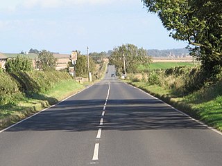
Milecastle 17

Last updated

Milecastle 17
Northumberland, England, UK
The site of Milecastle 17 - geograph.org.uk - 2601364.jpg
The site of Milecastle 17
Northumberland UK location map.svg
Red pog.svg
Milecastle 17
Location in Northumberland
Coordinates 55°00′31″N1°54′11″W / 55.00850°N 1.90303°W / 55.00850; -1.90303 Coordinates: 55°00′31″N1°54′11″W / 55.00850°N 1.90303°W / 55.00850; -1.90303
Grid reference NZ06306822

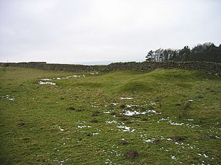
Milecastle 17 (Welton/Whittledean) was a milecastle of the Roman Hadrian's Wall. The milecastle is located near to the Whittle Dene reservoirs and is visible as a platform in the ground. Just 174m west of the milecastle is a distinct change in wall construction, indicating that it may have formed a boundary between different legions. The existence of the milecastle has been known since at least 1732 and excavations have produced numerous finds and evidence of post-Roman occupation. The associated turrets both lie beneath the B3618 Military Road. A stone found near the milecastle is the only known written record of the name of Gaius Julius Marcus, a Roman Governor of Britain whose name has been erased from other inscriptions possibly because he fell out of favour with Emperor Caracalla.

Contents

Construction

Milecastle 17 was a short-axis milecastle with Type I gateways. [1] Short axis milecastles are thought to have been constructed by the Legio II Augusta who were based in Isca Augusta (Caerleon). [2] The milecastle is located near to Welton, Northumberland and around 200 yards (180 m) from the Whittle Dene reservoirs from which it derives its common names. [3] The remains of the milecastle are visible in the ground as a low platform 14.93m by 17.68m in size. [1] Ploughing has reduced the size of the platform but it remains visible with a scarp on the eastern side and a scatter of stones to mark its position. [3]

At a point on the wall 174m west of Milecastle 17 there is a significant change in construction, discovered in 1931. [4] East of this point the wall is constructed at the thickness of the foundations for one course of stone before stepping in to a narrower wall, west of here the wall continues at full foundation thickness for three or four courses before stepping in. [4] In addition the western part tends to use smaller stones, and east of Milecastle 17 until Turret 12A all turrets have east doors and thick walls, with those west until Turret 21A having doors in the western part of the south wall and thinner walls. [4] These differences has been attributed to a boundary between two legions engaged in construction of the wall. [4]

A milestone used to stand to the east of the milecastle, erected in AD 213. [1] This stone is now missing but amounts to the only written record of the name of Gaius Julius Marcus, a governor of Roman Britain. [5] During this year it is known that Marcus made a large number of inscriptions declaring his loyalty to the paranoid emperor Caracalla. [5] In every other case apart from the milestone his name has been erased. [5] Roman historian Guy de la Bédoyère has proposed that Marcus may have been subsequently arrested, convicted of treason and executed on Caracalla's orders as happened to the governor of Gallia Narbonensis that same year. [5]

Excavations and investigations

Associated turrets

Each milecastle on Hadrian's Wall had two associated turret structures. These turrets were positioned approximately one-third and two-thirds of a Roman mile to the west of the Milecastle, and would probably have been manned by part of the milecastle's garrison. The turrets associated with Milecastle 17 are known as Turret 17A and Turret 17B.

Turret 17A

Turret 17A (Welton East) became a Scheduled Ancient Monument on 14 July 1997. [9] The site was excavated in 1931 when a door was located in the southwest corner, the access ladder platform in the southeast and an additional platform in the northwest. [4] [9] One of the finds discovered in 1931 was a whinstone ballista ball. [4] There are no visible surface remains, the site now lying beneath the B3618 Military Road. [9]

Location: 55°00′31″N1°54′40″W / 55.008688°N 1.911003°W / 55.008688; -1.911003 (Turret 17A)

Turret 17B

Turret 17B (Horsley) was scheduled at the same time as Turret 17A. [10] 17B was located on 11 June 1931 and excavated later that year. [10] It was found to be similar to 17A with a door at the southwest and a ladder platform in the southeast and lies beneath the B3618, leaving no visible surface traces of its existence. [10]

Location: 55°00′33″N1°55′07″W / 55.009233°N 1.918507°W / 55.009233; -1.918507 (Turret 17B)

Monument records

MonumentMonument Number English Heritage Archive Number
Milecastle 1720396NZ 06 NE 8
Turret 17A20399NZ 06 NE 9
Turret 17B20402NZ 06 NE 10

Related Research Articles

Milecastle 18

Milecastle 18 was a milecastle of the Roman Hadrian's Wall. It is located to the west of the settlement of East Wallhouses in Northumberland and is visible as a platform in the ground. The milecastle is of a unique construction, having a gateway associated with builders of the Legio II Augusta and a layout typical of the Legio VI Victrix or Legio XX Valeria Victrix. Historians have suggested that it may have been begun by men of one legion and finished by those of another. One of Milecastle 18's associated turrets shows evidence of being used as a workshop, possibly for the repair of shoes.
Milecastle 1

Milecastle 1 was a milecastle of the Roman Hadrian's Wall. It was located near the valley of Stott's Pow. Its remains are covered over, and are located beneath the recreation ground at Miller's Dene. Early excavations and investigations of Turret 0B were mistakenly interpreted as Milecastle 1. The Milecastle sits within the parish of Wallsend.

Milecastle 10

Milecastle 10 was a milecastle of the Roman Hadrian's Wall. It is located near to the modern village of Throckley in Tyne and Wear, northern England. Much of the milecastle lies beneath a road but partial remains of the north wall can be seen in the garden of Dene House. It has been excavated several times and its walls located, though the remains have been "considerably damaged by ploughing". Only one of the two associated turrets has been located and excavated.

Milecastle 13

Milecastle 13 was a milecastle of the Roman Hadrian's Wall. Its remains exist as a low platform south of the B6318 Military Road.
Milecastle 14

Milecastle 14 was a milecastle of the Roman Hadrian's Wall. Its remains exist as a low platform, south of the B6318 Military Road and about 1 kilometre (0.62 mi) to the west of the road junction at Rudchester Farm.

Milecastle 15

Milecastle 15 (Whitchester) was a milecastle of the Roman Hadrian's Wall. Its remains exist as a bold platform with robbed walls located on the southern side of the B6318 Military Road approximately 3 kilometres (1.9 mi) west of its crossing of the A69 road. It has not been excavated.

Milecastle 16

Milecastle 16 was a milecastle of the Roman Hadrian's Wall. The milecastle is located at Harlow Hill, Northumberland. There are no visible surface remains of the milecastle or either of its associated turrets.

Milecastle 19

Milecastle 19 was a milecastle of the Roman Hadrian's Wall. Sited just to the east of the hamlet of Matfen Piers, the milecastle is today covered by the B6318 Military Road. The milecastle is notable for the discovery of an altar by Eric Birley in the 1930s. An inscription on the altar is one of the few dedications to a mother goddess found in Roman Britain, and was made by members of the First Cohort of Varduli from northern Spain. The presence of the Vardulians at this milecastle has led to debate amongst archaeologists over the origins of troops used to garrison the wall. A smaller altar was found at one of the two associated turrets.
Milecastle 22

Milecastle 22 (Portgate) was a milecastle of the Roman Hadrian's Wall. Its remains exist as a low, turf covered platform just east of the Portgate roundabout. The platform is 0.5 metres (1.6 ft) on the east side, reducing to only a parch mark on the west side.

Milecastle 23

Milecastle 23 (Stanley) was a milecastle of the Roman Hadrian's Wall. Its remains exist as a low, grass covered platform with traces of an external ditch. It is located to the south of the B6318 Military Road around 1.5 kilometres (0.93 mi) west of its junction with the A68.

Milecastle 27

Milecastle 27 was a milecastle of the Roman Hadrian's Wall. It was located on the line of Hadrian's Wall, approximately midway between the A6079 and the River North Tyne. Its remains survive as a slight squarish platform with a maximum height of 0.4 metres (1.3 ft), but it is poorly defined to the north and east.
Milecastle 24

Milecastle 24 was a milecastle of the Roman Hadrian's Wall. Its remains exist as a low platform, and are located to the south of the B6318 Military Road around 3 kilometres (1.9 mi) west of its junction with the A68.

Milecastle 25

Milecastle 25 (Codlawhill) was a milecastle of the Roman Hadrian's Wall. Its remains exist as a low platform, and are located to the south of the B6318 Military Road, nearly 5 kilometres (3.1 mi) to the west of its junction with the A68.

Milecastle 26

Milecastle 26 (Planetrees) was a milecastle of the Roman Hadrian's Wall. Its position is slightly to the south of, but mostly covered by the B6318 Military Road., and it is located around 700 metres (0.43 mi) east of the B6318 Military Road's junction with the A6079. No visible traces exist currently. The dimensions are the same as Milecastles 23, 24, and 25.
Milecastle 28

Milecastle 28 (Walwick) was a milecastle of the Roman Hadrian's Wall in England. No remains are currently visible. Its location is immediately to the south of the B6318 Military Road in Walwick.
Milecastle 29

Milecastle 29 was a milecastle of the Roman Hadrian's Wall. Its remains exist as a mutilated earth platform accentuated by deep robber-trenches around all sides, and are located beside the B6318 Military Road. Like Milecastles 9, 23, 25, and 51, a ditch has been identified around the Milecastle, and is still visible to a small extent. It has been postulated that this was as a result of the need for drainage on the site.

Milecastle 30

Milecastle 30 was a milecastle of the Roman Hadrian's Wall. Its remains exist as an outward-facing scarp with a maximum height of 0.8 metres (2.6 ft). Masonry from the east wall remains in situ. The remaining stretch is 3.1 metres (10 ft) in length by 2.25 metres (7.4 ft) thick, and survives to a height of 0.6 metres (2.0 ft). It is located at the western part of Limestone Corner, just off the B6318 Military Road.

Milecastle 31

Milecastle 31 (Carrawburgh) was a milecastle of the Roman Hadrian's Wall. Its remains exist as a turf covered platform beside the B6318 Military Road, just to the east of Carrawburgh fort.

Milecastle 32

Milecastle 32 (Carraw) was a milecastle of the Roman Hadrian's Wall. Its remains exist as earthworks and with no exposed masonry. The layout of the milecastle walls is defined by robber trenches (to a maximum depth of 0.3 metres. The north wall is beneath a modern wall.

Milecastle 36

Milecastle 36 was one of the milecastles on Hadrian's Wall. There is little to see on the ground as most of the walls have been robbed and quarried away.

References

  1. 1 2 3 David J Breeze & Brian Dobson (1976). Hadrian's Wall. Allen Lane. p. 173. ISBN   0-14-027182-1.
  2. David J Breeze & Brian Dobson (1976). Hadrian's Wall. Allen Lane. pp. 14–15. ISBN   0-14-027182-1.
  3. 1 2 3 4 5 6 7 "Milecastle 17". Pastscape. English Heritage. Retrieved 31 October 2010.
  4. 1 2 3 4 5 6 David J Breeze & Brian Dobson (1976). Hadrian's Wall. Allen Lane. p. 174. ISBN   0-14-027182-1.
  5. 1 2 3 4 de la Bédoyère, Guy. "People of Roman Britain". Archived from the original on 20 July 2011. Retrieved 13 November 2010.
  6. 1 2 3 4 5 6 7 8 9 Wilmott, Tony. "The Hadrian's Wall Milecastle Project:1999–2000". English Heritage. Retrieved 13 November 2010.
  7. "CfA Reports from 1999". Centre for Archaeology. Retrieved 13 November 2010.
  8. Burnham, B.C, Keppie, L.J.F., Esmonde Cleary, A.S., Hassall, M.W.C. & Tomlin, R.S.O. (2000). "Roman Britain in 1999". Britannia. 31: 390. JSTOR   526933.{{cite journal}}: CS1 maint: multiple names: authors list (link)
  9. 1 2 3 "Turret 17A". Pastscape. English Heritage. Retrieved 31 October 2010.
  10. 1 2 3 "Turret 17B". Pastscape. English Heritage. Retrieved 31 October 2010.

Commons-logo.svg Media related to Milecastle 17 at Wikimedia Commons