Milecastle 10

Last updated

Milecastle 10
Tyne and Wear, England, UK
Hexham Road, Walbottle - geograph.org.uk - 3762164 - cropped.jpg
Milecastle 10 lies near the B6528 road near Throckley
Tyne and Wear UK location map.svg
Red pog.svg
Milecastle 10
Location in Tyne and Wear
Coordinates 54°59′43″N1°44′38″W / 54.995197°N 1.744027°W / 54.995197; -1.744027 Coordinates: 54°59′43″N1°44′38″W / 54.995197°N 1.744027°W / 54.995197; -1.744027
Grid reference NZ16476676

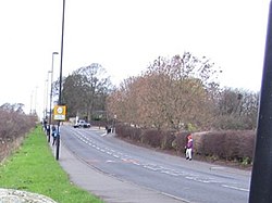
Milecastle 10 (Walbottle Dene) was a milecastle of the Roman Hadrian's Wall. It is located near to the modern village of Throckley in Tyne and Wear, northern England. Much of the milecastle lies beneath a road but partial remains of the north wall can be seen in the garden of Dene House. It has been excavated several times and its walls located, though the remains have been "considerably damaged by ploughing". Only one of the two associated turrets has been located and excavated.

Contents

Construction

Milecastle 10 was a long-axis milecastle with Type IV gateways. [1] Such milecastles were thought to have been constructed by the legio XX Valeria Victrix who were based in Deva Victrix (Chester). [2] The usually straight Hadrian's Wall changes direction in this area, making a 20 degree turn just before it crosses a Dene (valley) and heading towards the Great Hill at Heddon-on-the-Wall. [3]

The milecastle measures 78 feet 2 inches (23.83 m) long north to south and 67 feet (20 m) east to west with walls approximately 10 feet (3.0 m) wide. [4] The north gateway survives in the front garden of Dene House and consists of twelve foundation slabs with three stone blocks lying on top. [4] One of the blocks is marked with an asterisk, two of them contain pivot holes for a gate and one shows signs of a lewis-hole. [5] The southern part of the milecastle is visible only as a 0.4m high mound in a field and part of the ditch is also visible. [4] [5]

Excavations and investigations

Associated turrets

Each milecastle on Hadrian's Wall had two associated turret structures. These turrets were positioned approximately one-third and two-thirds of a Roman mile to the west of the Milecastle, and would probably have been manned by part of the milecastle's garrison. The turrets associated with Milecastle 10 are known as Turret 10A and Turret 10B.

Turret 10A

Turret 10A (Throckley East) is located 509 yards (465 m) west of Milecastle 10. The turret lies beneath the modern Hexham Road (B6528) and there are no visible surface remains but has been excavated in 1930 and 1980. [9] The 1930 excavation could only examine the south-east corner of the turret. It discovered that the walls were approximately 3 feet (0.91 m) thick and stood five courses of stone high. [9] The entrance to the turret was in the south wall. The 1980 excavation, carried out before some nearby construction work, was more extensive and discovered just two distinct occupation layers within the turret. [9]

Most of the pottery discovered in the turret has been dated to before 140 AD with just one sherd dating later than that. [9] This places the turret's occupation to within the early period of the wall's life with little later activity, though there is no evidence that the turret was demolished after it ceased to be occupied. [9] The excavation discovered that the walls consisted of a core of sandstone and clay surrounded by pointed mortar, with foundations of stone slabs set on clay. [9] Extensive areas of burning and charcoal were discovered within the turret which could represent a series of hearths in the door threshold and along the north wall. [3] [9] Other finds on the site have included a spearhead and four worked flints and a possible platform in the south west corner. [10]

The 1980 excavation removed the floor of the turret to examine the underlying clay layer. [9] Here they discovered a series of criss-crossed grooves in the clay that were vertical on one side and sloping on the other. [11] These were identified as ard (plough) marks that were likely to date to the late Neolithic or early Bronze Age periods and are certainly pre-Hadrianic. [9] The excavation was later backfilled and the ard marks and turret sealed beneath the modern road. [11]

Location: 54°59′45″N1°45′04″W / 54.995841°N 1.751213°W / 54.995841; -1.751213 (Turret 10A)

Turret 10B

Turret 10B (Throckley) has not yet been located and there are no visible surface remains. Its likely position is under Hexham Road but excavations carried out in 1928 and 1983 failed to locate the turret. [12] The soil in the area contains burnt wood remains possibly associated with ground clearance for the construction of the wall in this area. [10]

Location: 54°59′46″N1°45′32″W / 54.996036°N 1.758871°W / 54.996036; -1.758871 (Turret 10B)

Monument records

MonumentMonument Number English Heritage Archive Number
Milecastle 1022673NZ 16 NE 8
Turret 10A22678NZ 16 NE 9
Turret 10B22681NZ 16 NE 10

Related Research Articles

Milecastle 50

Milecastle 50 was a milecastle on Hadrian's Wall.

Milecastle 52

Milecastle 52 (Bankshead) was a milecastle on Hadrian's Wall.

Milecastle 4

Milecastle 4 was a milecastle of the Roman Hadrian's Wall. Its remains exist beneath the Newcastle Arts Centre at 67-75 Westgate Road. This position is some way away from its predicted position which is at these coordinates: 54.970440°N 1.608669°W The actual location is between the predicted positions of Turrets 4A and 4B, which has led to suggestions that the numbering and positioning of milecastles and turrets on this part of Hadrian's Wall should be reconsidered.

Milecastle 18

Milecastle 18 was a milecastle of the Roman Hadrian's Wall. It is located to the west of the settlement of East Wallhouses in Northumberland and is visible as a platform in the ground. The milecastle is of a unique construction, having a gateway associated with builders of the Legio II Augusta and a layout typical of the Legio VI Victrix or Legio XX Valeria Victrix. Historians have suggested that it may have been begun by men of one legion and finished by those of another. One of Milecastle 18's associated turrets shows evidence of being used as a workshop, possibly for the repair of shoes.

Milecastle 2

Milecastle 2 (Walker) was a milecastle of the Roman Hadrian's Wall. No remains are currently visible, having been built over, but its probable location is at or near the junction of the A187 Fossway and Tunstall Avenue, in the parish of Wallsend.

Milecastle 7 Milecastle of the Roman Hadrians Wall in United Kingdom

Milecastle 7 was a milecastle of the Roman Hadrian's Wall. The milecastle itself has not been discovered by archaeologists and its presumed location lies beneath a modern housing development. Roman finds have been made in the area and the associated structure of Turret 7B is a significant surviving structure of the wall.

Milecastle 8

Milecastle 8 was a milecastle of the Roman Hadrian's Wall. Its remains are located in West Denton, Newcastle upon Tyne. The milecastle has two associated turret structures that are known as turret 8A and turret 8B. The turrets and milecastle were excavated in the 1920s, yielding some pottery and stone carvings, and have since been overlain by modern roads. The exact location of the structures is disputed, with the road hiding any surface traces. The Milecastle forms part of the Hadrian's Wall World Heritage Site.

Milecastle 9

Milecastle 9 was a milecastle of the Roman Hadrian's Wall. Its remains exist partially as a low platform, and are located in West Denton, 300 yards (270 m) from Chapel House Farm. However, the northern part of the remains are now mostly covered by the modern roads (A69/B6528). The milecastle marks a watershed between those with relatively well-defined positions and those whose position are less certain.

Milecastle 14

Milecastle 14 was a milecastle of the Roman Hadrian's Wall. Its remains exist as a low platform, south of the B6318 Military Road and about 1 kilometre (0.62 mi) to the west of the road junction at Rudchester Farm.

Milecastle 16

Milecastle 16 was a milecastle of the Roman Hadrian's Wall. The milecastle is located at Harlow Hill, Northumberland. There are no visible surface remains of the milecastle or either of its associated turrets.

Milecastle 17

Milecastle 17 (Welton/Whittledean) was a milecastle of the Roman Hadrian's Wall. The milecastle is located near to the Whittle Dene reservoirs and is visible as a platform in the ground. Just 174m west of the milecastle is a distinct change in wall construction, indicating that it may have formed a boundary between different legions. The existence of the milecastle has been known since at least 1732 and excavations have produced numerous finds and evidence of post-Roman occupation. The associated turrets both lie beneath the B3618 Military Road. A stone found near the milecastle is the only known written record of the name of Gaius Julius Marcus, a Roman Governor of Britain whose name has been erased from other inscriptions possibly because he fell out of favour with Emperor Caracalla.

Milecastle 19

Milecastle 19 was a milecastle of the Roman Hadrian's Wall. Sited just to the east of the hamlet of Matfen Piers, the milecastle is today covered by the B6318 Military Road. The milecastle is notable for the discovery of an altar by Eric Birley in the 1930s. An inscription on the altar is one of the few dedications to a mother goddess found in Roman Britain, and was made by members of the First Cohort of Varduli from northern Spain. The presence of the Vardulians at this milecastle has led to debate amongst archaeologists over the origins of troops used to garrison the wall. A smaller altar was found at one of the two associated turrets.

Milecastle 22

Milecastle 22 (Portgate) was a milecastle of the Roman Hadrian's Wall. Its remains exist as a low, turf covered platform just east of the Portgate roundabout. The platform is 0.5 metres (1.6 ft) on the east side, reducing to only a parch mark on the west side.

Milecastle 23

Milecastle 23 (Stanley) was a milecastle of the Roman Hadrian's Wall. Its remains exist as a low, grass covered platform with traces of an external ditch. It is located to the south of the B6318 Military Road around 1.5 kilometres (0.93 mi) west of its junction with the A68.

Milecastle 24

Milecastle 24 was a milecastle of the Roman Hadrian's Wall. Its remains exist as a low platform, and are located to the south of the B6318 Military Road around 3 kilometres (1.9 mi) west of its junction with the A68.

Milecastle 25

Milecastle 25 (Codlawhill) was a milecastle of the Roman Hadrian's Wall. Its remains exist as a low platform, and are located to the south of the B6318 Military Road, nearly 5 kilometres (3.1 mi) to the west of its junction with the A68.

Milecastle 26

Milecastle 26 (Planetrees) was a milecastle of the Roman Hadrian's Wall. Its position is slightly to the south of, but mostly covered by the B6318 Military Road., and it is located around 700 metres (0.43 mi) east of the B6318 Military Road's junction with the A6079. No visible traces exist currently. The dimensions are the same as Milecastles 23, 24, and 25.

Milecastle 30

Milecastle 30 was a milecastle of the Roman Hadrian's Wall. Its remains exist as an outward-facing scarp with a maximum height of 0.8 metres (2.6 ft). Masonry from the east wall remains in situ. The remaining stretch is 3.1 metres (10 ft) in length by 2.25 metres (7.4 ft) thick, and survives to a height of 0.6 metres (2.0 ft). It is located at the western part of Limestone Corner, just off the B6318 Military Road.

Milecastle 31

Milecastle 31 (Carrawburgh) was a milecastle of the Roman Hadrian's Wall. Its remains exist as a turf covered platform beside the B6318 Military Road, just to the east of Carrawburgh fort.

Milecastle 32

Milecastle 32 (Carraw) was a milecastle of the Roman Hadrian's Wall. Its remains exist as earthworks and with no exposed masonry. The layout of the milecastle walls is defined by robber trenches (to a maximum depth of 0.3 metres. The north wall is beneath a modern wall.

References

  1. Daniels, Charles (1979). "Review: Fact and Theory on Hadrian's Wall". Britannia. 10: 362. JSTOR   526069.
  2. David J Breeze and Brian Dobson (1976). Hadrian's Wall. Allen Lane. pp. 14–15. ISBN   0-14-027182-1.
  3. 1 2 David J Breeze and Brian Dobson (1976). Hadrian's Wall. Allen Lane. p. 164. ISBN   0-14-027182-1.
  4. 1 2 3 4 5 6 7 8 "Milecastle 10". Pastscape. English Heritage. Retrieved 21 May 2010.
  5. 1 2 3 4 5 "Milecastle 10". Fortified England. Retrieved 25 June 2010.
  6. "CfA Reports from 1999". Centre for Archaeology. English Heritage. Retrieved 25 June 2010.
  7. 1 2 Burnham, B. C.; Keppie, L. J. F.; Esmonde, A. S.; Hassall, M. W. C.; Tomlin, R. S. O. "Roman Britain in 1999". Britannia. 2000. 31: 389. JSTOR   526933.
  8. "Hadrians Wall: The Vallum near Milecastle 10 (Walbottle Dene), Northumberland". National Archives. Retrieved 25 June 2010.
  9. 1 2 3 4 5 6 7 8 9 "Turret 10A". Pastscape. English Heritage. Archived from the original on 10 March 2012. Retrieved 25 June 2010.
  10. 1 2 David J Breeze and Brian Dobson (1976). Hadrian's Wall. Allen Lane. p. 165. ISBN   0-14-027182-1.
  11. 1 2 "Monument no. 938877". Pastscape. English Heritage. Archived from the original on 10 March 2012. Retrieved 25 June 2010.
  12. "Turret 10B". Pastscape. English Heritage. Archived from the original on 10 March 2012. Retrieved 21 May 2010.