Portgate

Last updated

Portgate
Northumberland, England, UK
Arbeia Roman Fort reconstructed gateway.jpg
Although the structure of the Portgate is unknown, it is likely to have resembled this reconstruction gateway at Arbeia
Northumberland UK location map.svg
Red pog.svg
Portgate
Location in Northumberland
Coordinates 55°00′46″N2°01′18″W / 55.012663°N 2.021612°W / 55.012663; -2.021612 Coordinates: 55°00′46″N2°01′18″W / 55.012663°N 2.021612°W / 55.012663; -2.021612
Grid reference NY98736869

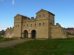
The Portgate was a fortified gateway, constructed as part of Hadrian's Wall where it crossed the Roman road now known as Dere Street, which preceded Hadrian's Wall by around 50 years. It was built to control traffic along Dere Street as it passed north through Hadrian's Wall. The gate's remains exist beneath the old B6318 Military Road to the south-west of the Stagshaw Roundabout (the B6318 was diverted slightly for the construction of the Stagshaw Roundabout, leaving two short sections of the existing road unlinked – the remains of the Portgate are buried beneath the western section). [1]

Contents

The Portgate is located just to the north of the Errington Arms at Stagshaw Roundabout The Errington Arms at Stagshaw - geograph.org.uk - 834783.jpg
The Portgate is located just to the north of the Errington Arms at Stagshaw Roundabout

Origins of the name

If any name was given to the structure by the Romans, it is no longer known. The name Portgate is thought to be of Anglo-Saxon origin.

Construction

The Portgate was constructed from very large masonry blocks. It projected between 3.06 metres (10.0 ft) and 3.66 metres (12.0 ft) north of the wall, sitting astride the wall. It was probably a square or rectangular structure. [2]

Excavations and investigations

There has been a square castellum, half within the wall and half without. There is a suggestion even today that the ditch of the wall turned northward round such a building.

Civil parish

Portgate was a civil parish, in 1951 the parish had a population of 52. [5] Portgate was formerly a township in St. John-Lee parish, [6] from 1866 Portgate was a civil parish in its own right until it was abolished on 1 April 1955 and merged with Corbridge. [7]

Monument records

MonumentMonument Number English Heritage Archive Number
Portgate181662NY 96 NE 5

Related Research Articles

<span class="mw-page-title-main">Milecastle 3</span>

Milecastle 3 (Ouseburn) was a milecastle of the Roman Hadrian's Wall. No remains exist, but it was thought to have been located at the junction of the A187 Byker Bridge and Stephen Street.

<span class="mw-page-title-main">Rochester, Northumberland</span> Village in England

Rochester is a small village and civil parish in north Northumberland, England. It is 5 miles (8 km) north-west of Otterburn on the A68 road between Corbridge and Jedburgh. The village is the site of the Roman fort of Bremenium, built there to protect the important Roman road of Dere Street, which passes through the village.

<span class="mw-page-title-main">Milecastle 1</span>

Milecastle 1 was a milecastle of the Roman Hadrian's Wall. It was located near the valley of Stott's Pow. Its remains are covered over, and are located beneath the recreation ground at Miller's Dene. Early excavations and investigations of Turret 0B were mistakenly interpreted as Milecastle 1. The Milecastle sits within the parish of Wallsend.

<span class="mw-page-title-main">Milecastle 2</span>

Milecastle 2 (Walker) was a milecastle of the Roman Hadrian's Wall. No remains are currently visible, having been built over, but its probable location is at or near the junction of the A187 Fossway and Tunstall Avenue, in the parish of Wallsend.

<span class="mw-page-title-main">Milecastle 5</span>

Milecastle 5 was the first milecastle west of Pons Aelius fort of the Roman Hadrian's Wall. No remains exist of the milecastle, though its supposed position is at the junction of the A186 Westgate road and the B1311 Corporation Street. No remains currently exist.

<span class="mw-page-title-main">Milecastle 12</span>

Milecastle 12 (Heddon) was a milecastle of the Roman Hadrian's Wall. Its remains lay under Town Farm, Heddon-on-the-Wall, with nothing visible on the surface.

<span class="mw-page-title-main">Milecastle 13</span>

Milecastle 13 was a milecastle of the Roman Hadrian's Wall. Its remains exist as a low platform south of the B6318 Military Road.

<span class="mw-page-title-main">Milecastle 14</span>

Milecastle 14 was a milecastle of the Roman Hadrian's Wall. Its remains exist as a low platform, south of the B6318 Military Road and about 1 kilometre (0.62 mi) to the west of the road junction at Rudchester Farm.

<span class="mw-page-title-main">Milecastle 16</span>

Milecastle 16 was a milecastle of the Roman Hadrian's Wall. The milecastle is located at Harlow Hill, Northumberland. There are no visible surface remains of the milecastle or either of its associated turrets.

<span class="mw-page-title-main">Milecastle 22</span>

Milecastle 22 (Portgate) was a milecastle of the Roman Hadrian's Wall. Its remains exist as a low, turf covered platform just east of the Portgate roundabout. The platform is 0.5 metres (1.6 ft) on the east side, reducing to only a parch mark on the west side.

<span class="mw-page-title-main">Milecastle 23</span> Milecastle in Northumberland, England, UK

Milecastle 23 (Stanley) was a milecastle of the Roman Hadrian's Wall. Its remains exist as a low, grass covered platform with traces of an external ditch. It is located to the south of the B6318 Military Road around 1.5 kilometres (0.93 mi) west of its junction with the A68.

<span class="mw-page-title-main">Milecastle 24</span>

Milecastle 24 was a milecastle of the Roman Hadrian's Wall. Its remains exist as a low platform, and are located to the south of the B6318 Military Road around 3 kilometres (1.9 mi) west of its junction with the A68.

<span class="mw-page-title-main">Milecastle 25</span>

Milecastle 25 (Codlawhill) was a milecastle of the Roman Hadrian's Wall. Its remains exist as a low platform, and are located to the south of the B6318 Military Road, nearly 5 kilometres (3.1 mi) to the west of its junction with the A68.

<span class="mw-page-title-main">Milecastle 26</span>

Milecastle 26 (Planetrees) was a milecastle of the Roman Hadrian's Wall. Its position is slightly to the south of, but mostly covered by the B6318 Military Road., and it is located around 700 metres (0.43 mi) east of the B6318 Military Road's junction with the A6079. No visible traces exist currently. The dimensions are the same as Milecastles 23, 24, and 25.

<span class="mw-page-title-main">Milecastle 28</span>

Milecastle 28 (Walwick) was a milecastle of the Roman Hadrian's Wall in England. No remains are currently visible. Its location is immediately to the south of the B6318 Military Road in Walwick.

<span class="mw-page-title-main">Milecastle 29</span>

Milecastle 29 was a milecastle of the Roman Hadrian's Wall. Its remains exist as a mutilated earth platform accentuated by deep robber-trenches around all sides, and are located beside the B6318 Military Road. Like Milecastles 9, 23, 25, and 51, a ditch has been identified around the Milecastle, and is still visible to a small extent. It has been postulated that this was as a result of the need for drainage on the site.

<span class="mw-page-title-main">Milecastle 30</span>

Milecastle 30 was a milecastle of the Roman Hadrian's Wall. Its remains exist as an outward-facing scarp with a maximum height of 0.8 metres (2.6 ft). Masonry from the east wall remains in situ. The remaining stretch is 3.1 metres (10 ft) in length by 2.25 metres (7.4 ft) thick, and survives to a height of 0.6 metres (2.0 ft). It is located at the western part of Limestone Corner, just off the B6318 Military Road.

<span class="mw-page-title-main">Milecastle 31</span>

Milecastle 31 (Carrawburgh) was a milecastle of the Roman Hadrian's Wall. Its remains exist as a turf covered platform beside the B6318 Military Road, just to the east of Carrawburgh fort.

<span class="mw-page-title-main">Milecastle 32</span>

Milecastle 32 (Carraw) was a milecastle of the Roman Hadrian's Wall. Its remains exist as earthworks and with no exposed masonry. The layout of the milecastle walls is defined by robber trenches (to a maximum depth of 0.3 metres. The north wall is beneath a modern wall.

<span class="mw-page-title-main">Milecastle 33</span>

Milecastle 33 was a milecastle of the Roman Hadrian's Wall, one of a series of small fortlets built at intervals of approximately one Roman mile along the length of the UNESCO World Heritage Site in northern England.

References

  1. "Portgate". Pastscape. English Heritage. Archived from the original on 10 March 2012. Retrieved 26 August 2010.
  2. Breeze, David J (1934), Handbook to the Roman Wall (14th Revised edition - Nov 2006), Society of Antiquaries of Newcastle upon Tyne, p. 184, ISBN   0-901082-65-1
  3. Horsley, John (1732), Britannia Romana or the Roman Antiquities of Britain, Frank Graham (published 1974), ISBN   0-85983-090-X
  4. The Journal of Roman Studies. London: Society for Promotion of Roman Studies. 57: 177. 1967.{{cite journal}}: Missing or empty |title= (help)
  5. "Population statistics Portgate Tn/CP through time". A Vision of Britain through Time . Retrieved 24 January 2022.
  6. "History of Portgate, in Tynedale and Northumberland". A Vision of Britain through Time. Retrieved 24 January 2022.
  7. "Relationships and changes Portgate Tn/CP through time". A Vision of Britain through Time. Retrieved 24 January 2022.

Bibliography