
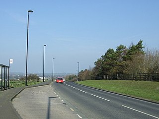
The Military Way is the modern name given to a Roman road constructed immediately to the south of Hadrian's Wall.
The Military Way is the modern name given to a Roman road constructed immediately to the south of Hadrian's Wall.
Evidence has shown that the road was constructed before the abandonment of the turrets in the second century (linking roads between the Military Way and some turrets have been identified). The existence of the Stanegate suggests that it was not included in the original plan, and therefore it is likely to have been constructed soon after the reoccupation of Hadrian's Wall following the abandonment of the Antonine Wall in 162 AD. [1]
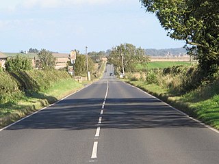
As with most Roman roads, the Military Way was constructed from large stones, and surfaced with gravel. It was usually around 6 metres (20 ft) wide with a camber of up to 46 centimetres (18 in). John Collingwood Bruce suggested that it was not intended for use by wheeled vehicles, and this is backed up by a survey of wall miles 40/41, where severe gradients up to 25% (33% in short stretches) were recorded. [1]
Spurs have been identified linking the Military Way to some milecastles, for example Milecastle 9.
Some milestones have been found along the road (taking columnar form). These indicate that, in the third century, distances were numbered westwards from Dere Street. [1]
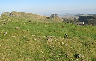
The Military Way runs along the top of the north mound of the Vallum in many places, and elsewhere runs between the Vallum and the curtain wall. [1] At the river crossings at Chesters Bridge and at Willowford Bridge near Birdoswald Roman fort, the bridges were widened in the early third century to take the road, as opposed to just the walkway as was previously the case. [2]
The course of the Military Way is still very much evident and walkable between Sewing Shields (near Milecastle 35) and Walltown Quarry (near Turret 45A). A public right of way follows the Military Way from Milking Gap (near Milecastle 38) to Walltown Quarry.

Milecastle 4 (Westgate Road) was a milecastle of the Roman Hadrian's Wall. Its remains exist beneath the Newcastle Arts Centre at 67-75 Westgate Road. This position is some way away from its predicted position which is at these coordinates: 54.970440°N 1.608669°W The actual location is between the predicted positions of Turrets 4A and 4B, which has led to suggestions that the numbering and positioning of milecastles and turrets on this part of Hadrian's Wall should be reconsidered.

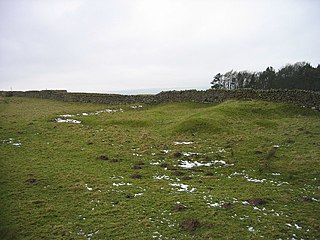
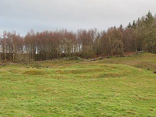
The Vallum is a huge earthwork associated with Hadrian's Wall in England. Unique on any Roman frontier, it runs practically from coast to coast to the south of the wall.
Milecastle 18 (East Wallhouses) was a milecastle of the Roman Hadrian's Wall. It is located to the west of the settlement of East Wallhouses in Northumberland and is visible as a platform in the ground. The milecastle is of a unique construction, having a gateway associated with builders of the Legio II Augusta and a layout typical of the Legio VI Victrix or Legio XX Valeria Victrix. Historians have suggested that it may have been begun by men of one legion and finished by those of another. One of Milecastle 18's associated turrets shows evidence of being used as a workshop, possibly for the repair of shoes.

Hadrian's Wall, also known as the Roman Wall, Picts' Wall, or Vallum Aelium in Latin, is a former defensive fortification of the Roman province of Britannia, begun in AD 122 in the reign of the Emperor Hadrian. Running from Wallsend on the River Tyne in the east to Bowness-on-Solway in the west of what is now northern England, it was a stone wall with large ditches in front of it and behind it that crossed the whole width of the island. Soldiers were garrisoned along the line of the wall in large forts, smaller milecastles, and intervening turrets. In addition to the wall's defensive military role, its gates may have been customs posts.
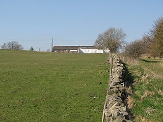
Milecastle 9 (Chapel House) was a milecastle of the Roman Hadrian's Wall. Its remains exist partially as a low platform, and are located in West Denton (to the west of Newcastle upon Tyne), 300 yards (270 m) from Chapel House Farm. However, the northern part of the remains are now mostly covered by the modern roads (A69/B6528). The milecastle marks a watershed between those with relatively well-defined positions (to the west) and those whose position are less certain (to the east).

Milecastle 10 (Walbottle Dene) was a milecastle of the Roman Hadrian's Wall. It is located near to the modern village of Throckley in Tyne and Wear, northern England. Much of the milecastle lies beneath a road but partial remains of the north wall can be seen in the garden of Dene House. It has been excavated several times and its walls located, though the remains have been "considerably damaged by ploughing". Only one of the two associated turrets has been located and excavated.

Milecastle 19 (Matfen Piers) was a milecastle of the Roman Hadrian's Wall. Sited just to the east of the hamlet of Matfen Piers, the milecastle is today covered by the B6318 Military Road. The milecastle is notable for the discovery of an altar by Eric Birley in the 1930s. An inscription on the altar is one of the few dedications to a mother goddess found in Roman Britain, and was made by members of the First Cohort of Varduli from northern Spain. The presence of the Vardulians at this milecastle has led to debate amongst archaeologists over the origins of troops used to garrison the wall. A smaller altar was found at one of the two associated turrets.
Milecastle 22 (Portgate) was a milecastle of the Roman Hadrian's Wall. Its remains exist as a low, turf covered platform just east of the Portgate roundabout (junction of the A68 and B6318). The platform is 0.5 metres (1.6 ft) on the east side, reducing to only a parch mark on the west side.

Milecastle 23 (Stanley) was a milecastle of the Roman Hadrian's Wall. Its remains exist as a low, grass covered platform with traces of an external ditch (as Milecastle 25). It is located to the south of the B6318 Military Road around 1.5 kilometres (0.93 mi) west of its junction with the A68.
Milecastle 24 (Wall Fell) was a milecastle of the Roman Hadrian's Wall. Its remains exist as a low platform, and are located to the south of the B6318 Military Road around 3 kilometres (1.9 mi) west of its junction with the A68.

Milecastle 25 (Codlawhill) was a milecastle of the Roman Hadrian's Wall. Its remains exist as a low platform, and are located to the south of the B6318 Military Road (about 1 metre (3.3 ft) high), nearly 5 kilometres (3.1 mi) to the west of its junction with the A68.

Milecastle 26 (Planetrees) was a milecastle of the Roman Hadrian's Wall. Its position is slightly to the south of, but mostly covered by the B6318 Military Road., and it is located around 700 metres (0.43 mi) east of the B6318 Military Road's junction with the A6079. No visible traces exist currently. The dimensions are the same as Milecastles 23, 24, and 25.
Milecastle 29 (Tower Tye) was a milecastle of the Roman Hadrian's Wall. Its remains exist as a mutilated earth platform accentuated by deep robber-trenches around all sides, and are located beside the B6318 Military Road. Like Milecastles 9, 23, 25, and 51, a ditch has been identified around the Milecastle, and is still visible to a small extent. It has been postulated that this was as a result of the need for drainage on the site.

Milecastle 30 (Limestone Corner) was a milecastle of the Roman Hadrian's Wall. Its remains exist as an outward-facing scarp with a maximum height of 0.8 metres (2.6 ft). Masonry from the east wall (both faces) remains in situ. The remaining stretch is 3.1 metres (10 ft) in length by 2.25 metres (7.4 ft) thick, and survives to a height of 0.6 metres (2.0 ft). It is located at the western part of Limestone Corner, just off the B6318 Military Road.

Milecastle 32 (Carraw) was a milecastle of the Roman Hadrian's Wall. Its remains exist as earthworks and with no exposed masonry. The layout of the milecastle walls is defined (still quite evident) by robber trenches (to a maximum depth of 0.3 metres (1 ft 0 in). The north wall is beneath a modern wall.

A turret was a small watch tower, incorporated into the curtain wall of Hadrian's Wall. The turrets were normally spaced at intervals of one third of a Roman mile between Milecastles, giving two Turrets between each Milecastle.
Milecastle 45 (Walltown) was a milecastle on Hadrian's Wall (grid reference NY67716657).

Milecastle 46 (Carvoran) was a milecastle on Hadrian's Wall (grid reference NY66466601).
Milecastle 65 (Tarraby) was a milecastle on Hadrian's Wall (grid reference NY40855793).

Milecastle 50TW (High House) was a milecastle on the Turf Wall section of Hadrian's Wall (grid reference NY60716583). The milecastle is located close to the Birdoswald Roman Fort and is unique in that it was not replaced by a stone milecastle when the turf wall was upgraded to stone, the replacement wall instead running some 200m to the north. The milecastle was partially demolished by the Romans after it was abandoned. The milecastle was excavated in 1934 and several Roman rubbish pits discovered. The remains of the two turrets associated with this milecastle (which were demolished when the turf wall was abandoned) have also been located. As the turf wall lies some distance from the stone wall, the sites are not accessible from the Hadrian's Wall Path.
Forts and structures of Hadrian's Wall | ||
|---|---|---|
| Wall Forts (East to West) |   | |
| Outpost Forts | ||
| Stanegate Forts |
| |
| Supply Forts | ||
| Cumbrian Coast Forts (North to South) |
| |
| Milecastles | ||
| Milefortlets | ||
| Other structures on Hadrian's Wall | ||
| Regular and linear features | ||