
Congleton was, from 1974 to 2009, a local government district with borough status in Cheshire, England. It included the towns of Congleton, Alsager, Holmes Chapel, Middlewich and Sandbach. The headquarters of the borough council were located in Sandbach.

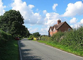
Ollerton is a village in the Borough of Cheshire East and the ceremonial county of Cheshire, England. It is approximately 2 miles (3.2 km) south east of the town of Knutsford, and had a population of 323 in 2001, rising marginally to 329 at the 2011 Census.

A civil parish is a country subdivision, forming the lowest unit of local government in England. There are 333 civil parishes in the ceremonial county of Cheshire, most of the county being parished. At the 2001 census, there were 565,259 people living in 332 parishes, accounting for 57.5 per cent of the county's population.

Haughton is a village and civil parish which lies northwest of Nantwich in the unitary authority of Cheshire East and the ceremonial county of Cheshire, England. According to the 2001 Census, its population was 223, reducing to 204 at the 2011 Census, and has four fully active farms.

The Bache is a small civil parish and suburb of Chester, Cheshire, England.

Balterley is a village and civil parish in the borough of Newcastle-under-Lyme in Staffordshire, England. According to the 2001 census it had a population of 204, increasing to 221 at the 2011 census. The parish borders Cheshire to the north, and the village is about six miles south-east of Crewe in Cheshire.

Basford is a civil parish in the unitary authority of Cheshire East and the ceremonial county of Cheshire, England, just south of Crewe. According to the 2001 census it had a population of 266, reducing slightly to 256 at the 2011 Census.

Betchton is a civil parish in the unitary authority of Cheshire East and the ceremonial county of Cheshire, England. According to the 2001 census it had a population of 620, increasing to 677 at the 2011 Census. The parish is immediately to the east of Sandbach, and includes Betchton Heath, Malkin's Bank and Hassall Green.
Blakenhall is a village and civil parish in the unitary authority of Cheshire East and the ceremonial county of Cheshire, England, about seven miles south-east of Nantwich. According to the 2001 census it had a population of 125, including the civil parishES of Checkley cum Wrinehill and Lea, Cheshire and increasing to 283 at the 2011 Census.

Broomhall Green is a village in the civil parish of Broomhall in the unitary authority of Cheshire East and the ceremonial county of Cheshire, England. The parish includes part of the settlement of Sandford. According to the 2001 Census the parish had a population of 206, decreasing marginally to 204 at the 2011 Census. The village is about 3½ miles south-west of Nantwich, on the A530 road.

Norbury is a civil parish in the unitary authority of Cheshire East and the ceremonial county of Cheshire. According to the 2001 census, the parish had a population of 190, increasing slightly to 194 at the 2011 Census.

Hulme Walfield is a small village and civil parish, just north of Congleton, in the unitary authority of Cheshire East and the ceremonial county of Cheshire. It is home to most of Westlow Mere. According to the 2001 census, the population of the civil parish was 140, increasing slightly to 148 at the 2011 Census

Swettenham is a village and civil parish in the unitary authority of Cheshire East and the ceremonial county of Cheshire, England. According to the 2001 Official UK Census, the population of the entire civil parish was 248, increasing to 291 at the 2011 Census.

Hatherton is a hamlet and civil parish in the unitary authority of Cheshire East and the ceremonial county of Cheshire, England. The hamlet is located 2¾ miles to the north east of Audlem and 3¾ miles to the south east of Nantwich. The parish also includes the small settlements of Birchall Moss, Broomlands and part of Artlebrook. Nearby villages include Hankelow, Stapeley, Walgherton and Wybunbury. According to the 2001 Census, Hatherton civil parish had a population of 344, increasing to 360 at the 2011 Census.

Moston is a small village and civil parish in the unitary authority of Cheshire West and Chester and the ceremonial county of Cheshire, England. It is situated in the north east of Chester, close to the Shropshire Union Canal and the A41 trunk road between Chester and Birkenhead. At the 2001 Census, Moston had a population of 680, falling to 642 at the 2011 Census.

Hassall is a village and civil parish in the Borough of Cheshire East and the ceremonial county of Cheshire, England. The civil parish contains the very small hamlet of Day Green. According to the 2001 Official UK Census, the population was 281, reducing to 265 at the 2011 Census.

Somerford Booths is a small civil parish in the unitary authority of Cheshire East and the ceremonial county of Cheshire, England. In the census of 2001 it was recorded as having a population of 175. increasing to 181 at the 2011 Census. The civil parish holds a parish council meeting under a grouping scheme with the civil parish of Hulme Walfield, and so it is consequently called Hulme Walfield & Somerford Booths Parish Council. The parish is small and now consists of scattered farms and small groupings of houses, including the hamlet of Newsbank. It contains Somerford Booths Hall as well as Grove House Farm and Broomfield Farm which are shown as ancient buildings on the Ordnance Survey map of the area.
Somerford is a civil parish in the unitary authority of Cheshire East and the ceremonial county of Cheshire, England. It is adjacent to the north west of Congleton, from which town it has some housing overflow. According to the 2001 census, the population of the civil parish was 343, increasing to 430 at the 2011 Census.
Hankelow is a village and civil parish in the unitary authority of Cheshire East and the ceremonial county of Cheshire, England. It used to be a township within the township of Audlem, one mile away on the Nantwich Road. According to the 2001 Census, the parish had a population of 272, reducing to 261 at the 2011 Census. Hankelow was formerly part of the Crewe and Nantwich parliamentary constituency. Following a parliamentary boundary review in 2008, the village transferred to the Eddisbury parliamentary constituency upon the dissolution of parliament.

Snelson is a civil parish in the Borough of Cheshire East and ceremonial county of Cheshire in England. It has a population of 157, rising marginally to 161 at the 2011 Census.


