Patna district Last updated November 23, 2025 District in Bihar, India
This article is about the district. For its eponymous headquarters, see
Patna .
District of Bihar in India
Patna district
Coordinates 25°25′N 85°10′E / 25.417°N 85.167°E / 25.417; 85.167 Country India State Bihar Division Patna Headquarters Patna • Lok Sabha constituencies 1. Pataliputra ,Patna sahib ,Munger (shared with Munger district) • Vidhan Sabha constituencies 14 • Total
3,202 km2 (1,236 sq mi) • Total
5,838,465 • Rank(IN: 15th) [ 1] [ needs update ] • Density1,823/km2 (4,723/sq mi) • Urban
2,514,590 • Literacy (2011)70.68% [ 2] [ 3] • Sex ratio1.897 ♂ /♀ Time zone UTC+05:30 (IST ) Major highways NH 30 , NH 83 HDI (2016) [ 4] (high ) GDP (District) (2023) US$30 [ 5] Website patna
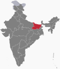
Patna district is one of the thirty-eight districts of Bihar state in eastern India . Patna , the capital of Bihar , is the district headquarters. The Patna district is a part of the Patna division . The Patna district is divided into 6 Subdivisions (Tehsils ) i.e. Patna Sadar , Patna City , Barh , Masaurhi , Danapur and Paliganj .
As of 2011, it is the most populous district of Bihar and the fifteenth most populous district in India . [ 6]
The revenue district of Patna comes under the jurisdiction of a District Collector (District Magistrate). The office of the Patna DM is in the Patna Collectorate .
History Patna is one of the oldest continuously inhabited places in the world . [ 7] Patna was founded in 490 BCE by the king of Magadha. Ancient Patna , known as Pataliputra , was the capital of the Magadha Empire under the Haryanka , Nanda , Mauryan , Shunga , Gupta and Pala empires. Pataliputra was a seat of learning and fine arts. Patliputra was home to many mathematicians, astronomers, astrologists and scholars including Gautam Buddha , Aryabhata , Panini , Vātsyāyana , Chanakya and Kālidāsa . [ 8] [ 9] Its population during the Maurya period (around 400 BCE) was about 400,000. [ 10] Patna served as the seat of power, political and cultural centre of the Indian subcontinent . With the fall of the Gupta Empire, Patna lost its glory. It was revived again in the 17th century by the British as a centre of international trade.
Main street of Patna, showing one side of the Chowk, 1814–15. City of Patna, on the River Ganges, 19th-century painting. Modern history The modern district of Patna was created in September 1770 as a provincial council by the British, to supervise revenue matters of Bihar. In 1793, Patna became a separate judicial district. This led to the foundation of the modern district. [ 11]
The reorganization of the districts in the State took effect in 1972. On November 9, 1972, Nalanda district was constituted by carving out the Bihar Sharif sub-division of Patna district. [ 12]
Geography Patna district occupies an area of 3,202 square kilometres (1,236 sq mi) , [ 13] bounded by the Son River to the west, and the Ganges to the north. In the south, it is bordered by the Nalanda, Arwal , by Jehanabad districts, in the east by Begusarai district, and by Lakhisarai to the southeast.
Administration The Patna district is headed by an IAS officer of the rank of District Magistrate (DM). The district is divided into sub-divisions or Tehsils, each headed by a Sub Divisional Magistrate (SDM).
These Tehsils are further divided into Blocks , each headed by a Block development officer (BDO).
Blocks The 23 Blocks under 6 Tehsils in Patna district are as follows:
Tehsil (Sub-division) CD Blocks Patna Sadar Patna Sadar, Sampatchak and Phulwari Sharif Patna City Fatuha , Daniyawaan and Khusrupur Barh Athmalgola , Mokama , Belchi , Ghoswari , Pandarak , Bakhtiyarpur and Barh Masaurhi Masaurhi, Punpun and Dhanarua Danapur Danapur, Maner , Bihta and Naubatpur Paliganj Paliganj, Dulhin Bazar and Bikram
Industries In Patna district the most Industries are located in Fatuha to DidarGanj.
Demographics Historical population Year 1901 1,028,073 — 1911 1,018,226 −0.10% 1921 998,101 −0.20% 1931 1,168,744 +1.59% 1941 1,357,416 +1.51% 1951 1,600,295 +1.66% 1961 1,861,811 +1.53% 1971 2,250,883 +1.92% 1981 3,019,201 +2.98% 1991 3,618,211 +1.83% 2001 4,718,592 +2.69% 2011 5,838,465 +2.15% source: [ 14]
Religions in Patna district (2011) [ 15] Religion Percent Hinduism
91.74% Islam
7.54% Other or not stated
0.72%
According to the 2011 census , Patna is the 15th most populous district, with a population of 5,838,465, [ 2] roughly equal to the nation of Nicaragua [ 16] or the US state of Maryland . [ 17] The district has a population density of 1,823 inhabitants per square kilometre (4,720/sq mi) . Its population growth rate over the decade 2001–2011 was 22.34%. Patna has a sex ratio of 897 females for every 1,000 males and a literacy rate of 70.68%. 43.07% of the population lives in urban areas. Scheduled Castes and Scheduled Tribes make up 15.77% and 0.15% of the population respectively. [ 2]
At the time of the 2011 Census of India , 46.35% of the population in the district spoke Magahi , 43.77% Hindi , 5.19% Urdu , 2.67% Bhojpuri and 1.24% Maithili as their first language. [ 18]
Climate Climate data for Patna Month Jan Feb Mar Apr May Jun Jul Aug Sep Oct Nov Dec Year Mean daily maximum °C (°F) 23.3 26.5 32.6 37.7 38.9 36.7 33.0 32.4 32.3 31.5 28.8 24.7 31.53 Mean daily minimum °C (°F) 9.2 11.6 16.4 22.3 25.2 26.7 26.2 26.2 25.7 21.8 14.7 9.9 19.65 Average precipitation mm (inches) 19 11 11 8 33 134 306 274 227 94 9 4 1,130 Source: worldweather.org [ 19]
Politics Parliamentary The district has three parliament constituencies :
30 Patna Sahib (Lok Sabha constituency) , covers Bakhtiarpur, Digha, Bankipur, Kumhrar, Patna Sahib and Fatuha. 31 Pataliputra (Lok Sabha constituency) , covers Danapur, Maner, Phulwari, Masaurhi, Paliganj, and Bikram. 28 Munger/Monghyr (Lok Sabha constituency) , covers Barh and Mokama and shared with Munger district . -Numbers denote constituency number.
List of villages The Patna district has 1,395 villages and 322 Gram Panchayats under all 23 Blocks. The list of villages in Patna Sadar Block is as follows:
Alipur ullar Digha East Digha West Fatehpur Mahuli Mainpura East Mainpura North Mainpura West Marchi Nakta Diyara Punadih Sabalpur Sonawapur References ↑ "District wise population in India as of 2011 census" . updateOX . 2011-05-24. Archived from the original on 2017-12-29. Retrieved 2017-12-28 . 1 2 3 "District Census Handbook: Patna" (PDF) . Census of India . Registrar General and Census Commissioner of India . 2011. ↑ "District-specific Literates and Literacy Rates, 2001" . Registrar General, India, Ministry of Home Affairs. Archived from the original on 14 April 2010. Retrieved 5 October 2010 . ↑ "Development of Human Development Index at District Level for EAG States" . March 2016. Retrieved 18 February 2022 . ↑ "Metroverse | Harvard Growth Lab" . ↑ "Patna Pin Code list, Population density, literacy rate and total Area with census 2011 details" . www.indiamapia.com . Archived from the original on 2017-10-17. Retrieved 2017-12-28 . ↑ "Populations of Largest Cities in PMNs from 2000BC to 1988AD" . Archived from the original on 29 September 2007. ↑ "Patna Tour" . cultureholidays.com. Archived from the original on 4 April 2016. Retrieved 28 August 2016 . ↑ "Ancient Patliputra" . go4patna.com. Archived from the original on 18 October 2016. Retrieved 28 August 2016 . ↑ O'Malley, L. S. S. (2005). James, J. F. W. (ed.). History of Magadha 23. ISBN 978-81-89224-01-1 . Retrieved 24 February 2011 . ↑ Singh, Vipul (2005). The Artisans in 18th Century Eastern India, a History of Survival ISBN 9788180692352 Archived from the original on 2017-12-29. Retrieved 2017-12-28 . ↑ "Nalanda celebrates foundation day — Times of India" . The Times of India . 10 November 2017. Archived from the original on 2017-12-29. Retrieved 2017-12-28 . ↑ Srivastava, Dayawanti; et al., eds. (2010). "States and Union Territories: Bihar: Government". India 2010: A Reference Annual (54th ed.). New Delhi, India: Additional Director General, Publications Division, Ministry of Information and Broadcasting (India) , Government of India . pp. 1118– 1119. ISBN 978-81-230-1617-7 ↑ "Table A-02 Decadal Variation in Population Since 1901: Bihar" (PDF) . census.gov.in . Registrar General and Census Commissioner of India . ↑ "Table C-01 Population by Religion: Bihar" . censusindia.gov.in . Registrar General and Census Commissioner of India . 2011. ↑ US Directorate of Intelligence. "Country Comparison:Population" . Archived from the original on 27 September 2011. Retrieved 1 October 2011 . Nicaragua 5,666,301 July 2011 est. ↑ "2010 Resident Population Data" . U. S. Census Bureau. Archived from the original on 19 October 2013. Retrieved 30 September 2011 . Maryland 5,773,552 1 2 "Table C-16 Population by Mother Tongue: Bihar" . censusindia.gov.in . Registrar General and Census Commissioner of India . 2011. ↑ "Climatological Information for Patna" . World Weather. Archived from the original on 8 August 2013. Retrieved 25 February 2011 . 1 2 Ministry of Panchayati Raj (8 September 2009). "A Note on the Backward Regions Grant Fund Programme" (PDF) . National Institute of Rural Development. Archived from the original (PDF) on 5 April 2012. Retrieved 27 September 2011 . ↑ By: Manav Saurav : Government of Bihar website :gov.bih.nic.in/Profile/Districts.htm ↑ "14 segments in Patna dist this time" . The Times of India . 5 October 2010. Archived from the original on 2017-12-29. ↑ "General Election 2009 Assembly constituencies" . Pataliputra . India elections.co.in. Archived from the original on 2009-04-24. Retrieved 2017-12-28 . ↑ "Monghyr (Munger) loksabha constituency seat election results" . IndiaStudyChannel.com . Archived from the original on 2017-12-29. Retrieved 2017-12-28 . ↑ "Patna Sahib loksabha constituency seat election results" . IndiaStudyChannel.com . Archived from the original on 2017-12-29. Retrieved 2017-12-28 . ↑ Dixon, Pauline (2013). International Aid and Private Schools for the Poor: Smiles, Miracles and Markets 65. ISBN 9781781953457 Archived from the original on 2015-06-19. ↑ "Class XI admission process begins in many schools" . The Times of India . 23 May 2015. Archived from the original on 4 March 2016. Retrieved 29 December 2017 . External links
Places adjacent to Patna district
General Districts Rivers Dams, barrages Transport Railway stations Lok Sabha constituencies See also
History of Patna Civic Economy Satellite town Localities/ Buildings Transport
Hospitals Education
Sports complex Shopping complex Clubs Culture Parks & grounds Constituencies
Other topics See also
International National Other
This page is based on this
Wikipedia article Text is available under the
CC BY-SA 4.0 license; additional terms may apply.
Images, videos and audio are available under their respective licenses.