
The Ohio River is a 981-mile (1,579 km) long river in the United States. It is located at the boundary of the Midwestern and Southern United States, flowing southwesterly from far-western Pennsylvania to its mouth on the Mississippi River at the southern tip of Illinois. It is the third largest river by discharge volume in the United States and the largest tributary by volume of the north-south flowing Mississippi River that divides the eastern from western United States. It is also the 6th oldest river on the North American continent. The river flows through or along the border of six states, and its drainage basin includes parts of 14 states. Through its largest tributary, the Tennessee River, the basin includes several states of the southeastern U.S. It is the source of drinking water for five million people.
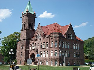
Barbour County is a county in north-central West Virginia, US. At the 2020 census, the population was 15,465. The county seat is Philippi, which was chartered in 1844. Both county and city were named for Philip P. Barbour (1783–1841), a U.S. Congressman from Virginia and Associate Justice of the U.S. Supreme Court. The county was formed in 1843 when the region was still part of the state of Virginia. In 1871, a small part of Barbour County was transferred to Tucker County, West Virginia.

The Appalachian Mountains, often called the Appalachians, are a system of mountains in eastern to northeastern North America. The Appalachians first formed roughly 480 million years ago during the Ordovician Period. They once reached elevations similar to those of the Alps and the Rocky Mountains before experiencing natural erosion. The Appalachian chain is a barrier to east–west travel, as it forms a series of alternating ridgelines and valleys oriented in opposition to most highways and railroads running east–west.

Rockingham County is a county located in the U.S. state of Virginia. As of the 2020 census, the population was 83,757. Its county seat is the independent city of Harrisonburg.

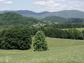
The Shenandoah Valley is a geographic valley and cultural region of western Virginia and the Eastern Panhandle of West Virginia in the United States. The valley is bounded to the east by the Blue Ridge Mountains, to the west by the eastern front of the Ridge-and-Valley Appalachians, to the north by the Potomac River and to the south by the James River. The cultural region covers a larger area that includes all of the valley plus the Virginia highlands to the west, and the Roanoke Valley to the south. It is physiographically located within the Ridge and Valley province and is a portion of the Great Appalachian Valley.

The Monongahela River —often referred to locally as the Mon —is a 130-mile-long (210 km) river on the Allegheny Plateau in north-central West Virginia and southwestern Pennsylvania. The river flows from the confluence of its west and east forks in north-central West Virginia northeasterly into southwestern Pennsylvania, then northerly to Pittsburgh and its confluence with the Allegheny River to form the Ohio River. The river's entire length is navigable via a series of locks and dams.

The Great Appalachian Valley, also called The Great Valley or Great Valley Region, is one of the major landform features of eastern North America. It is a gigantic trough—a chain of valley lowlands—and the central feature of the Appalachian Mountain system. The trough stretches about 1,200 miles (1,900 km) from Quebec to Alabama and has been an important north–south route of travel since prehistoric times.

The Allegheny Mountain Range, informally the Alleghenies, is part of the vast Appalachian Mountain Range of the Eastern United States and Canada and posed a significant barrier to land travel in less developed eras. The Allegheny Mountains have a northeast–southwest orientation, running for about 400 miles (640 km) from north-central Pennsylvania, southward through western Maryland and eastern West Virginia.

The Ridge-and-Valley Appalachians, also called the Ridge and Valley Province or the Valley and Ridge Appalachians, are a physiographic province of the larger Appalachian division and are also a belt within the Appalachian Mountains extending from southeastern New York through northwestern New Jersey, westward into Pennsylvania and southward into Maryland, West Virginia, Virginia, Kentucky, Tennessee, Georgia and Alabama. They form a broad arc between the Blue Ridge Mountains and the Appalachian Plateau physiographic province. They are characterized by long, even ridges, with long, continuous valleys in between.

The Kanawha River is a tributary of the Ohio River, approximately 97 mi (156 km) long, in the U.S. state of West Virginia. The largest inland waterway in West Virginia, its valley has been a significant industrial region of the state since early in the 19th century.

The Shenandoah River is the principal tributary of the Potomac River, 55.6 miles (89.5 km) long with two forks approximately 100 miles (160 km) long each, in the U.S. states of Virginia and West Virginia. The river and its tributaries drain the central and lower Shenandoah Valley and the Page Valley in the Appalachians on the west side of the Blue Ridge Mountains, in northwestern Virginia and the Eastern Panhandle of West Virginia. There is a hydroelectric plant along the Shenandoah river constructed in 2014 by Dominion.
The Potomac Highlands of West Virginia centers on five West Virginian counties in the upper Potomac River watershed in the western portion of the state's Eastern Panhandle, bordering Maryland and Virginia. Because of geographical proximity, similar topography and landscapes, and shared culture and history, the Potomac Highlands region also includes Pocahontas, Randolph, and Tucker counties, even though they are in the Monongahela River or New River watersheds and not that of the Potomac River.

The Winchester and Western Railroad is a shortline railroad operating from Gore through Winchester, Virginia and West Virginia to Hagerstown, Maryland. It also operates several lines in southern New Jersey, connecting to Conrail Shared Assets Operations at Millville and Vineland.
Laurel Mountain, also called Laurel Hill, is a long ridge in north-central West Virginia, US. Along with Rich Mountain to the south, it is considered to be the westernmost ridge of the Allegheny Mountains and the boundary between the Alleghenies and the Allegheny Plateau.
The West Virginia Division of Natural Resources (WVDNR) is an agency of the government of the U.S. state of West Virginia. While formerly known as the cabinet-level Department of Natural Resources, it is now part of the West Virginia Department of Commerce. The WVDNR is responsible for wildlife management, hunting and fishing regulations, and boater safety and also oversees state parks and resorts. It also operates the West Virginia State Wildlife Center, a zoo in French Creek that exhibits West Virginian wildlife.
The West Virginia Department of Transportation (WVDOT) is the state agency responsible for transportation in West Virginia. The Department of Transportation serves an umbrella organization for seven subsidiary agencies which are directly responsible for different areas of the state's infrastructure.

Pleasure riding is a form of equestrianism that encompasses many forms of recreational riding for personal enjoyment, absent elements of competition. In horse show competition, a wide variety of classes are labeled pleasure classes with judging standards based on the concept that horses or ponies exhibited should be well-mannered and thus a “pleasure” to ride.
Pleasure Valley may refer to:


