
Colonial Heights is an independent city in the Commonwealth of Virginia. As of the 2020 census, the population was 18,170. The Bureau of Economic Analysis combines the City of Colonial Heights with Dinwiddie County for statistical purposes.

At the Battle of Vitoria a British, Portuguese and Spanish army under the Marquess of Wellington broke the French army under King Joseph Bonaparte and Marshal Jean-Baptiste Jourdan near Vitoria in Spain, eventually leading to victory in the Peninsular War.
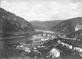
The Battle of Harpers Ferry was fought September 12–15, 1862, as part of the Maryland Campaign of the American Civil War. As Gen. Robert E. Lee's Confederate army invaded Maryland, a portion of his army under Maj. Gen. Thomas J. "Stonewall" Jackson surrounded, bombarded, and captured the Union garrison at Harpers Ferry, Virginia.

The Battle of Toulouse was one of the final battles of the Napoleonic Wars, four days after Napoleon's surrender of the French Empire to the nations of the Sixth Coalition. Having pushed the demoralised and disintegrating French Imperial armies out of Spain in a difficult campaign the previous autumn, the Allied British-Portuguese and Spanish army under the Duke of Wellington pursued the war into southern France in the spring of 1814.

Crescentwood is a neighbourhood in the River Heights area of Winnipeg, Manitoba. It is bordered on the north on Academy Road, on the east by the Assiniboine River, on the south by Corydon Avenue, and on the west by Cambridge Street.
Mechlenberg Heights is an unincorporated community in Jefferson County, West Virginia, United States. Mechlenberg Heights lies to the west of Shepherdstown along West Virginia Route 45.

Washington Heights is an unincorporated community on the Spruce Fork in Boone County in the U.S. state of West Virginia. Washington Heights lies to the south of Madison on West Virginia Route 17.
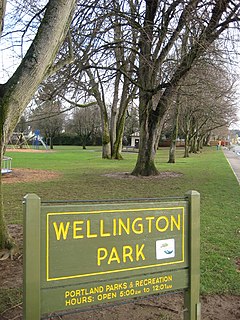
Roseway is a neighborhood in the Northeast section of Portland, Oregon. It is bordered by the neighborhoods Cully to the north and west, Sumner to the northeast, Madison South to the east and south, and Rose City Park to the west
Valley Heights is an unincorporated community in Summers County, West Virginia, United States. The community is located along the Greenbrier River, approximately 7 miles (11 km) southwest of Alderson and 15 miles (24 km) east of Hinton. Valley Heights is served by West Virginia Route 3 and West Virginia Route 12.
Charlton Heights is a census-designated place (CDP) in Fayette County, West Virginia, United States. Charlton Heights is located on the north bank of the Kanawha River, 4 miles (6.4 km) southwest of Gauley Bridge. Charlton Heights has a post office with ZIP code 25040. As of the 2010 census, its population was 406.
Montgomery Heights is an unincorporated community in Fayette County, West Virginia, United States. Montgomery Heights is located on the south bank of the Kanawha River, 4.5 miles (7.2 km) southeast of Montgomery.
Beard Heights is an unincorporated community in Pocahontas County, West Virginia, United States. Beard Heights is located on U.S. Route 219, 1.5 miles (2.4 km) southwest of Marlinton.
Tyler Heights, also known as Flatwoods, is an unincorporated community in Kanawha County, West Virginia, United States. Tyler Heights is located along West Virginia Route 622 at its junction with West Virginia Route 501, 5 miles (8.0 km) east-northeast of Nitro.

Godby Heights is an unincorporated community in Logan County, West Virginia, United States.
Logan Heights is an unincorporated community in Logan County, West Virginia, United States. It is part of the Mount Gay-Shamrock census-designated place.
Morgan Heights is an unincorporated community in Monongalia County, West Virginia, United States.


