Baramati ([baːɾamət̪iː]) is a city, a tehsil and a municipal council in Pune district in the state of Maharashtra, India. The city is about 100 km southeast of the city of Pune and about 250 km from Mumbai.
Ambattur is a northwestern neighbourhood of Chennai, India. It is located in Ambattur taluk of the Chennai District, surrounded by Avadi, Anna Nagar, Padi, Mogappair, Kallikuppam, Surapet, Korattur, Ayappakkam, Athipet and Thiruverkadu. It covers an area of 45 km2 (17 sq mi). The neighbourhood is served by Ambattur railway station of the Chennai Suburban Railway. Ambattur has its origins in a village of the same name which can be located at present as areas opposite to Ambattur telephone exchange. Ambattur was a village with large extents of agricultural farm lands irrigated by the once-sprawling Ambattur Lake. In 2011, the neighborhood had a population 466,205.
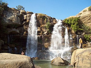
Manendragarh, is a city and administrative district headquarters of Manendragarh-Chirmiri-Bharatpur district in the state of Chhattisgarh, India. Formerly, it was the part of Koriya district. It is situated near the Chhattisgarh-Madhya Pradesh state border. The Chief Minister of Chhattisgarh state, Shri Bhupesh Baghel, inaugurated Manendragarh District on 9 September 2022 by separating it from korea district.

Digha is a seaside resort town in the state of West Bengal, India. It lies in Purba Medinipur district and at the northern end of the Bay of Bengal. It has a low gradient with a shallow sand beach. It is a popular sea resort in West Bengal.
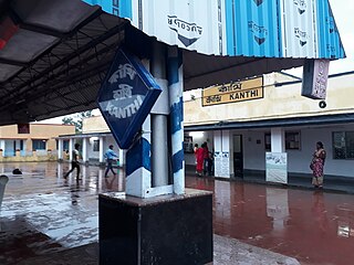
Contai popularly known as Kanthi is a coastal and subdivisional city and a municipality in Purba Medinipur district, West Bengal, India. It is the headquarters of the Contai subdivision.
Vuyyuru is a town in Krishna district of the Indian state of Andhra Pradesh. It is a Nagar panchayat and the headquarters of Vuyyuru Mandal. It is emerging as neighbourhood of Vijayawada, India situated 30 km away.
Nacharam is a neighbourhood of Hyderabad in the Indian state of Telangana. It falls under Uppal Mandal. It forms Ward No. 6 of Greater Hyderabad Municipal Corporation.

Ramnagar I is a community development block that forms an administrative division in Contai subdivision of Purba Medinipur district in the Indian state of West Bengal.

Ramnagar is a town and municipal board in the Nainital district of Kumaon, India. It is located approximately 65 kilometres (40 mi) from Nainital, the headquarters of the district.
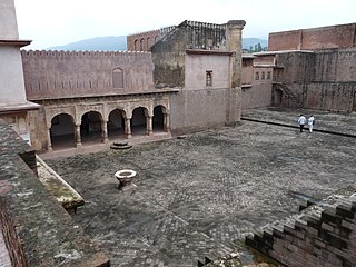
Ramnagar is a town and notified area committee in Udhampur District in the Indian union territory of Jammu and Kashmir.
Bidadi is a town situated on the Bengaluru – Mysuru expressway and is part of the Ramnagar in the state of Karnataka. The town is located 32 km from Bangalore towards Mysuru and is connected by both rail and bus to Bengaluru City. It is famous for a food dish called the "Thatte Idli" which is a larger flatter variant of the traditional south Indian idli.

Kandivali formerly Khandolee is a suburb in the north of Mumbai, Maharashtra, India and has a large Marathi, Koli, Gujarati population followed by others. British records highlight a fact which is different from what is suggested in the rest of the article. The area names that ends with "vali" were the actual valleys to the small hills surrounding the area, and that's how we have Kandolee Valley to Kandivali.
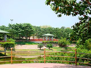
Sanathnagar is an industrial and residential neighbourhood in Hyderabad City, Telangana, India, and one of the most densely populated neighbourhoods in India.
Karwan is one of the major neighbourhoods in Hyderabad, Telangana, India. It is a part of the old city of Hyderabad.

Joka is a locality in South West Kolkata, India. It is a part of greater Behala region. This place is mostly known for Indian Institute of Management Calcutta and ESIC Medical College and Hospital.
Sagardighi is a town situated in the Sagardighi CD block in the Jangipur subdivision of Murshidabad district in the state of West Bengal, India.

Ramnagar II is a community development block that forms an administrative division in Contai subdivision of Purba Medinipur district in the Indian state of West Bengal.

Ahiran is a village in the Suti I CD block in the Jangipur subdivision of Murshidabad district in the state of West Bengal, India. It serves as the Headquarters of the Suti I administrative division.

Ramnagar is a neighborhood situated on the central part of Visakhapatnam City, India. The area, which falls under the local administrative limits of Greater Visakhapatnam Municipal Corporation. Ramnagar is located near Dwaraka Nagar, Asilmetta and Daba Gardens.
Ramnagar is a census town in the Raghunathganj I CD block in the Jangipur subdivision of the Murshidabad district in the state of West Bengal, India.


