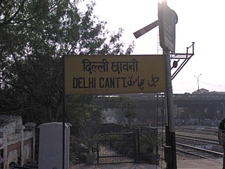
Delhi Cantonment is a Class I Cantonment Board established in 1914. The area of the Cantonment is 10,452 acres (42.30 km2) and the population of the Cantonment as per the 2011 census is 110,351.
Nanganallur or Nangainallur is one of the southern neighbourhoods of Chennai, India. Since September 2011, it has become a part of Chennai Corporation. It is a residential area close to the Chennai International Airport.
K.K. Nagar is a neighbourhood located in the southern part of Chennai, India. This is situated west of Ashok Nagar and the Chennai Airport is around 10 km southwest of this place. K.K. Nagar was a locality developed in the 1970s and early 1980s. K.K. Nagar is roughly 5 km2 in area. K.K. Nagar is organized by sectors and streets, and there are 15 sectors, and around 102 streets.

Koti is a locality in the city of Hyderabad, Telangana, India. It is one of the best-known commercial old suburbs of Hyderabad. There are two areas in the vicinity: King Koti and Ram Koti.
Mahemdavad is a town with municipality in the Kheda district in the Indian state of Gujarat. Mahemdavad is situated on the Vatrak River bank. The nearest city is Kheda. It is 30 km from largest city of Gujarat, Ahmedabad.
Nacharam is a neighbourhood of Hyderabad in the Indian state of Telangana. It falls under Uppal Mandal. It forms Ward No. 6 of Greater Hyderabad Municipal Corporation.

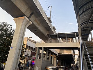
The Hyderabad Metro is a rapid transit system, serving the city of Hyderabad, Telangana, India. It is the third longest operational metro network in India after Delhi Metro and Namma Metro (Bengaluru), and the lines are arranged in a secant model. It is funded by a public–private partnership (PPP), with the state government holding a minority equity stake. Hyderabad Metro is the world's largest elevated Metro Rail system based on DBFOT basis. A special purpose vehicle company, L&T Metro Rail Hyderabad Ltd (L&TMRHL), was established by the construction company Larsen & Toubro to develop the Hyderabad metro rail project.
Sultan Bazar is an old commercial market in Hyderabad, Telangana, India. It lies between the commercial areas of Abids and Koti. It was previously known as the residency bazaar. Later it was named after the nawab of that area, Syed Sultanuddin, and so is known as sultan bazar now.
Loni is a town, near Ghaziabad city in Ghaziabad district in the state of Uttar Pradesh, India and Loni town is governed by Loni Municipal Council which comes under Ghaziabad Metropolitan Region.

Miyapur, located 22.5 kilometres (14.0 mi) northwest of Hyderabad in India, is part of Greater Hyderabad and administered by GHMC and developed by HMDA. Transportation is managed by UMTA.
Santosh Nagar Colony, or Santoshnagar Colony, is a residential and commercial area in Hyderabad, India. It is located near Saidabad in the Old City of Hyderabad and DRDO laboratories. Hyderabad International Airport is about 14 kilometres (8.7 mi) or a 30-minute drive away from here. It is divided into two areas, the Old Santoshnagar Colony and New Santoshnagar Colony. Santoshnagar falls under the Yakutpura assembly constituency, which is represented by All India Majlis-e-Ittehadul Muslimeen Legislator Jaffer Hussain Meraj.
Sanathnagar is an industrial and residential neighbourhood in Hyderabad City, Telangana, India, and one of the most densely populated neighbourhoods in India.

Nizampet is a satellite city of Hyderabad and a municipal corporation situated in Bachupally mandal, Medchal-Malkajgiri district of Telangana, India. It is administered as Nizampet Municipal Corporation.
Yakutpura is a traditional neighbourhoods in the Old City, Hyderabad in Telangana state, India. With a population of 6,3350 inhabitants, the size of the area is about 5.7 square kilometers.
Dabeerpura is one of the oldest neighborhoods in the Old City area of Hyderabad, Telangana, India. It is surrounded by Yakutpura, Chanchalguda, Purani Haveli, Noorkhan Bazar, and Azampura. Dabeerpura has one of the original thirteen gateways called darwaza. There is a big flyover over the train track in this suburb built in 1990.
Shivam Road is a major commercial and residential area in Amberpet, Hyderabad, Telangana, India. This area is named after the Shivam Temple which houses a large shiva lingam, with the foundation stone laid by Satya Sai Baba.
Afzal Gunj is one of the neighbourhoods in Old City, Hyderabad, Telangana, India, close to river Musi. Afzal Gunj is the hub of local transportation due to the presence of Central Bus Station in the region. The bus station provides services to most parts of the city.
Madhavaram Milk Colony is a neighbourhood in northern Chennai, a metropolitan city in Chennai district in the Indian state of Tamil Nadu.
Neredmet, formally known as Neredu Mettu, is a residential neighbourhood in Hyderabad, Telangana, India. It falls under Malkajgiri mandal & Circle in Medchal-Malkajgiri district. Neredmet currently serves as the headquarters of Rachakonda Police commissionerate, one of the three police commissionerates of Hyderabad City. It was earlier a part of Malkajgiri Municipality, but now it is administered under Malkajgiri Circle of GHMC-Secunderabad Zone. It forms Ward No. 136- Neredmet (Fully), Ward No. 137- Vinayak Nagar(Fully), Ward No. 138- Moula-Ali(Half), Ward No. 139- East Anandbagh(Partially), Ward No. 140- Malkajgiri (Half), of Greater Hyderabad Municipal Corporation.
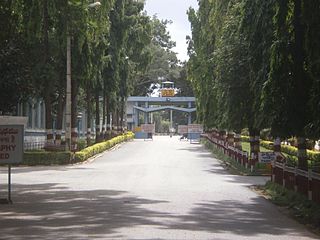
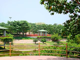
BHEL Township, Hyderabad is a suburb of Hyderabad, Telangana. This has been developed like other BHEL townships after Indian public sector engineering company BHEL started its operations here. Township is well known for its greenery and lush green campus and large numbers of quarters with full amenities. Hostels for ET's, Assistant Engineers and artisans are available here. It is spread over an area of around 16 km2 and provides facilities like, parks, community halls, sports complex, grounds, library, shopping centers, banks, and post offices. Free health services are extended to all the employees and their dependents through BHEL run hospital.