Reservoir modeling

Last updated
Screenshot of a structure map generated by Contour map software for an 8500ft deep gas & Oil reservoir in the Erath field, Vermilion Parish, Erath, Louisiana. The left-to-right gap, near the top of the contour map indicates a Fault line. This fault line is between the blue/green contour lines and the purple/red/yellow contour lines. The thin red circular contour line in the middle of the map indicates the top of the oil reservoir. Because gas floats above oil, the thin red contour line marks the gas/oil contact zone. Contour map software screen snapshot of isopach map for 8500ft deep OIL reservoir with a Fault line.jpg
Screenshot of a structure map generated by Contour map software for an 8500ft deep gas & Oil reservoir in the Erath field, Vermilion Parish, Erath, Louisiana. The left-to-right gap, near the top of the contour map indicates a Fault line. This fault line is between the blue/green contour lines and the purple/red/yellow contour lines. The thin red circular contour line in the middle of the map indicates the top of the oil reservoir. Because gas floats above oil, the thin red contour line marks the gas/oil contact zone.

In the oil and gas industry, reservoir modeling involves the construction of a computer model of a petroleum reservoir, for the purposes of improving estimation of reserves and making decisions regarding the development of the field, predicting future production, placing additional wells and evaluating alternative reservoir management scenarios.

Contents

A reservoir model represents the physical space of the reservoir by an array of discrete cells, delineated by a grid which may be regular or irregular. The array of cells is usually three-dimensional, although 1D and 2D models are sometimes used. Values for attributes such as porosity, permeability and water saturation are associated with each cell. The value of each attribute is implicitly deemed to apply uniformly throughout the volume of the reservoir represented by the cell.

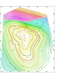
Types of reservoir model

Reservoir models typically fall into two categories:

Sometimes a single "shared earth model" is used for both purposes. More commonly, a geological model is constructed at a relatively high (fine) resolution. A coarser grid for the reservoir simulation model is constructed, with perhaps two orders of magnitude fewer cells. Effective values of attributes for the simulation model are then derived from the geological model by an upscaling process. Alternatively, if no geological model exists, the attribute values for a simulation model may be determined by a process of sampling geological maps.

Uncertainty in the true values of the reservoir properties is sometimes investigated by constructing several different realizations of the sets of attribute values. The behaviour of the resulting simulation models can then indicate the associated level of economic uncertainty.

The phrase "reservoir characterization" is sometimes used to refer to reservoir modeling activities up to the point when a simulation model is ready to simulate the flow of fluids.

Commercially available software is used in the construction, simulation and analysis of the reservoir models. [1]

Seismic to simulation

The processes required to construct reservoir models are described by the phrase Seismic to simulation. The process is successful if the model accurately reflects the original well logs, seismic data and production history.

Reservoir models are constructed to gain a better understanding of the subsurface that leads to informed well placement, reserves estimation and production planning. Models are based on measurements taken in the field, including well logs, seismic surveys, and production history. [2]

Seismic to simulation enables the quantitative integration of all field data into an updateable reservoir model built by a team of geologists, geophysicists, and engineers. Key techniques used in the process include integrated petrophysics and rock physics to determine the range of lithotypes and rock properties, geostatistical inversion to determine a set of plausible seismic-derived rock property models at sufficient vertical resolution and heterogeneity for flow simulation, stratigraphic grid transfer to accurately move seismic-derived data to the geologic model, and flow simulation for model validation and ranking to determine the model that best fits all the data.

Rock physics and petrophysics

The first step in seismic to simulation is establishing a relationship between petrophysical key rock properties and elastic properties of the rock. This is required in order to find common ground between the well logs and seismic data. [3]

Well logs are measured in depth and provide high resolution vertical data, but no insight into the inter-well space. Seismic are measured in time and provide great lateral detail but is quite limited in its vertical resolution. When correlated, well logs and seismic can be used to create a fine-scale 3D model of the subsurface.

Insight into the rock properties comes from a combination of basic geologic understanding and well-bore measurements. Based on an understanding of how the area was formed over time, geologists can predict the types of rock likely to be present and how rapidly they vary spatially. Well log and core measurements provide samples to verify and fine-tune that understanding.

Seismic data is used by petrophysicists to identify the tops of various lithotypes and the distribution of rock properties in the inter-well space using seismic inversion attributes such as impedance. Seismic surveys measure acoustic impedance contrasts between rock layers. As different geologic structures are encountered, the sound wave reflects and refracts as a function of the impedance contrast between the layers. Acoustic impedance varies by rock type and can therefore be correlated to rock properties using rock physics relationships between the inversion attributes and petrophysical properties such as porosity, lithology, water saturation, and permeability.

Once well logs are properly conditioned and edited, a petrophysical rock model is generated that can be used to derive the effective elastic rock properties from fluid and mineral parameters as well as rock structure information. The model parameters are calibrated by comparison of the synthetic to the available elastic sonic logs. Calculations are performed following a number of rock physics algorithms including: Xu & White, Greenberg & Castagna, Gassmann, Gardner, modified upper and lower Hashin-Shtrikman, and Batzle & Wang.

When the petrophysical rock model is complete, a statistical database is created to describe the rock types and their known properties such as porosity and permeability. Lithotypes are described, along with their distinct elastic properties.

MCMC geostatistical inversion

In the next step of seismic to simulation, seismic inversion techniques combine well and seismic data to produce multiple equally plausible 3D models of the elastic properties of the reservoir. Seismic data is transformed to elastic property log(s) at every trace. Deterministic inversion techniques are used to provide a good overall view of the porosity over the field, and serve as a quality control check. To obtain greater detail needed for complex geology, additional stochastic inversion is then employed. [4]

Geostatistical inversion procedures detect and delineate thin reservoirs otherwise poorly defined. [5] Markov chain Monte Carlo (MCMC) based geostatistical inversion addresses the vertical scaling problem by creating seismic derived rock properties with vertical sampling compatible to geologic models.

All field data is incorporated into the geostatistical inversion process through the use of probability distribution functions (PDFs). Each PDF describes a particular input data in geostatistical terms using histograms and variograms, which identify the odds of a given value at a specific place and the overall expected scale and texture based on geologic insight.

Once constructed, the PDFs are combined using Bayesian inference, resulting in a posterior PDF that conforms to everything that is known about the field. [6] A weighting system is used within the algorithm, making the process more objective.

From the posterior PDF, realizations are generated using a Markov chain Monte Carlo algorithm. These realizations are statistically fair and produce models of high detail, accuracy and realism. Rock properties like porosity can be cosimulated from the elastic properties determined by the geostatistical inversion. This process is iterated until a best fit model is identified.

Inversion parameters are tuned by running the inversion many times with and without well data. Without the well data, the inversions are running in blind-well mode. These blind-well mode inversions test the reliability of the constrained inversion and remove potential bias.

This statistical approach creates multiple, equi-probable models consistent with the seismic, wells, and geology. Geostatistical inversion simultaneously inverts for impedance and discrete properties types, and other petrophysical properties such as porosity can then be jointly cosimulated.

The output volumes are at a sample rate consistent with the reservoir model because making synthetics of finely sampled models is the same as from well logs. Inversion properties are consistent with well log properties because the histograms used to generate the output rock properties from the inversion are based on well log values for those rock properties.

Uncertainty is quantified by using random seeds to generate slightly differing realizations, particularly for areas of interest. This process improves the understanding of uncertainty and risk within the model.

Stratigraphic grid transfer

Following geostatistical inversion and in preparation for history matching and flow simulation, the static model is re-gridded and up-scaled. The transfer simultaneously converts time to depth for the various properties and transfers them in 3D from the seismic grid to a corner-point grid. The relative locations of properties are preserved, ensuring data points in the seismic grid arrive in the correct stratigraphic layer in the corner point grid. [6]

The static model built from seismic is typically orthogonal but flow simulators expect corner point grids. The corner point grid consists of cubes that are usually much coarser in the horizontal direction and each corner of the cube is arbitrarily defined to follow the major features in the grid. Converting directly from orthogonal to corner point can cause problems such as creating discontinuity in fluid flow.

An intermediate stratigraphic grid ensures that important structures are not misrepresented in the transfer. The stratigraphic grid has the same number of cells as the orthogonal seismic grid, but the boundaries are defined by stratigraphic surfaces and the cells follow the stratigraphic organization. This is a stratigraphic representation of the seismic data using the seismic interpretation to define the layers. The stratigraphic grid model is then mapped to the corner point grid by adjusting the zones.

Using the porosity and permeability models and a saturation height function, initial saturation models are built. If volumetric calculations identify problems in the model, changes are made in the petrophysical model without causing the model to stray from the original input data. For example, sealing faults are added for greater compartmentalization.

Model validation and ranking

In the last step of seismic to simulation, flow simulation continues the integration process by bringing in the production history. This provides a further validation of the static model against history. A representative set of the model realizations from the geostatistical inversion are history matched against production data. If the properties in the model are realistic, simulated well bottom hole pressure behavior should match historical (measured) well bottom hole pressure. [7] Production flow rates and other engineering data should also match.

Based on the quality of the match, some models are eliminated. After the initial history match process, dynamic well parameters are adjusted as needed for each of the remaining models to improve the match. The final model represents the best match to original field measurements and production data and is then used in drilling decisions and production planning.

See also

Related Research Articles

Geostatistics is a branch of statistics focusing on spatial or spatiotemporal datasets. Developed originally to predict probability distributions of ore grades for mining operations, it is currently applied in diverse disciplines including petroleum geology, hydrogeology, hydrology, meteorology, oceanography, geochemistry, geometallurgy, geography, forestry, environmental control, landscape ecology, soil science, and agriculture. Geostatistics is applied in varied branches of geography, particularly those involving the spread of diseases (epidemiology), the practice of commerce and military planning (logistics), and the development of efficient spatial networks. Geostatistical algorithms are incorporated in many places, including geographic information systems (GIS).

Petroleum geology is the study of origin, occurrence, movement, accumulation, and exploration of hydrocarbon fuels. It refers to the specific set of geological disciplines that are applied to the search for hydrocarbons.

In petroleum exploration and development, formation evaluation is used to determine the ability of a borehole to produce petroleum. Essentially, it is the process of "recognizing a commercial well when you drill one".

<span class="mw-page-title-main">Wireline (cabling)</span> Technology used in oil and gas wells

In the oil and gas industry, the term wireline usually refers to the use of multi-conductor, single conductor or slickline cable, or "wireline", as a conveyance for the acquisition of subsurface petrophysical and geophysical data and the delivery of well construction services such as pipe recovery, perforating, plug setting and well cleaning and fishing. The subsurface geophysical and petrophysical information results in the description and analysis of subsurface geology, reservoir properties and production characteristics.

<span class="mw-page-title-main">Hydrocarbon exploration</span> Attempts to locate oil and gas

Hydrocarbon exploration is the search by petroleum geologists and geophysicists for deposits of hydrocarbons, particularly petroleum and natural gas, in the Earth's crust using petroleum geology.

<span class="mw-page-title-main">Geologic modelling</span> Applied science of creating computerized representations of portions of the Earths crust

Geologic modelling,geological modelling or geomodelling is the applied science of creating computerized representations of portions of the Earth's crust based on geophysical and geological observations made on and below the Earth surface. A geomodel is the numerical equivalent of a three-dimensional geological map complemented by a description of physical quantities in the domain of interest. Geomodelling is related to the concept of Shared Earth Model; which is a multidisciplinary, interoperable and updatable knowledge base about the subsurface.

Well logging, also known as borehole logging is the practice of making a detailed record of the geologic formations penetrated by a borehole. The log may be based either on visual inspection of samples brought to the surface or on physical measurements made by instruments lowered into the hole. Some types of geophysical well logs can be done during any phase of a well's history: drilling, completing, producing, or abandoning. Well logging is performed in boreholes drilled for the oil and gas, groundwater, mineral and geothermal exploration, as well as part of environmental and geotechnical studies.

In petrophysics, Archie's law relates the in-situ electrical conductivity (C) of a porous rock to its porosity and fluid saturation of the pores:

Geosteering is the optimal placement of a wellbore based on the results of realtime downhole geological and geophysical logging measurements rather than three-dimensional targets in space. The objective is usually to keep a directional wellbore within a hydrocarbon pay zone defined in terms of its resistivity, density or even biostratigraphy. In mature areas, geosteering may be used to keep a wellbore in a particular reservoir section to minimize gas or water breakthrough and maximize economic production from the well. In the process of drilling a borehole, geosteering is the act of adjusting the borehole position on the fly to reach one or more geological targets. These changes are based on geological information gathered while drilling.

Petrophysics is the study of physical and chemical rock properties and their interactions with fluids.

<span class="mw-page-title-main">Reservoir simulation</span> Using computer models to predict the flow of fluids through porous media

Reservoir simulation is an area of reservoir engineering in which computer models are used to predict the flow of fluids through porous media.

<span class="mw-page-title-main">Petrel (reservoir software)</span> Software for exploration of petroleum and gas reserves

Petrel is a software platform used in the exploration and production sector of the petroleum industry. It enables the user to interpret seismic data, perform well correlation, build reservoir models, visualize reservoir simulation results, calculate volumes, produce maps and design development strategies to maximize reservoir exploitation. Risk and uncertainty can be assessed throughout the life of the reservoir. Although some other oil servicing companies hire the services of this software, Petrel is developed and built by Schlumberger.

In geophysics, seismic inversion is the process of transforming seismic reflection data into a quantitative rock-property description of a reservoir. Seismic inversion may be pre- or post-stack, deterministic, random or geostatistical; it typically includes other reservoir measurements such as well logs and cores.

<span class="mw-page-title-main">IRAP RMS Suite</span>

Roxar RMS is a reservoir characterization and modeling software suite. It is primarily designed for use in the oil and gas industry, helping engineers gather data from a wide variety of sources to efficiently build reliable reservoirs.

Heavy oil production is a developing technology for extracting heavy oil in industrial quantities. Estimated reserves of heavy oil are over 6 trillion barrels, three times that of conventional oil and gas.

A synthetic seismogram is the result of forward modelling the seismic response of an input earth model, which is defined in terms of 1D, 2D or 3D variations in physical properties. In hydrocarbon exploration this is used to provide a 'tie' between changes in rock properties in a borehole and seismic reflection data at the same location. It can also be used either to test possible interpretation models for 2D and 3D seismic data or to model the response of the predicted geology as an aid to planning a seismic reflection survey. In the processing of wide-angle reflection and refraction (WARR) data, synthetic seismograms are used to further constrain the results of seismic tomography. In earthquake seismology, synthetic seismograms are used either to match the predicted effects of a particular earthquake source fault model with observed seismometer records or to help constrain the Earth's velocity structure. Synthetic seismograms are generated using specialized geophysical software.

<span class="mw-page-title-main">Linear seismic inversion</span> Interpretation of seismic data using linear model

Inverse modeling is a mathematical technique where the objective is to determine the physical properties of the subsurface of an earth region that has produced a given seismogram. Cooke and Schneider (1983) defined it as calculation of the earth's structure and physical parameters from some set of observed seismic data. The underlying assumption in this method is that the collected seismic data are from an earth structure that matches the cross-section computed from the inversion algorithm. Some common earth properties that are inverted for include acoustic velocity, formation and fluid densities, acoustic impedance, Poisson's ratio, formation compressibility, shear rigidity, porosity, and fluid saturation.

<span class="mw-page-title-main">Ricardo A. Olea</span>

Ricardo Antonio Olea is a Chilean American who was a research mathematical statistician with the United States Geological Survey (2006–21). Previously, he spent most of his career with the National Oil Company of Chile (ENAP) in Punta Arenas and Santiago, and with the Kansas Geological Survey in Lawrence. He received the William Christian Krumbein Medal in 2004 from the International Association for Mathematical Geosciences. He served as Secretary-General (1992−1996) and President (1996–2000) for the International Association for Mathematical Geosciences; and Secretary General (2019–21) of the Compositional Data Association.

In petroleum engineering, TEM, also called TEM-function developed by Abouzar Mirzaei-Paiaman, is a criterion to characterize dynamic two-phase flow characteristics of rocks. TEM is a function of relative permeability, porosity, absolute permeability and fluid viscosity, and can be determined for each fluid phase separately. TEM-function has been derived from Darcy's law for multiphase flow.

<span class="mw-page-title-main">Kamel Bidari</span> Algerian politician

Kamel Bidari is the Algerian Minister of Higher Education and Scientific Research. He was appointed as minister on 9 September 2022.

References

  1. Stephen Tyson. An Introduction to Reservoir Modeling (2007), ISBN   978-1-906928-07-0.
  2. "RETINA Homepage".
  3. "Benefits of Integrating Rock Physics with Petrophysics: Five Key Reasons to Employ an Integrated, Iterative Workflow", Fugro-Jason White Paper, 2007.
  4. Francis, A., "Limitations of Deterministic and Advantages of Stochastic Seismic Inversion", CSEG Records, February 2005, p. 5-11.
  5. Merletti, G., Torres-Verdin, C., "Accurate Detection and Spatial Delineation of Thin-Sand Sedimentary Sequences via Joint Stochastic Inversion of Well Logs and 3D Pre-Stack Seismic Amplitude Data", SPE 102444.
  6. 1 2 "Incorporating Geophysics into Geologic Models: New Approach Makes Geophysical Models Available to Engineers in a Form They Can Use", Fugro-Jason White Paper, 2008.
  7. Castoro A., de Groot L., Forsyth D., Maguire R., Rijkers R., Webber R., "Accurate Reservoir Modelling Through Optimized Integration of Geostatistical Inversion And Flow Simulation. A North Sea Case Study", Petex, 2008.

Further reading