
Pala, or Palai is a town and a municipality in Kottayam district of Kerala, India. It is the headquarters of the Meenachil taluk and the Pala Revenue Division.

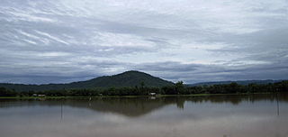
Palakkad is one of the 14 districts in the Indian state of Kerala. It was carved out of the southeastern region of the former Malabar District on 1 January 1957. It is located at the central region of Kerala and is the second largest district in the state after Idukki. The city of Palakkad is the district headquarters. Palakkad is bordered on the northwest by the Malappuram district, on the southwest by the Thrissur district, on the northeast by Nilgiris district, and on the east by Coimbatore district of Tamil Nadu. The district is nicknamed "The granary of Kerala". Palakkad is the gateway to Kerala due to the presence of the Palakkad Gap, in the Western Ghats. The 2,383 m high Anginda peak, which is situated in the border of Palakkad district, Nilgiris district, and Malappuram district, in Silent Valley National Park, is the highest point of elevation in Palakkad district. Palakkad city is about 347 kilometres (216 mi) northeast of the state capital, Thiruvananthapuram.
Diphu is the headquarter of Karbi Anglong district in the state of Assam in India. This small town is a popular tourist hill station for people of nearby cities.

Pauri is a town and a municipal board in Pauri Garhwal district in the Indian state of Uttarakhand. Pauri is the seat of the Divisional Commissioner of the Garhwal Division.
Gudivada is a city in Krishna district of the Indian state of Andhra Pradesh. It is a municipality and the headquarters of Gudivada mandal in Gudivada revenue division. It is one of the cities in the state to be a part of Andhra Pradesh Capital Region. It is the twenty-seventh most populous city in Andhra Pradesh and the three-hundredth most populous city in India with a population of 118,167 according to the 2011 Census of India.

Balurghat (pron:bʌlʊəˈgɑ:t) is a city and a municipality in the state of West Bengal, India. It is the district headquarter of the Dakshin Dinajpur district. It is one of the major cities connected through National Highway 512. In this town there are museum, parks, super speciality hospital, govt. offices, district court, schools, colleges, a university, police station, railway station, hotels, restaurants, cinema halls, temples, mosques, churches, etc. There is the Atreyee river which flows through this town. It is a place/town to live peacefully. It is a place to visit in the month of October to November when one can enjoy ritualistic and religious festivals. From the inner area of Balurghat one can go Hilli, a rural area, where one can see India-Bangladesh border.
Thottada is a census town and suburb of Kannur city situated on NH 66 of about 8 km (5.0 mi) south of Kannur railway station in Kerala State, India.
Barbigha is a city and a municipality in the Sheikhpura district of Bihar, India. It is well connected by road to the state capital of Patna. National highways NH33 and NH333A also pass through Barbigha, and Bihta-Sarmera four lane state highway passes from Gopalbad near it.
Gormi is a block and a nagar panchayat in Bhind district in the Indian state of Madhya Pradesh. Gormi is located at 26.6°N 78.52°E..
Kampli is a town in the Bellary district, Kampli taluk, in the Indian state of Karnataka. It is a headquarters of Kampli Taluk. The town is situated about 15 km away from Hampi.

Khirpai, also known as Kshirpai, is a city and a municipality in the Ghatal subdivision of the Paschim Medinipur district in the state of West Bengal, India. The city is situated between Ghatal and Chandrakona, near the banks of the rivers Shilabati and Kethai, and is one of the oldest municipalities in India. Khirpai is also famous for its Babarsa, a special type of sweetmeat, which is not available elsewhere.
Mahalingpur or Mahalingapura in Kannada is a town of Bagalkot district in the Indian state of Karnataka. Agriculture, weaving and jaggery production are the primary industries here. In the past, town was called as Naragatti. Later renamed as Mahalingpur after the gracious appearance of Lord Shri Mahalingeshwara. People speak typical Kannada, understand English and Hindi. The town is known for its picturesque surroundings and pleasant climate. The Ghataprabha River flows through nearby Nandagaon village from its source, which lies to the southwest of the town, and in Kudala Sangama gets merge with Krishna. Mahalingpur is one of the major commercial towns in the Bagalkot district. Jaggery and Saari's are common export marketing stuffs here.
Mullanpur Garibdass is a town in SAS Nagar district in the Indian state of Punjab, north of the city of Mohali and Chandigarh. Garibdas village is located in vicinity of this town.

Raipur Rani is a census town in Panchkula district in the Indian state of Haryana. It is located on the Panchkula city-Chandigarh-Nahan-Paonta Sahib-Dehradun highway 30 kilometres east from the Chandigarh-Mohali-Panchkula urban cities combine. It is about 20 kilometres from the Dera Bassi Industrial belt and 10 kilometres from the Barwala industrial estate. Narayangarh in the Ambala District is the next large town in its proximity.
Thiruverumbur is a neighbourhood in the city of Tiruchirapalli in the Indian state of Tamil Nadu. It was merged with the Tiruchirappalli Corporation in 2011.
Wangjing is a town and a municipal council in Thoubal district in the Indian state of Manipur. It is about 6 km from district headquarters and an agricultural town in Thoubal district in the Indian state of Manipur. It is bordered by Heirok village in the east, Tentha village in the south-west, and on the other side by agricultural land. Wangjing River, a rivulet flowing down from the eastern hills, runs through the middle of the town, serving as a natural spring. It is connected to other parts of the state by the Imphal–Moreh national highway. It is the junction between Heirok and Tentha village.

Koppa is a panchayat town in Chikkamagaluru district in the Indian state of Karnataka. It is the headquarters of Koppa sub-district. The town name Koppa is derived from Kopada (anger) Veerabadra Swamy temple, a historic temple that attracts devotees across Malnad.
Peringome is a town in Kannur district in the Indian state of Kerala. It is 60 km north-east of Kannur town.
Sreekrishnapuram is a town within the Ottappalam Tehsil of Palakkad district in the state of Kerala, India.
Mandawara is a village under Kuchaman City tehsil in Nagaur district in the Indian state of Rajasthan.


