
Hoshangabad, officially Narmadapuram, is a city and municipality in the Indian state of Madhya Pradesh. It serves as the headquarters of both Hoshangabad district and Narmadapuram division. It is located in central India, on the south bank of the Narmada River. Hoshangabad is 76.7 km from the state capital and the nearest airport Bhopal.

Mandla is a town with municipality in Mandla district in the Indian state of Madhya Pradesh. It is the administrative headquarters of Mandla District. The town is situated in a loop of the Narmada River, which surrounds it on three sides, and for 15 miles between Mandla and Ramnagar, Madhya Pradesh the river flows in a deep bed unbroken by rocks. The Narmada is worshiped here, and many ghats have been constructed on the banks of the river. It was a capital of the Gondwana Kingdom who built a palace and a fort, which in the absence of proper care have gone to ruins.
Mandleshwar is a town and nagar panchayat in the Khargone district of the India state of Madhya Pradesh. It is on the banks of Narmada River, 8 kilometres (5.0 mi) east of Maheshwar and 99 kilometres (62 mi) south of Indore. It is a "Pavitra nagri" as termed by the government of Madhya Pradesh, as it is an ancient town. It is the education centre of Maheshwar block, the location of the district court and district jail of Khargone, and is also the political centre of Maheshwar block.

Bithoor or Bithur is a town in Kanpur District, 23.4 kilometres (14.5 mi) by road north of the centre of Kanpur city, in Uttar Pradesh, India. Bithoor is situated on the right bank of the River Ganges, and is a centre of Hindu pilgrimage. Bithoor is also the centre for War of Independence of 1857 as Nana Sahib, a popular freedom fighter who was based there. The city is enlisted as a municipality of Kanpur metropolitan area.
Balaghat district is a district of Madhya Pradesh state in Central India. The town of Balaghat serves as its administrative headquarters.

Dehu is a census town in Pune district in the state of Maharashtra, India. Dehu is known for being the abode of Sant Tukaram. The Tukaram Palakhi heading to Pandharpur originates from Dehu in the month of Ashadh.

Budhni (बुधनी), also spelled Budni or Budhani, is a town and a Nagar Palika in Sehore district in the state of Madhya Pradesh, India. It is situated on Bhopal to Hoshangabad road at a distance of 7 km from Hoshangabad in north direction on the banks of Narmada River.It is also famous for Tractor testing i.e. CFMTTI (Institute under central government or Tractor Nagar.
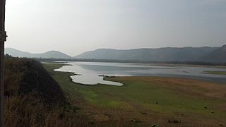
Bamhni Banjar is a town and nagar panchayat in the Mandla district in the state of Madhya Pradesh, India. Bamhni is commonly known as Bamhni Banjar because of the river Banjar that flows across it. The river originates from Kanha National Park and is one of the tributary of Narmada River. Banjar river later joins Narmada river in Mandla. It is situated between Mandla and Nainpur broad gauge railway line. Bamhni is a town which is centre of many village around them. It is 20 kilometres from the district headquarters in Mandla. Bamhni Banjar is home to the famous 'Sheetla Mata temple' which hosts the annual procession of 'Jwaare' in which more than 10,000 people take part. 'Banjar pull' is a tourist place of city. Bamhni has a vibrant cloth market with shops full of shiny and in-fashioned clothes. The market runs for the full week except in Wednesday, the market holiday. Bamhni Banjar has good educational schools like Gurukul English School, Saraswati Vidya Mandir, Bright Career School, Kanyashaala, Haveli High School, St. Convent among many others. Bamhni Banjar falls in-route to the NH-543 highway which connects Jabalpur city in Madhya Pradesh to Nagpur city in Maharashtra.

Barhalganj (बड़हलगंज) is a town in the municipality of Gorakhpur, Uttar Pradesh. The town is surrounded by several rivers, which are of religious significance to the Hindu population in Uttar Pradesh. Barhalganj is situated on the left bank of the Ghaghra river, a tributary of the Ganges, and the town is connected to the district of Mau by a bridge over the Saryu river.

Bodeli is a city and taluka in Chhota Udaipur district in the eastern part of the state of Gujarat, India.
Dharampuri is a town and headquarters of a tehsil in Dhar district in the state of Madhya Pradesh, India. It is situated on banks of river Narmada. It is a place of some historical and archaeological interest.
Doharighat is a town and a nagar panchayat in Mau district in the state of Uttar Pradesh, India.
Ghansor is a small census town in Seoni district in the state of Madhya Pradesh,. It serves the headquarters for Janpad panchayat Ghansor. It hosts a Railway station which comes in South Eastern Central Railways zone connecting Jabalpur and Balaghat. It has a government Community Health centre and has robust government education centre with a network of schools and colleges both Private and Public .It is well connected with bus services from Lakhnadon Seoni Jabalpur Mandla. It's weather conditions are- The lowest temperature is -4°c at winter night at 3:00 am in the year 2018. The highest temperature is 52°c at 3.00 pm n 2016 in summer season

Manihari is a town and a notified area in Katihar district in the Indian state of Bihar. Pincode of Manihari is 854113.
Mundi is a city and Tehsil in the Khandwa district of Nimar region the Indian state of Madhya Pradesh. It is situated in North Side of East Nimar District.
Nainpur is a town and Municipal Council in the Mandla district, of the Indian state of Madhya Pradesh.
Banapura is a small town in the Hoshangabad District of Madhya Pradesh, India. Banapura is a twin city of Seoni Malwa.

Nemawar is a small town in Dewas District, Madhya Pradesh, India. Handia is located on the left bank of the Narmada river opposite to Handia. However, it belongs to Khategaon block and tehsil of the Dewas district

Harali is a Town in Gadhinglaj Taluka Kolhapur district situated in the southwest corner of state Maharashtra, India. Harali is situated on banks of Hiranyakeshi river originated from the Great Amboli Ghats is about 7 km from Gadhinglaj towards south and 12 km from the second largest city Kadgaon in Gadhinglaj Taluka and just 2 km from Mahagaon,Gadhinglaj. It is managed by Town Council.In 2011 it has a population of about 15,856. Harali is the eight largest city and town in Gadhinglaj Taluka. Shri Appasaheb Nalawade Gadhinglaj Taluka Sahakari Sakhar Karkhana is situated in the town.
Mardana is a village in the state of Madhya Pradesh located on the banks of the river Narmada in India. The village falls under the Nimar region. The region predominantly speaks the local dialect "Nimadi" and Hindi. Nearest airport is Indore and nearest railway station is Khandwa.

