Nainpur

Last updated

Nainpur
Town
Madhya Pradesh location map.svg
Red pog.svg
Nainpur
Location in Madhya Pradesh, India
Coordinates: 22°26′N80°07′E / 22.43°N 80.12°E / 22.43; 80.12 Coordinates: 22°26′N80°07′E / 22.43°N 80.12°E / 22.43; 80.12
CountryFlag of India.svg  India
State Madhya Pradesh
District Mandla
Government
  Type Municipal Council
  BodyNainpur Municipal Council
Area
  Total10.5 km2 (4.1 sq mi)
Elevation
447 m (1,467 ft)
Population
 (2011)
  Total24,914
  Density2,400/km2 (6,100/sq mi)
Languages
  Official Hindi
Time zone UTC+5:30 (IST)
PIN
481776
Telephone code07646
Vehicle registration MP51 (MANDLA)
Sex ratio 961 /

Nainpur is a town and Municipal Council in the Mandla district, of the Indian state of Madhya Pradesh.

Contents

Geography

Nainpur is a municipality (e.g., town) north of the Nainpur Forest Range. The town borders Bamhni forest range. [1] 11A highway crosses this town. Nainpur is bordered by the Chakor river and the Thanwar river. South of Nainpur is a lake and Taalab Railway.

Demographics

As of 2011 India census, [2] Nainpur had a population of approximately 25,000. Males constitute 51% of the population and females 49%. Nainpur has an average literacy rate of 75%, higher than the national average of 59.5%; male literacy is 81% and female literacy is 68%. In Nainpur, 12% of the population is under 6 years of age.

Government

Nainpur is a Tehsil. It is administered by Nainpur Nagar Palika. The town is divided into 15 wards. Each ward is represented by a ward member known as a Parshad. These 15 members form a council (Parishad) that elects the Nagar Paalika Adhyaksha (head of the municipal council). Two nominated Parshads govern in the Parishad.

Climate

The city has the typical hot and dry climate of the Great Indian Plateau. Nainpur is hot during summers with temperatures reaching 44 Celsius, while the winters offer temperatures around 15 Celsius. The July to September months bring heavy rains with the onset of the Southwestern monsoon.

Economy

Nearby banks include State Bank Of India, Central Bank Of India, Narmada Jhabua Gramin Bank, Sahkari Bank Maryadit, and Branch of Fino Payments Bank.

It has an irrigation canal system to boost agriculture based economy.Business activities of town by forest produce from Neighbouring Satpura hills provide wild fruits locally called Jamun, Achar (chirongy), Barry, Sarifa, Anwla, chirongi, Bail & herbal fruits like Harra, Bahera, Gondh, Mahua. City has a big railway junction having large employee stimulate demand.

Health & Medical चिकित्सा एवं स्वास्थ्य

There are many government and private institutions in Nainpur from the point of view of medicine and health. Of these, the 100-bed Civil Hospital Nainpur is the most notable.नैनपुर में चिकित्सा एवं स्वास्थ्य की दृष्टि से कई शासकीय व निजी संस्थाएं हैं. इनमे से 100 बिस्तरीय सिविल अस्पताल नैनपुर सबसे उल्लेखनीय है Nainpur.


Transport

Nainpur is connected by broad gauge rail to the rest of India. It is on the route to Seoni-Mandla Highway. The nearest airport is Jabalpur.

Rail

Nainpur Junction was a railway hub on the Narrow Gauge (2 ft 6 in (762 mm)) line. It was the junction point of Jabalpur 110 km to its north, Balaghat 76 km to its south, Mandla 50 km to its east and Chhindwara 150 km to its west. It is connected to Nagpur via Chhindwara and Gondia. It was Asia's largest Narrow Gauge Railway Junction before the recent Gauge Conversion Project. Presently, Nainpur to Gondia and Nainpur To Mandla gauge conversion is complete. Nainpur to Seoni gauge conversion is also complete.People who comes from rail route from Jabalpur, Nagpur for Kanha National Park, break train journey here to go by road or by interchanging train to reach Chiraidongry station & then fallow road route to Kanha. A narrow gauge Rail Museum has been established in Nainpur to retain the glorious Narrow gauge era.

Road

Nainpur is connected to Jabalpur, Seoni, Chhindwara, Balaghat and Mandla by road. It is connected by Mandla to Raipur, Balaghat to Gondia and Seoni to Nagpur by road.

Notables

Sport

The city regularly witnesses tournaments with neighbouring towns.It has a railway playground that is regularly used for cricket, hockey, and football matches. "Garha Gend" is one of local game which is played with sticks & rubber or cotton made balls. This game can be played with many players. In this game each player having stick, establishes a station (Garha),Every stick or one of leg of player is on his/her station.Stations may be pieces of rock/stone placed on different locations on ground by each player except chalanger,who try to hit any player with ball in order to make one of stick holder (player) out otherwise he try to take over the unguarded station when the station holder busy in hitting the ball far distance.Players in this game make themself safe from hitting by ball, thrown by challenger & they hit the ball away,thrown by challenger to hit them. "Garanchi" is another local games require minimum two players,This game are played on moderately soft ground in rainy season in which sharp pointed rod is punched into ground after every steps till punching of rod fails to hold on ground & fall over the ground.The competitor who lost the toss in the beginning has to cover entire distance by one leg jump,from starting point of game to the last point where the sharp rod could not be penetrated into ground.

Amenities

It has bakery known for sweet dishes. Kalyan hotel sweet dish Rasmalai is notable. Picnic spots include Maaldhar, Siddhaghat, Ghoghra, Bhima Nala (fountain),Shikara & Thanwar Dam. It has lodging facilities to proceed Kanha National park via village Chiraidongry village.

Festivals

Besides regular festivals of Hindu, Muslims, Christians,Sikh,Jain,local tribe population along with other communities enjoy Daldali's Mela (yearly five-day festival) which takes place near Nainpur. It is celebrated during the second and third weeks of December.

Education

Nainpur City has 5 Higher Secondary schools, 10 Primary Level, 1 PG College, 2 Para-medical, and 6 computer institutions.Many local students successfully clear the engineering entrance exams to get admission in state engineering colleges.

Related Research Articles

<span class="mw-page-title-main">Jabalpur</span> City in Madhya Pradesh, India

Jabalpur is a city situated on the banks of Narmada River in the state of Madhya Pradesh, India. According to the 2011 census, it is the third-largest urban agglomeration in Madhya Pradesh and the country's 38th-largest urban agglomeration. Jabalpur is an important administrative, industrial and business center of Madhya Pradesh. It is the judicial capital of Madhya Pradesh as The Madhya Pradesh High Court along with other important administrative headquarters of India and Madhya Pradesh are located in Jabalpur. It is generally accepted that the game of Snooker originated in Jabalpur. Jabalpur is the administrative headquarters of Jabalpur district and the Jabalpur division. It also is a major education centre in India. The city is known for the marble rocks on the river Narmada at Bhedaghat.

<span class="mw-page-title-main">Wainganga River</span> River in Maharashtra, India

The Wainganga is a river in India originating in the Mahadeo Hills in Mundara in Gondwana region near the village Gopalganj in Seoni, Madhya Pradesh. It is a key tributary of the Godavari. The river flows south in a winding course through the states of Madhya Pradesh and Maharashtra, roughly 580 km (360 mi). After joining the Wardha River, the united stream, which is known as the Pranahita River, empties into the Godavari River at Kaleshwaram, Telangana.

Mandla is a city with municipality in Mandla district in the Indian state of Madhya Pradesh. It is the administrative headquarters of Mandla District. The city is situated in a loop of the Narmada River, which surrounds it on three sides, and for 15 miles between Mandla and Ramnagar, Madhya Pradesh the river flows in a deep bed unbroken by rocks. The Narmada is worshiped here, and many ghats have been constructed on the banks of the river. It was a capital of the Gondwana Kingdom who built a palace and a fort, which in the absence of proper care have gone to ruins.

<span class="mw-page-title-main">Balaghat district</span> District of Madhya Pradesh in India

Balaghat district is a district of Madhya Pradesh state in Central India. The town of Balaghat serves as its administrative headquarters.

<span class="mw-page-title-main">Seoni district</span> District of Madhya Pradesh in India

Seoni District is a district of Madhya Pradesh state in central India. The town of Seoni is the district headquarters.

Seoni is a city and a municipality in Seoni district in the Indian state of Madhya Pradesh. This tribal household dominated district was formed in the year 1956. Rudyard Kipling used the forests in the vicinity of Seoni, or as was spelled during British colonial rule, Seeonee, as the setting for the Mowgli stories in The Jungle Book and The Second Jungle Book (1894–1895), although the area is not an actual rainforest. Seoni is a city where tributary of the river Godavari, the Wainganga, originates. Seoni is reachable by road, major adjacent cities are Nagpur and Jabalpur. The National Highway 44 north–south corridor crosses from Seoni. The nearest airport is Nagpur (130 km); a small airport (air-strip) is available at Seoni near Sukhtara village for landing charter airplanes/helicopters. The Wainganga is a river in India originating in the Mahadeo Hills in Mundara near the village Gopalganj in Seoni, Madhya Pradesh. It is a key tributary of the Godavari. The river flows south in a winding course through the states of Madhya Pradesh and Maharashtra, roughly 579 km (360 mi). After joining the Wardha River, the united stream, which is known as the Pranahita River, empties into the Godavari River at Kaleshwaram, Telangana.

<span class="mw-page-title-main">Gondia</span> City in Maharashtra, India

Gondia is a city and municipal council in the Indian state of Maharashtra which serves the administrative headquarters of the eponymous administrative district. Gondia is also known as Rice City due to the abundance of rice mills in the area.Gondia Airport is only airport in district.

The Satpura Express was a daily express train which ran between Jabalpur Junction railway station of Jabalpur in Madhya Pradesh to another city of the same state, Balaghat Junction.

Keolari is a town and a tehsil in Seoni district in the state of Madhya Pradesh, India. The confluence of the Wainganga and Sagar rivers is located at Keolari. The town has a District Institute of Education Training. (D.I.E.T.).

<span class="mw-page-title-main">Balaghat Junction railway station</span> Railway station in Madhya Pradesh

Balaghat Junction is situated on the Jabalpur–Nainpur–Gondia section of South East Central Railway, in the Indian state of Madhya Pradesh. Rail routes through the junction include routes towards Jabalpur, Gondia, Katangi on the Satpura Railway. The "10001 Satpura Express", a narrow-gauge train, was started in 1901 by the British Government and completed 100 years of service in 2001. This train used to hold the unique distinction of operating first-class service on narrow-gauge track; it was the world's fastest narrow-gauge train.

Itwari is a railway station, junction, and terminus about 5 km from Nagpur railway station in Maharashtra state of India.

The Satpura Railway was a 2 ft 6 in narrow-gauge railway in the states of Madhya Pradesh and Maharashtra in central India.

<span class="mw-page-title-main">Bilaspur–Nagpur section</span>

The Bilaspur–Nagpur section is part of the Howrah–Nagpur–Mumbai line and connects Bilaspur in the Indian state of Chhattisgarh and Nagpur in Maharashtra. Part of one of the major trunk lines in the country, it passes through a forested plateau region interspersed with fertile valleys.

Gondia Junction serves Gondia in Gondia district in the Indian state of Maharashtra. It is one of the important railway stations in India of South East central railways zone railways. This station is India's third and first in Vidarbha to get mist cooling system.Its falls under nagpur division

<span class="mw-page-title-main">Chhindwara Junction railway station</span> Indian rail station in Madhya Pradesh

Chhindwara Railway Station serves Chhindwara in Chhindwara district in the Indian state of Madhya Pradesh.

Nainpur Junction railway station is a railway station in Mandla District, Madhya Pradesh. Its code is NIR. It serves the town of Nainpur.

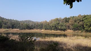
Chiraidongri railway station is a small railway station in Mandla district, Madhya Pradesh. Its code is CID. It serves Chiraidongri village. The station consists of two platforms. The platforms are not well sheltered. It lacks many facilities including water and sanitation. Chiraidongri was served by a narrow-gauge railway from Mandla Fort to Nainpur. Currently the section between Nainpur and Mandla Fort have been fully converted to Electrified Broadgauge line. From Nainpur Junction, the line connects to the fully converted Jabalpur–Gondia railway line, from narrow gauge to broad gauge. It is the nearest railway station from Kanha Tiger Reserve Mandla

Samnapur railway station is a small railway station in Balaghat district, Madhya Pradesh. Its code is SMC. It serves Samnapur village.

Lamta railway station is a small railway station in Balaghat district, Madhya Pradesh. Its code is LTA. It serves Lamta village.

Pindrai is a town of District Mandla in state Madhya Pradesh of India.

References

  1. Development of Forest Villages through Forest Development Agencies Madhya Pradesh
  2. "Census of India 2001: Data from the 2001 Census, including cities, villages and towns (Provisional)". Census Commission of India. Archived from the original on 16 June 2004. Retrieved 1 November 2008.
  3. NARROW GAUGE RAIL MUSEUM, NAINPUR