
Chhatarpur is a city and a municipality in Chhatarpur district in the state of Madhya Pradesh, India. It is the administrative headquarters of Chhatarpur District.

Narsinghpur is a city in Madhya Pradesh in central India. It is a district under Jabalpur division. Narsinghpur has a large temple dedicated to Lord Narasimha. As of 2001, Narsinghpur is the most literate district of the state.

Ratlam is a city in the northwestern part of the Malwa region in Madhya Pradesh state of India. The city of Ratlam lies 480 metres (1,570 ft)above sea level. It is the administrative headquarters of Ratlam district, which was created in 1947 after the independence of India. It is located 294 kilometres west of the state capital Bhopal.

Rewa district is a district of the Madhya Pradesh state in central India. The city of Rewa is the district headquarter. Rewa is sometimes called the "Land of White Tigers", as the first White Tiger was discovered here in 1951 by the Maharaja of the province, Martand Singh, in the nearby jungle of Govindgarh. Rewa was the capital city of a former state, Vindhya Pradesh.

Narsinghpur district is a district of Madhya Pradesh state in central India. Vindhyachal is on its northern border and the Satpura range extends along its entire length on the southern border. In the northern part, the Narmada river flows from east to west. Latitude 22º.45N 23º.15N, Longitude 78º.38E 79º.38E, Area 5125.55 Square Kilometers, 359.8 meters above sea level. The city of Narsinghpur is administrative headquarters of the district. As of 2001 Narsinghpur is the most literate district of MP.

Satna is a city in the Indian state of Madhya Pradesh. It serves as the headquarters of Satna district. It is 7th largest city and 8th most populous city of the state. The city is 500 km east of the state capital Bhopal. The city is distributed over a land area of 111.9 square kilometres.

Pathankot is a city and the district headquarters of the Pathankot district in Punjab, India. Pathankot is the 6th most populous city of Punjab, after Ludhiana, Amritsar, Jalandhar, Patiala and Bathinda. Its local government is a municipal corporation.
Mandi Bamora is a census town in Sagar district in the state of Madhya Pradesh, India. This place has a railway station Mandi Bamora. Mandi Bamora located as half- half way in two different district Bina-etawa and Vidisha. Tehsil is Bina. Mandi Bamora is very famous as a name "Great country" because two different districts boundaries separated two places Bamora and Sihora.
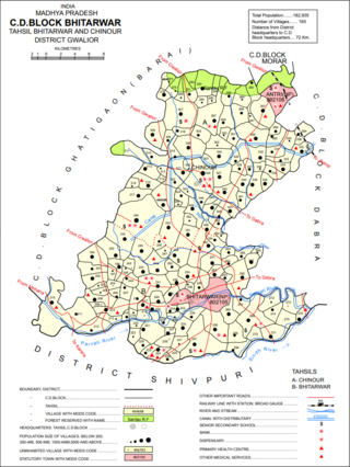
Bhitarwar is a city and a municipality in Gwalior district in the state of Madhya Pradesh, India. The town is surrounded by a river called Parbati.
Chichli is a census town in Narsimhapur district in the state of Madhya Pradesh, India.
Kareli is a city and a Municipality in the Indian state of Madhya Pradesh. Kareli is financial capital of the district Narsinghpur. Kareli is considered as best production town for Jaggery in India. Jaggery produced in Kareli is a single kadhai Jaggery which is highly demanded in many parts of India. It is well connected by transportation. Near Kareli, an ancient fair called Barman Mela is organised every year in the month of January on the bank of the river Narmada. There are many historic and religious places in Kareli like Chougan Quila,Deepeshwar Temple Barman, Deepeshwar temple is dedicated to lord Shiva. It is also taposthali of lord Bramha. India's longest highway NH-44 passes through Kareli and also connected to almost every part of the country by rail network. Before the construction of the Bina-Katni branch of the Indian Midland Railway, the metaled road from Saugor crossing the Nerbudda at Barmhan brought the bulk of the produce of the Sagar District to Kareli station. A mail cart ran from Kareli to Sagar, a distance of 122 km (76 mi). The trade of Kareli has now considerably declined, but it is still the exporting station for the southern parts of the Rehli tahsil of Sagar and the north of Narsinghpur. A cotton-ginning factory, the property of Raja Gokul Das, was opened in 1904. This is the nearest rail station and market for towns of Sagar district. Kareli is also educational hub for nearby area Schools like Govt. C.M.Rise School, Carmel School, Mahatma Gandhi College and many coaching institutes are situated. Agriculture based business are still doing well in the area like Kareli Sugar Mills, Dal Mills, there are many Tuar dal Mills in the city like Chacha Dal Mill, Oil plants like Shubham industries, Flour Mills like Malviya Mills, Jaggery Factories.
Nainpur is a town and Municipal Council in the Mandla district, of the Indian state of Madhya Pradesh.
Raghogarh-Ruthiyai or Raghogarh-Vijaypur is a town and municipality in Guna district in the Indian state of Madhya Pradesh.
Rajakhera is a city and a municipality situated near the banks of the Chambal River in Dholpur district in the Eastern part of the Indian state of Rajasthan. Its part of Braj region and the local language has Braj Bhasha dialect. The culture is fused with Rajasthan and its border states.

The 12853 / 12854 Amarkantak Express is a daily Superfast Express train which runs between the Bhopal Junction railway station in Bhopal, the capital city of Madhya Pradesh and Durg, a city in Chhattisgarh state in central India. This train replaced the 8225/8226 Bhopal–Bilaspur Mahanadi Express along with the 8291/8292 Bhopal–Raipur Express and the 1235/1236 Bhopal–Jabalpur Express.
The Shakkar River is a tributary of the Narmada River in the state of Madhya Pradesh in central India. It's originates from Chhindwara District. Shakkar River mainly Flowed in Chhindwara and Narsinghpur District.
Gadarwara railway station is a 'B' Category railway station under West Central Railways serving Gadarwara town, in Narsinghpur district of Madhya Pradesh state of India. It is under Jabalpur railway division of West Central Railway Zone of Indian Railways.

Gadarwara is one of the 230 Vidhan Sabha constituencies of Madhya Pradesh state in central India.

Tendukheda is a city and a nagar panchayat in narsinghpur district, it's also a tehsil headquarter,
Damaru Ghati is a Shiva temple in Madhya Pradesh, India. It is built in a valley shaped like a Damaru. It is located near the Gadarwara town. A shivalinga is established inside a temple shaped like a shivalinga. Statues of Lord Shiva, Nandi and Lord Hanuman are also present in the temple. Every year, thousands of tourists and devotees visit the temple to worship Lord Shiva during Mahashivaratri.


