List of Massachusetts state parks

Last updated

USA Massachusetts location map.svg
Green pog.svg
Green pog.svg
Green pog.svg
Green pog.svg
Green pog.svg
Green pog.svg
Green pog.svg
Green pog.svg
Green pog.svg
Green pog.svg
Green pog.svg
Green pog.svg
Green pog.svg
Green pog.svg
Green pog.svg
Green pog.svg
Green pog.svg
Green pog.svg
Green pog.svg
Green pog.svg
Green pog.svg
Green pog.svg
Green pog.svg
Green pog.svg
Green pog.svg
Green pog.svg
Green pog.svg
Green pog.svg
Green pog.svg
Green pog.svg
Green pog.svg
Green pog.svg
Green pog.svg
Green pog.svg
Green pog.svg
Green pog.svg
Green pog.svg
Green pog.svg
Green pog.svg
Green pog.svg
Green pog.svg
Green pog.svg
Green pog.svg
Green pog.svg
Green pog.svg
Green pog.svg
Green pog.svg
Green pog.svg
Green pog.svg
Green pog.svg
Green pog.svg
Green pog.svg
Green pog.svg
Green pog.svg
Green pog.svg
Green pog.svg
Green pog.svg
Green pog.svg
Green pog.svg
Green pog.svg
Green pog.svg
Green pog.svg
Green pog.svg
Green pog.svg
Green pog.svg
Green pog.svg
Green pog.svg
Green pog.svg
Green pog.svg
Green pog.svg
Green pog.svg
Green pog.svg
Green pog.svg
Green pog.svg
Green pog.svg
Green pog.svg
Green pog.svg
Green pog.svg
Green pog.svg
Green pog.svg
Green pog.svg
Green pog.svg
Green pog.svg
Green pog.svg
Green pog.svg
Green pog.svg
Green pog.svg
Green pog.svg
Green pog.svg
Green pog.svg
Green pog.svg
Green pog.svg
Green pog.svg
Green pog.svg
Green pog.svg
Green pog.svg
Green pog.svg
Green pog.svg
Green pog.svg
Green pog.svg
Green pog.svg
Green pog.svg
Green pog.svg
Green pog.svg
Green pog.svg
Green pog.svg
Green pog.svg
Green pog.svg
Green pog.svg
Massachusetts State Parks (Hover mouse over pog to popup clickable link)
Map all coordinates using: OpenStreetMap

This list of Massachusetts State Parks contains the state parks and recreation areas in the Commonwealth of Massachusetts managed by the Massachusetts Department of Conservation and Recreation as of 2015. [1]

Contents

The Bureau of State Parks and Recreation division of Department of Conservation and Recreation (Massachusetts) (DCR) is responsible for the maintenance and management of over 450,000 acres (1,820 sq km) of privately and state-owned forests and parks, nearly 10% of the Commonwealth's total land mass. Within the lands managed by the Bureau of State Parks and Recreation are some 29 campgrounds, over 2,000 miles (3,200 km) of trails, 87 beaches, 37 swimming, wading, and spray pools, 62 playgrounds, 55 ballfields, and 145 miles (233 km) of paved bike and rail trails.

DCR's Bureau of Urban Parks and Recreation manages the Metropolitan Park System of Greater Boston, the components of which are included in this list.

State parks

Name  County  Area [2] Estab-
lished
  
River / lake / other  ImageRemarks  
acresha
Alewife Brook Reservation Middlesex
42°23′48″N71°8′38″W / 42.39667°N 71.14389°W / 42.39667; -71.14389 (Alewife Brook Reservation)
136 acres55 ha1900Little Pond, Little River, Alewife Brook
Alewife Brook Reservation.jpg
A major portion of the Alewife Reservation is designated wetland. The Reservation is located at the end of the Minuteman Bike Path in Arlington
Ames Nowell State Park Plymouth
42°7′12.8994″N70°59′13.632″W / 42.120249833°N 70.98712000°W / 42.120249833; -70.98712000 (Ames Nowell State Park)
612 acres248 ha1959 Cleveland Pond
Cleveland Pond, Ames Nowell State Park, Abington MA.jpg
The park is primarily used for boating and fishing.
Ashland State Park Middlesex
42°14′30″N71°27′58″W / 42.24167°N 71.46611°W / 42.24167; -71.46611 (Ashland State Park)
472 acres191 ha1947 Ashland Reservoir
AshlandMA AshlandParkSpillway.jpg
Bash Bish Falls State Park Berkshire
42°06′53″N73°29′34″W / 42.11472°N 73.49278°W / 42.11472; -73.49278 (Bash Bish Falls State Park)
424 acres172 ha1924 Bash Bish Falls
Bash Bish Falls.jpg
Massachusetts' highest single-drop waterfall lies within the park borders.
Beartown State Forest Berkshire
42°14′00″N73°16′28″W / 42.23333°N 73.27444°W / 42.23333; -73.27444 (Beartown State Forest)
120 acres49 ha1921 Benedict Pond
Beartown State Forest.jpg
Approximately 7.5 miles (12.1 km) of the Appalachian Trail travels through the forest.
Beaver Brook Reservation Middlesex
42°23′26″N71°11′52″W / 42.39056°N 71.19778°W / 42.39056; -71.19778 (Beaver Brook Reservation)
303 acres123 ha1893
Waverly Oaks, Belmont, MA - 1.JPG
The park includes a cascading waterfall and a wading pool.
Belle Isle Marsh Reservation Suffolk
42°23′21″N70°59′21″W / 42.38917°N 70.98917°W / 42.38917; -70.98917 (Belle Isle Marsh Reservation)
188 acres76 ha1978 Belle Isle Marsh
BelleIsleMarshAlc2.JPG
The reservation includes landscaped pathways, benches, and an observation tower. A portion of the Boston Harborwalk runs through the reservation.
Blackstone River and Canal Heritage State Park Worcester
42°05′40″N71°37′23″W / 42.09444°N 71.62306°W / 42.09444; -71.62306 (Blackstone River and Canal Heritage State Park)
1,066 acres431 ha1981 Blackstone River
BlackstoneCanal 082.jpg
The park is the midpoint of the Blackstone River Valley National Heritage Corridor of the National Park System.
Blue Hills Reservation Norfolk
42°12′40″N71°7′40″W / 42.21111°N 71.12778°W / 42.21111; -71.12778 (Blue Hills Reservation)
6,165 acres2,495 ha1893 Houghton's Pond, Ponkapoag Pond
Eliot Tower Milton MA 02.jpg
The reservation has the distinction of being the largest conservation land within a major metropolitan area.
Borderland State Park Bristol, Norfolk
42°4′3″N71°9′13″W / 42.06750°N 71.15361°W / 42.06750; -71.15361 (Borderland State Park)
1,843 acres746 ha1971
Ames Mansion Borderland.jpg
On National Register of Historic Places
Boston Harbor Islands State Park Norfolk, Plymouth, Suffolk
42°19′11.6″N70°55′45.6″W / 42.319889°N 70.929333°W / 42.319889; -70.929333 (Boston Harbor Islands State Park)
404 acres163 ha1996 Boston Harbor
Gallops Island.JPG
Bradley Palmer State Park Essex
42°38′0″N70°53′43″W / 42.63333°N 70.89528°W / 42.63333; -70.89528 (Bradley Palmer State Park)
736 acres298 ha1944 Ipswich River
Restored farmhouse Bradley Palmer SP August 2012.JPG
The park that features rolling meadows, lush evergreens and old carriage roads lined with rhododendrons.
Breakheart Reservation Essex, Middlesex
42°29′21″N71°2′23″W / 42.48917°N 71.03972°W / 42.48917; -71.03972 (Breakheart Reservation)
652 acres264 ha1934Silver Lake, Pearce Lake, Saugus River
BreakheartReservationLowerPondView.jpg
The reservation is hardwood forest principally used for birding, fishing and hiking.
Brimfield State Forest Hampden
42°6′0″N72°14′56″W / 42.10000°N 72.24889°W / 42.10000; -72.24889 (Brimfield State Forest)
3,523 acres1,426 ha1924 Dean Pond
Dean Pond Recreation Area, Brimfield State Forest, Brimfield MA.jpg
Bristol Blake State Reservation Norfolk
42°6′28.6″N71°19′5″W / 42.107944°N 71.31806°W / 42.107944; -71.31806 (Bristol Blake State Reservation)
140 acres57 ha1959 [3] Kingfisher Pond, Stony Brook Pond, Teal MarshAdjacent to Stony Brook Wildlife Sanctuary
Brook Farm Historic Site Suffolk
42°17′29″N71°10′26.7″W / 42.29139°N 71.174083°W / 42.29139; -71.174083 (Brook Farm Historic Site)
141 acres57 ha1988
BrookFarm-PrintShop.jpg
C. M. Gardner State Park Hampden
42°16′31″N72°52′14.5″W / 42.27528°N 72.870694°W / 42.27528; -72.870694 (C. M. Gardner State Park)
85 acres34 ha1959 Westfield River
CMGardnerStatePark PicnicArea.jpg
Callahan State Park Middlesex
42°20′35″N71°26′55″W / 42.34306°N 71.44861°W / 42.34306; -71.44861 (Callahan State Park)
958 acres388 ha1970
Eagle Pond, Callahan State Park, Framingham MA.jpg
Camp Nihan Environmental Education Camp Essex
42°29′32.6″N71°1′11.4″W / 42.492389°N 71.019833°W / 42.492389; -71.019833 (Camp Nihan Environmental Education Camp)
65 acres26 ha1929 Saugus River Part of Breakheart Reservation
Castle Island Suffolk
42°20′15″N71°0′38″W / 42.33750°N 71.01056°W / 42.33750; -71.01056 (Castle Island)
22 acres8.9 ha Boston Harbor
Fort Independence (Boston) - DSC00727.JPG
The present fort, built between 1834 and 1851, is the eighth generation of forts and it is one of the oldest fortified sites in British North America.
Charles River Reservation Suffolk, Middlesex
42°21′20″N71°6′56″W / 42.35556°N 71.11556°W / 42.35556; -71.11556 (Charles River Reservation)
863 acres349 ha1910 Charles River
Charles River Esplanade - IMG 3777.jpg
Includes Charles River Dam, Charles River Basin and Esplanade, John F. Kennedy Park, and Teddy Ebersol's Red Sox Fields. Covers Charles River below Watertown Dam; see also Upper Charles River Reservation
Chester-Blandford State Forest Hampden
42°14′58″N72°56′58″W / 42.24944°N 72.94944°W / 42.24944; -72.94944 (Chester-Blandford State Forest)
2,776 acres1,123 ha1924
Chestnut Hill Reservation Suffolk
42°20′7″N71°9′29″W / 42.33528°N 71.15806°W / 42.33528; -71.15806 (Chestnut Hill Reservation)
1 acre0.40 ha1870 Chestnut Hill Reservoir
Chestnut Hill Reservation, Chestnut Hill MA.jpg
The Chestnut Hill Reservoir Historic District is considered a nineteenth-century masterpiece of engineering, urban planning and landscape design.
Chicopee Memorial State Park Hampden
42°10′45″N72°32′13″W / 42.17917°N 72.53694°W / 42.17917; -72.53694 (Chicopee Memorial State Park)
562 acres227 ha1893 Cooley Brook Reservoir The park includes two 25-acre (10 ha) ponds.
Clarksburg State Park Berkshire
42°44′5″N73°4′35″W / 42.73472°N 73.07639°W / 42.73472; -73.07639 (Clarksburg State Park)
3,629 acres1,469 ha Mauserts Pond
Mauserts Pond, Clarksburg State Park, Clarksburg MA.jpg
Adjoins 3,011 acre Clarksburg State Forest
Cochituate State Park Middlesex
42°18′45″N71°22′27″W / 42.31250°N 71.37417°W / 42.31250; -71.37417 (Cochituate State Park)
872 acres353 ha Lake Cochituate
Lake Cochituate, Cochituate MA.jpg
Connecticut River Greenway State Park Franklin, Hampden, Hampshire
42°36′27″N72°32′30″W / 42.60750°N 72.54167°W / 42.60750; -72.54167 (Connecticut River Greenway State Park)
1,048 acres424 ha1986 Connecticut River
Connecticut River Greenway State Park.JPG
Multiple state land holdings in the Pioneer Valley of Western Massachusetts
Constitution Beach Suffolk
42°23′5.5″N71°0′36.2″W / 42.384861°N 71.010056°W / 42.384861; -71.010056 (Constitution Beach)
82 acres33 ha1952 Boston Harbor
CONSTITUTION BEACH-WITHIN SIGHT AND SOUND OF LOGAN AIRPORT'S TAKEOFF RUNWAY. 22R - NARA - 548468.jpg
Cutler Park Reservation Norfolk
42°16′16″N71°11′45″W / 42.27111°N 71.19583°W / 42.27111; -71.19583 (Cutler Park Reservation)
739 acres299 ha1962 Charles River
Cutler Park Needham MA.jpg
It contains the largest remaining fresh water marsh on the middle Charles, and includes a boardwalk through a cattail marsh out onto an island.
D.A.R. State Forest Hampshire
42°27′25″N72°47′50″W / 42.45694°N 72.79722°W / 42.45694; -72.79722 (D.A.R. State Forest)
1,728 acres699 ha1929Upper and Lower Highland Lake
DARStateForestMarker.jpg
Demarest Lloyd State Park Bristol
41°31′44″N70°59′0″W / 41.52889°N 70.98333°W / 41.52889; -70.98333 (Demarest Lloyd State Park)
200 acres81 ha1953 Buzzards Bay
Demarest Lloyd P1140020.jpg
Dighton Rock State Park Bristol
41°48′46″N71°6′23″W / 41.81278°N 71.10639°W / 41.81278; -71.10639 (Dighton Rock State Park)
98 acres40 ha1955 Taunton River
Dighton Rock Museum.JPG
Dighton Rock is an 11-foot (3.4 m) high glacial erratic covered with petroglyphs and has since been moved to a museum at the park.
Dorchester Shores Reservation Suffolk
42°17′50″N71°2′44″W / 42.29722°N 71.04556°W / 42.29722; -71.04556 (Dorchester Shores Reservation)
44 acres18 ha1962 Neponset River The reservation comprises two beaches and a park.
Douglas State Forest Worcester
42°3′30″N71°47′13″W / 42.05833°N 71.78694°W / 42.05833; -71.78694 (Douglas State Forest)
5,525 acres2,236 ha1934 Wallum Lake
Douglas State Forest, Douglas MA.jpg
Features include a rare Atlantic White Cedar swamp and 7.8 miles (12.6 km) of the Midstate Trail
Dunn State Park Worcester
42°34′48″N71°58′12″W / 42.58000°N 71.97000°W / 42.58000; -71.97000 (Dunn State Park)
132 acres53 ha1915 Dunn Pond
Dunn Pond State Park.jpg
Ellisville Harbor State Park Plymouth
41°50′34″N70°32′13″W / 41.84278°N 70.53694°W / 41.84278; -70.53694 (Ellisville Harbor State Park)
97 acres39 ha1991 Cape Cod Bay
Beach, Ellisville Harbor State Park, Ellisville MA.jpg
Walking trails overlooking a tidal marsh, sandy/rocky beach at trail end
Elm Bank Reservation Norfolk
42°16′34″N71°18′9″W / 42.27611°N 71.30250°W / 42.27611; -71.30250 (Elm Bank Reservation)
175 acres71 ha1996 Charles River
Elm Bank Wellesley MA - Rhododendron Garden.jpg
Benjamin Pierce Cheney's property, now run by Massachusetts Horticultural Society
Erving State Forest Franklin
42°37′21″N72°22′41″W / 42.62250°N 72.37806°W / 42.62250; -72.37806 (Erving State Forest)
2,422 acres980 ha1920 Millers River
Laurel Lake, Erving State Forest, Erving MA.jpg
The 110-mile (180 km) Metacomet-Monadnock Trail passes through a western parcel of the state forest.
F. Gilbert Hills State Forest Norfolk
42°3′28″N71°17′0″W / 42.05778°N 71.28333°W / 42.05778; -71.28333 (F. Gilbert Hills State Forest)
1,030 acres420 ha
Fgilbert trail.JPG
Fall River Heritage State Park Bristol
41°42′20″N71°9′38″W / 41.70556°N 71.16056°W / 41.70556; -71.16056 (Fall River Heritage State Park)
14 acres5.7 ha1985 Taunton River
Visitor's building at Fall River Heritage State Park.jpg
Federated Women's Club State Forest Worcester
42°29′27″N72°15′15″W / 42.49083°N 72.25417°W / 42.49083; -72.25417 (Federated Women's Club State Forest)
970 acres390 ha1933 Fever Brook
West Street, Federated Women's Club State Forest, Petersham MA.jpg
Fort Phoenix State Reservation Bristol
41°37′27″N70°53′56″W / 41.62417°N 70.89889°W / 41.62417; -70.89889 (Fort Phoenix State Reservation)
1 acre0.40 ha Atlantic Ocean
Fort Phoenix.JPG
Revolutionary War fort; 1/2 mile of Buzzards Bay beachfront
Fort Revere Park Plymouth
42°18′17″N70°54′21″W / 42.30472°N 70.90583°W / 42.30472; -70.90583 (Fort Revere Park)
6 acres2.4 ha1976 Atlantic Ocean
Hull - Fort Revere.JPG
On Telegraph Hill in Hull, Massachusetts. Remnants of two seacoast fortifications, water tower with observation deck, military history museum and picnic facilities
Francis D. Martini Memorial Shell Park and Moynihan Recreation Area Suffolk
42°14′36″N71°7′37″W / 42.24333°N 71.12694°W / 42.24333; -71.12694 (Francis D. Martini Memorial Shell Park and Moynihan Recreation Area)
5.6 acres2.3 ha Neponset River Outdoor theatre and play fields
Freetown-Fall River State Forest Bristol
41°45′28″N71°3′48″W / 41.75778°N 71.06333°W / 41.75778; -71.06333 (Freetown-Fall River State Forest)
5,217 acres2,111 ha1930
Statue of The C.C.C. Worker Freetown Fall River State Forest MA.jpg
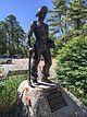
The park includes Profile Rock, a granite outcropping which local Native Americans believe to be the image of Chief Massasoit. Also in the forest is a 227-acre (92 ha) Wampanoag reservation
Gardner Heritage State Park Worcester
42°34′38″N71°59′39″W / 42.57722°N 71.99417°W / 42.57722; -71.99417 (Gardner Heritage State Park)
0 acres0 ha1985
Visitors Center, Gardner Heritage State Park, Gardner MA.jpg
Restored 19th century fire station with exhibits; closed since 2002
Georgetown-Rowley State Forest Essex
42°42′5″N70°58′26″W / 42.70139°N 70.97389°W / 42.70139; -70.97389 (Georgetown-Rowley State Forest)
1,041 acres421 ha
Granville State Forest Hampden
42°3′35″N72°58′17″W / 42.05972°N 72.97139°W / 42.05972; -72.97139 (Granville State Forest)
2,432 acres984 ha1921 Hubbard River
Granville State Forest,Granville MA.jpg
Great Brook Farm State Park Middlesex
42°33′21″N71°21′12″W / 42.55583°N 71.35333°W / 42.55583; -71.35333 (Great Brook Farm State Park)
909 acres368 ha1967 Meadow Pond
Great Brook Farm State Park, Carlisle MA.jpg
Greycourt State Park Essex
42°43′46″N71°10′51″W / 42.72944°N 71.18083°W / 42.72944; -71.18083 (Greycourt State Park)
24 acres9.7 ha2001
Portico stairs, Greycourt State Park, Methuen, Massachusetts - 20090527.jpg
The park is built atop the restored ruins of the Charles H. Tenney estate.
Halibut Point State Park Essex
42°41′22″N70°37′59″W / 42.68944°N 70.63306°W / 42.68944; -70.63306 (Halibut Point State Park)
55 acres22 ha1981
Rockport2007 008.jpg
Features a former granite quarry and 60-foot (18 m) tower with coastal views
Hammond Pond Reservation Middlesex
42°19′30″N71°10′36″W / 42.32500°N 71.17667°W / 42.32500; -71.17667 (Hammond Pond Reservation)
59 acres24 ha1968
Hammond Pond Reservation, Chestnut Hill MA.jpg
Hampton Ponds State Park Hampden
42°10′45″N72°41′22″W / 42.17917°N 72.68944°W / 42.17917; -72.68944 (Hampton Ponds State Park)
47 acres19 ha Pequot Pond
Hampton Ponds State Park.jpg
Harold Parker State Forest Essex
42°37′33″N71°4′54″W / 42.62583°N 71.08167°W / 42.62583; -71.08167 (Harold Parker State Forest)
3,320 acres1,340 ha1916Stearns Pond
Stearns Pond, Harold Parker State Forest, North Andover MA.jpg
Hemlock Gorge Reservation Middlesex
42°18′52″N71°13′35″W / 42.31444°N 71.22639°W / 42.31444; -71.22639 (Hemlock Gorge Reservation)
16 acres6.5 ha1895 Charles River
Echo Bridge - Newton, MA - DSC09470.jpg
Holyoke Heritage State Park Hampden
42°12′18″N72°36′26″W / 42.20500°N 72.60722°W / 42.20500; -72.60722 (Holyoke Heritage State Park)
7 acres2.8 ha1986
Holyoke Heritage State Park, Holyoke MA.jpg
The park features include a visitor center with exhibits about paper manufacturing and Holyoke's industrial and cultural history.
Hopkinton State Park Middlesex
42°14′57″N71°31′32″W / 42.24917°N 71.52556°W / 42.24917; -71.52556 (Hopkinton State Park)
1,245 acres504 ha1947 Hopkinton Reservoir
Hopkinton Dam and Spillway, Ashland MA.jpg
The park features a bathing pond for swimming that is physically separated from the reservoir, where nonmotorized boating is permitted
Horseneck Beach State Reservation Bristol
41°30′28″N71°2′55″W / 41.50778°N 71.04861°W / 41.50778; -71.04861 (Horseneck Beach State Reservation)
815 acres330 ha1956
Horseneck.JPG
Popular for its two-mile (3 km) long sandy beach on the shore of Buzzards Bay. Also camping, fishing and a salt marsh.
Jug End State Reservation and Wildlife Management Area Berkshire 1,191 acres482 ha1994
View from Jug End peak on Appalachian Trail east of Jug End State Reservation-WMA "Guilder Hollow Road" block.jpg
Kenneth Dubuque Memorial State Forest Franklin 7,405 acres2,997 ha1997Hallockville Pond, Crooked Pond
Lake Dennison Recreation Area Worcester 121 acres49 ha Lake Dennison
Lake Dennison, Winchendon MA.jpg
The park is an extension of Otter River State Forest
Lake Lorraine State Park Hampden 3 acres1.2 haclosed to the public
Lake Wyola State Park Franklin 42 acres17 ha1997 Lake Wyola
Lake Wyola, Shutesbury MA.jpg
Lawrence Heritage State Park Essex 50 acres20 ha1980
Visitor Center, Lawrence Heritage State Park, Lawrence MA.jpg
Leominster State Forest Worcester 4,246 acres1,718 ha1922
Crow Hill Pond, Leominster State Forest, Westminster MA.jpg
The Midstate Trail runs through the western edge of the forest.
Lowell-Dracut-Tyngsboro State Forest Middlesex 1,109 acres449 ha1941
Lowell Heritage State Park Middlesex 60 acres24 ha1975 Merrimack River
Vandenberg Esplanade, Lowell Heritage State Park, Lowell MA.jpg
Precursor to Lowell National Historical Park; preserves the city's seminal role in the American Industrial Revolution
Lynn Heritage State Park Essex 4 acres1.6 ha1986
Lynn Heritage State Park Visitors Center, Lynn MA.jpg
Lynn Shore Reservation Essex 22 acres8.9 ha
Red Rock Park, Lynn Shore Reservation, Lynn MA.jpg
Manuel F. Correllus State Forest Dukes 5,215 acres2,110 ha1908Little PondIn the interior of Martha's Vineyard, the park is the focus of one of the largest environmental restoration projects in the country.
Massasoit State Park Bristol 1,207 acres488 haLake Rico, Furnace Pond, King's Pond, Middle Pond, Little Bearhole Pond, and Big Bearhole Pond
Middle Pond, Massasoit State Park, Taunton MA.jpg
Maudslay State Park Essex 483 acres195 ha1985 Merrimack River
Rose Garden 1.JPG
Middlesex Fells Reservation Middlesex 2,283 acres924 ha1893Bellevue and Spot Ponds
MiddlesexFells SpotPond.jpg
Mohawk Trail State Forest Franklin 7,758 acres3,140 ha1921Includes Cold River Virgin Forest, National Natural Landmark
Monroe State Forest Franklin 3,750 acres1,520 ha1924 Dunbar Brook
Moore State Park Worcester 737 acres298 ha Eames Pond
Moore State Park Sawmill.jpg
Mount Everett State Reservation Berkshire 2,492 acres1,008 ha1908 Guilder Pond
MountEverettBearsDenRd.JPG
Mount Grace State Forest Franklin 1,578 acres639 ha1920 Mount Grace
View of Mount Monadnock from the Mount Grace fire tower.jpg
Mount Greylock State Reservation Berkshire 12,455 acres5,040 ha1898
Mount Greylock war memorial.jpg
Mount Holyoke Range State Park Hampshire 3,000 acres1,200 ha1940
Mount Holyoke south.jpg
Mount Sugarloaf State Reservation Franklin 533 acres216 ha1907
LoafObservatory.jpg
Mount Tom State Reservation Hampden 1,967 acres796 ha1902
Visitor Center, Mount Tom State Reservation, Holyoke MA.jpg
Mount Washington State Forest Berkshire 4,619 acres1,869 ha1958
CT MA NY Boundary Marker on Mount Frissell Trail.jpg
Myles Standish Monument State Reservation Plymouth 30 acres12 ha1920
Myles Standish monument in Duxbury, Mass.jpg
A 120-foot (37 m) tower with 125 steps that overlooks Plymouth Harbor and Duxbury Beach.
Myles Standish State Forest Plymouth 12,029 acres4,868 ha1916
EHR Pond 5483.JPG
Pitch pine and scrub oak forest with sixteen ponds for fishing, canoeing, swimming. Camping on four of the ponds, bicycle trails, equestrian trails, and horse camping.
Mystic River Reservation Middlesex 359 acres145 ha1893 Mystic Lakes; Mystic River
ArlingtonMA MysticParkway.jpg
Nahant Beach Reservation Essex 67 acres27 ha Atlantic Ocean
Nahant Beach Reservation, Nahant MA.jpg
Nantasket Beach Reservation Plymouth 39 acres16 ha
Nasketucket Bay State Reservation Plymouth 210 acres85 ha1999
Nantasket Beach, Nantasket MA.jpg
Natural Bridge State Park Berkshire 44 acres18 ha1985 Hudson Brook
Natural Bridge, North Adams, MA.jpg
It contains the only natural white marble arch/bridge in North America. The natural bridge spanning Hudson Brook, was formed by glacial melt about 11,000 BC, from 550 million year old bedrock.
Neponset River Reservation Suffolk 1,880 acres760 ha
Neponset River Reservation 1 Dorchester Massachusetts.jpg
Nickerson State Park Barnstable 1,967 acres796 ha1934 Cliff Pond
Flax Pond, Nickerson State Park, Brewster MA.jpg
October Mountain State Forest Berkshire 16,460 acres6,660 ha1915
Finerty Pond October Mountain State Forest IMG 2767.jpg
Otter River State Forest Worcester 1,022 acres414 ha1915 Otter River, Millers River
Pearl Hill State Park Middlesex 1,000 acres400 haPark Hill Brook
Pearl Hill State Park, Townsend MA.jpg
Pilgrim Memorial State Park Plymouth 6 acres2.4 ha1920
Plymouth Rock, Water St, Plymouth (493637) (11108906366).jpg
Site of Plymouth Rock
Pittsfield State Forest Berkshire 10,601 acres4,290 ha
Pope John Paul II Park Reservation Suffolk 66 acres27 ha2001 Neponset River Estuary
BostonMA PopeJohnPaulIIPark 1.jpg
Reclaimed former landfill and commercial area
Purgatory Chasm State Reservation Worcester 100 acres40 ha1919
Purgatory chasm lovers leap.jpg
The Chasm was created when glacial meltwater from a burst ice dam ripped out blocks of bedrock at the end of the last Ice Age (14,000 years ago).
Quabbin Reservoir Hampshire 39 sq mi100 km21938
230 QUABBIN.JPG
Quincy Quarries Reservation Norfolk 22 acres8.9 ha1985
Quincy Quarries Reservation June 2009 3.jpg
Quincy Shores Reservation Norfolk 87 acres35 ha1899
Quincy Shore Reservation.jpg
Quinsigamond State Park Worcester 38 acres15 ha
Quinsigamond State Park, Worcester MA.jpg
Revere Beach Reservation Suffolk 84 acres34 ha1896
Revere ahdg.jpg
Robinson State Park Hampden 1,025 acres415 ha1934 Westfield River
Westfield River, Robinson State Park, Agawam MA.jpg
Roxbury Heritage State Park Suffolk 3 acres1.2 ha1992
RoxburyHeritagePark-DillawayThomas.JPG
The 1750 Dillaway-Thomas House and a small park
Rumney Marsh Reservation Essex, Suffolk 815 acres330 ha1992 Saugus River; Pines River
RumneyMarsh02.jpg
Rutland State Park Worcester 284 acres115 ha Whitehall Pond Swimming, picnicking and boating.
Salisbury Beach State Reservation Essex 355 acres144 ha1931
Salisbury Beach in Winter, Salisbury MA.jpg
The park's main feature is its 3.8-mile (6.1 km)-long beach, one of the most popular in the Commonwealth.
Sandisfield State Forest Berkshire 4,190 acres1,700 ha York Lake
York Lake, Sandisfield State Forest, New Marlborough MA.jpg
Sandy Point State Reservation Essex 134 acres54 ha
Beach Shelter.JPG
Savoy Mountain State Forest Berkshire 10,457 acres4,232 ha1918
Savoy Mountain State Forest.jpg
Scusset Beach State Reservation Barnstable 459 acres186 ha1957
Scusset BeachNW.jpg
On Cape Cod Bay at the east end of the Cape Cod Canal, a popular swimming and camping area.
Shawme-Crowell State Forest Barnstable 624 acres253 ha
Shawme-Crowell State Forest, Sandwich MA.jpg
Forested 285 site campground
J.A. Skinner State Park Hampshire 843 acres341 ha1940 Connecticut River
The Summit House at Skinner State Park, Hadley MA.jpg
South Cape Beach State Park Barnstable 460 acres190 ha
South Cape Beach State Park, Mashpee MA.jpg
A component of the Waquoit Bay National Estuarine Research Reserve with a one-mile (1.6 km) stretch of beach.
Southwest Corridor Park Suffolk 221 acres89 ha1987
SouthwestCorridorParkRuggles.JPG
Greenway of 4.7 miles (7.6 km) that runs South End, Back Bay, Roxbury and Jamaica Plain neighborhoods
Spencer State Forest Worcester 903 acres365 ha1922Howe Pond
Corridor 71, Spencer State Forest, Spencer MA.jpg
Squantum Point Park Norfolk 46 acres19 ha2001
Squantum point park.jpg
Stony Brook Reservation Suffolk 616 acres249 ha1894Turtle Pond
Stony Brook Reservation Parkways Boston MA.jpg
Streeter Point Recreation Area Worcester 1 acre0.40 ha East Brimfield Reservoir Fishing, swimming, picnicking
Sudbury Reservoir Middlesex; Worcester 4,943 acres2,000 ha1898 Sudbury Reservoir
SudburyDam.jpg
Tolland State Forest Berkshire 4,415 acres1,787 ha1925 Otis Reservoir
Upper Charles River Reservation Middlesex, Norfolk, Suffolk 863 acres349 ha Charles River
Hemlock Gorge (Charles River Reservation) - DSC09456.JPG
Covers Charles River between Watertown Dam and Riverdale Park, West Roxbury; see also Charles River Reservation
Upton State Forest Worcester 2,790 acres1,130 ha1915
Grove of Sawara Cypress, Upton State Forest, MA.jpeg
Has Civilian Conservation Corps structures
Wachusett Mountain State Reservation Worcester 2,288 acres926 ha1899
View of Mount Wachusett and Wachusett Lake from the Westminster side, MA.jpg
Wachusett Reservoir Worcester 4,135 acres1,673 ha1908 Nashua River; Quinapoxet River
Wachusett Res 2005.jpg
Wahconah Falls State Park Berkshire 48 acres19 ha Wahconah Falls Brook
Walden Pond State Reservation Middlesex 335 acres136 ha1922 Walden Pond
Walden Pond.jpg
Waquoit Bay National Estuarine Research Reserve Barnstable 110 acres45 ha1987 Waquoit Bay; Quashnet River; Childs River; ponds
Visitor Center, Waquoit Bay National Estuarine Research Reserve, Waquoit MA.jpg
Ware River Watershed Area Worcester 23,000 acres9,300 ha
Watson Pond State Park Bristol 163 acres66 ha
Pavilion at Watson Pond State Park, Taunton MA.jpg
Webb Memorial State Park Norfolk 59 acres24 ha1980 Hingham Bay
Webb Memorial State Park, Hingham MA.jpg
Wells State Park Worcester 1,445 acres585 ha1968 Walker Pond
Wendell State Forest Franklin 7,566 acres3,062 ha1921 Millers River, Quabbin Reservoir
Ruggles Pond.JPG
Western Gateway Heritage State Park Berkshire 8 acres3.2 ha1986
Western-heritage-park-north-adams-2009.png
Weymouth Back River Reservation Norfolk 35 acres14 ha
Stodders Neck, Weymouth Back River Reservation, Hingham MA.jpg
Site of Stodder's Neck and Abigail Adams Park
Whitehall State Park Middlesex 837 acres339 ha1947Whitehall Reservoir
Willard Brook State Forest Middlesex 2,929 acres1,185 ha1930
Ashby - Route 119 in Willard Brook SF.jpg
Willowdale State Forest Essex 2,491 acres1,008 ha Hood Pond
Willowdale State Forest.jpg
Wilson Mountain Reservation Norfolk 215 acres87 ha1995
Trail leading into Wilson Mountain Reservation, Dedham MA.jpg
Windsor State Forest Berkshire 1,824 acres738 ha1925 Westfield River
Winthrop Shore Reservation Suffolk 18 acres7.3 ha1900 Atlantic Ocean
Winthrop Beach, Winthrop MA.jpg
Wompatuck State Park Plymouth 3,579 acres1,448 ha1967 Aaron River Reservoir
Veery (7235498720).jpg

State trails

NameTownsCountyLengthEstab-
lished
ImageRemarks
mikm
Ashuwillticook Rail Trail Cheshire, Lanesborough, Adams Berkshire 11 mi18 km2001
Adams flagman hut 044.JPG
Conversion of rail corridor dating from 1845
Canalside Rail Trail Deerfield, Montague Franklin 3.7 mi6.0 km2008
IMG 3948 New York, New Hampshire, and Hartford rail bridge.jpg
Trail along the Connecticut River
Cape Cod Rail Trail Dennis, Harwich, Brewster, Orleans, Eastham, Wellfleet Barnstable 25.5 mi41.0 km1976
Cape Cod Rail Trail Rotary, Harwich MA.jpg
22-mile trail on Cape Cod
Lower Neponset River Trail City of Boston Suffolk 2.4 mi3.9 km2010 [4]
Neponset Trail east of Shawmut underpass in August 2016.JPG
Runs along the Neponset River in Dorchester
Mahican-Mohawk Trail Berkshire, Franklin 30 mi48 kmIn development
Mass Central Rail Trail - Wayside City of Waltham, towns of Weston, Wayland, Sudbury, Marlborough, Stow, Hudson, Bolton, and Berlin Middlesex, Worcester 23 mi37 km2010
MCRT Wayside, Concord Road underpass, Weston MA.jpg
In development, sections in Waltham, Wayland, Weston, and Hudson are complete.
Nashua River Rail Trail Ayer, Groton, Pepperell, Dunstable Middlesex 12.5 mi20.1 km2002
Nashua River Rail Trail 3.JPG
Trail along the Nashua River
Norwottuck Rail Trail City of Northampton, towns of Hadley, Amherst, and Belchertown Hampshire 11 mi18 km1992
IMG 3819-Norwottuck-Rail-Trail-bridge.jpg
Part of the Mass Central Rail Trail
Southern New England Trunkline Trail Douglas, Uxbridge, Millville, Blackstone, Bellingham, Franklin Norfolk, Worcester 22 mi35 km1984
View along SNETT Blackstone River bridge (1), October 2020.jpg
22-mile trail from Franklin State Forest to Douglas State Forest


Other trails

NameTownsCountyLengthEstab-
lished
ImageRemarks
mikm
Appalachian Trail Great Barrington, Dalton, Cheshire, North Adams, Williamstown Berkshire 90 mi140 km1923
Appalachian Trail footbridge, North Adams MA.jpg
Part of 2200-mile East Coast foot trail; maintained by the Berkshire Chapter of the Appalachian Mountain Club

See also

Related Research Articles

<span class="mw-page-title-main">Department of Conservation and Recreation</span> State agency of the Commonwealth of Massachusetts

The Department of Conservation and Recreation (DCR) is a state agency of the Commonwealth of Massachusetts, United States, situated in the Executive Office of Energy and Environmental Affairs. It is best known for its parks and parkways. The DCR's mission is "To protect, promote and enhance our common wealth of natural, cultural and recreational resources for the well-being of all." The agency is the largest landowner in Massachusetts.

<span class="mw-page-title-main">Mass Central Rail Trail</span> Partially completed rail trail from Northampton, Massachusetts to Boston

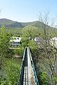
The Mass Central Rail Trail (MCRT) is a partially completed rail trail between Northampton, Massachusetts and Boston along the former right-of-way (ROW) of the Massachusetts Central Railroad. It currently has 59 miles (95 km) open, and 94.5 miles (152.1 km) are open or protected for trail development. When complete, it will be 104 miles (167 km) long through Central Massachusetts and Greater Boston, forming the longest rail trail in New England. Many sections of the trail, including the Norwottuck Branch of the Mass Central Rail Trail and the Somerville Community Path, have been developed as separate projects but serve as part of the complete Mass Central Rail Trail. The Norwottuck Network, a 501(c)(3) nonprofit that supports the build and operation of the MCRT, maintains interactive maps of the MCRT and rail trails that connect with the MCRT, and other Massachusetts trails.

Dorchester Shores Reservation is a Massachusetts state park consisting of three non-contiguous areas totaling 44 acres (18 ha) along the eastern edge of the Dorchester section of Boston. The area is composed of beaches and a park along the extended mouth of the Neponset River: Savin Hill/Malibu Beach, Tenean Beach, and Victory Road Park. Savin Hill is adjacent to Malibu Beach and has been restored to its original Olmsted Brothers design. The reservation is managed by the Department of Conservation and Recreation.

<span class="mw-page-title-main">Douglas State Forest</span> Protected area in Massachusetts, United States

Douglas State Forest is a publicly owned forest with recreational features located in the town of Douglas, Massachusetts, bordering both Connecticut and Rhode Island. The state forest's 5,525 acres (2,236 ha) include Wallum Lake and a rare Atlantic white cedar swamp, 5 acres (2.0 ha) of which are designated as a Massachusetts Wildland. The forest is managed by the Massachusetts Department of Conservation and Recreation.

<span class="mw-page-title-main">Brimfield State Forest</span> Protected area in Massachusetts, United States

Brimfield State Forest is a Massachusetts state forest located in and around the town of Brimfield in Hampden County, Massachusetts. The forest includes Dean Pond Recreation Area, a popular spot for fishing, picnicking and swimming. The park is managed by the Department of Conservation and Recreation.

Manuel F. Correllus State Forest is a Massachusetts state forest located on Martha's Vineyard. The forest borders Martha's Vineyard Airport on three sides and is chiefly in the towns of West Tisbury and Edgartown. The forest is managed by the Department of Conservation and Recreation.

<span class="mw-page-title-main">Myles Standish State Forest</span> Protected area in Massachusetts, United States

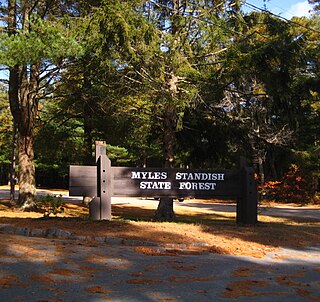
Myles Standish State Forest is a state forest located in the towns of Plymouth and Carver in southeastern Massachusetts, approximately 45 miles (70 km) south of Boston. It is the largest publicly owned recreation area in this part of Massachusetts and is managed by the Department of Conservation and Recreation (DCR).

<span class="mw-page-title-main">Mount Holyoke Range State Park</span> State park in Hampshire County, Massachusetts

Mount Holyoke Range State Park is a state-owned, public recreation area encompassing the eastern half of the Holyoke Range in the Pioneer Valley region of Massachusetts. The state park is adjacent to J. A. Skinner State Park, which occupies the western half of the Holyoke Range. Both are managed by the Massachusetts Department of Conservation and Recreation.

<span class="mw-page-title-main">Squantum Point Park</span>

Squantum Point Park is a state-owned, public recreation area located on the Squantum peninsula of Quincy, Massachusetts, United States. The park was created on the site of the former Squantum Naval Air Station, which is preserved in a 2,700-foot-long (820 m) strip of runway, and the former dockworks of the Bethlehem Shipbuilding Corporation. The park is managed by the Massachusetts Department of Conservation and Recreation and is associated with the development of the Neponset River Reservation.

<span class="mw-page-title-main">Spencer State Forest</span> Protected area in Massachusetts, United States

Spencer State Forest is a Massachusetts state forest and recreation reserve located in the town of Spencer, managed by the Massachusetts Department of Conservation and Recreation. The 92 mile (148 km) Midstate Trail passes through the state forest. The Commonwealth of Massachusetts also conducts logging in some parts of the property.

<span class="mw-page-title-main">Mystic River Reservation</span> Nature reserve in Massachusetts

The Mystic River Reservation is a publicly owned nature preserve with recreational features located along the Mystic River in the towns of Winchester, Arlington, Medford, Somerville, Everett, and Chelsea in eastern Massachusetts. The reserve is part of the nearly 76-square-mile (200 km2) Mystic River watershed. It is managed by the Massachusetts Department of Conservation and Recreation.

<span class="mw-page-title-main">Pope John Paul II Park Reservation</span> State park of Massachusetts, United States

Pope John Paul II Park Reservation, officially the Saint Pope John Paul II Park, and also known as Pope Park, is a 66-acre (27 ha) Massachusetts state park bordering the Neponset River in the Dorchester section of Boston. The park was reclaimed from the former site of a landfill and the Neponset Drive-In as part of the Lower Neponset River Master Plan and the development of the Neponset River Reservation. The park is managed by the Department of Conservation and Recreation (DCR).

<span class="mw-page-title-main">Pearl Hill State Park</span> State park in Middlesex County, Massachusetts

Pearl Hill State Park is a 1,000-acre (400 ha) Massachusetts state park located in the town of Townsend about 50 miles (80 km) from Boston. The park lies adjacent to Willard Brook State Forest and is managed by the Department of Conservation and Recreation (DCR).

<span class="mw-page-title-main">Granville State Forest</span> Protected area in Massachusetts, United States

Granville State Forest is a Massachusetts state park located in the towns of Granville and Tolland in the southern Berkshire Hills along the state's southern border with Connecticut. The park is managed by the Department of Conservation and Recreation (DCR). It is adjacent to Connecticut's Tunxis State Forest.

Kenneth Dubuque Memorial State Forest is a Massachusetts state forest in the northern Berkshire Hills in the towns of Hawley, Plainfield, and Savoy. The forest is managed by the Department of Conservation and Recreation (DCR). In 1985, the forest was named in memory of Kenneth M. Dubuque, a former employee of the Department of Environmental Management.

<span class="mw-page-title-main">Metropolitan Park System of Greater Boston</span>

The Metropolitan Park System of Greater Boston is a system of reservations, parks, parkways and roads under the control of the Massachusetts Department of Conservation and Recreation (DCR) in and around Boston that has been in existence for over a century. The title is used by the DCR to describe the areas collectively: "As a whole, the Metropolitan Park System is currently eligible for listing on the National Register of Historic Places", as outlined on the department's website. The DCR maintains a separate Urban Parks and Recreation division to oversee the system, one of five such divisions within the department—DCR's Bureau of State Parks and Recreation manages the remainder of Massachusetts state parks. Direct design and maintenance functions for the parkways and roads within the system are provided by the DCR Bureau of Engineering.

<span class="mw-page-title-main">Harold Parker State Forest</span> Protected area in Massachusetts, United States

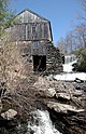
Harold Parker State Forest is a publicly owned forest with recreational features encompassing more than 3,300 acres (1,300 ha) in the towns of Andover, North Andover, North Reading, and Middleton, Massachusetts. Ponds, swamps, rolling hills, glacial erratics and rocky outcroppings can be found in the state forest, which features more than 35 miles (56 km) of backwoods roads and trails as well as remnants of 18th-century farming and milling operations. It is managed by the Massachusetts Department of Conservation and Recreation.

<span class="mw-page-title-main">Jug End State Reservation and Wildlife Management Area</span> Protected area in Massachusetts, United States

Jug End State Reservation and Wildlife Management Area is a public recreation area located in the towns of Egremont and Mount Washington, Massachusetts. The reservation occupies the site of the former Jug End Barn resort, which has been allowed to return to a natural state. Mount Everett State Reservation is adjacent to the south. It is managed by the Department of Conservation and Recreation.

<span class="mw-page-title-main">Lower Neponset River Trail</span>

The Lower Neponset River Trail is a 2.4-mile-long (3.9 km) rail trail running along the Neponset River in the Dorchester section of Boston, Massachusetts. It roughly follows the path of the eastern part of the Dorchester and Milton Branch Railroad from the Port Norfolk neighborhood in Dorchester to the Central Avenue T Station in Milton, passing through Pope John Paul II Park, the Neponset Marshes, and the Lower Mills area.

References

  1. "Massachusetts State Parks". MassParks. Executive Office of Energy and Environmental Affairs. Retrieved August 6, 2015.
  2. "2012 Acreage Listing" (PDF). Department of Conservation and Recreation. April 2012. Retrieved August 6, 2015.
  3. "Section 7. Bristol Blake State Reservation". Mass.gov. Department of Conservation and Recreation. Retrieved July 24, 2022.
  4. Mink, Jessica. "The Neponset River: A History". NeponsetGreenway.org. Retrieved August 5, 2022.