Niobrara County, Wyoming

Last updated

Niobrara County
Stagecoach Museum Lusk WY.jpg
Stagecoach Museum in Lusk
Map of Wyoming highlighting Niobrara County.svg
Location within the U.S. state of Wyoming
Wyoming in United States.svg
Wyoming's location within the U.S.
Coordinates: 43°03′N104°28′W / 43.05°N 104.47°W / 43.05; -104.47
CountryFlag of the United States.svg United States
StateFlag of Wyoming.svg  Wyoming
FoundedFebruary 21, 1911 (authorized)
1913 (organized)
Named for Niobrara River
Seat Lusk
Largest townLusk
Area
  Total2,628 sq mi (6,810 km2)
  Land2,626 sq mi (6,800 km2)
  Water1.9 sq mi (5 km2)  0.07%
Population
 (2020)
  Total2,467
  Density0.94/sq mi (0.36/km2)
Time zone UTC−7 (Mountain)
  Summer (DST) UTC−6 (MDT)
Congressional district At-large
Website www.niobraracounty.org
Niobrara County (WY) SR85 Wy niobrara1.jpg
Niobrara County (WY) SR85

Niobrara County is a county in the U.S. state of Wyoming. As of the 2020 United States Census, the population was 2,467, [1] making it the least populous county in Wyoming. Its county seat is Lusk. [2] Its eastern boundary abuts the west lines of the states of Nebraska and South Dakota.

Contents

History

Niobrara County was created on February 21, 1911, of area annexed from Converse County. Its organization was established in 1913. [3]

The county was named for the Niobrara River, which rises near Lusk. [4]

Geography

According to the US Census Bureau, the county has a total area of 2,628 square miles (6,810 km2), of which 2,626 square miles (6,800 km2) is land and 1.9 square miles (4.9 km2) (0.07%) is water. [5]

In comparison to the state of Rhode Island, the county has more than twice the land area, with approximately 1/500 of the population. [6]

Adjacent counties

Major highways

National protected area

Demographics

Historical population
CensusPop.Note
1920 6,321
1930 4,723−25.3%
1940 5,98826.8%
1950 4,701−21.5%
1960 3,750−20.2%
1970 2,924−22.0%
1980 2,9240.0%
1990 2,499−14.5%
2000 2,407−3.7%
2010 2,4843.2%
2020 2,467−0.7%
2023 (est.)2,354 [7] −4.6%
US Decennial Census [8]
1870–2000 [9] 2010–2016 [1]
Niobrara County (WY) SR85N Wy niobrara2.jpg
Niobrara County (WY) SR85N

2000 census

As of the 2000 United States Census, [10] of 2000, there were 2,407 people, 1,011 households, and 679 families in the county. The population density was 1 person per square mile (0.39 person/km2). There were 1,338 housing units at an average density of 0.5 units per square mile (0.19 units/km2). The racial makeup of the county was 98.05% White, 0.12% Black or African American, 0.50% Native American, 0.12% Asian, 0.50% from other races, and 0.71% from two or more races. 1.50% of the population were Hispanic or Latino of any race. 35.1% were of German, 18.7% English, 11.2% Irish and 5.7% American ancestry.

There were 1,011 households, out of which 27.10% had children under the age of 18 living with them, 57.60% were married couples living together, 6.00% had a female householder with no husband present, and 32.80% were non-families. 29.50% of all households were made up of individuals, and 14.10% had someone living alone who was 65 years of age or older. The average household size was 2.28 and the average family size was 2.81.

The county population contained 22.60% under the age of 18, 6.10% from 18 to 24, 26.00% from 25 to 44, 26.60% from 45 to 64, and 18.70% who were 65 years of age or older. The median age was 43 years. For every 100 females there were 95.20 males. For every 100 females age 18 and over, there were 88.80 males.

The median income for a household in the county was $29,701, and the median income for a family was $33,714. Males had a median income of $25,909 versus $17,016 for females. The per capita income for the county was $15,757. About 10.70% of families and 13.40% of the population were below the poverty line, including 15.00% of those under age 18 and 15.60% of those age 65 or over.

2010 census

As of the 2010 United States Census, there were 2,484 people, 1,069 households, and 659 families in the county. [11] The population density was 0.9 people per square mile (0.35 people/km2). There were 1,338 housing units at an average density of 0.5 units per square mile (0.19 units/km2). [12] The racial makeup of the county was 96.5% white, 0.8% American Indian, 0.4% Asian, 0.2% black or African American, 0.5% from other races, and 1.6% from two or more races. Those of Hispanic or Latino origin made up 2.1% of the population. [11] In terms of ancestry, 41.5% were German, 19.0% were English, 17.7% were Irish, 6.6% were Swedish, and 3.0% were American. [13]

Of the 1,069 households, 23.2% had children under the age of 18 living with them, 50.4% were married couples living together, 7.4% had a female householder with no husband present, 38.4% were non-families, and 34.5% of all households were made up of individuals. The average household size was 2.12 and the average family size was 2.71. The median age was 46.1 years. [11]

The median income for a household in the county was $45,813 and the median income for a family was $57,153. Males had a median income of $41,898 versus $30,323 for females. The per capita income for the county was $22,885. About 6.3% of families and 11.5% of the population were below the poverty line, including 17.9% of those under age 18 and 13.3% of those age 65 or over. [14]

Communities

Towns

Census-designated place

Unincorporated communities

Politics

Like almost all of Wyoming, Niobrara County is overwhelmingly Republican. No Democratic presidential candidate has won Niobrara County since Franklin D. Roosevelt beat Alf Landon in 1936 by thirty-eight votes, and none since Lyndon Johnson in 1964 has attained thirty percent of the county's vote.

United States presidential election results for Niobrara County, Wyoming [15]
Year Republican Democratic Third party
No.%No.%No.%
2020 1,11885.47%15511.85%352.68%
2016 1,11684.93%1158.75%836.32%
2012 1,02280.09%20015.67%544.23%
2008 1,01778.65%24418.87%322.47%
2004 1,06480.97%23017.50%201.52%
2000 88878.79%19016.86%494.35%
1996 75758.01%32524.90%22317.09%
1992 63548.85%29822.92%36728.23%
1988 82569.27%35429.72%121.01%
1984 1,09880.79%23917.59%221.62%
1980 1,07576.13%27019.12%674.75%
1976 1,04270.55%42728.91%80.54%
1972 1,24581.00%28918.80%30.20%
1968 1,13676.24%25016.78%1046.98%
1964 1,12257.10%84342.90%00.00%
1960 1,36270.57%56829.43%00.00%
1956 1,24870.67%51829.33%00.00%
1952 1,65273.13%58826.03%190.84%
1948 97555.87%75343.15%170.97%
1944 1,31261.37%82638.63%00.00%
1940 1,42754.22%1,20045.59%50.19%
1936 1,08648.37%1,12450.07%351.56%
1932 90841.56%1,23756.61%401.83%
1928 1,42474.21%46924.44%261.35%
1924 82048.43%20211.93%67139.63%
1920 96973.52%34526.18%40.30%
1916 53345.63%59951.28%363.08%
1912 50049.36%28227.84%23122.80%

The Wyoming Department of Corrections Wyoming Women's Center is located in Lusk. [16] The facility was operated by the Wyoming Board of Charities and Reform until that agency was dissolved as a result of a state constitutional amendment passed in November 1990. [17]

See also

Related Research Articles

<span class="mw-page-title-main">Johnson County, Wyoming</span> County in Wyoming, United States

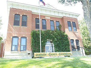
Johnson County is a county in the north central part of the U.S. state of Wyoming. At the 2020 United States Census, the population was 8,447. The county seat is Buffalo. Kaycee is the only other incorporated town in the county.

<span class="mw-page-title-main">Weston County, Wyoming</span> County in Wyoming, United States

Weston County is a county in the U.S. state of Wyoming. As of the 2020 United States Census, the population was 6,838. Its county seat is Newcastle. Its east boundary line abuts the west line of the state of South Dakota.

<span class="mw-page-title-main">Washakie County, Wyoming</span> County in Wyoming, United States

Washakie County is a county in the U.S. state of Wyoming. As of the 2020 United States Census, the population was 7,685. Its county seat is Worland.

<span class="mw-page-title-main">Sheridan County, Wyoming</span> County in Wyoming, United States

Sheridan County is a county in the U.S. state of Wyoming. As of the 2020 United States Census, the population was 30,921. The county seat is Sheridan. Its northern boundary abuts the Montana state border.

<span class="mw-page-title-main">Platte County, Wyoming</span> County in Wyoming, United States

Platte County is a county located in the U.S. state of Wyoming. As of the 2020 United States Census, the population was 8,605. Its county seat is Wheatland.

<span class="mw-page-title-main">Hot Springs County, Wyoming</span> County in Wyoming, United States

Hot Springs County is a county in the U.S. state of Wyoming. As of the 2020 United States Census, the population was 4,696, making it the second-least populous county in Wyoming. Its county seat is Thermopolis. The county is named for the hot springs located in Hot Springs State Park.

<span class="mw-page-title-main">Goshen County, Wyoming</span> County in Wyoming, United States

Goshen County is a county in the U.S. state of Wyoming. As of the 2020 United States Census, the population was 12,498. Its county seat is Torrington. The eastern boundary of the County borders the Nebraska state line.

<span class="mw-page-title-main">Fremont County, Wyoming</span> County in Wyoming, United States

Fremont County is a county in the U.S. state of Wyoming. As of the 2020 United States census, the population was 39,234, making it the fifth-most populous county in Wyoming. Its county seat is Lander. The county was founded in 1884 and is named for John C. Frémont, a general, explorer, and politician. It is roughly the size of the state of Vermont.

<span class="mw-page-title-main">Converse County, Wyoming</span> County in Wyoming, United States

Converse County is a county located in the U.S. state of Wyoming. As of the 2020 United States Census, the population was 13,751. Its county seat is Douglas.

<span class="mw-page-title-main">Carbon County, Wyoming</span> County in Wyoming, United States

Carbon County is a county in the U.S. state of Wyoming. As of the 2020 United States Census, the population was 14,537. Its county seat is Rawlins. Its south border abuts the north line of Colorado.

<span class="mw-page-title-main">Sioux County, Nebraska</span> County in Nebraska, United States

Sioux County is a county in the U.S. state of Nebraska. As of the 2020 United States Census, the population was 1,135. Its county seat is Harrison.

<span class="mw-page-title-main">Attica, New York</span> Town in New York, United States

Attica is a town in Wyoming County, New York, United States. The population was 7,702 as of 2010.

<span class="mw-page-title-main">Hawk Springs, Wyoming</span> CDP in Wyoming, United States

Hawk Springs is a census-designated place (CDP) in Goshen County, Wyoming, United States. The population was 45 at the 2010 census.

<span class="mw-page-title-main">Huntley, Wyoming</span> CDP in Wyoming, United States

Huntley is a census-designated place (CDP) in Goshen County, Wyoming, United States. The population was 30 according to the 2010 census.

<span class="mw-page-title-main">Torrington, Wyoming</span> City in Wyoming, United States

Torrington is a city in, and the county seat of, Goshen County, Wyoming, United States. The population was 6,501 at the 2010 census.

<span class="mw-page-title-main">Lance Creek, Wyoming</span> CDP in Wyoming, United States

Lance Creek is a census-designated place (CDP) in Niobrara County, Wyoming, United States. The population was 43 at the 2010 census. Lance Creek is the namesake of the Lance Formation, a rock formation from the Late Cretaceous that has yielded fossils from a diverse number of species.

<span class="mw-page-title-main">Manville, Wyoming</span> Town in Wyoming, United States

Manville is a town in Niobrara County, Wyoming, United States. The population was 95 at the 2010 census.

<span class="mw-page-title-main">Van Tassell, Wyoming</span> Town in Wyoming, United States

Van Tassell is a town in Niobrara County, Wyoming, United States. The population was 15 at the 2010 census.

<span class="mw-page-title-main">Newcastle, Wyoming</span> City in Wyoming, United States

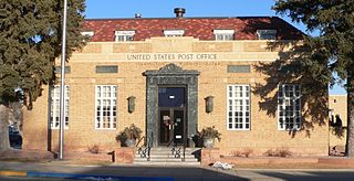
Newcastle is a city in and the county seat of Weston County, Wyoming, United States. The population was 3,374 at the 2020 census.

<span class="mw-page-title-main">Lusk, Wyoming</span> Town in Wyoming, United States

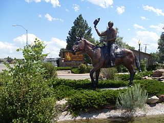
Lusk is a high-plains town in the eastern part of the U.S. state of Wyoming. The town is the seat of Niobrara County. The town was founded in July 1886, by Frank S. Lusk, a renowned Wyoming rancher, partner in the Western Live Stock Company, and stockholder in the Wyoming Central Railway. Cattle ranching remains the primary industry in the town of Lusk.

References

  1. 1 2 "State & County QuickFacts". US Census Bureau. Archived from the original on June 6, 2011. Retrieved January 25, 2014.
  2. "Find a County". National Association of Counties. Retrieved June 7, 2011.
  3. Long, John H., ed. (2004). "Wyoming: Individual County Chronologies". Wyoming Atlas of Historical County Boundaries. The Newberry Library . Retrieved August 19, 2015.
  4. Urbanek, Mae (1988). Wyoming Place Names. Missoula MT: Mountain Press Pub. Co. ISBN   0-87842-204-8.
  5. "2010 Census Gazetteer Files". US Census Bureau. August 22, 2012. Retrieved August 18, 2015.
  6. "Science for a changing world". www.usgs.gov. Retrieved June 22, 2018.
  7. "QuickFacts". United States Census Bureau. Retrieved March 24, 2024.
  8. "US Decennial Census". US Census Bureau. Retrieved August 18, 2015.
  9. "Historical Decennial Census Population for Wyoming Counties, Cities, and Towns". Wyoming Department of Administration & Information, Division of Economic Analysis. Retrieved January 25, 2014.
  10. "U.S. Census website". US Census Bureau. Retrieved May 14, 2011.
  11. 1 2 3 "Profile of General Population and Housing Characteristics: 2010 Demographic Profile Data". US Census Bureau. Archived from the original on February 13, 2020. Retrieved January 12, 2016.
  12. "Population, Housing Units, Area, and Density: 2010 - County". US Census Bureau. Archived from the original on February 13, 2020. Retrieved January 12, 2016.
  13. "Selected Social Characteristics in the US – 2006-2010 American Community Survey 5-Year Estimates". US Census Bureau. Archived from the original on February 13, 2020. Retrieved January 12, 2016.
  14. "Selected Economic Characteristics – 2006-2010 American Community Survey 5-Year Estimates". US Census Bureau. Archived from the original on February 13, 2020. Retrieved January 12, 2016.
  15. Leip, David. "Atlas of US Presidential Elections". uselectionatlas.org. Retrieved April 5, 2018.
  16. Contact Institutions. Wyoming Department of Corrections. Retrieved August 22, 2010.
  17. About the Department of Corrections. Wyoming Department of Corrections. Retrieved August 22, 2010.

43°03′N104°28′W / 43.05°N 104.47°W / 43.05; -104.47