
Stadio Cino e Lillo Del Duca is a multi-purpose stadium in Ascoli Piceno, Italy. It is currently used mostly for football matches and the home of Ascoli Picchio F.C. 1898. The stadium was built in 1962 and holds 20,550.

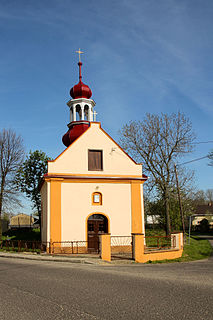
Záluží is a village in Central Bohemian Region of the Czech Republic. It has around 460 inhabitants. Ludmila Mottlova is mayor.
Wolica is a village in Poland located in Lesser Poland Voivodeship, in Bochnia County, in Gmina Łapanów. It had a population of 230 in 2005. It lies approximately 3 kilometres (2 mi) west of Łapanów, 19 km (12 mi) south-west of Bochnia, and 33 km (21 mi) south-east of the regional capital Kraków.
Czyste is a village in the administrative district of Gmina Inowrocław, within Inowrocław County, Kuyavian-Pomeranian Voivodeship, in north-central Poland.

Choratan is a town in the Tavush Province of Armenia. Settlers from Choratan founded Artsvashen in 1854.

Stare Rudki is a village in the administrative district of Gmina Augustów, within Augustów County, Podlaskie Voivodeship, in north-eastern Poland. It lies approximately 11 kilometres (7 mi) west of Augustów and 87 km (54 mi) north of the regional capital Białystok.
Dobki is a village in the administrative district of Gmina Tykocin, within Białystok County, Podlaskie Voivodeship, in north-eastern Poland.
Şurakənd or Shurakend may refer to:

Çorman is a village in the Lachin Rayon of Azerbaijan.
Günəşli is a village in the Gadabay Rayon of Azerbaijan. The village forms part of the municipality of Dəyəqarabulaq.
Yuanmou County is under the administration of the Chuxiong Yi Autonomous Prefecture, in the north of Yunnan province, China, bordering Sichuan province to the north.
Sulęcin-Kolonia is a village in the administrative district of Gmina Ostrów Mazowiecka, within Ostrów Mazowiecka County, Masovian Voivodeship, in east-central Poland.
Stawiska is a village in the administrative district of Gmina Ujsoły, within Żywiec County, Silesian Voivodeship, in southern Poland, close to the border with Slovakia. It lies approximately 3 kilometres (2 mi) west of Ujsoły, 26 km (16 mi) south of Żywiec, and 87 km (54 mi) south of the regional capital Katowice.
Niekazanice is a village in the administrative district of Gmina Branice, within Głubczyce County, Opole Voivodeship, in southwest Poland, near the Czech border. It lies approximately 5 kilometres (3 mi) east of Branice, 18 km (11 mi) south of Głubczyce, and 69 km (43 mi) south of the regional capital Opole.
Jabłonowice is a settlement in the administrative district of Gmina Choczewo, within Wejherowo County, Pomeranian Voivodeship, in northern Poland. It lies approximately 4 kilometres (2 mi) north-west of Choczewo, 31 km (19 mi) north-west of Wejherowo, and 67 km (42 mi) north-west of the regional capital Gdańsk.
Markopil is a village (selo) in Brodivskyi Raion, Lviv Oblast, in western Ukraine.

Wrightsville is an unincorporated community in Fairfield Township, Madison County, Ohio, United States. It is located at 39°51′40″N83°14′50″W, at the intersection of Ohio State Route 665 and Georgesville-Wrightsville Road, approximately four miles north of Kiousville. Some national maps mistakenly show Wrightsville in Franklin County.

Trummen is a lake in Växjö Municipality, Kronoberg County, Sweden. It covers approximately seventy-five hectares, and sits 161.2 meters above sea level. It is near Teleborg Castle, Linnaeus University, and Sankt Sigfrids Hospital.

Rutenovići is a village in the municipality of Višegrad, Bosnia and Herzegovina.
Çiçəkli is a village in the Gadabay Rayon of Azerbaijan. The village forms part of the municipality of Şahdağ.


