The Struve Geodetic Arc is a chain of survey triangulations stretching from Hammerfest in Norway to the Black Sea, through ten countries and over 2,820 km, which yielded the first accurate measurement of a meridian.

Korunková is a village and municipality in Stropkov District in the Prešov Region of north-eastern Slovakia.
Głębock is a village in the administrative district of Gmina Podgórzyn, within Jelenia Góra County, Lower Silesian Voivodeship, in south-western Poland. Prior to 1945 it was in Germany.

Yaquboba is a village in the Khachmaz Rayon of Azerbaijan. The village forms part of the municipality of Yalama.

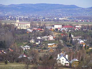
Ujanowice is a village in the administrative district of Gmina Laskowa, within Limanowa County, Lesser Poland Voivodeship, in southern Poland. It lies approximately 8 kilometres (5 mi) east of Laskowa, 11 km (7 mi) north-east of Limanowa, and 57 km (35 mi) south-east of the regional capital Kraków.

Sułkowice is a village in the administrative district of Gmina Andrychów, within Wadowice County, Lesser Poland Voivodeship, in southern Poland. It lies approximately 5 kilometres (3 mi) south of Andrychów, 12 km (7 mi) south-west of Wadowice, and 50 km (31 mi) south-west of the regional capital Kraków.

Wrocanka is a village in the administrative district of Gmina Miejsce Piastowe, within Krosno County, Subcarpathian Voivodeship, in south-eastern Poland. It lies approximately 6 kilometres (4 mi) south of Krosno and 48 km (30 mi) south-west of the regional capital Rzeszów.
Antoniewo is a village in the administrative district of Gmina Gozdowo, within Sierpc County, Masovian Voivodeship, in east-central Poland.

Józefowo is a village in the administrative district of Gmina Rząśnik, within Wyszków County, Masovian Voivodeship, in east-central Poland. It lies approximately 6 kilometres (4 mi) north of Rząśnik, 19 km (12 mi) north of Wyszków, and 64 km (40 mi) north of Warsaw.
Nowa Ruda is a village in the administrative district of Gmina Wierzbinek, within Konin County, Greater Poland Voivodeship, in west-central Poland.

Rue Pastourelle is a street in the third district of Paris.

Mikołajki is a village in the administrative district of Gmina Młynary, within Elbląg County, Warmian-Masurian Voivodeship, in northern Poland. It lies approximately 5 kilometres (3 mi) south of Młynary, 24 km (15 mi) east of Elbląg, and 65 km (40 mi) north-west of the regional capital Olsztyn.
Sudoměř is a village and municipality in Mladá Boleslav District in the Central Bohemian Region of the Czech Republic.

Longting District is a district of the city of Kaifeng, Henan province, China.
Hoadly is an unincorporated community in Prince William County, in the U.S. state of Virginia.
The Oosterparkbuurt is a neighborhood of Amsterdam, Netherlands. The neighborhood derives its name from the Oosterpark. Three of the main streets in the neighborhood - the Eerste Oosterparkstraat, Tweede Oosterparkstraat and Derde Oosterparkstraat - were also named after the park. The neighborhood was built late in the 19th century. Until World War II, the neighborhood was home to many working class Jews. During urban renewal operations of the 1970s and 1980s many of the original 19th-century housing was demolished and replaced.

The Großer Knechtsand is a large sandbank beyond the Weser and Elbe estuaries in the eastern part of Lower Saxony's Wadden Sea off the coast of North Germany. It lies between the islands of Mellum and Neuwerk. The central area of the sandbank lies above the high water mark, forming the Hochsand of Hoher Knechtsand, which was formerly an island. The Hochsand lies 11 km west of the village of Berensch on the nearest part of the mainland in the borough of Cuxhaven in the Land Wursten.

Skenderovići is a village in the municipality of Srebrenica, Bosnia and Herzegovina.
The rue Charlemagne is a street in the 4th arrondissement of Paris, in the Saint-Gervais quarter, near the Saint-Paul quarter.
Mapleton is an unincorporated community in Stark County, in the U.S. state of Ohio.


