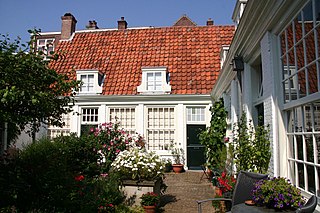
Hofje van Guurtje de Waal is a hofje in Haarlem, Netherlands.
Yeya is a river in Krasnodar Krai, Russia. It falls into the Yeya Firth of Taganrog Bay, Sea of Azov. It is 311 kilometres (193 mi) long with a drainage basin of 8,650 square kilometres (3,340 sq mi). It dries up in summer. A port town of Yeysk is located by the Yeya Firth at the neck of the Yeya Spit.

Vicaria is a neighbourhood of Naples, southern Italy. It takes its name from the eastern section of via dei Tribunali, in the neighbourhood of San Lorenzo, once known as "via della Vicaria", since the Vicaria housed the main tribunal under the Spanish vicerealm.
Kelsey is a rural municipality in the province of Manitoba in Western Canada. It consists of several disjoint parts. The largest part is Carrot Valley, located around and southwest of The Pas along the Carrot River, but the communities of Wanless and Cranberry Portage, located further north, are also part of the municipality. It is 867.64 km² large. Also lying in the area around The Pas is the Opaskwayak Cree Nation Indian reserve.

Shirakamut is a town in the Lori Province of Armenia. The town was the epicenter of 1988 Armenian earthquake.

Dąbrówka is a settlement in the administrative district of Gmina Janów, within Sokółka County, Podlaskie Voivodeship, in north-eastern Poland. It lies approximately 11 kilometres (7 mi) east of Janów, 11 km (7 mi) north-west of Sokółka, and 40 km (25 mi) north of the regional capital Białystok.
Podpolichno is a village in the administrative district of Gmina Chęciny, within Kielce County, Świętokrzyskie Voivodeship, in south-central Poland. It lies approximately 7 kilometres (4 mi) west of Chęciny and 18 km (11 mi) west of the regional capital Kielce.
Błażowa Dolna is a village in the administrative district of Gmina Błażowa, within Rzeszów County, Subcarpathian Voivodeship, in south-eastern Poland. It lies approximately 20 kilometres (12 mi) east of Błażowa and 31 km (19 mi) south-east of the regional capital Rzeszów.
Sośnica is a village in the administrative district of Gmina Dobrzyca, within Pleszew County, Greater Poland Voivodeship, in west-central Poland. It lies approximately 6 kilometres (4 mi) east of Dobrzyca, 8 km (5 mi) west of Pleszew, and 80 km (50 mi) south-east of the regional capital Poznań.
Olszewo is a village in the administrative district of Gmina Mikołajki, within Mrągowo County, Warmian-Masurian Voivodeship, in northern Poland. It lies approximately 10 kilometres (6 mi) north-east of Mikołajki, 25 km (16 mi) east of Mrągowo, and 78 km (48 mi) east of the regional capital Olsztyn.
Jasnopole is a village in the administrative district of Gmina Kalisz Pomorski, within Drawsko County, West Pomeranian Voivodeship, in north-western Poland. It lies approximately 5 kilometres (3 mi) north-west of Kalisz Pomorski, 25 km (16 mi) south of Drawsko Pomorskie, and 86 km (53 mi) east of the regional capital Szczecin.
Sobiemirowo is a settlement in the administrative district of Gmina Sławoborze, within Świdwin County, West Pomeranian Voivodeship, in north-western Poland. It lies approximately 5 kilometres (3 mi) south-west of Sławoborze, 11 km (7 mi) north-west of Świdwin, and 88 km (55 mi) north-east of the regional capital Szczecin.
Ivanopil is an urban-type settlement in Chudniv Raion, Zhytomyr Oblast, Ukraine. Population: 3,409 (2013 est.) In 2001, population was 3,993.
Todorovce is a village in the municipality of Leskovac, Serbia. According to the 2002 census, the village has a population of 521 people.
Pala is a village in Kuusalu Parish, Harju County in northern Estonia.

Taylorstown, Pennsylvania is a census-designated place in Blaine Township, Washington County, Pennsylvania, United States. Taylorstown has been assigned the ZIP codes 15323 and 15365. As of the 2010 census the population of Taylorstown was 217 residents.

Baku Museum of Modern Art is a museum of modern art located in Baku, Azerbaijan.
Hidden Valley is an unincorporated community in Jefferson Township, Somerset County, Pennsylvania, United States. Hidden Valley Resort, a ski resort is located within the community, along the southern side of Pennsylvania Route 31. The Pennsylvania Turnpike is within a few miles of the community, which lies in the Laurel Highlands.
Huổi Lèng is a commune (xã) and village of the Mường Chà District of Điện Biên Province, northwestern Vietnam.
Alsace Manor is a census-designated place (CDP) in Alsace Township, Berks County, Pennsylvania. It is located approximately 7 miles northeast of the city of Reading. As of the 2010 census the population was 478.


