10th federal electoral district of Guerrero

Last updated

The 10th federal electoral district of Guerrero (Distrito electoral federal 10 de Guerrero) is a defunct federal electoral district of the Mexican state of Guerrero.

Contents

During its existence, the 10th district returned one deputy to the Chamber of Deputies for each of the 51st to 59th sessions of Congress. Votes cast in the district also counted towards the calculation of proportional representation ("plurinominal") deputies elected from the country's electoral regions. [1] [2]

Created as part of the 1977 political reforms, [3] it was first contested in the 1979 mid-term election and elected its last deputy in the 2003 mid-terms. It was dissolved during the Federal Electoral Institute's 2005 redistricting process because the state's population no longer warranted ten districts. [4]

Territory

1996–2005
In its final form, the 10th district covered the urban core of the municipality of Acapulco. The head town (cabecera distrital), where results from individual polling stations were gathered together and tallied, was the port city of Acapulco. The remainder of the municipality was assigned to the 9th district. [5] [6]

1978–1996
The districting scheme in force from 1978 to 1996 was the result of the 1977 electoral reforms, which increased the number of single-member seats in the Chamber of Deputies from 196 to 300. Under that plan, Guerrero's district allocation rose from six to ten. [7] The newly created 10th district had its head town at Chilapa de Álvarez in the state's Mountain region and it comprised the municipalities of Ahuacuotzingo, Atenango del Río, Copalillo, Cualac, Chilapa, Huamuxtitlán, Huitzuco, Mártir de Cuilapán, Olinalá, Xochihuehuetlán and Zitlala. [8]

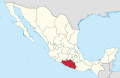
Deputies returned to Congress

Flag of Mexico.svg National parties
Current
PAN Party (Mexico).svg PAN
PRI Party (Mexico).svg PRI
PT Party (Mexico).svg PT
PVE Party (Mexico).svg PVEM
Logo Partido Movimiento Ciudadano (Mexico).svg MC
Morena logo (alt).svg Morena
Defunct or local only
Logo del Partido Laborista Mexicano.svg PLM
Logo Partido Nacional Revolucionario.svg PNR
Logo Partido de la Revolucion Mexicana.svg PRM
Logo del Partido Populista (Mexico).png PP
Emblema PPS.svg PPS
PARM logo (Mexico) (1954-1994).svg PARM
PFCRN Logo.png PFCRN
CON logo (Mexico).svg Convergencia
PNA Party (Mexico).svg PANAL
PSD logo (Mexico).svg PSD
Partido Encuentro Social (Mexico).svg PES
PRD logo (Mexico).svg PRD
Tenth federal electoral district of Guerrero
ElectionDeputyPartyTermLegislature
The 10th district was suspended between 1930 and 1978
1979 Dámaso Lanche Guillén [9] PRI Party (Mexico).svg 1979–1982 51st Congress
1982 Rubén Pérez Espino [10] PRI Party (Mexico).svg 1982–1985 52nd Congress
1985 Jorge Montúfar Araujo [11] PRI Party (Mexico).svg 1985–1988 53rd Congress
1988 Rubén Figueroa Alcocer [12] PRI Party (Mexico).svg 1988–1991 54th Congress
1991 Jesús Ramírez Guerrero [13] PRI Party (Mexico).svg 1991–1994 55th Congress
1994 Abel Velasco Velasco [14] PRI Party (Mexico).svg 1994–1997 56th Congress
1997 Alberto López Rosas  [ es ] [15] PRD Party (Mexico).svg 1997–2000 57th Congress
2000 David Augusto Sotelo Rosas [16] PRD Party (Mexico).svg 2000–2003 58th Congress
2003 Irma Figueroa Romero [17] PRD Party (Mexico).svg 2003–2006 59th Congress

References

  1. "How Mexico Elects Its Leaders — The Rules". Mexico Solidarity Project. 31 January 2024. Retrieved 18 August 2024.
  2. "Circunscripciones" (PDF). ayuda.ine.mx. Instituto Nacional Electoral . Retrieved 18 August 2024.
  3. Baños Martínez, Marco Antonio; Palacios Mora, Celia (2014). "Evolución territorial de los distritos electorales federales uninominales, 1977–2010" [Territorial evolution of the federal uninominal electoral districts, 1977–2010]. Investigaciones Geográficas (84). Mexico City: Instituto de Geografía, UNAM: 92. doi:10.14350/rig.34063 . Retrieved 18 August 2024.
  4. "Distritación 2004: Camino para la Democracia". Cartografía. Instituto Federal Electoral. 2005. Retrieved 18 August 2024.
  5. "La redistritación electoral mexicana, 1996: Memoria". Instituto Federal Electoral. 1997. p. 277. Archived from the original on 16 July 2024. Retrieved 18 August 2024.
  6. "Distritación de 1996 de Guerrero" (PDF). Instituto Federal Electoral. Archived from the original (PDF) on 11 September 2008. Retrieved 18 August 2024.
  7. González Casanova, Pablo (1993). Las Elecciones en México: evolución y perspectivas (3 ed.). Siglo XXI. p. 219. ISBN   9789682313219 . Retrieved 18 August 2024.
  8. "Guerrero". División del Territorio de la República en 300 Distritos Electorales Uninominales para Elecciones Federales. Diario Oficial de la Federación. 29 May 1978. p. 25. Retrieved 18 August 2024. The link contains a list of the municipalities covered.
  9. "Legislatura 51" (PDF). Cámara de Diputados . Retrieved 18 August 2024.
  10. "Legislatura 52" (PDF). Cámara de Diputados . Retrieved 18 August 2024.
  11. "Legislatura 53" (PDF). Cámara de Diputados . Retrieved 18 August 2024.
  12. "Legislatura 54" (PDF). Cámara de Diputados . Retrieved 18 August 2024.
  13. "Legislatura 55" (PDF). Cámara de Diputados . Retrieved 18 August 2024.
  14. "Legislatura 56" (PDF). Cámara de Diputados . Retrieved 18 August 2024.
  15. "Perfil: Dip. Alberto López Rosas, LVII Legislatura". Sistema de Información Legislativa (SIL). SEGOB . Retrieved 18 August 2024.
  16. "Perfil: Dip. David Augusto Sotelo Rosas, LVIII Legislatura". Sistema de Información Legislativa (SIL). SEGOB . Retrieved 18 August 2024.
  17. "Perfil: Dip. Irma Sinforina Figueroa Romero, LIX Legislatura". Sistema de Información Legislativa (SIL). SEGOB . Retrieved 18 August 2024.

16°52′N99°54′W / 16.867°N 99.900°W / 16.867; -99.900