Guerrero, officially the Free and Sovereign State of Guerrero, is one of the 32 states that comprise the 32 Federal Entities of Mexico. It is divided into 81 municipalities. The state has a population of about 3.5 million people. It is located in southwest Mexico and is bordered by the states of Michoacán to the north and west, the State of Mexico and Morelos to the north, Puebla to the northeast and Oaxaca to the east. In addition to the capital city, Chilpancingo and the largest city Acapulco, other cities in Guerrero include Petatlán, Ciudad Altamirano, Taxco, Iguala, Ixtapa, and Zihuatanejo. Today, it is home to a number of indigenous communities, including the Nahuas, Mixtecs, Tlapanecs, Amuzgos, and formerly Cuitlatecs. It is also home to communities of Afro-Mexicans in the Costa Chica region.

Municipalities are the second-level administrative divisions of Mexico, where the first-level administrative division is the state. They should not be confused with cities or towns that may share the same name as they are distinct entities and do not share geographical boundaries. As of March 2024, there are 2,476 municipalities in Mexico, excluding the 16 boroughs of Mexico City.

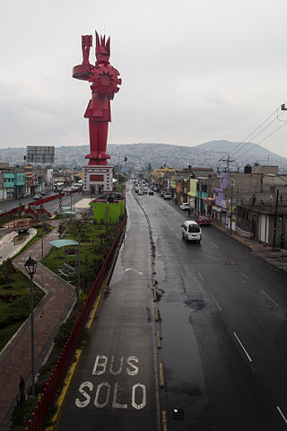
Chimalhuacán is a city and municipality located in the eastern part of State of Mexico, Mexico. It lies just outside the northeast border of Mexico City and is part of the Greater Mexico City urban area.

Práxedis Gilberto Guerrero is the municipal seat of the municipality of Práxedis G. Guerrero in the northern Mexican state of Chihuahua.

Coyuca de Catalán is a municipality in the Mexican state of Guerrero. The municipal seat lies at Coyuca de Catalán. The municipality covers an area of 921.9 km2.

Tlapehuala is a municipality in the Mexican state of Guerrero. The municipal seat lies at Tlapehuala. The municipality covers an area of 266.7 km2.

Chilapa de Álvarez is a municipality in the Mexican state of Guerrero. The municipal seat lies at Chilapa de Álvarez. The municipality covers an area of 566.8 km².

Legislative elections were held in Mexico on 7 June 2015, alongside municipal elections.
Terrorism in Mexico is the phenomenon of organized violence against civilians. It appeared in the 1960s, committed by communist guerrillas.
Same-sex marriage has been legal in Guerrero since 31 December 2022. After the Supreme Court of Justice of the Nation ruled that same-sex marriage bans are unconstitutional nationwide under the Constitution of Mexico on 12 June 2015, officials in Guerrero began announcing plans for a collective group wedding. Governor Rogelio Ortega Martínez submitted a same-sex marriage bill to Congress on 7 July 2015 and instructed civil registrars to issue marriage licenses to same-sex couples. Legislators lamented they would have preferred to have the bill passed before marriages took place, but given the time line presented, it was unlikely. On 10 July 2015, twenty same-sex couples were married by Ortega Martínez in Acapulco.

San Quintín is a municipality in the Mexican state of Baja California. Its municipal seat is located in the city of San Quintín, Baja California. According to the 2020 census, it had a population of 117,568 inhabitants. The municipality has an area of 32,883.93 km2. There are a few National Parks and a World Heritage Site at Bahia de Los Angeles.
The Mariano Sánchez Añón Insurrectional Cell was an urban guerrilla group in the Greater Mexico City area.
A moment magnitude Mw 7.0 or 7.1 earthquake occurred near the city of Acapulco in the Mexican state of Guerrero at on 7 September with an estimated intensity of VIII (Severe) on the MMI scale. The earthquake killed 13 people and injured at least 23 others. At least 1.6 million people in Mexico were affected by the earthquake which resulted in localized severe damage. The earthquake occurred on the anniversary of the 2017 Chiapas earthquake which measured Mw 8.2. It was also the largest earthquake in Mexico since the 2020 Oaxaca earthquake.
The Los Rojos Cartel is a Mexican criminal organization that emerged as a split from the Beltran-Leyva Cartel, being led at first by brothers Arturo "El Barbas" and Héctor "El Ingeniero", Alfredo "El Mochomo" and Jésus Nava Romero "El Rojo", hence the name of the group. The group also has an important participation in drug trafficking to the United States.
Ñuu Savi is a municipality in the Mexican state of Guerrero. It is located 85 kilometres (53 mi) southeast of the state capital of Chilpancingo. Its creation from the municipality of Ayutla de los Libres was approved in 2021 and went into force on 21 May 2022.

San Nicolás is a municipality in the Mexican state of Guerrero. It is located 165 kilometres (103 mi) southeast of the state capital of Chilpancingo. It is named after its patron saint, Nicholas of Tolentino. Its creation from the municipality of Cuajinicuilapa was approved in 2021 and went into force on 21 May 2022.
Santa Cruz del Rincón is a municipality in the Mexican state of Guerrero. It is located about 100 kilometres (62 mi) southeast of the state capital of Chilpancingo. Its creation from the municipality of Malinaltepec was approved in 2021 and went into force on 21 May 2022.


