
Ahome is a municipality on the coast of the Gulf of California in the northwestern part of the Mexican state of Sinaloa; it is adjacent to the southern border of Sonora state. It reported 388,344 inhabitants in the 2005 census. Ahome is also the name of the second-largest community in the municipality. The municipal seat is the port city of Los Mochis, its largest community. It is the third most important municipality in the state of Sinaloa, and is a commercial corridor to the northwest of the country. It is situated on the Pacific coastal plain, at the entrance of the Gulf of California and lies in the heart of a rich agricultural region, Fort Valley. It stands at 25°33′50″N108°46′00″W.

Mexicali Municipality is a municipality in the Mexican state of Baja California. Its municipal seat is located in the city of Mexicali. As of 2020, the municipality had a total population of 1,049,792. The municipality has an area of 13,700 km2 (5,300 sq mi). This includes many smaller outlying communities as well as the city of Mexicali. Also, the islands of Baja California located in the Gulf of California are part of the municipality, among them the mudflat islands at the mouth of the Colorado River, Isla Ángel de la Guarda and the islands of the San Lorenzo Marine Archipelago National Park. Mexicali is the northernmost municipality of Latin America.
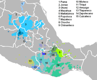
Tlapanec, or Meꞌphaa, is an indigenous Mexican language spoken by more than 98,000 Tlapanec people in the state of Guerrero. Like other Oto-Manguean languages, it is tonal and has complex inflectional morphology. The ethnic group themselves refer to their ethnic identity and language as Me̱ꞌpha̱a̱.
The Codices Azoyú I & II are two Mesoamerican pictorial codices, painted in Tlapa around 1565. They were accidentally discovered in 1940 in the town of Azoyú, after which they are named. Both codices depict and offer supporting evidence for the Mesoamerican belief of nahualism.

The Municipality of Pachuca de Soto, or Municipality of Pachuca, is one of the Municipalities of the state of Hidalgo, located in east-central Mexico.

San Pablo del Monte is the largest city in the Mexican state of Tlaxcala, and is the municipal seat of the municipality of San Pablo del Monte. It is located at the southernmost point in the state, near the border with the adjoining state of Puebla. It is a suburb of the city of Puebla and a component of its metropolitan area. At the census of 2005 the population of the city was 55,760.

Santa Ana Chiautempan is a city in Chiautempan Municipality in the south-central part of the Mexican state of Tlaxcala. The city serves as the municipal seat of the municipality, which covers an area of 66.21 km². At the 2005 census it had a population of 46,776 inhabitants, the fourth-largest community in the state in population. The city lies at the extreme western end of the municipality, which had a census population of 63,300 inhabitants.

Zihuatanejo de Azueta is a municipality located on the Pacific coast in the western part of the Mexican state of Guerrero. It includes the major resort communities of Zihuatanejo and Ixtapa in addition to numerous other towns. In 2010 it had a population of 118,211 inhabitants. It has an area of 1468 km². Its municipal seat is the city of Zihuatanejo. Its municipal president for the 2005-08 period was Silvano Blanco Deaquino.

Comonfort is a Mexican town and municipality in the state of Guanajuato. It was named after Mexican general and President Ignacio Comonfort. The municipality has an area of 485.90 square kilometres and is bordered to the north and northeast by San Miguel de Allende, to the east by the state of Querétaro, to the south and southwest by, Apaseo el Grande, Celaya and Santa Cruz de Juventino Rosas, respectively. The municipality had a population of 67,642 inhabitants according to the 2005 census.
Tuzantla is a municipality in the eastern part of the Mexican state of Michoacán. The municipality has an area of 1,018.49 square kilometres and is bordered to the north by the municipalities of Jungapeo and Hidalgo, to the east by Juárez and Susupuato, to the south by Tiquicheo and the state of Guerrero, and to the west by Tiquicheo and Tzitzio. The municipality had a population of 15,302 inhabitants according to the 2005 census. Its municipal seat is the city of the same name.
Arteaga is a municipality located in the southern region of the Mexican state of Michoacán. The municipality has an area of 3,454.71 square kilometres and is bordered to the north by the municipality of La Huacana, to the east by Churumuco and the state of Guerrero, to the south by Lázaro Cárdenas, and to the west by Coalcomán de Vázquez Pallares, Tumbiscatío, Aguililla and Aquila. The municipality had a population of 21,173 inhabitants according to the 2005 census. Its municipal seat is the city of the same name.

Pueblo Viejo is one of the 212 municipalities of the Mexican state of Veracruz. It is located in the state's Huasteca Alta region. The municipal seat is the city of Ciudad Cuauhtémoc, Veracruz.
Ciudad Cuauhtémoc is a city in the Huasteca Alta region of the Mexican state of Veracruz. It serves as the municipal seat of the surrounding Pueblo Viejo Municipality.

Azoyú is one of the 81 municipalities of Guerrero, in south-western Mexico. The municipal seat lies at Azoyu. The municipality covers an area of 784.6 km².
Cuajinicuilapa Municipality is one of the 81 municipalities of Guerrero, in south-western Mexico. The municipal seat lies at Cuajinicuilapa. The municipality covers an area of 857.1 km². As of 2005, the municipality had a total population of 25,537.
Tlapa de Comonfort is one of the 81 municipalities of Guerrero, in south-western Mexico. The municipal seat lies at Tlapa de Comonfort. The municipality covers an area of 1,054 km².
Lerdo de Tejada is a municipality in the Mexican state of Veracruz, located 207 kilometres (129 mi) southeast of the state capital Xalapa. It is named after Sebastián Lerdo de Tejada, the 27th President of Mexico.

Huamelulpan is an archaeological site of the Mixtec culture, located in the town of San Martín Huamelulpan at an elevation of 2,218 metres (7,277 ft), about 96 kilometres (60 mi) north-west of the city of Oaxaca, the capital of Oaxaca state.
Tototepec is a town located in the state of Guerrero in Mexico. It is located in the municipality of Tlapa de Comonfort and has a population of 2,573 as of 2012. In Mixteco, the indigenous language of the region, the town is known as Yozononi. The town's elevation is 1,670 meters above sea level.
Regional communications in ancient Mesoamerica are believed to have been extensive. There were various trade routes attested since prehistoric times. In this article, especially the routes starting in the Mexico Central Plateau, and going down to the Pacific coast will be considered. These contacts then went on as far as Central America.


