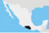
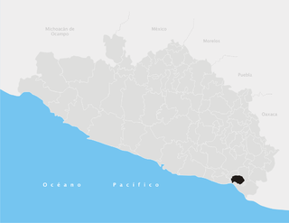
Guerrero, officially the Free and Sovereign State of Guerrero, is one of the 32 states which comprise the 32 Federal Entities of Mexico. It is divided in 81 municipalities and its capital city is Chilpancingo and its largest city is Acapulco. It is located in Southwestern Mexico. It is bordered by the states of Michoacán to the north and west, the State of Mexico and Morelos to the north, Puebla to the northeast and Oaxaca to the east. In addition to the capital city, the state's largest cities include Acapulco, Petatlán, Ciudad Altamirano, Taxco, Iguala, Ixtapa, Zihuatanejo, and Santo Domingo. Today, it is home to a number of indigenous communities, including the Nahuas, Mixtecs, Tlapanecs, Amuzgos, and formerly Cuitlatecs. It is also home to communities of Afro-Mexicans in the Costa Chica region.

Chilpancingo de los Bravo is the capital and second-largest city of the state of Guerrero, Mexico. In 2010 it had a population of 187,251 people. The municipality has an area of 2,338.4 km2 (902.9 sq mi) in the south-central part of the state, situated in the Sierra Madre del Sur, on the bank of the Huacapa River. The city is on Mexican Federal Highway 95 which connects Acapulco to Mexico City. It is served by Chilpancingo National Airport, which is one of the five airports in the state.

Zihuatanejo de Azueta is a municipality located on the Pacific coast in the western part of the Mexican state of Guerrero. It includes the major resort communities of Zihuatanejo and Ixtapa in addition to numerous other towns. In 2010 it had a population of 118,211 inhabitants. It has an area of 1468 km². Its municipal seat is the city of Zihuatanejo. Its municipal president for the 2005-08 period was Silvano Blanco Deaquino.

Chichihualco is a city in the south of Mexico. It forms the administrative centre of the municipality of Leonardo Bravo, found in the centre of Guerrero state about 21 kilometres northwest of the state capital, Chilpancingo.
Montecristo de Guerrero is a town and one of the 119 Municipalities of Chiapas, in southern Mexico.
Alcozauca de Guerrero is one of the 81 municipalities of Guerrero, in south-western Mexico. The municipal seat lies at Alcozauca de Guerrero. The municipality covers an area of 55,160 hectares.

Iliatenco is one of the 81 municipalities of Guerrero, in south-western Mexico. The municipal seat lies at Iliatenco. In 2005, the municipality had a total population of 10,039 and is the newest of municipalities in Guerrero, formed in 2005
Juchitán is one of the 81 municipalities of Guerrero, in south-western Mexico. The municipal seat lies at Juchitán. Founded in 2004, it is one of the newest municipalities in Guerrero.

Tixtla de Guerrero is one of the 81 municipalities of Guerrero, in south-western Mexico. The municipal seat lies at Tixtla de Guerrero. The municipality covers an area of 290 square kilometres (110 sq mi).
Pilcaya is one of the 81 municipalities of Guerrero, in south-western Mexico. The municipal seat lies at Pilcaya. The municipality covers an area of 62.1 km².
Xochihuehuetlan is one of the 81 municipalities of Guerrero, in south-western Mexico. The municipal seat lies at Xochihuehuetlan. The municipality covers an area of 191.6 km².
Zitlala is one of the 81 municipalities of Guerrero, in south-western Mexico. The municipal seat lies at Zitlala. The municipality covers an area of 308.2 km².
Alcozauca de Guerrero is a city and seat of the municipality of Alcozauca de Guerrero, in the state of Guerrero, south-western Mexico.
Coahuayutla de Guerrero is a city and seat of the municipality of Coahuayutla de José María Izazaga, in the state of Guerrero, south-western Mexico. In 2005, the population of Coahuayutla de Guerrero was 1,373.
Zumpango del Río is the capital of Eduardo Neri Municipality, within the state of Guerrero, in central−western Mexico.
Tlapehuala is a city and seat of the municipality of Tlapehuala, in the state of Guerrero, south-western Mexico.
Zapotitlán Tablas is a city and seat of the municipality of Zapotitlán Tablas, in the state of Guerrero, south-western Mexico.

Tierra Caliente is a cultural and geographical region in southern Mexico that comprises some low-elevation areas of the states of Michoacán, Guerrero and Mexico. As the name suggests, the region is characterized by a hot climate. The overall precipitation is also low - around 600 mm/year, but can be as low as 400 mm in some low-lying areas of Michoacán and Guerrero.
La Esmeralda or Escuela Nacional de Pintura, Escultura y Grabado (ENPEG) is a Mexican art school founded in 1927 and located in Mexico City.
The Guerrero Nahuatl language is a Nahuan language spoken by 150,000 people in Mexico.