Syunik is the southernmost province of Armenia. It is bordered by the Vayots Dzor Province to the north, Azerbaijan's Nakhchivan Autonomous Republic exclave to the west, Azerbaijan to the east, and Iran to the south. Its capital and largest city is the town of Kapan. The Statistical Committee of Armenia reported its population was 141,771 in the 2011 census, down from 152,684 at the 2001 census.
The 1988 Armenian earthquake, also known as the Spitak earthquake, occurred on December 7 at with a surface wave magnitude of 6.8 and a maximum MSK intensity of X (Devastating). The shock occurred in the northern region of Armenia which is vulnerable to large and destructive earthquakes and is part of a larger active seismic belt that stretches from the Alps to the Himalayas. Activity in the area is associated with tectonic plate boundary interaction and the source of the event was slip on a thrust fault just to the north of Spitak. The complex incident ruptured multiple faults, with a strike-slip event occurring shortly after the initiation of the mainshock. Between 25,000 and 50,000 were killed and up to 130,000 were injured.
The 2000 Baku earthquake occurred on November 25 at 22:09 local time with an epicenter just offshore Baku, Azerbaijan. It measured 6.8 on the moment magnitude scale and the maximum felt intensity was VI on the Mercalli intensity scale. It was followed three minutes later by a quake measuring 5.9. It was the strongest for almost 160 years, since 1842 in the Baku suburbs and in addition to the capital, affected Sumgayit, Shamakhi and neighboring cities. According to the United States Geological Survey, the epicentre was in the Caspian Sea, 25 km to the south-southeast of Baku. The earthquake was felt as far away as e.g. Tbilisi, 600 km northwest of the epicentre, Makhachkala and the Karabudakh and Isberbas settlements in Dagestan.

The 1950 Assam–Tibet earthquake, also known as the Assam earthquake, occurred on 15 August and had a moment magnitude of 8.7. The epicentre was located in the Mishmi Hills. It is the strongest earthquake ever recorded on land.
The 1938 Banda Sea earthquake occurred on February 2 at 04:04 local time with an estimated magnitude of 8.5-8.6 on the moment magnitude scale. Shaking was intense with an assigned Rossi–Forel intensity of VII and intensity of VI (Strong) on the Modified Mercalli intensity scale. This oblique-slip event generated a destructive tsunami of up to 1.5 metres in the Banda Sea region, but there were no deaths.

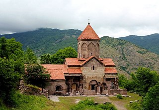
Aghitu is a village in the Sisian Municipality of the Syunik Province in Armenia. It is located on the left bank of the Vorotan river, 7 kilometers east of the regional capital of Sisian.

The 2002 Denali earthquake occurred at 22:12:41 UTC November 3 with an epicenter 66 km ESE of Denali National Park, Alaska, United States. This 7.9 Mw earthquake was the largest recorded in the United States in 37 years. The shock was the strongest ever recorded in the interior of Alaska. Due to the remote location, there were no fatalities and only one injury.

The following is a summary of significant earthquakes during the 21st century. In terms of fatalities, the 2004 Indian Ocean earthquake was the most destructive event with 227,898 confirmed fatalities, followed by the 2010 Haiti earthquake with about 160,000 fatalities, the 2008 Sichuan earthquake with 87,587 fatalities, the 2005 Kashmir earthquake suffered by Pakistan with 87,351 fatalities, and the 2023 Turkey–Syria earthquakes with at least 59,488 fatalities.

The 1995 Neftegorsk earthquake occurred on 28 May at on northern Sakhalin Island in the Russian Far East. It was the most destructive earthquake known within the current state of Russia, with a magnitude of 7.1 and maximum Mercalli intensity of IX (Violent) that devastated the oil town of Neftegorsk, where 1,989 of its 3,977 citizens were killed, and another 750 injured.
Striking southern Italy on 8 September, the 1905 Calabria earthquake had a moment magnitude of 7.2 and a maximum Mercalli intensity of XI (Extreme). The first major earthquake of the 20th century, it severely damaged parts of Lipari, Messina Province and a large area between Cosenza and Nicotera and killed between 557 and 2,500 people.

The Sagaing Fault is a major fault in Myanmar, a mainly continental right-lateral transform fault between the Indian Plate and Sunda Plate. It links the divergent boundary in the Andaman Sea with the zone of active continental collision along the Himalayan front. It passes through the populated cities of Mandalay, Yamethin, Pyinmana, the capital Naypyidaw, Toungoo and Pegu before dropping off into the Gulf of Martaban, running for a total length of over 1200 kilometers.
An earthquake occurred on 1 June 1786 in and around Kangding, in what is now China's Sichuan province. It had an estimated magnitude of about 7.75 and a maximum perceived intensity of X (Extreme) on the Mercalli intensity scale. The initial quake killed 435 people. After an aftershock ten days later, a further 100,000 died when a landslide dam collapsed across the Dadu river.

The geology of Armenia was shaped by geological upheaval that pushed up the Earth's crust to form the Armenian plateau 25 million years ago. This created the complex topography of Armenia.
The 1976 Sabah earthquake occurred at 10:56 am on 26 July near Lahad Datu in the eastern portion of Sabah, Malaysia. The moment magnitude 6.3 earthquake is one of the strongest in Malaysia to be recorded by seismic instruments. It had a focal mechanism corresponding to strike-slip faulting. While slightly larger than the 2015 Sabah earthquake, the 1976 event caused less extensive damage, in the form of cracks on several buildings and ground cracks.

The 1918 San Jacinto earthquake occurred in extreme eastern San Diego County in Southern California on April 21 at . The shock had a moment magnitude of 6.7 and a maximum Mercalli intensity of IX (Violent). Several injuries and one death occurred with total losses estimated to be $200,000.
The 1139 Ganja earthquake was one of the worst seismic events in history. It affected the Seljuk Empire and the Kingdom of Georgia, in modern-day Azerbaijan and Georgia. The earthquake had an estimated magnitude of 7.7 , 7.5 and 7.0–7.3 . A disputed death toll of 230,000–300,000 resulted from this event, making it one of the deadliest earthquakes ever recorded.
The 1840 Ahora earthquake occurred on 2 July at 16:00 local time, affecting Ağrı Province in the Eastern Anatolia Region of present-day Turkey. The earthquake had an epicenter near Mount Ararat, where it triggered an eruption and caused a landslide that destroyed villages. An estimated 10,000 people were killed by the earthquake and its damaging aftershocks. Earthquake catalogs place the surface-wave magnitude at Ms 7.4 and maximum Modified Mercalli intensity scale assigned IX (Violent).
The 1969 Alaşehir earthquake occurred on March 28 at 03:48 local time near the city of Alaşehir in Turkey's Manisa Province. The Mw 6.8 earthquake struck at 10 km (6.2 mi) depth. It had a MSK 64 intensity of VIII (Destructive). At least 53 people were killed in the earthquake.
The 1979 Saint Elias earthquake affected Alaska at 12:27 AKST on 28 February. The thrust-faulting 7.5 earthquake had an epicenter in the Granite Mountains. Though the maximum recorded Modified Mercalli intensity was VII, damage was minimal and there were no casualties due to the remoteness of the faulting. Damage also extended across the border in parts of Yukon, Canada.
The 1957 Alborz earthquake struck northern Iran's Mazandaran province at 04:12 local time on 2 July. It had a moment magnitude (Mw ) of 7.1 and occurred at a focal depth of 15 km (9.3 mi). The thrust-faulting shock was assigned a maximum Modified Mercalli intensity of IX (Violent). It devastated 120 villages in the Alborz Mountains and caused an estimated 1,500 fatalities. The earthquake also triggered landslides including one that dammed the Haraz River. Some damage was also reported in Tehran, Qaem Shahr and Sari. The total damage was estimated at US$25 million.