UTC time | 1931-09-25 05:59:51 |
---|---|
ISC event | 907033 |
USGS-ANSS | ComCat |
Local date | 25 September 1931 |
Local time | 12:59 |
Magnitude | 7.3 Mw [1] |
Depth | 35 km (22 mi) [1] |
Epicenter | 5°11′S102°31′E / 5.18°S 102.51°E [1] |
Areas affected | Indonesia |
Max. intensity | IX (Destructive) [2] |
Tsunami | 1 m |
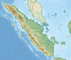
The 1931 Southwest Sumatra earthquake occurred on 25 September at 05:59 UTC. It was located between the Enggano Island and Sumatra, Indonesia, then under the rule of Dutch East Indies. [3] It had a magnitude of Mw 7.3, [1] or Ms 7.5. [4] [5]
The earthquake occurred off southwest Sumatra. Some huts were shifted by about 0.5 metre. The earthquake could be felt in Padang, more than 500 km away and in Bandung, about 600 km away. It was reported that the earthquake was even felt in Pamekasan, Madura Island, about 1250 km away. A tsunami of 1 metre high was reported. [3]
An earthquake occurred on July 17, 2006, at 15:19:27 local time along a subduction zone off the coast of west and central Java, a large and densely populated island in the Indonesian archipelago. The shock had a moment magnitude of 7.7 and a maximum perceived intensity of IV (Light) in Jakarta, the capital and largest city of Indonesia. There were no direct effects of the earthquake's shaking due to its low intensity, and the large loss of life from the event was due to the resulting tsunami, which inundated a 300 km (190 mi) portion of the Java coast that had been unaffected by the earlier 2004 Indian Ocean earthquake and tsunami that was off the coast of Sumatra. The July 2006 earthquake was also centered in the Indian Ocean, 180 kilometers (110 mi) from the coast of Java, and had a duration of more than three minutes.
The 1938 Banda Sea earthquake occurred on February 2 at 04:04 local time with an estimated magnitude of 8.5-8.6 on the moment magnitude scale. Shaking was intense with an assigned Rossi–Forel intensity of VII and intensity of VI (Strong) on the Modified Mercalli intensity scale. This oblique-slip event generated a destructive tsunami of up to 1.5 metres in the Banda Sea region, but there were no deaths.
The 2007 Bengkulu earthquakes were a series of megathrust earthquakes that struck the Sunda Trench off the coast of Sumatra, Indonesia, with three of magnitude 7 or greater. A series of tsunami bulletins was issued for the area. The most powerful of the series had a magnitude of 8.4, which makes it in the top 20 of the largest earthquakes ever recorded on a seismograph.
The 1833 Sumatra earthquake occurred on November 25 at about 22:00 local time, with an estimated magnitude in the range of 8.8–9.2 Mw . It caused a large tsunami that flooded the southwestern coast of the island. There are no reliable records of the loss of life, with the casualties being described only as 'numerous'. The magnitude of this event has been estimated using records of uplift taken from coral microatolls.
The Sunda megathrust is a fault that extends approximately 5,500 km (3300 mi) from Myanmar (Burma) in the north, running along the southwestern side of Sumatra, to the south of Java and Bali before terminating near Australia. It is a megathrust, located at a convergent plate boundary where it forms the interface between the overriding Eurasian plate and the subducting Indo-Australian plate. It is one of the most seismogenic structures on Earth, being responsible for many great and giant earthquakes, including the 2004 Indian Ocean earthquake and tsunami that killed over 227,000 people. The Sunda megathrust can be divided into the Andaman Megathrust, Sumatra(n) Megathrust and Java(n) Megathrust. The Bali-Sumbawa segment is much less active and therefore does not have the "megathrust" term associated with it.
The 1797 Sumatra earthquake occurred at 22:00 local time on 10 February. It was the first in a series of great earthquakes that ruptured part of the Sumatran segment of the Sunda megathrust. It caused a damaging tsunami that was particularly severe near Padang, where a 150–200 t English ship was driven 1 km (0.62 mi) inland up the Arau River.
The 1861 Sumatra earthquake occurred on 16 February and was the last in a sequences of earthquakes that ruptured adjacent parts of the Sumatran segment of the Sunda megathrust. It caused a devastating tsunami which led to several thousand fatalities. The earthquake was felt as far away as the Malay peninsula and the eastern part of Java. The rupture area for the 2005 Nias–Simeulue earthquake is similar to that estimated for the 1861 event.
The 1881 Nicobar Islands earthquake occurred at about 07:49 local time on 31 December, with an epicentre beneath Car Nicobar. It occurred as two separate ruptures, the largest of which had an estimated magnitude of 7.9 on the moment magnitude scale and triggered a tsunami that was observed around the Bay of Bengal. It is probably the earliest earthquake for which rupture parameters have been estimated instrumentally.
The 1984 Northern Sumatra earthquake occurred with a moment magnitude of 7.2 on November 17 at 06:49 UTC. The epicentre was located off the coast of Sumatra, near the island of Nias, where building damage was reported. This earthquake could be strongly felt in parts of Northern Sumatra, including Padang and Medan. The focal mechanism corresponded to reverse faulting.
The 1935 Sumatra earthquake occurred at 09:35 local time on 28 December. It had a magnitude of Mw 7.7 and a maximum felt intensity of VII (Damaging) on the European macroseismic scale. It triggered a minor tsunami.
In seismology, a tsunami earthquake is an earthquake which triggers a tsunami of significantly greater magnitude, as measured by shorter-period seismic waves. The term was introduced by Japanese seismologist Hiroo Kanamori in 1972. Such events are a result of relatively slow rupture velocities. They are particularly dangerous as a large tsunami may arrive at a coastline with little or no warning.
The 1943 Alahan Panjang earthquakes occurred on June 8 and June 9 UTC in Sumatra, then under Japanese occupation. This was an earthquake doublet.
The 2012 Indian Ocean earthquakes were magnitude 8.6 and 8.2 Mw undersea earthquakes that struck near the Indonesian province of Aceh on 11 April at 15:38 local time. Initially, authorities feared that the initial earthquake would cause a tsunami and warnings were issued across the Indian Ocean; however, these warnings were subsequently cancelled. These were unusually strong intraplate earthquakes and the largest strike-slip earthquake ever recorded.
The 1994 Liwa earthquake occurred on 16 February at 00:07 local time. It was located in southern Sumatra, Indonesia. The magnitude of the earthquake was put at Mw 6.9, Mw 7.0, or Ms 7.2, according to different sources.
On 4 May 2000 at 12:21 WITA, a Mw7.5 earthquake struck off the coast of Banggai Islands Regency, Central Sulawesi, Indonesia, which was followed by a damaging local tsunami. The earthquake and tsunami killed at least 54 people and injured 270 others, with most of the damage and casualties occurring in the Banggai Islands.
The 1995 Kerinci earthquake struck near Sungai Penuh in Jambi Province on the island of Sumatra, Indonesia. It earthquake occurred at 01:18 WIB local time on October 7. The earthquake measured 6.7 Mw on the moment magnitude scale, and 6.9–7.0 Ms on the surface-wave magnitude scale. Between 84 and possibly even 100 people were killed in the earthquake. An extimated 4,000 buildings collapsed or were seriously damaged while a further 5,000 suffered some damage.
The 1843 Nias earthquake off the northern coast of Sumatra, Indonesia caused severe damage when it triggered a tsunami along the coastline. The earthquake with a moment magnitude (Mw ) of 7.8 lasted nine minutes, collapsing many homes in Sumatra and Nias. It was assigned a maximum modified Mercalli intensity of XI (Extreme).
The 1933 Sumatra earthquake or Liwa earthquake occurred in West Lampung Regency, Lampung Province, Indonesia on June 25. The earthquake had an estimated surface-wave magnitude (Ms ) of 7.7 occurring at a shallow depth of 20 km. It had an epicenter onshore, devastating the city of Liwa. At least 788 people were reported killed, although the death toll may have been in the thousands. Aftershocks followed, including one which was strong enough to cause additional fatalities. The mainshock also triggered a nearby volcanic eruption two weeks later, killing some people.
The 1979 Yapen earthquake occurred on September 12 at 05:17:51 UTC. It had an epicenter near the coast of Yapen Island in Irian Jaya, Indonesia. Measuring 7.5 on the moment magnitude scale and having a depth of 20 km (12 mi), it caused severe damage on the island. At least 115 were killed due to shaking and a moderate tsunami.
The 1979 Saint Elias earthquake affected Alaska at 12:27 AKST on 28 February. The thrust-faulting Mw 7.5 earthquake had an epicenter in the Chugach Range. Though the maximum recorded Modified Mercalli intensity was VII, damage was minimal and there were no casualties due to the remoteness of the faulting. Damage also extended across the border in parts of Yukon, Canada.