2009 West Java earthquake

Last updated
2009 West Java earthquake
ShakeMap - 2009 West Java earthquake.pdf
Indonesia West Java location map.svg
Bullseye1.png
Indonesia relief location map.jpg
Bullseye1.png
UTC  time2009-09-02 07:55:01
ISC  event 15161670
USGS-ANSS ComCat
Local date2 September 2009
Local time14:55:01 WIB
Magnitude7.0 Mw [1]
Depth49 km (30 mi)
Epicenter 7°46′55″S107°17′49″E / 7.782°S 107.297°E / -7.782; 107.297
Areas affected Indonesia
Max. intensity VII (Very strong)
Tsunami20 cm
Casualties81 dead
1,297 injured
210,000 displaced

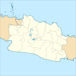
An earthquake occurred on September 2, 2009 at 14:55:01 local time in West Java, Indonesia. [1] The magnitude 7.0 earthquake killed at least 81 people, injured over 1,297, and displaced over 210,000 (including more than 140,000 in Tasikmalaya regency). [2] [3] The quake was felt in the capital Jakarta, although damage there was minimal, and it was Indonesia's deadliest earthquake since the 2006 Pangandaran earthquake and tsunami. [4]

Contents

Cause

The earthquake's focus lies close to the major fault plane where the Indo-Australian Plate is being subducted beneath the Eurasian Plate. However, the focal mechanisms determined for this event shows reverse faulting at a high angle to the trend of the subduction zone and it has been suggested that the cause was deformation within the descending slab. [1] Analysis of GPS data, tsunami run-ups and the effect of stress transfer compared to aftershock distribution supports a west-dipping reverse fault. [5]

Another earthquake in the same subduction zone occurred only 5 days later in the ocean south of Yogyakarta. This newer quake (magnitude 6.2) [6] is considered to be related to the West Java earthquake. [7]

Damage

Buildings in Bandung and Tasikmalaya, the town closest to the epicenter, were damaged, and hundreds of people were injured. [8] An estimated 18,300 homes and offices were earlier thought to have been damaged. This figure later rose to 87,000.

The quake was felt in Jakarta, Indonesia's capital; [9] causing evacuation in many office buildings and hotels. Several office buildings along major thoroughfares in Central Jakarta suffered damage.

At least 11 houses were covered by a landslide in Cianjur. [10]

Around 37 inhabitants, including 13 children, of Cikangkareng were affected by a landslide caused by the quake and are thought to have been buried beneath rubble. [11] The area has become a breeding ground for voyeurs who are flocking to the area to take photographs of the destruction and victims. [12]

At least one hospital was destroyed by the quake. [13]

Victims

Confirmed death tolls by area were issued by The Jakarta Post on 4 September. [14]

AreaTotal
Cianjur 21 [14]
Garut 10 [14]
Tasikmalaya 9 [14]
Bandung 8 [14]
Ciamis At least 1 [14]
Sukabumi At least 1 [14]
Bogor At least 1 [14]
West Bandung At least 1 [10]

The Bandung Health Agency says nearby victims of the quake will be eligible for free medical treatment for at least a month. [15] Rescuers have been equipped with machinery but are struggling. [16] 34 doctors and 52 paramedics were sent to at least 12 districts. [15]

More than 25,000 affected people were housed in makeshift tents. [13]

A group of 30 volunteers comprising Malaysian medical students from several universities in Indonesia, headed by Malaysian Students Department director in Indonesia Dr Junaidi Abu Bakar were deployed to provide assistance. They provided food and clothing as well as meals for the breaking of fast. [17]

See also

Related Research Articles

<span class="mw-page-title-main">Tasikmalaya</span> City in West Java, Indonesia

Tasikmalaya is a landlocked city in West Java, Indonesia. The city is sometimes dubbed kota santri or "the City of a Thousand Pesantrens" for its abundance of Islamic boarding schools. Located around 120 kilometres (75 mi) southeast from the provincial capital of Bandung, Tasikmalaya is passed by Indonesian National Route 3.

<span class="mw-page-title-main">2006 Pangandaran earthquake and tsunami</span> Destructive tsunami earthquake south of Java Island

An earthquake occurred on July 17, 2006 at 15:19:27 local time along a subduction zone off the coast of west and central Java, a large and densely populated island in the Indonesian archipelago. The shock had a moment magnitude of 7.7 and a maximum perceived intensity of IV (Light) in Jakarta, the capital and largest city of Indonesia. There were no direct effects of the earthquake's shaking due to its low intensity, and the large loss of life from the event was due to the resulting tsunami, which inundated a 300 km (190 mi) portion of the Java coast that had been unaffected by the earlier 2004 Indian Ocean earthquake and tsunami that was off the coast of Sumatra. The July 2006 earthquake was also centered in the Indian Ocean, 180 kilometers (110 mi) from the coast of Java, and had a duration of more than three minutes.

<span class="mw-page-title-main">September 2007 Sumatra earthquakes</span> Earthquakes affecting Indonesia

The September 2007 Sumatra earthquakes were a series of megathrust earthquakes that struck the Sunda Trench off the coast of Sumatra, Indonesia, with three of magnitude 7 or greater. A series of tsunami bulletins was issued for the area. The most powerful of the series had a magnitude of 8.5, which makes it in the top 20 of the largest earthquakes ever recorded on a seismograph.

<span class="mw-page-title-main">2009 Sumatra earthquakes</span> Earthquake in Indonesia

The first of the 2009 Sumatra earthquakes occurred on 30 September off the coast of Sumatra, Indonesia with a moment magnitude of 7.6 at 17:16:10 local time. The epicenter was 45 kilometres (28 mi) west-northwest of Padang, West Sumatra, and 220 kilometres (140 mi) southwest of Pekanbaru, Riau. Government and authorities confirmed 1,115 dead, 1,214 severely injured and 1,688 slightly injured. The most deaths occurred in the areas of Padang Pariaman (675), Padang (313), Agam (80) and Pariaman (37). In addition, around 135,000 houses were severely damaged, 65,000 houses were moderately damaged and 79,000 houses were slightly damaged. An estimated 250,000 families have been affected by the earthquake through the total or partial loss of their homes and livelihoods.

The 1982 Flores earthquake struck the island of Flores in Indonesia on December 25. Registering a moment magnitude of 5.9, according to the International Seismological Centre, it created landslides and was reportedly accompanied by a tsunami. The earthquake killed thirteen people and left 390 injured, also destroying 1,875 houses and 121 other buildings. The villages of Layahong and Oyong Barang were damaged by seven seconds of shaking.

On 2 July 2013, an earthquake struck the Indonesian island of Sumatra on 2 July with a moment magnitude of 6.1 and a maximum Mercalli intensity of VI (Strong). The strike-slip earthquake killed at least 43 people and injured more than 2,500 others in the province of Aceh where approximately 4,300 homes were damaged or destroyed.

<span class="mw-page-title-main">2017 Java earthquake</span> 2017 earthquake centered in Tasikmalaya, West Java, Indonesia

The 2017 Java earthquake occurred on 15 December 2017 when a moment magnitude 6.5 earthquake struck the Indonesian island of Java, specifically the city of Tasikmalaya on 23:47:58 West Indonesian Time in West Java, Indonesia. The earthquake struck at a depth of 91 km and was categorized as a strong but deep earthquake. It was initially registered as a 7.3 magnitude earthquake by Indonesian agencies. Widespread damage was reported across Tasikmalaya, the nearest major city to the epicentre. A tsunami warning was immediately issued by the authorities but was subsequently cancelled. Four people have been confirmed dead.

<span class="mw-page-title-main">2018 Sulawesi earthquake and tsunami</span> 7.5 Mw earthquake Landslide and tsunami in Indonesia

On 28 September 2018, a shallow, large earthquake struck in the neck of the Minahasa Peninsula, Indonesia, with its epicentre located in the mountainous Donggala Regency, Central Sulawesi. The magnitude 7.5 quake was located 70 km (43 mi) away from the provincial capital Palu and was felt as far away as Samarinda on East Kalimantan and also in Tawau, Malaysia. This event was preceded by a sequence of foreshocks, the largest of which was a magnitude 6.1 tremor that occurred earlier that day.

<span class="mw-page-title-main">2019 Sunda Strait earthquake</span> 7 July 2019, earthquakes in Indonesia

The 2019 Sunda Strait earthquake occurred on the night of 2 August 2019, when a magnitude 6.9 earthquake rattled Sunda Strait at a moderate depth of 52.8 kilometres. The epicentre was located 214 km from Bandar Lampung, the capital of Lampung and 147 km west of Sumur, Pandeglang Regency. The earthquake struck with a maximum intensity of VI (Strong). The earthquake prompted a tsunami warning in the area, with authorities urging coastal residents to immediately evacuate to higher grounds.

<span class="mw-page-title-main">2019 Ambon earthquake</span> Earthquake affecting Maluku, Indonesia

On 26 September 2019, a strong magnitude 6.5 earthquake struck Seram Island in Maluku, Indonesia, near the provincial capital of Ambon. The earthquake struck at 07:46:44 Eastern Indonesia Time with a shallow depth of 18 km. The tremor could be felt throughout the island, with an intensity of very strong (VII) reportedly felt in the provincial capital of Ambon.

<span class="mw-page-title-main">2021 East Java earthquake</span> Earthquake in Indonesia

An earthquake occurred on 10 April 2021 at 14:00 local time (UTC+07:00) off the south coast of eastern Java. The epicenter of the earthquake is located 44 km south southwest of Gondanglegi Kulon in East Java province. Measuring 6.0 or 6.1 on the moment magnitude scale (Mw ) and having a depth of 82.3 km, the earthquake caused moderate shaking measuring V on the Mercalli intensity scale. At least 10 individuals are known to have died from the earthquake and another 104 were seriously injured.

The 2021 Bali earthquake struck at 04:18 local time (UTC+08:00) when people were still sleeping on 15 October 2021. It resulted in 4 deaths and 73 more injured, despite having a moment magnitude of 4.7.

<span class="mw-page-title-main">2021 Flores earthquake</span> Earthquake in Indonesia

An earthquake occurred 112 km, offshore, north of Maumere in the Flores Sea on December 14. The quake had a moment magnitude of 7.3 according to the United States Geological Survey (USGS). One person was killed and 173 others suffered injuries.

<span class="mw-page-title-main">2022 Sumatra earthquake</span> Earthquake in Indonesia

On 25 February 2022 at 08:39 WIB, a moment magnitude (Mw ) 6.2 earthquake struck West Sumatra, Indonesia at a depth of 4.0 km (2.5 mi). Preceded by one foreshock and followed by over 200 aftershocks, the mainshock had an epicenter at the foot of Mount Talakmau in Pasaman Regency. The mainshock was the result of strike-slip faulting along a previously unidentified segment of the Great Sumatran Fault. At least 27 people died, 457 were injured, and 19,221 others were displaced. It inflicted 780 million Indonesian rupiahs (Rp) worth of damage. The heaviest damage was recorded at three villages around Mount Talakmau. Landslides and flash floods caused additional damage and casualties.

<span class="mw-page-title-main">1867 Java earthquake</span> Earthquake in the Dutch East Indies (present-day Indonesia)

The 1867 Central Java earthquake occurred on June 10 at between 04:20 and 04:30 local time. It struck off the southern coast of the Indonesian island with an estimated moment magnitude of 7.8 (Mw ). Widespread devastation occurred in Central Java, where as many as 700 people were killed. The intermediate-depth intraslab earthquake did not cause a tsunami.

<span class="mw-page-title-main">2022 West Java earthquake</span> Earthquake in Indonesia

On 21 November 2022, at 13:21 WIB (UTC+07:00), a Mww 5.6 earthquake struck near Cianjur in West Java, Indonesia. The strike-slip earthquake occurred with a focal depth of 11 km (6.8 mi). Between 335 and 635 people died, 7,729 were injured and five remain missing. More than 62,628 homes were damaged across 16 districts in Cianjur Regency and the surrounding region. It is the deadliest earthquake to hit Indonesia since the 2018 Sulawesi earthquake. Damage evaluated after the event earned it a maximum Modified Mercalli intensity of VIII (Severe).

A moment magnitude 7.6 earthquake struck offshore near the Tanimbar Islands, Maluku, Indonesia, at a depth of 105.1 km, on 10 January 2023.

An earthquake affected the island of Java, Indonesia on 22 January 1780. The source and magnitude of the earthquake remains debated among seismologists. Proposed origins of the earthquake include shallow inland back-arc thrusting along a fault located within the upper crust on the island or rupture of the subduction zone off the southern coast of Java. The magnitude of the earthquake is estimated to be at least 8.5, while other sources usually refer to it with a range of Mw  8.0 to 8.5 for the megathrust earthquake. For the shallow crustal earthquake source, the magnitude range is Mw  7.0 to 8.0.

References

  1. 1 2 3 ANSS, "Java 2009: M 7.0 - Java, Indonesia", Comprehensive Catalog, U.S. Geological Survey, retrieved 2 October 2018
  2. "Korban Tewas Akibat Gempa Sudah 79 Orang" Kompas newspaper, Sept 8, 2009
  3. "KATALOG GEMPABUMI SIGNIFIKAN DAN MERUSAK 1821-2017" (PDF) (in Indonesian). BMKG . Retrieved October 16, 2022.
  4. "Indonesian Quake Death Toll Reaches 64 as Rescue Work Continues". Bloomberg. 2009-09-04. Retrieved 2009-09-04.
  5. Gunawan, E.; Widiyantoro, S.; Marliyani, G.I.; Sunarti, E.; Ida, R.; Gusman, A.R. (2019). "Fault source of the 2 September 2009 Mw 6.8 Tasikmalaya intraslab earthquake, Indonesia: Analysis from GPS data inversion, tsunami height simulation, and stress transfer". Physics of the Earth and Planetary Interiors. 291: 54–61. Bibcode:2019PEPI..291...54G. doi:10.1016/j.pepi.2019.04.004. S2CID   155851594.
  6. "Magnitude 6.2 - SOUTH OF JAVA, INDONESIA". Archived from the original on 2009-09-10. Retrieved 2009-09-10.
  7. "KOMPAS.com - Gempa Yogyakarta Terkait dengan Gempa di Jawa Barat". Archived from the original on 2009-09-11. Retrieved 2009-09-10.
  8. Staff (September 2, 2009) "Strong earthquake strikes Indonesia's Java island". The China Post.
  9. "Deadly earthquake hits Indonesia". BBC News. September 2, 2009. Archived from the original on 2 September 2009. Retrieved 2 September 2009.
  10. 1 2 "Search on for trapped Indonesians". CNN. September 4, 2009. Retrieved 2009-09-04.
  11. CBC News (September 4, 2009). "Indonesian quake death toll rises to 63". CBC . Retrieved 2009-09-04.
  12. Asprihanto, Heru (September 4, 2009). "Indonesia quake landslide attracts voyeurs". The Washington Post . Retrieved 2009-09-04.[ dead link ]
  13. 1 2 "Over 25, 000 Indonesian quake-affected people live in makeshift tents". Xinhua News Agency. September 4, 2009. Archived from the original on November 2, 2012. Retrieved 2009-09-04.
  14. 1 2 3 4 5 6 7 8 Erwida Maulia (September 4, 2009). "Aftershock and aid follow earthquake". The Jakarta Post . Archived from the original on 5 September 2009. Retrieved 2009-09-04.
  15. 1 2 "Bandung Health agency provides free medical treatment for Java quake victims". The Jakarta Post . 2009-09-04. Archived from the original on 2009-09-05. Retrieved 2009-09-04.
  16. "Death toll of Indonesia's quake reaches to 63". Xinhua News Agency. September 4, 2009. Archived from the original on September 7, 2009. Retrieved 2009-09-04.
  17. "Malaysian medical students help in Indonesian quake". Archived from the original on 2012-10-10. Retrieved 2013-05-12.