1699 Java earthquake

Last updated
1699 Java earthquake
Java Relief Map.svg
Bullseye1.png
Indonesia relief location map.jpg
Bullseye1.png
Local dateJanuary 5, 1699 (1699-01-05)
Local timeEarly morning
Magnitude7.4–8.0 Mw
Epicenter 6°04′41″S105°54′47″E / 6.078°S 105.913°E / -6.078; 105.913 Coordinates: 6°04′41″S105°54′47″E / 6.078°S 105.913°E / -6.078; 105.913
Type Intraslab
Areas affected Java, Sumatra
Max. intensity IX (Violent)
LandslidesYes
Casualties>128 dead

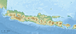
On the morning of January 5, 1699, a violent earthquake rocked the then Dutch East Indies city of Batavia on the island of Java. In the contemporary period, the Indonesian capital city Jakarta. Dutch accounts of the event described the earthquake as being "so heavy and strong" and beyond comparable to other known earthquakes. [1] This event was so large that it was felt throughout west Java, and southern Sumatra.

Contents

Tectonic setting

The Indonesian islands of Java, Sumatra and Lesser Sunda chain lie along a destructive plate boundary where the Australian Plate meets the Sunda Plate. The plates converge, with the Australian Plate being much denser as it is oceanic lithosphere, subducting beneath the less dense Sunda Plate. Subduction is responsible for the large megathrust earthquakes along the west coast of Sumatra and south coast of Java. It also plays a significant role in the volcanic activity on the islands. However, intraplate earthquakes can also occur as the Australian Plate deforms when it is subducting; faults within the downgoing slab may result in intermediate-depth events that are also considerably large.

Earthquake

At least 28 people in Batavia were fatally wounded and 49 stone-constructed structures collapsed as a result of the earthquake. Some 21 homes and 29 barns were also obliterated. [2] Almost every home situated in the city suffered some extent of damage. The earthquake uprooted and toppled many trees, blocking waterways and choking river systems. At Mount Salak, a volcano on the island of Java, the violent tremors triggered landslides and debris masses, blocking rivers and causing floods. The combination of earth and vegetation produced a debris flow that passed through the Ci Liwung river and into Batavia, where it entered the Java Sea.

In the port settlement of Bantam, now Banten, the earthquake destroyed a storage warehouse and caused additional damages. In Lampung, Sumatra, the earthquake threw every home off its foundations. [3] More than 100 people were reported killed in Lampung. [4]

Origin

The characteristics of the event is not well determined but most likely a large intermediate-depth earthquake. Other researchers suggest it was a megathrust event with a magnitude of 9.0 Mw along the Sunda megathrust. If it were an intraslab earthquake occurring within the downgoing Australian Plate as it subducts beneath the Sunda Plate along the Sunda megathrust, the estimated moment magnitude (Mw) would be 7.4 to 8.0, with an epicenter near Batavia, and a focal depth of 100 km. [4] Modelling of the 1699 earthquake scenarios show that an intraslab earthquake of Mw 8.0 provided results consistent with historical documentation of the earthquake. High Mercalli intensity values at IX corresponds to the pattern of damage described by Dutch officials in Java and Sumatra. As Banten Province is situated on pyroclastic deposits and Quaternary sediments, seismic waves were likely amplified, resulting in higher degrees of shaking. [5]

Simulations of a magnitude 9.0 earthquake only produced shaking assigned at VI to VII which did not match the damage descriptions. Such intensities would only cause moderate damage. Weaker levels of shaking would occur in the mountainous regions, which were insufficient to trigger a landslide. [5] The earthquake was not accompanied by a tsunami, further disproving the megathrust theory for an earthquake of such intensity. [4]

Future hazard

In a simulation model, if an earthquake of similar size occurred in modern times, it would cause about 100,000 deaths. [6]

See also

Related Research Articles

Megathrust earthquakes occur at convergent plate boundaries, where one tectonic plate is forced underneath another. The earthquakes are caused by slip along the thrust fault that forms the contact between the two plates. These interplate earthquakes are the planet's most powerful, with moment magnitudes (Mw) that can exceed 9.0. Since 1900, all earthquakes of magnitude 9.0 or greater have been megathrust earthquakes.

<span class="mw-page-title-main">2006 Pangandaran earthquake and tsunami</span> Destructive tsunami earthquake south of Java Island

An earthquake occurred on July 17, 2006 at 15:19:27 local time along a subduction zone off the coast of west and central Java, a large and densely populated island in the Indonesian archipelago. The shock had a moment magnitude of 7.7 and a maximum perceived intensity of IV (Light) in Jakarta, the capital and largest city of Indonesia. There were no direct effects of the earthquake's shaking due to its low intensity, and the large loss of life from the event was due to the resulting tsunami, which inundated a 300 km (190 mi) portion of the Java coast that had been unaffected by the earlier 2004 Indian Ocean earthquake and tsunami that was off the coast of Sumatra. The July 2006 earthquake was also centered in the Indian Ocean, 180 kilometers (110 mi) from the coast of Java, and had a duration of more than three minutes.

<span class="mw-page-title-main">1833 Sumatra earthquake</span> Seismic event

The 1833 Sumatra earthquake occurred on November 25 at about 22:00 local time, with an estimated magnitude in the range of 8.8–9.2 Mw . It caused a large tsunami that flooded the southwestern coast of the island. There are no reliable records of the loss of life, with the casualties being described only as 'numerous'. The magnitude of this event has been estimated using records of uplift taken from coral microatolls.

<span class="mw-page-title-main">Sunda megathrust</span> Geological feature

The Sunda megathrust is a fault that extends approximately 5,500 km (3300 mi) from Myanmar (Burma) in the north, running along the southwestern side of Sumatra, to the south of Java and Bali before terminating near Australia. It is a megathrust, located at a convergent plate boundary where it forms the interface between the overriding Eurasian plate and the subducting Indo-Australian plate. It is one of the most seismogenic structures on Earth, being responsible for many great and giant earthquakes, including the 2004 Indian Ocean earthquake and tsunami that killed over 227,000 people. The Sunda megathrust can be divided into the Andaman Megathrust, Sumatra(n) Megathrust and Java(n) Megathrust. The Bali-Sumbawa segment is much less active and therefore does not have the "megathrust" term associated with it.

<span class="mw-page-title-main">2010 Mentawai earthquake and tsunami</span> 2010 Indonesian earthquake and tsunami

The 2010 Mentawai earthquake occurred with a moment magnitude of 7.8 on 25 October off the western coast of Sumatra at 21:42 local time. The earthquake occurred on the same fault that produced the 2004 Indian Ocean earthquake. It was widely felt across the provinces of Bengkulu and West Sumatra and resulted in a substantial localized tsunami that struck the Mentawai Islands.

The 1917 Bali earthquake occurred at 06:50 local time on 21 January. It had an estimated magnitude of 6.6 on the surface wave magnitude scale and had a maximum perceived intensity of IX (Violent) on the Mercalli intensity scale. It caused widespread damage across Bali, particularly in the south of the island. It triggered many landslides, which caused 80% of the 1,500 casualties.

The 1975 Bagan earthquake occurred on July 8 at 6:34 pm local time in Bagan, Myanmar. Many important stupas and temples were destroyed. The strongest intensity was felt in the towns of Nyaung-U, Pakokku, and Yesagyo, and in the Myaing townships on the confluence of the Ayeyawady River. Damages were also reported in Chauk and Natmauk townships. It had a magnitude of Mw 7.0.

The 1907 Sumatra earthquake occurred on January 4 at 05:19:12 UTC. The estimated magnitude is 7.5–8.0 Ms, with an epicentre close to Simeulue, off Sumatra. It triggered a widespread and damaging tsunami that caused at least 2,188 deaths. The low observed intensity compared to the size of the tsunami has led to its interpretation as a tsunami earthquake. Higher levels of shaking observed on Nias are attributed to a large aftershock, less than an hour later. The tsunami gave rise to the S'mong legend, which is credited with saving many lives during the 2004 earthquake.

<span class="mw-page-title-main">2019 Sunda Strait earthquake</span> 7 July 2019, earthquakes in Indonesia

The 2019 Sunda Strait earthquake occurred on the night of 2 August 2019, when a magnitude 6.9 earthquake rattled Sunda Strait at a moderate depth of 52.8 kilometres. The epicentre was located 214 km from Bandar Lampung, the capital of Lampung and 147 km west of Sumur, Pandeglang Regency. The earthquake struck with a maximum intensity of VI (Strong). The earthquake prompted a tsunami warning in the area, with authorities urging coastal residents to immediately evacuate to higher grounds.

The 1912 Maymyo earthquake or Burma earthquake struck Burma on the morning of May 23, with an epicentre near Taunggyi and Pyin Oo Lwin in Shan State. The earthquake was initially calculated at 8.0 on the surface wave magnitude scale (Ms ) by Beno Gutenberg and Charles Francis Richter, and described by them as being one of the most remarkable seismic events in the early 1900s. Recent re-evaluation of the earthquake, however, have revised the magnitude to 7.6–7.9. It was preceded by two foreshocks on May 18 and 21 with respective intensities V and VII on the Rossi–Forel scale, while the mainshock was assigned IX. Shaking was felt throughout most of Burma, parts of Siam and Yunnan; an area covering approximately 375,000 square miles. It was one of the largest earthquakes in the country.

The 1988 Myanmar–India earthquake, also known as the Indo–Burma earthquake struck the Sagaing Region of Myanmar, about 30 kilometres (19 mi) from the border with India on 6 August at 7:06 am MMT with a moment magnitude (Mw ) of 7.3 or Richter magnitude (ML ) of 7.5. At least five people were killed, more than 30 were injured, and another 30 were missing as a result. Serious damage was reported in India and Bangladesh, while some minor damage occurred in Myanmar. The earthquake was reportedly felt in the Soviet Union.

The 2017 Guatemala earthquake struck near the city of Malacatán in the San Marcos Department, near the Guatemala–Mexico border at 1:29 am local time (UTC−06:00) on June 14. The earthquake killed five people, and caused 30 injuries, 11 of which were from Chiapas, Mexico across the border. No tsunami warning was issued.

The 1993 Kushiro–Oki earthquake was one of two large earthquake to strike the Japanese island of Hōkkaido within the same year. The earthquake with a magnitude of 7.6 Mw or 7.8 MJMA struck at 11:06 UTC or 08:06 pm JST on January 15 near the town of Ashoro. Shaking reached a maximum intensity of IX (Violent) on the Mercalli intensity scale, causing considerable damage, and was felt throughout the island, into northern Honshu, Sakhalin, and the Kuril Islands. As a result of the tremors, two people were killed and more than 600 were wounded.

<span class="mw-page-title-main">2008 Simeulue earthquake</span> Earthquake in Indonesia

On February 20, 2008, an earthquake with a moment magnitude of 7.4 struck off the coast of Sumatra at a hypocentre depth of 26 km. The earthquake had an epicenter located on the island of Simeulue, northwest from Sinabang, a small town on the island. Three people were killed and an additional 25 seriously injured as a result of the earthquake.

The 1852 Banda Sea earthquake struck on 26 November at 07:40 local time, affecting coastal communities on the Banda Islands. It caused violent shaking lasting five minutes, and was assigned XI on the Modified Mercalli intensity scale in the Maluku Islands. A tsunami measuring up to 8 m (26 ft) slammed into the islands of Banda Neira, Saparua, Haruku and Ceram. The tsunami caused major damage, washing away many villages, ships and residents. At least 60 people were killed in the earthquake and tsunami. The earthquake had an estimated moment magnitude of 7.5 or 8.4–8.8, according to various academic studies.

<span class="mw-page-title-main">1834 Java earthquake</span> Earthquake on the island of Java in 1834

The 1834 Java earthquake struck the Dutch East Indies island of Java, in the city of Bogor. The earthquake occurred on the morning of October 11, 1834. It was assigned VIII (Severe) to IX (Violent) on the Modified Mercalli intensity scale.

The 1815 Bali earthquake occurred on November 22 between 22:00 and 23:00 local time (WITA), affecting the Bali Kingdom. The estimated moment magnitude 7.0 earthquake struck off the north coast of Bali at a shallow depth. It was assigned a maximum intensity of IX (Violent) on the Mercalli intensity scale, causing severe damage in Buleleng and Tabanan. The earthquake caused a landslide and tsunami that killed 11,453 people.

The 1843 Nias earthquake off the northern coast of Sumatra, Indonesia caused severe damage when it triggered a tsunami along the coastline. The earthquake with a moment magnitude (Mw ) of 7.8 lasted nine minutes, collapsing many homes in Sumatra and Nias. It was assigned a maximum modified Mercalli intensity of XI (Extreme).

The 1933 Sumatra earthquake or Liwa earthquake occurred in West Lampung Regency, Lampung Province, Indonesia on June 25. The earthquake had an estimated surface-wave magnitude (Ms ) of 7.7 occurring at a shallow depth of 20 km. It had an epicenter onshore, devastating the city of Liwa. At least 76 people were reported killed, although the death toll may have been in the thousands. Aftershocks followed, including one which was strong enough to cause additional fatalities. The mainshock also triggered a nearby volcanic eruption two weeks later, killing some people.

<span class="mw-page-title-main">1867 Java earthquake</span> Earthquake in the Dutch East Indies (present-day Indonesia)

The 1867 Central Java earthquake occurred on June 10 at between 04:20 and 04:30 local time. It struck off the southern coast of the Indonesian island with an estimated moment magnitude of 7.8 (Mw ). Widespread devastation occurred in Central Java, where as many as 700 people were killed. The intermediate-depth intraslab earthquake did not cause a tsunami.

References

  1. Reid, A. (2012), Historical Evidence for Major Tsunamis in the Java Subduction Zone (PDF), ARI Working Paper No. 178, Asia Research Institute, p. 4, retrieved 2017-01-11
  2. Heriyanto, Devina (2018). "Third earthquake in 2018 in Lebak: Is Jakarta ready for megathrust quake?". Jakarta, Indonesia. The Jakarta Post. Retrieved 19 June 2021.
  3. Wichmann, Arthur (1918). Die erdbeben des Indischen Archipels bis zum Jahre 1857[Earthquakes of the Indian Archipelago Until the Year 1857] (in German) (20 ed.). Afdeling Natuurkunde Nederlandse Verhandelingen. p. 193.
  4. 1 2 3 Griffin, Jonathan; Nguyen, Ngoc; Cummins, Phil; Cipta, Athanasius (2019). "Historical Earthquakes of the Eastern Sunda Arc: Source Mechanisms and Intensity‐Based Testing of Indonesia's National Seismic Hazard Assessment". Bulletin of the Seismological Society of America. GeoScienceWorld. 109 (1): 43–65. Bibcode:2019BuSSA.109...43G. doi:10.1785/0120180085. S2CID   134096659.
  5. 1 2 Ngoc Nguyen , Jonathan Griffin , Athanasius Cipta , Phil R. Cummins (2015). "Indonesia's Historical Earthquakes: Modelled examples for improving the national hazard map". Record 2015/23. Canberra, Australia: Geoscience Australia. doi:10.11636/Record.2015.023. ISSN   2201-702X . Retrieved 19 June 2021.{{cite journal}}: CS1 maint: multiple names: authors list (link)
  6. "Indonesia's Historical Earthquakes Modelled examples for improving the national hazard map". ResearchGate. January 2015. Retrieved 17 June 2022.