 | |
| UTC time | Doublet earthquake: |
|---|---|
| 1943-06-08 20:42:46 | |
| 1943-06-09 03:06:20 | |
| ISC event | |
| 899871 | |
| 899872 | |
| USGS-ANSS | |
| ComCat | |
| ComCat | |
| Local date | June 9, 1943 [1] |
| Local time | |
| 03:42:46 | |
| 10:06:20 | |
| Magnitude | |
| Ms 7.5 [2] | |
| Ms 7.8 [3] | |
| Depth | 15 km (9.3 mi) [2] 10 km (6.2 mi) [3] |
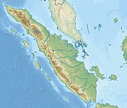
| Epicenter | 1°00′S101°00′E / 1.0°S 101.0°E [1] |
| Areas affected | Indonesia |
| Max. intensity | IX (Destructive) (both events) [4] |

The 1943 Alahan Panjang earthquakes occurred on June 8 and June 9 UTC (June 9, 1943, local time) in Sumatra, then under Japanese occupation. This was an earthquake doublet (the shocks occurred at the same location on consecutive days). [5]
Contents
The first mainshock occurred on June 8 at 20:42 UTC. It ruptured the Suliti segment of the Sumatran Fault Zone. The magnitude was given as Mw 7.2, [1] or Ms 7.1. [6]
The second mainshock occurred on June 9 at 03:06 UTC. It ruptured the Sumani segment of the Sumatran Fault Zone and perhaps the northwestern part of the Suliti segment. The magnitude was given as Mw 7.5, [1] or Ms 7.4. [6]
Alahan Panjang was damaged in the earthquakes. [5] Right lateral offsets were reported near the town of Solok. [6]
Near the Sumani segment, earthquake doublets occurred repeatedly. [7] Similar earthquake doublet nearby include the earthquakes in 1926 and 2007. [8]