March 2007 Sumatra earthquakes

Last updated
March 2007 Sumatra earthquakes
Indonesia Sumatra relief location map.jpg
Bullseye1.png
Indonesia relief location map.jpg
Bullseye1.png
UTC  time Doublet earthquake:    
 2007-03-06 03:49:38
 2007-03-06 05:49:25
ISC  event 
  11691339
  11691369
USGS-ANSS  
  ComCat
  ComCat
Local dateMarch 6, 2007 (2007-03-06)
Local time 
 10:49 a.m. WIB
 12:49 p.m. WIB
Magnitude 
 6.4 Mwc [1]
 6.3 Mwc [2]
Epicenter 0°29′N100°30′E / 0.49°N 100.5°E / 0.49; 100.5
Fault Great Sumatran Fault
Type Strike-slip
Areas affected Indonesia
Max. intensityA. MMI VIII (Severe)
B. MMI VI (Strong)
Casualties68 fatalities; over 460 serious injuries [3]
Map of the Great Sumatran Fault with labelled segments Great Sumatran Fault.png
Map of the Great Sumatran Fault with labelled segments

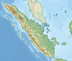
The March 2007 Sumatra earthquakes occurred near the northern end of Lake Singkarak in Sumatra, Indonesia, on March 6. The first shock in this earthquake doublet struck with a maximum Mercalli intensity of VIII (Severe) and the second shock that arrived two hours later had a maximum Mercalli intensity of VI (Strong). [4] [5]

Contents

Earthquakes

The initial quake at 10:49 (03:49 UTC) measured 6.4 on the moment magnitude scale and the second quake at 12:49 (05:49 UTC) measured 6.3. [4] [5] The earthquakes were felt as far away as Singapore and Malaysia, which prompted the evacuation of some buildings there. [6]

Effects

Over 60 fatalities and 460 serious injuries have been reported, spread across many towns and regencies in West Sumatra. [3] Over 43,000 houses were damaged, with over 12,000 of those severely damaged. [7] The severe damage to other structures includes over 130 public facilities, 310 mosques, 60 government buildings, 370 schools, and 230 shops. [7] According to the governor of West Sumatra, Agam Regency is the worst affected area, though other areas including Solok Regency and Tanah Datar are also badly affected. [8] The total value of damage is estimated to be around 1.4 trillion Indonesian rupiah (US$160 million). [7]

Response

A variety of local and international aid organizations have deployed to the region to assist victims. A number of countries have pledged aid, including the Netherlands (US$2.0 million), Sweden (US$1.0 million), Canada (US$0.21 million), Malaysia (US$0.16 million), United States (US$0.1 million) and Taiwan (US$0.06 million). The US AID has supplied them with all sorts of essentials like blankets, water, food and first aid kits.

See also

Related Research Articles

The 2005 Hindu Kush earthquake hit northeastern Afghanistan with a magnitude of 6.5 on December 12 at 21:47 (UTC). According to the United States Geological Survey, the maximum Mercalli intensity was V (Moderate) at Chitral. Five people were killed in the Hindu Kush region and landslides blocked several roads near Bagh, Kashmir. The earthquake occurred some 65 miles away from Faizabad, a city in the Hindu Kush mountains, but it could be felt in many neighboring areas. It could even be felt about 200 miles away in Islamabad, Pakistan. The quake was strong enough to trigger panic among survivors of October's devastating earthquake, who came out from their makeshift shelters in freezing temperatures. Although magnitude–6 earthquakes typically cause severe damage, this quake caused relatively little due to the fact that it occurred deep underground.

<span class="mw-page-title-main">2005 Kashmir earthquake</span> Earthquake in South Asia

An earthquake occurred at 08:50:39 Pakistan Standard Time on 8 October 2005 in Azad Jammu and Kashmir, a territory under Pakistan. It was centred near the city of Muzaffarabad, and also affected nearby Balakot in Khyber Pakhtunkhwa and some areas of Jammu and Kashmir, India. It registered a moment magnitude of 7.6 and had a maximum Mercalli intensity of XI (Extreme). The earthquake was also felt in Afghanistan, Tajikistan, India and the Xinjiang region. The severity of the damage caused by the earthquake is attributed to severe upthrust. Over 86,000 people died, a similar number were injured, and millions were displaced. It is considered the deadliest earthquake in South Asia, surpassing the 1935 Quetta earthquake.

<span class="mw-page-title-main">September 2007 Sumatra earthquakes</span> Earthquakes affecting Indonesia

The September 2007 Sumatra earthquakes were a series of megathrust earthquakes that struck the Sunda Trench off the coast of Sumatra, Indonesia, with three of magnitude 7 or greater. A series of tsunami bulletins was issued for the area. The most powerful of the series had a magnitude of 8.4, which makes it in the top 20 of the largest earthquakes ever recorded on a seismograph.

<span class="mw-page-title-main">2000 Enggano earthquake</span> Earthquake affecting Indonesia

At 23:28 local time on June 4, 2000 southern Sumatra, Indonesia was struck by an earthquake of moment magnitude 7.9 with a maximum Mercalli intensity of VI (Strong). The event occurred off the coast near Enggano Island. There were more than 100 fatalities and up to 2,585 injuries. Over 730 aftershocks shook the area afterwards, one just eleven minutes after the mainshock.

<span class="mw-page-title-main">2009 West Papua earthquakes</span> Earthquake in Southwest Papua, Indonesia

The 2009 West Papua earthquakes occurred on January 4 local time in Indonesia's Tambrauw Regency in Southwest Papua. The very large earthquake doublet comprised a Mw 7.6 initial shock that had a maximum Mercalli intensity of VI (Strong) and a second event measuring Mw  7.4 and a maximum Mercalli intensity of VII. The events took place less than three hours apart to the east-northeast of Sorong on the Bird's Head Peninsula and left at least four people dead and dozens injured.

The 2009 Afghanistan earthquake was a dip-slip doublet earthquake occurred in eastern Afghanistan, with an initial shock of magnitude of 5.2 Mw  at 01:57:51 April 17 local time, with a second shock of 5.1 Mw  occurring several hours later. The maximum Mercalli intensity was VI (Strong).

<span class="mw-page-title-main">2010 Mentawai earthquake and tsunami</span> 2010 Indonesian earthquake and tsunami

The 2010 Mentawai earthquake occurred with a moment magnitude of 7.8 on 25 October off the western coast of Sumatra at 21:42 local time. The earthquake occurred on the same fault that produced the 2004 Indian Ocean earthquake. It was widely felt across the provinces of Bengkulu and West Sumatra and resulted in a substantial localized tsunami that struck the Mentawai Islands.

<span class="mw-page-title-main">1990 Vrancea earthquakes</span> Romanian powerful earthquake

The 1990 Vrancea earthquakes were three earthquakes on 30 and 31 May 1990 with magnitudes of 7.0 Mw and 6.2 Mw  that struck the Romanian county of Vrancea, on two consecutive days. Severe damage in the Bucharest-Brăila-Brașov area was reported and dozens of casualties in Romania and neighbouring Moldova, Ukraine and Bulgaria.

<span class="mw-page-title-main">2016 Sumatra earthquake</span> Earthquake off the coast of Sumatra, Indonesia

The 2016 Sumatra earthquake was a 7.8 magnitude earthquake which struck on 2 March 2016 in the Indian Ocean, approximately 800 kilometers southwest of Sumatra in Indonesia. Tsunami warnings were issued for Indonesia and Australia, but were withdrawn two hours later. There were no deaths directly related to the earthquake.

<span class="mw-page-title-main">2018 Papua New Guinea earthquake</span> Earthquake affecting Papua New Guinea

The Papua New Guinea earthquake was a magnitude 7.5 earthquake that occurred in the Hela Province of Papua New Guinea on 26 February 2018, at 3:44 a.m. local time. The earthquake's epicenter was 10 kilometres (6.2 mi) west of the town of Komo. The maximum felt intensity was IX (Violent) on the Mercalli intensity scale. A total of 160 people were killed and many others were injured. An aftershock of M6.0 killed 11 people on 4 March, while another aftershock of M6.7 occurred at 00:13 local time on 7 March, killing at least 25 more. A 6.3 aftershock killed another 4 people on 7 April, more than a month after the first tremors hit the area.

<span class="mw-page-title-main">2018 Hawaii earthquake</span> 6.9-magnitude earthquake in Hawaii

On May 4, 2018, an earthquake with a magnitude of Mw 6.9 struck Hawaii island in the Hawaii archipelago at around 12:33 p.m. local time. The earthquake's epicenter was near the south flank of Kīlauea, which has been the site of seismic and volcanic activity since late April of that year. According to the United States Geological Survey the quake was related to the new lava outbreaks at the volcano, and it resulted in the Hilina Slump moving about two feet. It was the largest earthquake to affect Hawaii since the 1975 earthquake, which affected the same region, killing two people and injuring another 28.

On 4 May 2000 at 12:21 WITA, Banggai Islands Regency was hit by an earthquake of magnitude 7.5 Mw, followed by a tsunami. The Banggai Islands, an archipelago located at the far eastern end of Central Sulawesi, Indonesia, was the worst affected by the earthquake. Eighty percent of Banggai's buildings were destroyed. Damage also occurred on Peleng. The earthquake triggered a local tsunami of up to 6 m in height that caused significant damage east of Luwuk on the mainland and on Peleng.

The 2020 Central Idaho earthquake occurred in the western United States on March 31, 2020, at 5:52 PM MDT, near Ruffneck Peak in the Sawtooth Mountains of central Idaho, 72 miles (116 km) northeast of Boise and 19 miles (31 km) northwest of Stanley. It had a magnitude of 6.5 and was felt with a maximum intensity of VIII.

<span class="mw-page-title-main">2021 Larissa earthquake</span> Earthquake in Greece

On March 3, 2021, 12:16:09 the 2021 Larissa earthquake had a magnitude of 6.3 Mw with an intensity of VIII (Severe) on the Mercalli Scale 9 kilometers west of Týrnavos, Greece. One person was confirmed dead with eleven other people injured. Light shaking was also felt as far as Albania, North Macedonia, Kosovo and Montenegro.

<span class="mw-page-title-main">2021 Flores earthquake</span> Earthquake in Indonesia

An earthquake occurred 112 km, offshore, north of Maumere in the Flores Sea on 14 December. The quake had a moment magnitude of 7.3 according to the United States Geological Survey (USGS). One person was killed and 173 others suffered injuries.

On 29 November, at 14:10 UTC, a magnitude 7.7 Mw earthquake struck off the southern coast of Taliabu Island Regency in North Maluku, Indonesia. At least 41 people were killed on the nearby islands and a tsunami was triggered. Several hundred homes, buildings and offices were damaged or destroyed.

References

  1. ANSS. "Sumatra 2007a". Comprehensive Catalog. U.S. Geological Survey.
  2. ANSS. "Sumatra 2007b". Comprehensive Catalog. U.S. Geological Survey.
  3. 1 2 "Indonesia: Earthquakes West Sumatra Province OCHA Situation Report No. 6" (Press release). United Nations Office for the Coordination of Humanitarian Affairs. 2007-03-16. Retrieved 2007-03-16.
  4. 1 2 USGS. "M6.4 - southern Sumatra, Indonesia". United States Geological Survey.
  5. 1 2 USGS. "M6.3 - southern Sumatra, Indonesia". United States Geological Survey.
  6. "Quakes kill 82 in Indonesia". The Age. 2007-03-06. Retrieved 2007-03-06.
  7. 1 2 3 "West Sumatra Earthquake, March 13, 2007 : 17.00 PM" (Press release). West Sumatra Provincial Government. 2007-03-13. Archived from the original on September 27, 2007. Retrieved 2007-03-16.
  8. "Indonesia: Earthquakes West Sumatra Province OCHA Situation Report No. 5" (Press release). United Nations Office for the Coordination of Humanitarian Affairs. 2007-03-12. Retrieved 2007-03-14.

Further reading