  | |
| UTC time | 2010-06-16 03:16:27 |
|---|---|
| ISC event | 600181845 |
| USGS-ANSS | ComCat |
| Local date | June 16, 2010 |
| Local time | 12:16 |
| Magnitude | 7.0 Mw |
| Depth | 15 km (9 mi) [1] |
| Epicenter | 2°13′S136°35′E / 2.22°S 136.58°E [1] |
| Type | Strike-slip |
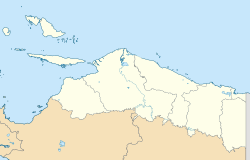
| Areas affected | Indonesia, Papua |
| Max. intensity | MMI VII (Very strong) |
| Foreshocks | 6.2 Mw June 16 at 03:06:03 |
| Aftershocks | 6.6 Mw June 16 at 03:58:09 |
| Casualties | 17 killed, 75 injured |
The 2010 Papua earthquake occurred on June 16 at 12:16 local time (03:16 UTC) in Papua province of Indonesia. The magnitude 7.0 mainshock was preceded by an Mw 6.2 foreshock 10 minutes earlier, and was followed 42 minutes later by an Mw 6.6 aftershock.