 | |
| UTC time | 1994-02-15 17:07:43 |
|---|---|
| ISC event | 185661 |
| USGS-ANSS | ComCat |
| Local date | 16 February 1994 |
| Local time | 00:07 WIB (Indonesia Western Standard Time) |
| Magnitude | 7.0 Mw |
| Depth | 23 km (14 mi) |
| Epicenter | 4°58′01″S104°18′07″E / 4.967°S 104.302°E |
| Fault | Great Sumatran fault |
| Type | Strike-slip |
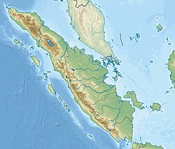
| Areas affected | Indonesia |
| Max. intensity | MMI X (Extreme) [1] |
| Casualties | 207 dead and 2000+ injured |

The 1994 Liwa earthquake occurred on 16 February 1994 at 00:07 local time. It was located in southern Sumatra, Indonesia. The magnitude of the earthquake was put at Mw 6.9, Mw 7.0, or Ms 7.2, according to different sources. [2] [3] [4] [5]
Contents
The earthquake caused 207 deaths and 2000 injuries. There was damage from landslides, mudslides, and fires in Lampung Province. Power outage occurred in western Lampung. [6] Six-thousand buildings were damaged or destroyed by landslides in the Liwa area. In addition to southern Sumatra, the earthquake could be felt in western Java and Singapore. [2] Intense smoke and gas activity was observed in the Suwoh volcanic area. [5]
The earthquake took place at the Sumatran Fault Zone. The Sumatran Fault Zone is 1,900 km long and highly segmented. It can be divided into about 20 segments. [3] The earthquake occurred in a subparallel strand 2.5 km southwest of the principal trace of the Kumering segment. [4] [7] The focal mechanism is of right-lateral strike-slip faulting. [5]