Local date | November 22, 1815 |
---|---|
Local time | 22:00-23:00 WITA |
Magnitude | Mw 7.3 [1] [2] |
Depth | 27 km (17 mi) |
Epicenter | 8°00′S115°00′E / 8.0°S 115.0°E |
Fault | Flores back-arc thrust fault |
Max. intensity | MMI IX (Violent) [3] |
Tsunami | Yes [4] |
Casualties | 11,453 dead [5] |
The 1815 Bali earthquake occurred on November 22 between 22:00 and 23:00 local time (WITA), affecting the Bali Kingdom. The estimated moment magnitude 7.0 earthquake struck off the north coast of Bali at a shallow depth. It was assigned a maximum intensity of IX (Violent) on the Mercalli intensity scale, causing severe damage in Buleleng and Tabanan. The earthquake caused a landslide and tsunami that killed 11,453 people.
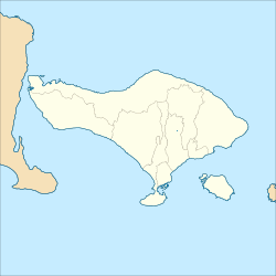
Off the north coast of Bali is the Flores back-arc thrust fault, located in the back-arc region. It formed due to the convergence between the Sunda and Australian plates, accommodating compression. The two plates converge northward at a rate of 80 mm (3.1 in)/yr, in which the Sunda megathrust takes 70 mm (2.8 in)/yr of the movement. The remaining 10 mm (0.39 in)/yr rate is accommodated by the Flores Back Arc Thrust Fault. It runs off the north coast of the Lesser Sunda Islands, in the Banda Sea. [6] The fault extends east–west for 800 km (500 mi) off the north coast of Bali to Wetar. [7] Geologists postulate the fault is divided into two segments; the 450 km (280 mi)-long Flores Thrust, and 450 km (280 mi)-long Wetar Thrust. Its origin has been attributed to several causes proposed by researchers; magmatic intrusion, gravitational sliding, reverse subduction or active spreading in the back-arc. [7] It is a complex zone of thrust faults that are connected at depth.
The earthquake and tsunami is thought to be the result of a thrust fault rupture on the Flores back-arc thrust fault. [8] The fault was the source of approximately 26 magnitude 6.0+ earthquakes since 1960. These earthquakes were calculated to be at depths of up to 40 km (25 mi) beneath the crust. It was also the source of the 1992 and 2018 earthquakes that caused many fatalities. [7] The 1815 event is the earliest documented earthquake along the fault. [9] Modelling of a moment magnitude 7.3 earthquake at 10 km (6.2 mi) depth could produce Modified Mercalli intensity VIII–IX along the north central and eastern parts of Bali. Modified Mercalli intensity V in Surabaya corresponded to the historical descriptions of the event. [10] On Lombok, the earthquake was felt VII.
The earthquake occurred at 22:00 local time. In Buleleng shaking was described as violent; then followed by aftershocks that persisted for an hour. Shaking was felt in Bima, Surabaya, and Lombok. A massive "explosion" was observed along the coastal ranges which triggered a landslide. The landslide buried Singaraja and Buleleng, resulting in at least 10,253 fatalities. A large On Lake Tamblingan, a fissure extended from Buleleng to Tabanan. This agitated the lake and caused flooding. [3]
These reported explosions were due to the mountainside collapsing during the earthquake. Heavy rainfall prior to the earthquake also destabalized these mountain slopes which contributed to the landslide. The landslide carried rocks 15 to 30 m (49 to 98 ft) across; it travelled down the Banyumala River and increased its volume while gathering river debris. Dutch official Bloemen Waanders reported the flow depth at 3 to 3.6 m (9.8 to 11.8 ft) while Gusti Panji Sakti said it was 6 to 12 m (20 to 39 ft). According to Waanders, 17 villages were engulfed by the flow. [1]
A destructive tsunami also washed onto the Balinese coast, killing an additional 1,200 people. [4] [5] The tsunami was triggered by the flows entering the sea along the coast. It devastated several villages but no tsunami was reported on nearby Lombok and Java. Sakti estimated the tsunami run-up at 2 to 3 m (6 ft 7 in to 9 ft 10 in). The coastal buildings of Buleleng harbor in Pabean District were swept away. [1]
Mount Rinjani is an active volcano in Indonesia on the island of Lombok. Administratively the mountain is in the Regency of North Lombok, West Nusa Tenggara. It rises to 3,726 metres (12,224 ft), making it the second highest volcano in Indonesia. It is also the highest point in the Indonesian province of West Nusa Tenggara. Adjacent to the volcano is a 6-by-8.5-kilometre caldera, which is filled partially by the crater lake known as Segara Anak or Anak Laut, due to the color of its water, as blue as the sea (laut). This lake is approximately 2,000 metres (6,600 ft) above sea level and estimated to be about 200 metres (660 ft) deep; the caldera also contains hot springs. The lake and mountain are sacred to the Sasak people and Hindus, and are the site of religious rituals. UNESCO made Mount Rinjani Caldera a part of the Global Geoparks Network in April 2018. Its catastrophic eruption in 1257 was the largest volcanic eruption in the last 2000 years.
An earthquake occurred on July 17, 2006, at 15:19:27 local time along a subduction zone off the coast of west and central Java, a large and densely populated island in the Indonesian archipelago. The shock had a moment magnitude of 7.7 and a maximum perceived intensity of IV (Light) in Jakarta, the capital and largest city of Indonesia. There were no direct effects of the earthquake's shaking due to its low intensity, and the large loss of life from the event was due to the resulting tsunami, which inundated a 300 km (190 mi) portion of the Java coast that had been unaffected by the earlier 2004 Indian Ocean earthquake and tsunami that was off the coast of Sumatra. The July 2006 earthquake was also centered in the Indian Ocean, 180 kilometers (110 mi) from the coast of Java, and had a duration of more than three minutes.
The 1938 Banda Sea earthquake occurred on February 2 at 04:04 local time with an estimated magnitude of 8.5-8.6 on the moment magnitude scale. Shaking was intense with an assigned Rossi–Forel intensity of VII and intensity of VI (Strong) on the Modified Mercalli intensity scale. This oblique-slip event generated a destructive tsunami of up to 1.5 metres in the Banda Sea region, but there were no deaths.
The 1992 Flores earthquake and tsunami occurred on 12 December on the island of Flores in Indonesia. With a magnitude of 7.8 and a maximum Mercalli intensity of VIII (Severe), it was the largest and also the deadliest earthquake in 1992 and in the Lesser Sunda Islands region. The earthquake was caused by slip on the Flores Thrust fault. This fault dips to the south underneath Flores Island. The epicenters of most earthquakes on the Flores Thrust are on Flores Island.
The 1917 Bali earthquake occurred at 06:50 local time on 21 January. It had an estimated magnitude of 6.6 on the surface-wave magnitude scale and had a maximum perceived intensity of IX (Violent) on the Mercalli intensity scale. It caused widespread damage across Bali, particularly in the south of the island. It triggered many landslides, which caused 80% of the 1,500 casualties.
The 1901 Black Sea earthquakewas a 7.2 magnitude earthquake, the most powerful earthquake ever recorded in the Black Sea. The earthquake epicenter was located in the east of Cape Kaliakra, 30 kilometres (19 mi) off northeast coast of Bulgaria. The mainshock occurred at a depth of 15 km (9.3 mi) and generated a 4–5-metre (13–16 ft) high tsunami that devastated the coastal areas of Romania and Bulgaria. In Romania, the earthquake was felt not only throughout Northern Dobruja, but also in Oltenia and Muntenia, and even in southern Moldova.
The 1979 Bali earthquake occurred at 03:58 local time on 18 December with a surface-wave magnitude of 6.3. The shock occurred southeast of the coast of Karangasem Regency in the Lombok Strait, and about 60 kilometres (37 mi) east-northeast of Denpasar. Up to 80 percent of the buildings in Karangasem Regency were damaged, between 15,000 and 500,000 people were displaced, and road links to the provincial capital of Denpasar were briefly severed.
The 1976 Bali earthquake occurred at 15:13 local time on 14 July with a surface-wave magnitude of 6.5. The shock occurred 5 kilometres (3.1 mi) south of the Bali Sea coast of the Buleleng Regency, and about 65 kilometres (40 mi) northwest of Denpasar. Up to ninety percent of houses in Buleleng Regency were seriously damaged or destroyed and the Seririt sub-district was almost completely destroyed, where a school building collapsed and trapped at least 200 students. 573 people are believed to have died; at least 544 in Buleleng Regency, 24 in Jembrana and 5 in Tabanan. Four thousand more suffered injuries and an estimated 450,000 were left temporarily homeless.
A Mw 6.4 earthquake struck the island of Lombok on the morning of 29 July 2018 at a shallow depth of 14 km (8.7 mi). Widespread damage was reported in the area, and authorities confirmed that 20 people were killed in the earthquake while hundreds were injured.
The Flores back-arc thrust fault is a major system of west–east trending thrust faults that extend eastwards from west of Lombok just south of where Sunda Shelf ends at Bali Sea, towards the islands of Sumbawa, Flores, and Alor, with a total length of at least 800 km., entering the Weber Basin and Aru Basin adjacent Sahul Shelf of the Australian plate. The thrust faults are south-dipping and lie within the back arc region of the Sunda–Banda Arc, which is related to the ongoing subduction of the Australian plate beneath the Sunda and Banda Sea plates. The thrust fault system developed as a result of the onset of continental collision as continental crust of the Australian plate reached the Sunda Trench. The eastern part of the fault system is also known as the Wetar thrust. Above the main thrust fault are a series of imbricate (overlapping) thrust faults. These imbricate thrust faults are shallower in depth than the main Flores thrust. Although the exact thrust faults have not been established, these faults were thought to be responsible for the 2018 Lombok earthquakes.
The western coast of West Sulawesi was struck by a major earthquake on 23 February 1969 at 00:36 UTC. It had a magnitude of 7.0 Mw and a maximum felt intensity of VIII on the Modified Mercalli intensity scale. It triggered a major tsunami that caused significant damage along the coast of the Makassar Strait. At least 64 people were killed, with possibly a further 600 deaths caused by the tsunami.
The 1674 Ambon earthquake occurred on February 17 between 19:30 and 20:00 local time in the Maluku Islands. The resulting tsunami reached heights of up to 100 metres (330 ft) on Ambon Island killing over 2,000 individuals. It was the first detailed documentation of a tsunami in Indonesia and the largest ever recorded in the country. The exact fault which produced the earthquake has never been determined, but geologists postulate either a local fault, or a larger thrust fault offshore. The extreme tsunami was likely the result of a submarine landslide.
The 1852 Banda Sea earthquake struck on 26 November at 07:40 local time, affecting coastal communities on the Banda Islands. It caused violent shaking lasting five minutes, and was assigned XI on the Modified Mercalli intensity scale in the Maluku Islands. A tsunami measuring up to 8 m (26 ft) slammed into the islands of Banda Neira, Saparua, Haruku and Ceram. The tsunami caused major damage, washing away many villages, ships and residents. At least 60 people were killed in the earthquake and tsunami. The earthquake had an estimated moment magnitude of 7.5 or 8.4–8.8, according to various academic studies.
On the morning of January 5, 1699, a violent earthquake rocked the then Dutch East Indies city of Batavia on the island of Java, now known as the Indonesian capital city of Jakarta. Dutch accounts of the event described the earthquake as being "so heavy and strong" and beyond comparable to other known earthquakes. This event was so large that it was felt throughout west Java, and southern Sumatra.
The 1790 Oran earthquake occurred on 10 October, striking near the coastal city of Oran in Algeria. The earthquake had an evaluated maximum seismic intensity of VIII–X on the European macroseismic scale (EMS-98). An estimated 3,000 people died during the earthquake and accompanying tsunami. The magnitude of this earthquake has been disputed among members of the paleoseismology field, with estimates ranging from 7.5 to even as small as 5.5.
The 2021 Bali earthquake struck at 04:18 local time (UTC+08:00) when people were still sleeping on 15 October 2021. It resulted in 4 deaths and 73 more injured, despite having a moment magnitude of 4.7.
An earthquake occurred 112 km, offshore, north of Maumere in the Flores Sea on 14 December. The quake had a moment magnitude of 7.3 according to the United States Geological Survey (USGS). One person was killed and 173 others suffered injuries.
The 1843 Nias earthquake off the northern coast of Sumatra, Indonesia caused severe damage when it triggered a tsunami along the coastline. The earthquake with a moment magnitude (Mw ) of 7.8 lasted nine minutes, collapsing many homes in Sumatra and Nias. It was assigned a maximum modified Mercalli intensity of XI (Extreme).
On 29 November, at 14:10 UTC, a magnitude 7.7 Mw earthquake struck off the southern coast of Taliabu Island Regency in North Maluku, Indonesia. At least 41 people were killed on the nearby islands and a tsunami was triggered. Several hundred homes, buildings and offices were damaged or destroyed.
The 1867 Central Java earthquake occurred on June 10 at between 04:20 and 04:30 local time. It struck off the southern coast of the Indonesian island with an estimated moment magnitude of 7.8 (Mw ). Widespread devastation occurred in Central Java, where as many as 700 people were killed. The intermediate-depth intraslab earthquake did not cause a tsunami.