  | |
| UTC time | 1994-06-02 18:17:34 |
|---|---|
| ISC event | 167105 |
| USGS-ANSS | ComCat |
| Local date | June 3, 1994 |
| Local time | 01:17:37 WIB (Indonesia Western Standard Time) |
| Magnitude | 7.8 Mw [1] |
| Depth | 18 km (11 mi) [1] |
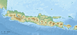
| Epicenter | 10°31′S112°52′E / 10.51°S 112.87°E [1] |
| Areas affected | Indonesia |
| Max. intensity | MMI V (Moderate) [2] |
| Casualties | 250 killed |

An earthquake occurred on June 3, 1994, at 01:17:37 local time (June 2, at 18:17:37 GMT) off the coast of Indonesia. The epicenter was off the eastern part of the southern Java coast, near the east end of the Java Trench. [3]