1982 Flores earthquake

Last updated
1982 Flores earthquake
Indonesia relief location map.jpg
Bullseye1.png
Flores Locator Topography.png
Bullseye1.png
UTC  time1982-12-25 12:28:02
ISC  event 587394
USGS-ANSS ComCat
Local dateDecember 25, 1982 (1982-12-25)
Local time20:28
Duration7 seconds
Magnitude5.9 Mw [1]
Depth10 km (6 mi) [1]
Epicenter 8°22′S123°04′E / 8.36°S 123.07°E / -8.36; 123.07 [1]
Type Strike-slip [2]
Total damage $1.45 million [2]
Max. intensity VI (Strong) [3]
Casualties13 dead [2]
390 injured [2]

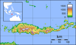
The 1982 Flores earthquake struck the island of Flores in Indonesia on December 25. Registering a moment magnitude of 5.9, according to the International Seismological Centre, it created landslides and was reportedly accompanied by a tsunami. The earthquake killed thirteen people and left 390 injured, also destroying 1,875 houses [4] and 121 other buildings. [5] The villages of Layahong and Oyong Barang were damaged by seven seconds of shaking. [6]

Contents

Tectonic setting

The Lesser Sunda Islands lie in a region with frequent seismicity, and there is a history of tsunamis in the area. Both the subduction of the Australian Plate and the crust in the Flores Sea could be responsible for this activity. [7]

Impact

The five most affected districts were evacuated of 6,000 people. The local and regional governments were petitioned for supplies like tents, medicine, and food. The earthquake was followed by several aftershocks. [5]

See also

Related Research Articles

<span class="mw-page-title-main">2005 Nias–Simeulue earthquake</span> 2005 earthquake in Sumatra, Indonesia

The 2005 Nias–Simeulue earthquake occurred on 28 March off the west coast of northern Sumatra, Indonesia. At least 915 people were killed, mostly on the island of Nias. The event caused panic in the region, which had already been devastated by the massive tsunami triggered by the 2004 Indian Ocean earthquake, but this earthquake generated a relatively small tsunami that caused limited damage. It was the third most powerful earthquake since 1965 in Indonesia.

<span class="mw-page-title-main">2006 Greece earthquake</span>

The 2006 Greece earthquake – also known as the Kythira earthquake – occurred on January 8 at 13:34:53 local time and was felt throughout the entire eastern Mediterranean basin. The earthquake an Mw magnitude 6.7 and a maximum Mercalli intensity of VII. Its epicentre was located just off the island of Kythira about 200 kilometres (120 mi) south of Athens.

The 2006 Tonga earthquake occurred on 4 May at 04:26:35 local time with a moment magnitude of 8.0 and a maximum Mercalli intensity of VII. One injury occurred and a non-destructive tsunami was observed.

<span class="mw-page-title-main">September 2007 Sumatra earthquakes</span> Earthquakes affecting Indonesia

The September 2007 Sumatra earthquakes were a series of megathrust earthquakes that struck the Sunda Trench off the coast of Sumatra, Indonesia, with three of magnitude 7 or greater. A series of tsunami bulletins was issued for the area. The most powerful of the series had a magnitude of 8.5, which makes it in the top 20 of the largest earthquakes ever recorded on a seismograph.

The 1992 Flores earthquake and tsunami occurred on December 12 on the island of Flores in Indonesia. With a magnitude of 7.8 and a maximum Mercalli intensity of VIII (Severe), it was the largest and also the deadliest earthquake in 1992 and in the Lesser Sunda Islands region. The earthquake was caused by slip on the Flores Thrust fault. This fault dips to the south underneath Flores Island. The epicenters of most earthquakes on the Flores Thrust are on Flores island.

<span class="mw-page-title-main">2000 Enggano earthquake</span> Earthquake affecting Indonesia

At 23:28 local time on June 4, 2000 southern Sumatra, Indonesia was struck by an earthquake of moment magnitude 7.9 with a maximum Mercalli intensity of VI (Strong). The event occurred off the coast near Enggano Island. There were more than 100 fatalities and up to 2,585 injuries. Over 730 aftershocks shook the area afterwards, one just eleven minutes after the mainshock.

<span class="mw-page-title-main">2009 West Papua earthquakes</span> Earthquake in Southwest Papua, Indonesia

The 2009 West Papua earthquakes occurred on January 4 local time in Indonesia's Tambrauw Regency in Southwest Papua. The very large earthquake doublet comprised a Mw 7.6 initial shock that had a maximum Mercalli intensity of VI (Strong) and a second event measuring Mw  7.4 and a maximum Mercalli intensity of VII. The events took place less than three hours apart to the east-northeast of Sorong on the Bird's Head Peninsula and left at least four people dead and dozens injured.

<span class="mw-page-title-main">April 2010 Sumatra earthquake</span> Earthquake in Indonesia

The April 2010 Sumatra earthquake occurred on April 7 at 5:15 AM local time with a moment magnitude of 7.8 and a maximum Mercalli intensity of V (Moderate). The shock occurred near the Banyak Islands, off the island of Sumatra in Indonesia. A tsunami watch was issued according to the Pacific Tsunami Warning Center in Honolulu which was later canceled. A 40 cm surge was reported in the Banyak Islands an hour after the quake, along with 62 injuries. Power outages were reported throughout the province of North Sumatra as well as in Aceh. This quake is one in a sequence of large earthquakes along the Sunda megathrust in the 2000s.

The 2010 Papua earthquake occurred on June 16 at 12:16 local time in Papua province of Indonesia. The magnitude 7.0 mainshock was preceded by an Mw 6.2 foreshock 10 minutes earlier, and was followed 42 minutes later by an Mw  6.6 aftershock.

<span class="mw-page-title-main">1993 Guam earthquake</span> 1993 earthquake and tsunami centered on the U.S. territory of Guam

The 1993 Guam earthquake occurred on August 8 at 6:34:26 pm local time with a moment magnitude of 7.8 and a maximum Mercalli intensity of IX (Violent). The thrust earthquake generated a non-destructive tsunami.

On 4 May 2000 at 12:21 WITA, Banggai Islands Regency was hit by an earthquake of magnitude 7.5 Mw, followed by a tsunami. The Banggai Islands, an archipelago located at the far eastern end of Central Sulawesi, Indonesia, was the worst affected by the earthquake. Eighty percent of Banggai's buildings were destroyed. Damage also occurred on Peleng. The earthquake triggered a local tsunami of up to 6 m in height that caused significant damage east of Luwuk on the mainland and on Peleng.

On January 30, 1973, at 15:01 (UTC–6), a magnitude 7.6 earthquake struck 35.3 km (21.9 mi) beneath the Sierra Madre del Sur range in the Mexican states of Colima, Jalisco and Michoacán. On the Mercalli intensity scale, the earthquake reached a maximum intensity of X (Extreme), causing serious damage in the region. At least 56 people were killed and about 390 were injured. The event is commonly referred to as the Colima earthquake.

On 29 November, at 14:10 UTC, a magnitude 7.7 Mw earthquake struck off the southern coast of Taliabu Island Regency in North Maluku, Indonesia. At least 41 people were killed on the nearby islands and a tsunami was triggered. Several hundred homes, buildings and offices were damaged or destroyed.

References

  1. 1 2 3 ISC (2015), ISC-GEM Global Instrumental Earthquake Catalogue (1900–2009), Version 2.0, International Seismological Centre
  2. 1 2 3 4 USGS (September 4, 2009), PAGER-CAT Earthquake Catalog, Version 2008_06.1, United States Geological Survey
  3. "M 5.9 - 98 km ENE of Maumere, Indonesia". United States Geological Survey. Archived from the original on 27 January 2022. Retrieved January 27, 2022.
  4. "Significant Earthquakes of the World: 1982". United States Geological Survey. January 5, 2010. Archived from the original on 7 June 2011. Retrieved June 25, 2011.
  5. 1 2 "Flores Quake Toll Rises to 13". New Straits Times . December 30, 1982. Retrieved June 25, 2011.
  6. "Quake Kills 4, Injures 49". The Press-Courier . December 27, 1982. Retrieved June 25, 2011.
  7. Ismanto, W. & Prajuto (1989). "Penyebaran Gempa Bumi di Nusa Tenggara Dan Sekitarnya". Majalah Ikatan Ahli Geologi Indonesia (in Indonesian). 12 (1).