1996 Biak earthquake

Last updated

1996 Biak earthquake
Indonesia Papua 2022 location map.svg
Bullseye1.png
Indonesia relief location map.jpg
Bullseye1.png
UTC  time1996-02-17 05:59:30
ISC  event 947787
USGS-ANSS ComCat
Local date17 February 1996 (1996-02-17)
Local time14:59:30 WIT (Indonesia Eastern Standard Time)
Magnitude8.2 Mw [1]
Depth20 km (12 mi) [1]
Epicenter 0°57′S136°56′E / 0.95°S 136.94°E / -0.95; 136.94 [1]
Type Megathrust [2]
Total damage $US 4.2 million [3]
Max. intensity IX (Violent)
Tsunami7.7 m (25 ft)
Casualties108 dead, 423 injured, 58 missing, 10,000 displaced

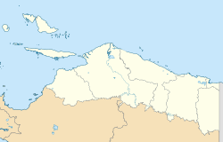
The 1996 Biak earthquake, or the Irian Jaya earthquake, occurred on 17 February at 14:59:30 local time near Biak Island, Indonesia. The earthquake, which occurred on the New Guinea Trench, had a moment magnitude of 8.2 and a maximum Mercalli intensity of IX (Violent). [4] The run-up height of the generated tsunami reached 7.7 m (25 ft). The disaster left at least 108 people dead, 423 injured, and 58 missing. [5] It damaged or destroyed 5,043 houses which subsequently made another 10,000 homeless. [5] At Korim, 187 houses were destroyed. [6] Various countries and organizations provided aid and relief in the aftermath of the earthquake.

Contents

Tectonic setting

Tectonic map of the New Guinea region with relative plate motion. New Guinea Tectonics.png
Tectonic map of the New Guinea region with relative plate motion.

New Guinea lies within a very complex tectonic regime surrounded by microplates which accommodate the collision and oblique convergence between the Australian Plate and the Pacific Plate. [7] [8] In the north, the Caroline Plate and North Bismarck Plate subduct underneath the Bird's Head Plate and the Woodlark Plate along the New Guinea Trench. [9] [10] [11] The earthquake occurred at the central portion of the trench. The western portion of New Guinea has parallel subduction zones to the north and south of it along a continuation of the Philippine Trench and a convergent boundary between the Bird's Head Plate and the Banda Sea Plate. [12] [11] In western central New Guinea, the Maoke Plate has multiple boundaries with various plates. [13] At the far eastern portion of the island, the South Bismarck Plate interacts with the Woodlark Plate, as well as the Solomon Sea Plate subducting underneath the Woodlark Plate. [9] [11] The largest on-land plate boundary in the region, however, is between the Woodlark Plate and the Australian Plate. [11] Though generally considered largely aseismic before this earthquake, this region of the New Guinea Trench may have experienced a similar large earthquake in 1914. [14]

Earthquake

Focal mechanisms indicate shallow-angle reverse faulting which is consistent with a subduction zone rupture. It ruptured an area 230 km (140 mi) long and 100 km (62 mi) wide along the New Guinea oceanic trench with an average slip of 4 m (13 ft). From the hypocenter, the rupture propagated 180 km (110 mi) to the west before propagating another 50 km (31 mi) east, ~15 seconds later. The largest slip was ~12 m (39 ft) near the hypocenter. [14] Large aftershocks struck the area, with various focal mechanisms. The mainshock may have triggered nearby seismic structures to activate. Aftershocks were most common in the areas with the highest slip from the mainshock. [14]

Tsunami

Teletsunami observations [15] [16]
LocationRecorded height (m)
Shionomisaki, Japan0.96
Chichi, Japan1.03
Tateyama, Japan0.90
Shemya, USA0.35
Adak, USA0.10
Port Alberni, Canada0.37
Winter Harbour, Canada0.15
Crescent City, USA0.18
Santa Monica, USA0.05

At Madori, on the west coast of Biak, a run-up of 7.7 m (25 ft) was measured, while at Korem in northern Biak, waves were up to 5.4 m (18 ft). The tsunami also affected parts of nearby islands, including Yapen, Owi, and Pai, where waves of 4–7 m (13–23 ft) were measured. [6] [17] [18] Roughly five minutes after the shaking, nearby residents heard an extraordinarily loud sound, such as one from an airplane, which they understood as a signal that a large wave was approaching. The local coastal population fled for higher ground as result. This action is credited with saving many lives from the tsunami. [6]

The tsunami produced was larger than expected for the size and location of the earthquake. A localized submarine landslide was a plausible explanation for the strong waves in western Biak. [19] This is further supported by the west coast of Biak being struck by the tsunami first, despite facing away from the main tsunami source. This does not align with a traditional shallow earthquake rupture tsunami, which further lends credence to the theory of a submarine landslide in the area near Madori. Multiple landslides were reported in the area near the maximum run-up height. [20] [6]

Aftermath

Domestic relief efforts

Immediately after the earthquake, the government of Indonesia provided rice to the affected. [21] Some time after, the government, army, and Red Cross evacuated affected individuals, distributed aid, and constructed a mass kitchen for 1,000 residents. Transportation was a challenge as bad weather and high waves stopped boats from being able to effectively deliver relief. A team involving members of multiple governmental ministries, and the agency for National Logistics Administration airlifted 36 tents, 5,300 blankets, 500 kg (1,100 lb) of medicine, ambulances, water pumps, water containers, water, clothing, food, kerosene lamps, and plastic sheeting. [22] The Ministry of Social Affairs later delivered a further US$15,486 of food, 34 tons of rice, and "other immediate relief items". The Indonesian public donated US$74,588, as well as food items and building materials. The First Lady of Indonesia contributed US$63,938 in cash, as well as 8,000 pieces of clothing. [23]

International relief efforts

The UNDP donated US$25,000 for blankets, plastic sheeting, and food. [23] Australia donated US$55,555 for emergency relief items and to cover the costs of relief operations carried out by helicopter. [23] Japan donated US$84,000 toward a three-member team of experts to help assess damage and to assist in relief operations. An additional US$192,000 was provided to cover the costs of airlifting tents, water tanks, generators, carpentry kits, and medical equipment, and another US$200,000 to help locals buy relief items. [23] As well, the government of Yamagata Prefecture chipped in US$9,346. [23] USAID donated US$265,486 for housing (plastic sheeting, tents, blankets), US$10,000 to help with distributing relief as well as a two-member assessment team. Another US$10,000 was to distribute relief items. [23] The Association of Medical Doctors of Asia contributed a team of three doctors with supplies and tools to help treat the injured. [23]

See also

Related Research Articles

<span class="mw-page-title-main">1946 Aleutian Islands earthquake</span> Earthquake near the Aleutian Islands, Alaska

The 1946 Aleutian Islands earthquake occurred near the Aleutian Islands, Alaska on April 1, 1946. The shock measured 8.6, Mt 9.3 or 7.4. It had a maximum Mercalli intensity of VI (Strong). It resulted in 165–173 casualties and over US $26 million in damage. The seafloor along the fault was elevated, triggering a Pacific-wide tsunami with multiple destructive waves at heights ranging from 45–138 ft (14–42 m). The tsunami obliterated the Scotch Cap Lighthouse on Unimak Island, Alaska among others, and killed all five lighthouse keepers. Despite the destruction to the Aleutian Island Unimak, the tsunami had almost an imperceptible effect on the Alaskan mainland.

The 1957 Andreanof Islands earthquake occurred at 04:22 local time on March 9 with a moment magnitude estimated between 8.6 and 9.1 and a maximum Modified Mercalli intensity of VIII (Severe). It occurred south of the Andreanof Islands group, which is part of the Aleutian Islands arc. The event occurred along the Aleutian Trench, the convergent plate boundary that separates the Pacific Plate and the North American plates near Alaska. A basin-wide tsunami followed, with effects felt in Alaska and Hawaii, and strong waves recorded across the Pacific rim. Total losses were around $5 million.

<span class="mw-page-title-main">2006 Pangandaran earthquake and tsunami</span> Destructive tsunami earthquake south of Java Island

An earthquake occurred on July 17, 2006 at 15:19:27 local time along a subduction zone off the coast of west and central Java, a large and densely populated island in the Indonesian archipelago. The shock had a moment magnitude of 7.7 and a maximum perceived intensity of IV (Light) in Jakarta, the capital and largest city of Indonesia. There were no direct effects of the earthquake's shaking due to its low intensity, and the large loss of life from the event was due to the resulting tsunami, which inundated a 300 km (190 mi) portion of the Java coast that had been unaffected by the earlier 2004 Indian Ocean earthquake and tsunami that was off the coast of Sumatra. The July 2006 earthquake was also centered in the Indian Ocean, 180 kilometers (110 mi) from the coast of Java, and had a duration of more than three minutes.

The 2007 Solomon Islands earthquake took place on 2 April 2007, near the provincial capital of Gizo on Ghizo Island, in the Solomon Islands. Its magnitude was estimated at 8.1 on the Mw scale, and 7.8 on the Ms scale. The tsunami that followed the earthquake killed 52 people. According to the USGS, the earthquake was recorded around 7:39:56 a.m. local time (UTC+11). The focus was 10 km (6 mi) deep and 40 km (25 mi) south southeast of Gizo township on New Georgia Islands in Western Province. There were numerous aftershocks, the largest of which had a magnitude of 6.2.

The Solomon Sea Plate is a minor tectonic plate to the northwest of the Solomon Islands archipelago in the south Pacific Ocean. It roughly corresponds with the Solomon Sea east of Papua New Guinea. The plate boundaries are associated with high earthquake activity as part of the New Britain subduction zone.

The South Bismarck Plate is a small tectonic plate located mainly in the southern Bismarck Sea. The eastern part of New Guinea and the island of New Britain are on this plate. It is associated with high earthquake and volcanic activity as part of the New Britain subduction zone within the Pacific Ring of Fire.

The 2000 New Ireland earthquakes occurred off the coast of New Ireland Province, Papua New Guinea on November 16 and 17.

<span class="mw-page-title-main">Sunda megathrust</span> Geological feature

The Sunda megathrust is a fault that extends approximately 5,500 km (3300 mi) from Myanmar (Burma) in the north, running along the southwestern side of Sumatra, to the south of Java and Bali before terminating near Australia. It is a megathrust, located at a convergent plate boundary where it forms the interface between the overriding Eurasian plate and the subducting Indo-Australian plate. It is one of the most seismogenic structures on Earth, being responsible for many great and giant earthquakes, including the 2004 Indian Ocean earthquake and tsunami that killed over 227,000 people. The Sunda megathrust can be divided into the Andaman Megathrust, Sumatra(n) Megathrust and Java(n) Megathrust. The Bali-Sumbawa segment is much less active and therefore does not have the "megathrust" term associated with it.

Shortly after midnight local time on January 20, 1981, eastern Indonesia was struck by an earthquake known as the 1981 Irian Jaya earthquake. Registering a moment magnitude of 6.7, it killed more than 300 people, damaging structures and buildings across the Irian Jaya province. Indonesia is highly active in terms of seismicity and volcanic eruptions, with a subduction zone and many faults. It is neighbored by several tectonic plates. Such earthquakes pose a significant threat to life in the area through earthquakes and also tsunamis.

The 1965 Rat Islands earthquake occurred at 05:01 UTC, on 4 February. It had a magnitude of 8.7 and triggered a tsunami of over 10 m on Shemya Island, but caused very little damage.

<span class="mw-page-title-main">Tsunami earthquake</span> Type of earthquake which triggers a tsunami of far-larger magnitude

In seismology, a tsunami earthquake is an earthquake which triggers a tsunami of significantly greater magnitude, as measured by shorter-period seismic waves. The term was introduced by Japanese seismologist Hiroo Kanamori in 1972. Such events are a result of relatively slow rupture velocities. They are particularly dangerous as a large tsunami may arrive at a coastline with little or no warning.

The 1959 Kamchatka earthquake occurred on May 4 at 19:15 local time with a moment magnitude of 8.0–8.3, and a surface wave magnitude of 8.25. The epicenter was near the Kamchatka Peninsula, Russian SFSR, USSR. Building damage was reported in Petropavlovsk-Kamchatsky. The maximum intensity was VIII (Damaging) on the Medvedev–Sponheuer–Karnik scale. The intensity in Petropavlovsk-Kamchatsky was about VIII MSK.

The 1979 Tumaco earthquake occurred at 02:59 local time on 12 December with a moment magnitude of 8.2 and a maximum Mercalli intensity of IX (Violent). The epicenter was just offshore from the border between Ecuador and Colombia, near the port city of Tumaco. It triggered a major tsunami, which was responsible for most of the estimated 300–600 deaths. The hardest hit area was Colombia's Nariño Department.

The 1942 Peru earthquake occurred on August 24 at 17:50 local time and was located near the border of the departments of Ica and Arequipa, Peru. It had a magnitude of Mw 8.2 or Ms 8.4.

On January 1, 1996, at 4:05 p.m. Central Indonesia Time, an earthquake with an epicenter in the Makassar Strait struck north of Minahasa on the island of Sulawesi, Indonesia. The earthquake measured 7.9 on the moment magnitude scale and was centered off Tolitoli Regency in Central Sulawesi, or 25 km from the Tonggolobibi village. A tsunami of 2–4 m (6.6–13.1 ft) was triggered by this earthquake as a result. At least 350 buildings were badly damaged, nine people died and 63 people were injured.

<span class="mw-page-title-main">2016 Solomon Islands earthquakes</span> Seismic events

On 9 December 2016 at 4:38 a.m. local time, the Solomon Islands region was rocked by an Mww 7.8 earthquake, centered 30 km off San Cristobal Island, about 61 km southwest of Kirakira, the capital of Makira-Ulawa Province. Initially registering magnitude 8.0, later downgraded to 7.8, the temblor prompted tsunami warnings that kept countries surrounding the Coral, Tasman and Solomon Sea on high alert, but was later cancelled. A large aftershock of magnitude 6.9 occurred shortly afterwards. This earthquake was largely felt, waking many residents who later ran to high ground for fears of a potential tsunami. The earthquake killed a child and affected some 34,000 people in Makira, South Malaita and Guadalcanal Island where many had lost their homes or had no access to basic needs. Earthquakes are common in this region, with little or no fatalities. This earthquake is tied with three other magnitude 7.8 earthquakes for the second largest earthquake of 2016. On 17 December, the Solomon Islands would be rattled again by a 7.9 magnitude earthquake, this time 54 km east of Taron, Papua New Guinea.

<span class="mw-page-title-main">2021 Chignik earthquake</span> 7th largest earthquake in the US

An earthquake occurred off the coast of the Alaska Peninsula on July 28, 2021, at 10:15 p.m. local time. The large megathrust earthquake had a moment magnitude of 8.2 according to the United States Geological Survey (USGS). A tsunami warning was issued by the National Oceanic and Atmospheric Administration (NOAA) but later cancelled. The mainshock was followed by a number of aftershocks, including three that were of magnitude 5.9, 6.1 and 6.9 respectively.

<span class="mw-page-title-main">2002 Sandaun earthquake</span> Earthquake in Papua New Guinea

On September 9, 2002, a magnitude 7.6 earthquake struck off the coast of Wewak, Sandaun Province, Papua New Guinea. The shallow reverse earthquake triggered a local tsunami measuring 5 meters high. The disaster resulted in at least 6 deaths, 70 injuries and building damage.

The 1979 Yapen earthquake occurred on September 12 at 05:17:51 UTC. It had an epicenter near the coast of Yapen Island in Irian Jaya, Indonesia. Measuring 7.5 on the moment magnitude scale and having a depth of 20 km (12 mi), it caused severe damage on the island. At least 115 were killed due to shaking and a moderate tsunami.

<span class="mw-page-title-main">New Guinea Trench</span> Fault line between the Anatolian Plate and the northward-moving Arabian Plate

The New Guinea Trench is a trench along the northern coast of New Guinea. It may represent the seafloor expression of an active subduction zone.

References

  1. 1 2 3 ISC (2015), ISC-GEM Global Instrumental Earthquake Catalogue (1900–2009), Version 2.0, International Seismological Centre, archived from the original on 25 November 2016, retrieved 15 February 2016
  2. Okal, E.; Piatanesi, A.; Heinrich, P. (1999), "Tsunami detection by satellite altimetry" (PDF), Journal of Geophysical Research, 104 (B1): 611, Bibcode:1999JGR...104..599O, doi: 10.1029/1998JB000018 , archived (PDF) from the original on 13 June 2010, retrieved 29 August 2010
  3. USGS (4 September 2009), PAGER-CAT Earthquake Catalog, Version 2008_06.1, United States Geological Survey, archived from the original on 17 July 2020, retrieved 8 November 2018
  4. "Katalog Gempabumi Signifikan dan Dirasakan". bmkg.go.id. BMKG. Archived from the original on 25 July 2021. Retrieved 11 August 2021.
  5. 1 2 "Hari Ini dalam Sejarah: Gempa dan Tsunami Terjang Irian Jaya, 108 Orang Meninggal". Kompas (in Indonesian). 17 February 2021. Archived from the original on 4 August 2022. Retrieved 4 August 2022.
  6. 1 2 3 4 Imamura, Fumihiko; Subandono, D.; Watson, G.; Moore, A.; Takahashi, T.; Matsutomi, H.; Hidayat, R. (13 May 1997). "Irian Jaya earthquake and tsunami cause serious damage". Eos, Transactions American Geophysical Union. 78 (19): 197. Bibcode:1997EOSTr..78..197I. doi: 10.1029/97EO00128 .
  7. Taylor, M. A. J.; Dmowska, R.; Rice, J. R., Comparison of Coulomb Shear Stress Changes from the Feb. 17, 1996 Biak Mw = 8.2 Event and a Subsequent Seismic Inversion, archived from the original on 15 July 2010, retrieved 29 August 2010
  8. Koulali, A.; Tregoning, Paul; Mcclusky, Simon; Stanaway, Richard; Wallace, L.; Lister, Gordon (2015). "New Insights into the present-day kinematics of the central and western Papua New Guinea from GPS". Geophysical Journal International. 202 (2): 202. doi: 10.1093/gji/ggv200 . hdl: 1885/104031 .
  9. 1 2 Wallace, Laura M.; Stevens, Colleen; Silver, Eli; McCaffrey, Rob; Loratung, Wesley; Hasiata, Suvenia; Stanaway, Richard; Curley, Robert; Rosa, Robert; Taugaloidi, Jones (18 May 2004). "GPS and seismological constraints on active tectonics and arc-continent collision in Papua New Guinea: Implications for mechanics of microplate rotations in a plate boundary zone". J. Geophys. Res. 109 (109). Bibcode:2004JGRB..109.5404W. doi: 10.1029/2003JB002481 .
  10. Tregoning, Paul. "Plate kinematics in the western Pacific derived from geodetic observations" (PDF). Australian National University. Archived (PDF) from the original on 15 June 2022. Retrieved 2 August 2022.
  11. 1 2 3 4 Bird, P. (2003). "An updated digital model of plate boundaries". Geochem. Geophys. Geosyst. 4 (3): 1027. Bibcode:2003GGG.....4.1027B. doi: 10.1029/2001GC000252 . S2CID   9127133.
  12. Kaymacki, Nuretdin; Decker, John; Orange, Dan; Teas, Philip; van Heiningen, Peter (September 2015). "Tectonic Characteristics and Evolution Banda Sea Region". International Conference and Exhibition, Melbourne, Australia 13-16 September 2015. p. 90. doi:10.1190/ice2015-2205090. S2CID   131074367. Archived from the original on 13 September 2022. Retrieved 2 August 2022.
  13. Fawzy Ismullah Massinai, Muhammad; Resky Ariansyah, Muh; Trisartika Sirumpa, Riana; Altin Massinai, Muhammad (October 2020). "Relative present-day motion on Palu-Koro Fault". IOP Conference Series: Earth and Environmental Science. 575 (575): 012185. Bibcode:2020E&ES..575a2185F. doi: 10.1088/1755-1315/575/1/012185 . S2CID   228963531.
  14. 1 2 3 Henry, C.; Das, S. (2002), "The Mw 8.2, 17 February 1996 Biak, Indonesia, earthquake: Rupture history, aftershocks, and fault plane properties", Journal of Geophysical Research, 107 (B11): 2312, Bibcode:2002JGRB..107.2312H, doi: 10.1029/2001JB000796
  15. "Tsunami Newsletter, Vol. XXVIII, No. 2, July 1996, 35 p." (PDF). International Tsunami Information Center. Archived (PDF) from the original on 5 August 2022. Retrieved 4 August 2022.
  16. Stephenson, Frederick E.; Rabinovich, Alexander B. (February 2009). "Tsunamis on the Pacific Coast of Canada Recorded in 1994–2007". Pure and Applied Geophysics. 166 (1–2): 177–210. Bibcode:2009PApGe.166..177S. doi:10.1007/s00024-008-0440-7. S2CID   140181911. Archived from the original on 13 September 2022. Retrieved 5 August 2022.
  17. Julius, Admiral Musa; Daryono (2021). "Overview of 1990s deadly tsunamis in Indonesia". E3S Web of Conferences. 331 (331): 7001. Bibcode:2021E3SWC.33107001J. doi: 10.1051/e3sconf/202133107001 . S2CID   245171123.
  18. Prawiradisastra, Suryana; Santoso, Eko Widi (1997). "Identifikasi Gempa Biak 17 Pebruari 1996 sebagai Upaya Program Mitigasi Bencana". Alami: Jurnal Teknologi Reduksi Risiko Bencana (in Indonesian). 2 (3). Archived from the original on 13 September 2022. Retrieved 4 August 2022.
  19. Yudhicara, Yudhicara (2014). "Tsunami Characteristics along The Coast of Biak Island based on the 1996 Biak Tsunami Traces". Indonesian Journal on Geoscience. 7 (1). doi:10.17014/ijog.v7i1.135. Archived from the original on 4 August 2022. Retrieved 2 August 2022.
  20. Matsutomi, H.; Shuto, N.; Imamura, F. (November 2001). "Field Survey of the 1996 Irian Jaya Earthquake Tsunami in Biak Island". Natural Hazards. 24 (3): 199–212. doi:10.1023/A:1012042222880. S2CID   129537661. Archived from the original on 13 September 2022. Retrieved 2 August 2022.
  21. "Indonesia - Earthquake Information Report No.1". reliefweb. UN DHA. Archived from the original on 3 August 2022. Retrieved 3 August 2022.
  22. "Indonesia - Earthquake Information Report No.2". reliefweb. UN DHA. Archived from the original on 3 August 2022. Retrieved 3 August 2022.
  23. 1 2 3 4 5 6 7 "Indonesia - Earthquake Information Report No.3". reliefweb. UN DHA. Archived from the original on 3 August 2022. Retrieved 3 August 2022.