 USGS ShakeMap for the earthquake | |
  | |
| UTC time | 1999-12-21 14:14:57 |
|---|---|
| ISC event | 2108724 |
| USGS-ANSS | ComCat |
| Local date | 21 December 1999 |
| Local time | 21:14:57 WIB (UTC+7) |
| Magnitude | 6.5 Mw |
| Depth | 56.0 km (34.8 mi) |
| Epicenter | 6°50′42″S105°33′18″E / 6.845°S 105.555°E |
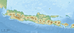
| Areas affected | Banten, Jakarta, West Java, Lampung |
| Max. intensity | MMI VII (Very strong) |
| Tsunami | No |
| Casualties | 5 dead, 220 injured |
The 1999 Sunda Strait earthquake occurred on 21 December at 21:14:57 local time in Sunda Strait region near the island of Java, Indonesia with a moment magnitude of 6.5. [1]