1999 Chamoli earthquake

Last updated

1999 Chamoli earthquake
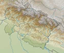
India Uttarakhand relief map.svg
Bullseye1.png
India relief location map.jpg
Bullseye1.png
UTC  time1999-03-28 19:05:11
ISC  event 1547491
USGS-ANSS ComCat
Local date29 March 1999
Local time00:35
Magnitude6.6 Mw (ANSS)
Depth15 kilometres (9 mi)
Epicenter 30°30′43″N79°24′11″E / 30.512°N 79.403°E / 30.512; 79.403
TypeThrust [1]
Areas affected India
Max. intensity VIII (Severe) [2]
CasualtiesApproximately 103 dead [3]

The 1999 Chamoli earthquake occurred on 29 March in the Chamoli district in the Indian state of Uttar Pradesh (now in Uttarakhand). Approximately 103 people died in the earthquake.

Contents

Cause

The Himalaya Range has been undergoing crustal shortening along the 2,400 km long northern edge of the Indian Plate which resulted in the formation of several thrust faults including the Main Central Thrust (MCT), the Main Boundary Thrust (MBT) and the Main Frontal Thrust (MFT). The MCT consists of three sub-thrusts: MCT I, MCT II and MCT III. Many earthquakes have occurred along these thrust faults. It is thought that the Chamoli earthquake in 1999 was associated with these fault systems. [4]

Description

The earthquake was the strongest to hit the foothills of the Himalayas in more than ninety years. [5] Apart from the Chamoli district, the quake also affected five other districts of Uttar Pradesh viz. Rudraprayag, Tehri Garhwal, Bageshwar, Uttarkashi and Pauri Garhwal (all are in Uttarakhand now). Among these, Chamoli and Rudraprayag were the most affected districts. [3] Aftershocks continued and most of the aftershocks occurred in the east of Chamoli. [4] Officials from Pakistan reported that the quake was also felt in Lahore and Gujranwala. [5]

Damage and casualties

Severe ground deformations resulted from the earthquake. Formation of ground fissures were reported from many areas. Landslides and changes in the groundwater flow were also reported. Well-developed ground cracks were seen in Gopeshwar, Chamoli and Bairagna. Cracks were observed in asphalt roads at several locations. [4] Landslips cut off parts of Mandakini valley and Mandal valley and many major roads. [6]

The death toll was 103. [3] Several hundred people were injured and approximately 50,000 houses were damaged. [7] Over 2,000 villages were affected by the earthquake. [8] Electricity, water supply and communication were also severely affected by the earthquake especially in the Chamoli town, Gopeshwar and Okhimath region of Rudraprayag district. [6] According to Mike Wooldridge, correspondent for the BBC News, Chamoli suffered most damage and almost all the houses and shops built on slopes in the lower part of the town were destroyed. [5]

The bridge deck of a pedestrian suspension bridge situated near Bairagna developed lateral buckling and the cables of the bridge were loosened. Water pipelines in Chamoli and Gopeshwar towns were damaged affecting water supply due to landslides caused by the quake. The concrete-lined canals of the irrigation network in the affected region sustained some cracks. [4]

In Delhi, many buildings sustained non-structural damage. [9] According to Dr B.L. Wadhera, who filed a public interest litigation in the Delhi High Court, cracks developed in the Shastri Bhavan in Delhi which houses several Union Ministries. [10] Damage occurred in several buildings in Dehradun also. A few old buildings of the Survey of India sustained collapse of gable masonry, and cracks developed along the junctions between the pitched roof and the masonry walls. [4]

Relief efforts

Rescue operations were hampered by landslides, loss of electrical power and the loss of communication links with Chamoli. Many road workers became involved to clear landslide debris from a 16 km stretch of road leading to the worst-affected area. [5] Local people carried out search and rescue operations. [4] Rescue efforts were led by the Indian Army [5] and Paramilitary personnel were also called-in to aid. [4] The army used helicopters to ferry in supplies. [5] Food and other necessary supplies were air-dropped to villages which lacked motorable roads and where roads were damaged due to landslides. [4] Locals organized a committee to make sure that those most affected receive food. [5]

See also

Related Research Articles

<span class="mw-page-title-main">Uttarkashi district</span> District in Uttarakhand, India

Uttarkashi District is a district of Garhwal division of the Uttarakhand state in northern India, and has its headquarters at Uttarkashi city. It has six Tehsils namely Barkot, Dunda, Bhatwadi, Chinyalisaur, Purola and Mori.

The 1952 Kern County earthquake occurred on July 21 in the southern San Joaquin Valley and measured 7.3 on the moment magnitude scale. The main shock occurred at 4:52 am Pacific Daylight Time, killed 12 people, injured hundreds more and caused an estimated $60 million in property damage. A small sector of damage near Bealville corresponded to a maximum Mercalli intensity of XI (Extreme), though this intensity rating was not representative of the majority of damage. The earthquake occurred on the White Wolf Fault near the community of Wheeler Ridge and was the strongest to occur in California since the 1906 San Francisco earthquake.

The 1997 Jabalpur earthquake occurred on May 22, at 04:21:31 AM in Jabalpur District in the Indian state of Madhya Pradesh. The epicenter of the earthquake was located near Koshamghat village. According to geologist Dr V. Subramanyan, former professor at the Indian Institute of Technology Bombay, the earthquake was caused by movement on the Narmada Fault.

The 1905 Kangra earthquake occurred in the Kangra Valley and the Kangra region of the Punjab Province in India on 4 April 1905. The earthquake measured 7.8 on the surface wave magnitude scale and killed more than 20,000 people. Apart from this, most buildings in the towns of Kangra, Mcleodganj and Dharamshala were destroyed.

The 1991 Uttarkashi earthquake occurred at 02:53:16 Indian Standard Time (UTC+05:30) on 20 October with a moment magnitude of 6.8 and a maximum Mercalli intensity of IX (Violent). This thrust event was instrumentally recorded and occurred along the Main Central Thrust in the Uttarkashi and Gharwal regions of the Indian state of Uttarakhand. High intensity shaking resulted in the deaths of at least 768 people and the destruction of thousands of homes.

The 2011 Sikkim earthquake occurred with a moment magnitude of 6.9 and was centered within the Kanchenjunga Conservation Area, near the border of Nepal and the Indian state of Sikkim, at 18:10 IST on Sunday, 18 September. The earthquake was felt across northeastern India, Nepal, Bhutan, Bangladesh and southern Tibet.

<span class="mw-page-title-main">Garhwal Himalayas</span> Mountain ranges in India

The Garhwal Himalayas are mountain ranges located in the Indian state of Uttarakhand.

The 2012 Negros earthquake occurred on February 6 at 11:49 PST, with a body wave magnitude of 6.7 and a maximum intensity of VII (Destructive) off the coast of Negros Oriental, Philippines. The epicenter of the thrust fault earthquake was approximately 72 kilometres (45 mi) north of Negros Oriental's provincial capital, Dumaguete.

<span class="mw-page-title-main">May 2015 Nepal earthquake</span> 2015 earthquake centered near Kodari, Nepal

A major earthquake occurred in Nepal on 12 May 2015 at 12:50 pm local time with a moment magnitude of 7.3, 18 kilometres (11 mi) southeast of Kodari. The epicenter was on the border of Dolakha and Sindhupalchowk, two districts of Nepal. This earthquake occurred on the same fault as the larger magnitude 7.8 earthquake of 25 April, but further east than the original quake. As such, it is considered to be an aftershock of the April quake. It struck at a depth of 18.5 km (11.5 mi). Shaking was felt in northern parts of India including Bihar, Uttar Pradesh and West Bengal. Tremors were felt as far as about 2,400 km away from the epicenter in Chennai.

<span class="mw-page-title-main">Amrita Rawat</span> Indian politician

Amrita Rawat, also known as Shri Amrita Mata ji, is a Member of the Legislative Assembly of Uttarakhand, India. Shri Amrita Rawat is married to Shri Satpal Maharaj.

The 1990 Upland earthquake occurred at 15:43:37 local time on February 28 with a moment magnitude of 5.7 and a maximum Mercalli Intensity of VII. This left-lateral strike-slip earthquake occurred west of the San Andreas Fault System and injured thirty people, with total losses of $12.7 million. Many strong motion instruments captured the event, with an unexpectedly high value seen on water tank near the epicentral area.

<span class="mw-page-title-main">2018 Papua New Guinea earthquake</span> Earthquake affecting Papua New Guinea

The Papua New Guinea earthquake was a magnitude 7.5 earthquake that occurred in the Hela Province of Papua New Guinea on 26 February 2018, at 3:44 a.m. local time. The earthquake's epicenter was 10 kilometres (6.2 mi) west of the town of Komo. The maximum felt intensity was IX (Violent) on the Mercalli intensity scale. A total of 160 people were killed and many others were injured. An aftershock of M6.0 killed 11 people on 4 March, while another aftershock of M6.7 occurred at 00:13 local time on 7 March, killing at least 25 more. A 6.3 aftershock killed another 4 people on 7 April, more than a month after the first tremors hit the area.

<span class="mw-page-title-main">2019 Kashmir earthquake</span> Earthquake in Kashmir

The 2019 Kashmir earthquake struck regions of Pakistan with an epicentre in Azad Kashmir on 24 September at 16:02 local time. It had a magnitude of 5.4 Mww and a maximum felt intensity of VII on the Modified Mercalli intensity scale or VIII on the European macroseismic scale. There was severe damage in Mirpur District, causing the deaths of 40 people and injuring a further 850. The epicentre of the shallow quake was near the city of Mirpur, Pakistan. The tremors were felt in the Kashmir region, Punjab (Pakistan), Punjab (India), Uttarakhand and northern parts of India including New Delhi.

The 2021 Assam earthquake struck 11 km away from Dhekiajuli, Assam, India at 07:51 (IST) on April 28, 2021 with a moment magnitude of 6.0 at 34.0 km (21.1 mi) depth. The quake struck with an epicenter 140 km north of the main city of Guwahati. It resulted in two fatalities and at least 12 injuries.

The 1995 Menglian earthquake or 1995 Myanmar–China earthquake occurred on 12 July at 05:46:43 local time in the Myanmar–China border region. The earthquake had an epicenter on the Myanmar side of the border, located in the mountainous region of Shan State. It registered 7.3 on the Chinese surface wave magnitude scale (Ms ) and 6.8 on the moment magnitude scale (Mw ). With a maximum Mercalli intensity assigned at VIII, the quake killed eleven people and left another 136 injured. Over 100,000 homes in both countries were destroyed and 42,000 seriously damaged. Some damage to structures were also reported in Chiang Mai and Chiang Rai, Thailand. The low death toll from this earthquake was attributed to an early warning issued prior to it happening. Precursor events including foreshocks and some seismic anomalies led to an evacuation of the area before the mainshock struck. It is thought to be one of the few successfully predicted earthquakes in history.

<span class="mw-page-title-main">2021 Balochistan earthquake</span> Earthquake near Harnai, Pakistan

An earthquake struck Pakistan's province of Balochistan near the city of Harnai on 7 October 2021. The moment magnitude 5.9 Mww  quake struck in the early morning at 03:01 local time, killing at least 42 people and injuring 300 others. The earthquake occurred just one day before the anniversary of the 2005 Kashmir earthquake.

The 1993 Finisterre Range earthquakes began on October 13 with a Mw  6.9 mainshock, followed by Mw  6.5 and 6.7 earthquakes. These earthquakes struck beneath the Finisterre Range, north of Markham Valley in Morobe Province, Papua New Guinea. The complex earthquake sequence seriously damaged many villages in the rural Eastern Papua New Guinea region, generating landslides and killing at least 60 people.

The 1803 Garhwal earthquake occurred in the early morning of September 1 at 01:30 local time. The estimated 7.8-magnitude-earthquake had an epicenter in the Garhwal Himalaya near Uttarkashi, British India. Major damage occurred in the Himalaya and Indo-Gangetic Plain, with the loss of between 200 and 300 lives. It is among the largest Himalaya earthquakes of the 19th-century, caused by thrust faulting.

The 1980 Nepal earthquake devastated the Nepal–India border region on the evening of July 29. The epicenter of the 6.6 Mw earthquake was located in Nepal, northwest of Khaptad National Park. At least 200 people died and 5,600 were injured in the disaster. Extensive damage occurred on both sides of the border, amounting to 245 million USD.

A moment magnitude 5.7 earthquake struck Doti District, Sudurpashchim Province, Nepal on 9 November 2022. The earthquake was widely felt in western Nepal and northern India.

References

  1. Rastogi, Bal. (2000). Chamoli earthquake of magnitude 6.6 on 29 March 1999. Journal of the Geological Society of India. 55. 505–514.
  2. National Geophysical Data Center / World Data Service (NGDC/WDS) (1972), Significant Earthquake Database, National Geophysical Data Center, NOAA, doi:10.7289/V5TD9V7K
  3. 1 2 3 Chamoli earthquake of 29 March 1999 Archived 5 April 2008 at the Wayback Machine India Meteorological Department
  4. 1 2 3 4 5 6 7 8 Chamoli (Himalaya, India) Earthquake of 29 March 1999 National Information Center of Earthquake Engineering
  5. 1 2 3 4 5 6 7 World: South Asia Quake death toll nears 100 BBC News
  6. 1 2 29 March 1999 Chamoli earthquake: A preliminary report on earthquake-induced landslides using IRS-1C/1D data Indian Academy of Sciences
  7. Estimation of source parameters of Chamoli Earthquake, India Indian Academy of Sciences
  8. Chamoli Earthquake of 29 March 1999, India Archived 21 November 2007 at the Wayback Machine Asian Disaster Preparedness Center
  9. Who's afraid of earthquakes really? [usurped] The Hindu
  10. 'Delhi ill-equipped to handle quakes' [usurped] The Hindu

Further reading