2016 Uttarakhand forest fires

Last updated

2016 Uttarakhand forest fires
Forest fire in Almora District 2016.jpg
Forest fire in Almora district of Uttarakhand state
Date(s)April – May 2016
Location Uttarakhand and Himachal Pradesh, India
Statistics
Total area4,538 hectares (11,210 acres) [1]
Impacts
Deaths9
Non-fatal injuries17
The state of Uttarakhand within India India UK.svg
The state of Uttarakhand within India

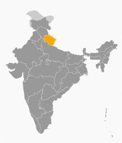
The 2016 Uttarakhand forest fires were a series of widespread, damaging wildfires that took place in Uttarakhand, India between April and May. The fires were caused by a heatwave that spread across Uttarakhand and were the worst recorded in the region with a reported 4,538 hectares (11,210 acres) of forest burnt down and seven people dead. [2] [3]

Contents

Officials detected nearly 1,600 total fires which were brought under control by 2 May, and as rain fell the following day, it reduced the impact of the wildfires. [4] [5] [6] An initial report on 4 May noted that 3,500 hectares (8,600 acres) had been destroyed by the fire. [7] [3]

History and causes

Forest fires caused by humans in the Himalayan state of Uttarakhand have been a regular event. Since the formation of the state in 2000, more than 44,518 hectares (110,010 acres) of forest land has been lost to fire. [2]

Some fires during 1921, 1930, and 1942 have been associated with popular movements against the then British government's forestry policies and as a call for independence. Most of these fires occur in the chir pine (Pinus roxburghii) zone which is prone to fire.

Burnt Chir Pine Chir pine trees felled by forest fires .jpg
Burnt Chir Pine

But the pine itself is resistant to the fire. Instead of harming them, these fires help in their regeneration by reducing coverage of broad-leaf trees, which leads to an increase in the land covered by chir pine and oak. The broad-leaved forest is dominated by oak species, including Banj oak ( Quercus leucotrichophora ). Resin is harvested from these pines, and fires are often intentionally set to remove the carpet of pine needles that come in the way of harvesting activity. [8] In June 1981, a blanket ban was introduced against the felling of standing trees 1000 meters above sea level, a ban that prohibits the removal of pine trees in the areas where they are invading. Apart from accidental fires, several causes and motivations for setting fires have been noted which include encroachment on forest lands and concealing illegal timber extraction. Major illicit timber trade relies on pine forests since it is often used for construction. [7]

A major cause for the fires was attributed to the record high temperatures and severe lack of rainfall due to a dry winter. [9] The Uttarakhand forest fires had also come as India suffered one of its worst droughts in years with the government noting over 330 million were affected by water shortages. [10]

Early 2016 events and controversy

The forest fires began on February 2, 2016, and went initially unnoticed for several weeks, [11] while Parliament was in a state of outrage over the presidential rule which had been imposed on Uttarakhand [12]

Consequently, these fires went largely unchecked and spread from the pine forests on the slopes of the sub-Himalayan region to the oak and broadleaf forests which resulted in heavy clouds of smoke that changed the usually blue skies to grey. This smoke affected tourism within the state and fearing bad publicity, the locals did not report the fires.[ citation needed ]

The conservationist Ela Smetacek started a public awareness campaign to highlight the damage from the fires calling on the Indian government to address the issue. Her Facebook post was shared over 58,000 times as it showed the entire hillsides ablaze with walls of flames engulfing even the tallest trees. [13]

The campaign gathered widespread support from social media users and Indian media which led to a series of claims and counter-claims between the environment minister, the conservationist, and other activists ensued, as Smetacek blamed the timber and builder mafia for the purposely-lit fires, stating that 1,300 fires could be seen from satellite pictures and that an arson attack across the state was evident. [14] The post demanding the fires be recognized as a national emergency, and the need of immediate deployment of NDRF teams, led to the government taking action, deploying the National Disaster Response Force and making use of Indian Air Force Mi-17 helicopters fitted with Helicopter bucket (bambi buckets) to douse the fires with water.

Seven fatalities were reported as of 4 May 2016. [3] The Pinegrove School, a boarding school at Kasauli, was evacuated as fires had reached its compound walls. [15] Tourism and wildlife at the Jim Corbett National Park and Rajaji Tiger reserve regions were affected. [16] Various other locations in these Himalayan states of Uttarakhand and Himachal Pradesh are tourist attractions in summer, and they now face heavy air pollution. [17] The forest fires also disrupted the functioning of the Kalka–Shimla Railway line. [18] On 3 May, the forest department estimated the monetary losses at approximately 29 lakh (US$36,000). The estimate is based on the standard rule book followed by the department with empirical formulae for such calculations. Various ecologists and environmental activists have disregarded the estimate, noting that it does not take into account ecological and wildlife losses. They added that these fires have also destroyed vegetation which holds rainfall, which might result in floods in the monsoon season. [19]

Scientists of the Govind Ballabh Pant Institute of Himalayan Environment and Development formed a team to survey the area and study the effects of the fires on the melting of glaciers. [20] Ecologists suggested that clearing of forest floors of the fallen pine leaves, which are readily combustible, should be undertaken by the forest department as well as locals on a grassroots level to prevent such major fire outbreaks. Production of biomass briquettes from these pine needles should be promoted, serving as a source of fuel as well as a solution to prevent wildfires. [21] [22] On 30 April, the National Disaster Response Force was deployed for rescue operations in the Kumaon and Garhwal areas. Around 6,000 personnel from the Forest Department were deployed. As of 30 April 2016, 922 incidences[ spelling? ] of fire were reported affecting around 2,000 hectares (4,900 acres) of forest area. [7] The Mi-17 helicopters of the Indian Air Force with Helicopter bucket (bambi buckets) were used to douse the fires with water. However, the heavy smog that developed in the area affected the aerial operations of the army. [23] The affected area later increased to around 3,500 hectares (8,600 acres), extending into Himachal Pradesh. The regions saw rainfalls on 3 May ranging from 7mm to 11mm, which helped in controlling the fire. [3]

Soaring temperatures reignited the forest fires on 18 May 2016 covering an area of nearly 180 hectares of green land spreading over 111 districts. Rangers and Divisional Forest Officers rush to the spot and extinguish the fire as soon as possible to reduce the damage done. This was the result of the temperatures of Uttarakhand which were about 4 to 5 degrees higher than the average temperatures at this time of the year. According to government sources, the forest fires combined have destroyed nearly 4,048 hectares of land, in 1,857 incidents. [1]

Subsequently, the World Bank granted 500 crores rupees (US$75M) to the Uttarakhand forest department to research the cause of the forest fires, which was later increased [24] by 600 crores (US$90M). [25]

The Indian central government later announced a series of funds amounting to over 50,000 crores (US$7.5B) to go towards afforestation across the state of Uttarakhand and the country. [26]

Vegetation destroyed in a forest near Dhaulinag Temple in Bageshwar district Vegetation destroyed after 2016 Uttarakhand Forest Fires.jpg
Vegetation destroyed in a forest near Dhaulinag Temple in Bageshwar district

Controversy and long term impact

Reports were published in the local media which variously blamed both the local people and timber companies for the forest fires. Environmental journalist Bahar Dutt blamed the television media for their "Delhi centrist world view" that disregarded the historical and ecological natural causes of fire, due to the high density of pine trees that increases the fire hazards. [27] Various tourism-related associations suggested that the exaggerated representation of the fires by the media could reduce tourism, a major part of the state economy. Part of a team of conservationists and biologists who studied the private and state forests since 1950, Smetacek maintained forest fires did not occur naturally in the geographical topography of the region concerned. Natural fires are not seen anywhere in Indian forests, she added. The introduction of pine trees by the British caused a more volatile fuel to the (man-made) fires. [28]

Fires directly destroy biodiversity and have indirect long-term impacts, including the encouragement of fire and pioneer species. It has been suggested that the dark carbon dust emitted by the fires deposited on Himalayan glaciers could hasten the glaciers' melting. This could affect the hydrology of the rivers that are a source of water for human populations in northern India. [29] The average temperature of northern India saw an increase of 0.2 °C. [20]

See also

Related Research Articles

<span class="mw-page-title-main">Himachal Pradesh</span> State in northern India

Himachal Pradesh is a state in the northern part of India. Situated in the Western Himalayas, it is one of the thirteen mountain states and is characterised by an extreme landscape featuring several peaks and extensive river systems. Himachal Pradesh is the northernmost state of India and shares borders with the union territories of Jammu and Kashmir and Ladakh to the north, and the states of Punjab to the west, Haryana to the southwest, Uttarakhand to the southeast and a very narrow border with Uttar Pradesh to the south. The state also shares an international border to the east with the Tibet Autonomous Region in China. Himachal Pradesh is also known as Dev Bhoomi or Dev Bhumi, meaning 'Land of Gods' and Veer Bhoomi which means 'Land of the Brave'.

<span class="mw-page-title-main">Manali, Himachal Pradesh</span> Town in India

Manali is a town, near Kullu town in Kullu district in the Indian state of Himachal Pradesh. It is situated in the northern end of the Kullu Valley, formed by the Beas River. The town is located in the Kullu district, approximately 270 kilometres (170 mi) north of the state capital of Shimla and 544 kilometres (338 mi) northeast of the national capital of New Delhi. With a population of 8,096 people recorded in the 2011 Indian census Manali is the beginning of an ancient trade route through Lahaul (H.P) and Ladakh, over the Karakoram Pass and onto Yarkand and Hotan in the Tarim Basin of China. Manali is a popular tourist destination in India and serves as the gateway to the Lahaul and Spiti district as well as the city of Leh in Ladakh.

<span class="mw-page-title-main">Dehradun</span> Winter capital of Uttarakhand, India

Dehradun, also known as Dehra Doon, is the capital and the most populous city of the Indian state of Uttarakhand. It is the administrative headquarters of the eponymous district and is governed by the Dehradun Municipal Corporation, with the Uttarakhand Legislative Assembly holding its winter sessions in the city as its winter capital. Part of the Garhwal region, and housing the headquarters of its Divisional Commissioner, Dehradun is one of the "Counter Magnets" of the National Capital Region (NCR) being developed as an alternative center of growth to help ease the migration and population explosion in the Delhi metropolitan area and to establish a smart city in the Himalayas. It is the third largest city in the Himalayas after Kathmandu and Srinagar.

<span class="mw-page-title-main">Uttarakhand</span> State in northern India

Uttarakhand, formerly known as Uttaranchal, is a state in northern India. The state is divided into two divisions, Garhwal and Kumaon, with a total of 13 districts. The winter capital and largest city of the state is Dehradun, which is also a railhead. On 5 March 2020, Bhararisain, a town in the Gairsain Tehsil of the Chamoli district, was declared as the summer capital of Uttarakhand. The High Court of the state is located in Nainital, but is to be moved to Haldwani in future.

<span class="mw-page-title-main">Kalesar National Park</span> Protected area in Haryana, India

Kalesar National Park and adjacent Kalesar Wildlife Sanctuary (13,209 acres are protected areas in Kalesar of Yamunanagar district of Haryana state in India, 46 kilometres from Yamunanagar city, 122 kilometres from Chandigarh. Kalesar National Park was established in 2003. Kalesar National Park and Kalesar Wildlife Sanctuary are contiguous to Simbalbara National Park in Himachal Pradesh and Rajaji National Park in Uttarakhand. Kalesar is a popular destination for leopards, panthers, elephants, red jungle fowl and bird-watching. This forested area in the Shivalik foothills is covered primarily with sal with smattering of Semul, Amaltas and Bahera trees as well. Wildlife jeep safaris are available on 3 tracks. Park is closed July to September and during the remaining months visiting hours are 6 am to 10 am and 4 pm to 7 pm during summers, and 7 am to 11 am and 3.30 pm to 6 pm during winters.

<span class="mw-page-title-main">Himalayan subtropical pine forests</span>

The Himalayan subtropical pine forests are a large subtropical coniferous forest ecoregion covering portions of Bhutan, India, Nepal, and Pakistan.

<span class="mw-page-title-main">Geography of Himachal Pradesh</span>

The state of Himachal Pradesh is spread over an area 55,673 km2 (21,495 sq mi) and is bordered by Jammu and Kashmir and Ladakh on the north, Punjab on the southwest, Haryana on the south, Uttarakhand on the southeast, a small border with Uttar Pradesh in the south, and Tibet on the east. Entire Himachal Pradesh lies in the mountainous Himalaya region, rich in natural resources

<span class="mw-page-title-main">Kausani</span> Hill Station in Uttarakhand, India

Kausani is a hill station and Village situated in Bageshwar district in the state of Uttarakhand, India. It is famous for its scenic splendour and its spectacular 300 km-wide panoramic view of Himalayan peaks like Trisul, Nanda Devi and Panchchuli. Mahatma Gandhi called this place the 'Switzerland of India', due to similarity in landscapes.

<span class="mw-page-title-main">Harsil</span> Village in Uttarakhand, India

Harsil is a village, tourist hill station and army area located on the banks of the Bhagirathi River, on the way to Gangotri, a Hindu pilgrimage site in Uttarkashi district of the Indian state of Uttarakhand.

<span class="mw-page-title-main">Economy of Uttarakhand</span>

Uttarakhand's gross state domestic product for 2004 is estimated at $6 billion in current prices. Born out of partition of Uttar Pradesh, the new state of Uttarakhand produces about 8% of the output of the old Uttar Pradesh state.

<span class="mw-page-title-main">Geography of Uttarakhand</span>

Uttarakhand has a total geographic area of 53,483 km2, of which 86% is mountainous and 65% is covered by forest. Most of the northern parts of the state are part of Greater Himalaya ranges, covered by the high Himalayan peaks and glaciers, while the lower foothills were densely forested till denuded by the British log merchants and later, after independence, by forest contractors. Recent efforts in reforestation, however, have been successful in restoring the situation to some extent. The unique Himalayan ecosystem plays host to many animals, plants and rare herbs. Two of India's great rivers, the Ganges and the Yamuna take birth in the glaciers of Uttarakhand, and are fed by myriad lakes, glacial melts and streams.

<span class="mw-page-title-main">Western Himalayan subalpine conifer forests</span>

The Western Himalayan subalpine conifer forests is a temperate coniferous forests ecoregion of the middle and upper elevations of the western Middle Himalayas of Nepal, India, and Pakistan.

The ecology of the Himalayas varies with climate, rainfall, altitude, and soils. The climate ranges from tropical at the base of the mountains to permanent ice and snow at the highest elevations. The amount of yearly rainfall increases from west to east along the southern front of the range. This diversity of climate, altitude, rainfall and soil conditions supports a variety of distinct plant and animal species, such as the Nepal gray langur

Govind Pashu Vihar National Park and Wildlife Sanctuary is a national park in Supin Range, near Uttarkashi town in the district and state of the same name in India. It was established initially as a wildlife sanctuary in 1955, and was later converted into a national park. It is named after prominent Indian freedom fighter and politician Govind Ballabh Pant, who became Home Minister in 1955 and is credited for establishing Hindi as an official language of India.

<span class="mw-page-title-main">2013 North India floods</span> Floods that occurred in Northern India in 2013

In June 2013, a mid-day cloudburst centered on the North Indian state of Uttarakhand caused devastating floods and landslides, becoming the country's worst natural disaster since the 2004 tsunami. The rainfall received that month was far greater than the rainfall the state usually received. Debris blocked the rivers, causing major overflow. The main day of the flood was 16 June 2013.

Sanjiv Chaturvedi is an Indian Forest Service (IFS) officer posted as Chief Conservator of Forest (Research) at Haldwani in the Nainital district of Uttarakhand. Chaturvedi was a Chief Vigilance Officer (CVO) at AIIMS, New Delhi from 2012 to 2014, and served in the government of Haryana from 2005 to 2012.

<span class="mw-page-title-main">Outline of Uttarakhand</span> Overview of and topical guide to Uttarakhand

The following outline is provided as an overview of and topical guide to Uttarakhand:

<span class="mw-page-title-main">2019 Bandipur forest fires</span>

In February 2019, major forest fires broke out in numerous places across the Bandipur National Park in Karnataka state in India. The National Remote Sensing Centre of the Indian Space Research Organisation (ISRO) carried out an assessment of the total area affected by the fire. On 25 February 2019, it estimated the extent of burnt area to be about 10,920 acres in the last five days from 21 February 2019.

The 2020 Uttarakhand forest fires started in late May, after several forest fires broke out in Srinagar of Pauri Garhwal district in Uttarakhand, India. As of 24 May 2020, 46 fires were reported covering around 71 hectares and 2 people have died.

The 2020–21 Dzüko Valley wildfires occurred in the states of Nagaland and Manipur in North-east India, beginning on 29 December 2020. The wildfire resulted in widespread environmental damage in the ecologically sensitive region of the Dzüko Valley, destroying 200 acres of old-growth forest. On 9 January 2021, Nagaland government officers stated that the fire had been brought under control and it was confirmed to have been doused by 11 January 2021.

References

  1. 1 2 "Fresh forest fires in Uttarakhand destroy 180 hectares of green cover". 18 May 2016.
  2. 1 2 Upadhyay, Vineet (12 February 2020). "Second-worst in 16 yrs, fires destroy 2,521 hectares forest cover in Uttarakhand". The Times of India . Retrieved 25 August 2020.
  3. 1 2 3 4 "Uttarakhand forest fire: Rain brings relief, death toll reaches seven". The Indian Express . 4 May 2016.
  4. "Showers help in fighting Uttarakhand forest fires". The Hindu. 4 May 2016.
  5. "Uttarakhand forest fire controlled: Rijiju". The Hindu . 2 May 2016.
  6. "Centre gives over Rs 47,000 cr to 27 states for green activities - The Economic Times". The Economic Times. Retrieved 25 August 2020.
  7. 1 2 3 Upadhyay, Kavita (30 April 2016). "Uttarakhand battles fire crisis". The Hindu . Dehradun. Retrieved 9 May 2016.
  8. Chandran, Manoj; Sinha, A.R.; Rawat, R.B.S. (2011). Replacing controlled burning practice by alternate methods of reducing fuel load in the Himalayan longleaf pine (Pinus roxburghii Sarg.) forests (PDF). 5th International Wildland Fire Conference. Archived from the original (PDF) on 12 April 2016. Retrieved 4 May 2016.
  9. "Uttarakhand forest fires: IAF's chopper Mi-17 to spray water over burning forests". India Today. 1 May 2020. Retrieved 22 September 2020.
  10. "Uttarakhand fires: Battle to douse deadly blaze in Indian state". BBC News. 2 May 2016. Retrieved 21 September 2020.
  11. "India fires: Rainfall douses deadly blazes in Uttarakhand". BBC News. 5 May 2016. Retrieved 3 September 2020.
  12. "All you need to know about President's rule in Uttarakhand". Hindustan Times. 27 March 2016. Retrieved 23 August 2020.
  13. "How India's 'tree hugger' is tackling forest fires". BBC News. 5 May 2016. Retrieved 25 August 2020.
  14. "Daily fire bulletin to be issued in Uttarakhand to keep fake news on forest fires under check". Hindustan Times. 2 June 2020. Retrieved 3 September 2020.
  15. "Forest Fires Reach Boarding School In Himachal's Kasauli, Children Safe". NDTV. 2 May 2016. Retrieved 11 May 2016.
  16. Jotirmay Thapliyal. "Forest fires threaten tiger reserves". Tribune India . Retrieved 11 May 2016.
  17. Ghosh, Deepshikha (3 May 2016). "In Uttarakhand Fires, Devastating Impact On Glaciers, Birds: 10 Developments". NDTV . Retrieved 11 May 2016.
  18. Modi, Ajay (3 May 2016). "Peak tourism season in Uttarakhand hit by forest fire". Business Standard . Retrieved 9 May 2016.
  19. Trivedi, Anupam (3 May 2016). "Uttarakhand forest fire: Loss much more than estimated, say ecologists". Hindustan Times . Dehradun. Retrieved 11 May 2016.
  20. 1 2 "The devastating effects of the Uttarakhand fires". Rediff . 3 May 2016. Retrieved 11 May 2016.
  21. Vibha Sharma (2 May 2016). "Poor mgmt reason for forest fires: Experts". Tribune India. Retrieved 11 May 2016.
  22. "Uttarakhand fires: Battle to douse deadly blaze in Indian state". BBC . 2 May 2016. Retrieved 11 May 2016.
  23. Sharma, Mohit (3 May 2016). "Thick smog in Uttarakhand, Himachal Pradesh fires spread". Asian Age . Retrieved 11 May 2016.
  24. "ADB's Rs 500 crore grant to help Uttarakhand fight forest fires - Times of India". The Times of India. 16 May 2016.
  25. "Uttarakhand to get Rs 600-Cr World Bank aid to bolster forest fire-fighting efforts - Times of India". The Times of India. 7 May 2017.
  26. "It Took a Viral Facebook Post to Put Out the Uttarakhand Fires". The New Indian Express.
  27. Dutt, Bahar (6 May 2016). "How the media got the Uttarakhand fire story wrong". Live Mint . Retrieved 9 May 2016.
  28. Mehta, Mayank Aggarwal,Nikita (2 May 2016). "Understanding the Uttarakhand forest fire". Livemint. Retrieved 3 September 2020.{{cite web}}: CS1 maint: multiple names: authors list (link)
  29. "Uttarakhand forest fires could melt glaciers faster, say experts". The Times of India. 3 May 2016.