
Madhya Pradesh is a state in central India. Its capital is Bhopal, and its largest city is Indore. Other major cities of the state are Jabalpur and Gwalior. Madhya Pradesh is the second largest Indian state by area and the fifth largest state by population with over 72 million residents. It borders the states of Uttar Pradesh to the northeast, Chhattisgarh to the east, Maharashtra to the south, Gujarat to the west, and Rajasthan to the northwest.

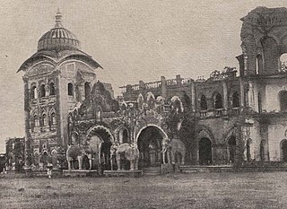
Jabalpur, formerly Jubbulpore, is a city situated on the banks of Narmada River in the state of Madhya Pradesh, India. It is the 3rd-largest urban agglomeration of the state and the 38th-largest of the country. Jabalpur is the administrative headquarters of the Jabalpur district and the Jabalpur division. It is the judicial capital of Madhya Pradesh with Madhya Pradesh High Court being located in the city. It is generally accepted that the game of snooker originated in Jabalpur. Jabalpur is also the railway headquarters of the West Central Railway. Jabalpur Cantonment is one of the largest cantonments in India and houses the army headquarters of five states. The city is known for the marble rocks on the river Narmada at Bhedaghat. It is also known as 'Sanskardhani' meaning 'The Cultural Capital' highlighting the city's rich cultural and historical heritage. The city of Jabalpur was among the first 7 smart cities selected for the Smart Cities Mission.

The 2001 Gujarat earthquake, also known as the Bhuj earthquake, occurred on 26 January at . The epicentre was about 9 km south-southwest of the village of Chobari in Bhachau Taluka of Kutch (Kachchh) District of Gujarat, India.
The 2006 Kīholo Bay earthquake occurred on October 15 at with a magnitude of 6.7 and a maximum Mercalli intensity of VIII (Severe). The shock was centered 21 kilometers (13 mi) southwest of Puakō and 21 km (13 mi) north of Kailua-Kona, Hawaiʻi, just offshore of the Kona Airport, at a depth of 38.2 km (23.7 mi). It produced several aftershocks, including one that measured a magnitude of 6.1 seven minutes after the main shock. The Pacific Tsunami Warning Center measured a nondestructive tsunami of 4 in (100 mm) on the coast of the Big Island.
The 1999 Chamoli earthquake occurred on 29 March in the Chamoli district in the Indian state of Uttar Pradesh. Approximately 103 people died in the earthquake.
The 1934 Nepal–India earthquake or 1934 Bihar–Nepal earthquake was one of the worst earthquakes in India's history. The towns of Munger and Muzaffarpur were completely destroyed. This 8.0 magnitude earthquake occurred on 15 January 1934 at around 2:13 pm IST and caused widespread damage in northern Bihar and in Nepal.
The 1967 Koynanagar earthquake occurred near Koynanagar town in Maharashtra, India on 11 December local time. The magnitude 6.6 shock hit with a maximum Mercalli intensity of VIII (Severe). It occurred near the site of Koyna dam, raising questions about induced seismicity, and claimed at least 177 lives and injured over 2,200.
The 1991 Uttarkashi earthquake occurred at 02:53:16 Indian Standard Time (UTC+05:30) on 20 October with a moment magnitude of 6.8 and a maximum Mercalli intensity of IX (Violent). This thrust event was instrumentally recorded and occurred along the Main Central Thrust in the Uttarkashi and Gharwal regions of the Indian state of Uttarakhand. High intensity shaking resulted in the deaths of at least 768 people and the destruction of thousands of homes.
The 2003 Altai earthquake, or 2003 Chuya earthquake, occurred on September 27 at with a moment magnitude of 7.3 and a maximum Mercalli intensity of X (Extreme). The epicenter of this oblique-slip shock was in Altai Republic, Russia near the borders of Mongolia, China, and Kazakhstan. Three deaths and five injuries were reported and the total damage was listed as $10.6–33 million.
The 1943 Tosya–Ladik earthquake occurred at 01:20 local time on 27 November, near Tosya, Kastamonu Province, in northern Turkey. The earthquake had an estimated moment magnitude of 7.5–7.7 and a maximum felt intensity of XI (Catastrophic) on the MSK-64 scale. Its effects were observed for over 45,000 km2. The earthquake was felt in Trabzon, Isparta, Elazığ, Zonguldak and Yozgat. Damage was seen in Kastamonu, Çankırı, Çorum, Amasya, Samsun, Tokat, Sinop and Ordu. As a result of the earthquake, more than 2,500 were killed and 5,000 were injured.
The 1941 Andaman Islands earthquake struck the Andaman Islands on June 26 with a magnitude of 7.7 to 8.1. Details of this event are poorly known as much of Southeast Asia was in the turmoil of World War II. The quake caused severe damage in the Andaman Islands. The tsunami it triggered was reported along the Andaman and Nicobar Islands, India and British Ceylon. There may have been damage and deaths in Bangladesh, Myanmar, and Thailand due to the tsunami.
The 2013 Balochistan earthquakes were the deadliest to affect Pakistan since 2005. The mainshock, occurring on 24 September, had a moment magnitude of 7.8 and maximum Mercalli intensity of IX (Violent). It had an epicenter located in Awaran District, 113 km (70 mi) northwest of Bela. The mainshock killed over 820 people, injured hundreds of others, and left 100,000 people homeless. The Awaran District was among the worst affected with 80 percent of its housing stock damaged or destroyed. On 28 September, the region was affected by a Mw 6.8 aftershock, killing an additional 15 people. Rescue and recovery efforts were severely hampered by insurgents who attacked military troops sent to distribute aid. These attacks also prompted the Pakistan government to close its doors to international aid.
The 1969 Sharm El Sheikh earthquake occurred on March 31 off the southern Sinai Peninsula in northeastern Egypt. The epicenter was located near Shadwan island, southwest of the city of Sharm El Sheikh, at the confluence of the Red Sea and the Gulf of Suez. This normal-slip shock measured 6.6 on the moment magnitude scale, had a maximum reported intensity of VII on the Mercalli intensity scale, and was responsible for several deaths and injuries.

The 2000 Tottori earthquake occurred on 6 October 2000, at with a moment magnitude of 6.7 and a maximum Mercalli intensity of X (Extreme). The epicenter was located in Nambu, near the border with Yasugi, Shimane. About $150 million in damage was caused, with 109,095 homes damaged or destroyed, and at least 182 people were injured.

Vivek Krishna Tankha is an Indian lawyer and politician, serving as a Senior Advocate at the Supreme Court of India and as a Member of Parliament. He previously had served as the Additional Solicitor General of India and Advocate General of Madhya Pradesh.

The 1918 San Jacinto earthquake occurred in extreme eastern San Diego County in Southern California on April 21 at . The shock had a moment magnitude of 6.7 and a maximum Mercalli intensity of IX (Violent). Several injuries and one death occurred with total losses estimated to be $200,000.
The National Centre for Seismology (NCS) is an office of India's Ministry of Earth Sciences. The office monitors earthquakes and conducts seismological research. Specifically, it provides earthquake surveillance and hazard reports to governmental agencies. It consists of various divisions:
An earthquake affected Myanmar on 5 May 1930 with a moment magnitude (Mw ) 7.4. The shock occurred 35 km (22 mi) beneath the surface with a maximum Rossi–Forel intensity of IX. The earthquake was the result of rupture along a 131 km (81 mi) segment of the Sagaing Fault—a major strike-slip fault that runs through the country. Extensive damage was reported in the southern part of the country, particularly in Bago and Yangon, where buildings collapsed and fires erupted. At least 550, and possibly up to 7,000 people were killed. A moderate tsunami struck the Burmese coast which caused minor damage to ships and a port. It was felt for over 570,000 km2 (220,000 sq mi) and as far as Shan State and Thailand. The mainshock was followed by many aftershocks; several were damaging. The December earthquake was similarly sized which also occurred along the Sagaing Fault.
The 1985 Kayrakkum earthquake struck Soviet Tajikistan on October 13 at about 22:00 local time. The earthquake measured Mw 5.8 and struck at a depth of 17.1 km (10.6 mi). At least 29 people died, over 80 were injured and another 8,000 were made homeless. Damage totaled $US200 million. Figures of the casualties were not disclosed until the following month.
The 1977 Khurgu earthquake struck southern Iran near Bandar Abbas in Hormozgan province on the morning of March 22. The earthquake measuring moment magnitude (Mw ) 6.7 struck at a depth of 12.5 km (7.8 mi). Thirty five villages were heavily damaged including over 20 which were destroyed. There were 152–167 people killed and 556 injured.

