
The Tibet Autonomous Region, officially the Xizang Autonomous Region, often shortened to Tibet or Xizang, is an autonomous region of China and part of Southwestern China.
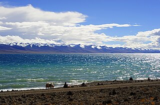
Damxung is a county of Lhasa City, lying to the north of its main center of Chengguan, in the Tibet Autonomous Region, China. Its administrative seat is Damquka. The terrain is rugged, including the western Nyenchen Tanglha Mountains, with their highest peak rising to 7,111 metres (23,330 ft). As of 2013 the population was 40,000, with most of the people engaged in animal husbandry.

Yushu Tibetan Autonomous Prefecture, also transliterated as Yüxü or Yulshul, is an autonomous prefecture of Southwestern Qinghai Province, China. Largely inhabited by Tibetans, the prefecture has an area of 188,794 square kilometres (72,894 sq mi) and its seat is located in the town of Gyêgu in Yushu County, which is the place of the old Tibetan trade mart of Jyekundo. The official source of the Yellow River lies within the prefecture. Historically, the area belongs to the cultural realm of Kham in Eastern Tibet.

The 1950 Assam–Tibet earthquake, also known as the Assam earthquake, occurred on 15 August and had a moment magnitude of 8.7. The epicentre was located in the Mishmi Hills. It is one of the strongest earthquakes ever recorded on land.

Lhasa Gonggar Airport is the airport serving Lhasa, the capital city of the Tibet Autonomous Region, People's Republic of China. It is about 97 kilometres (60 mi) to Lhasa and about 62 kilometres (39 mi) southwest of the city in Gyazhugling, Gonggar County of Shannan.

Gertse County, Gêrzê County or Gaize County is a county located in Ngari Prefecture in the northwest of the Tibet Autonomous Region, China, bordering Xinjiang to the north.

An earthquake occurred in the province of Sichuan, China at 14:28:01 China Standard Time on May 12, 2008. Measuring at 8.0 , the earthquake's epicenter was located 80 kilometres (50 mi) west-northwest of Chengdu, the provincial capital, with a focal depth of 19 km (12 mi). The earthquake ruptured the fault for over 240 km (150 mi), with surface displacements of several meters. The earthquake was also felt as far away as Beijing and Shanghai—1,500 and 1,700 km away, respectively—where office buildings swayed with the tremor, as well as Bangkok, Thailand and Hanoi, Vietnam. Strong aftershocks, some exceeding 6 , continued to hit the area up to several months after the main shock, causing further casualties and damage. The earthquake also caused the largest number of geohazards ever recorded, including about 200,000 landslides and more than 800 quake lakes distributed over an area of 110,000 km2 (42,000 sq mi).
The 2010 Yushu earthquake struck on April 14 and registered a magnitude of 6.9 Mw or 7.1 Ms. It originated in Yushu, Qinghai, China, at 7:49 am local time. According to the Xinhua News Agency, 2,698 people were confirmed dead, 270 missing and 12,135 injured, 1,434 of them severely. The epicenter was located in Rima village (日玛村/日麻村), Upper Laxiu township (上拉秀乡) of Yushu County, in remote and rugged terrain, near the border of Tibet Autonomous Region, about 30 km from Gyêgu town or Jyekundo, the seat of Yushu County, and about 240 km from Qamdo. The epicenter was in a sparsely populated area on the Tibetan plateau that is regularly hit by earthquakes.
The 1927 Gulang earthquake occurred at 06:32 a.m. on 23 May. This 7.6 magnitude event had an epicenter near Gulang, Gansu in the Republic of China. There were 40,912 deaths. It was felt up to 700 km (435 mi) away.
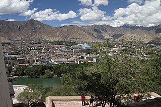
Lhasa is a prefecture-level city, one of the main administrative divisions of the Tibet Autonomous Region of China. It covers an area of 29,274 square kilometres (11,303 sq mi) of rugged and sparsely populated terrain. Its urban center is Lhasa, with around 300,000 residents, which mostly corresponds with the administrative Chengguan District, while its suburbs extend into Doilungdêqên District and Dagzê District. The consolidated prefecture-level city contains additional five, mostly rural, counties.
China Tibet Broadcasting is a broadcast network headquartered in Lhasa, Tibet Autonomous Region of the People's Republic of China. Its radio programmes were founded in 1959. Its English language audio broadcast is called Holy Tibet, broadcasts at 07:00 and 16:00 UTC every day.
The 1952 Damxung earthquake struck Tibet with moment magnitude of 7.5 in the early morning hours of August 18. The epicenter was located in the Nyenchen Tanglha Mountains in Damxung County, Lhasa Prefecture, Tibet, People's Republic of China. There was significant damage in Damxung (Dangquka) and nearby Nagqu County. It was felt in Lhasa, over 100 km (62 mi) to the south.

On 7 January 2025 at 09:05 CST (UTC+8), an earthquake measuring Mw 7.1 struck Tingri County, located in the Shigatse prefecture-level city of the Tibet Autonomous Region of Southwestern China. Between 126 and 400 people were killed and 338 were injured in the region. The earthquake also injured 13 people in Nepal and caused minor damage in Northern India. Shaking was felt across South Asia. The earthquake was the largest in China since the Maduo earthquake in May 2021 and the deadliest since the Jishishan earthquake in December 2023. It was caused by normal faulting and originated within the continental crust at 10 km (6.2 mi) depth.
