Solok

Last updated • 1 min readFrom Wikipedia, The Free Encyclopedia
Solok
City of Solok
Kota Solok
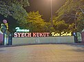
Balai Kota Solok panjang.jpg
Solok City hall
Pasar Raya Solok.jpg
Solok Public market
Masjid Agung di Solok.jpg
Al-Muhsinin Grand mosque
Solok 2022 Bennylin 08.jpg
Syech Kukut park
Alam Bareh Solok 02.jpg
Rice fields (Bareh) in Solok
Logo Kota Solok.png
Motto(s): 
Indonesian: Bersih, Elok, Rapi, Aman dan Sejahtera (BERAS)
(Clean, Elegant, Neat, Safe and Prosperous)
Lokasi Sumatra Barat Kota Solok.svg
Location within West Sumatra
Indonesia Sumatra location map.svg
Red pog.svg
Solok
Location in Sumatra and Indonesia
Indonesia location map.svg
Red pog.svg
Solok
Solok (Indonesia)
Coordinates: 00°47′59″S100°39′58″E / 0.79972°S 100.66611°E / -0.79972; 100.66611
Country Flag of Indonesia.svg  Indonesia
Region Sumatra
Province Flag of West Sumatra.svg  West Sumatra
Government
  Mayor Ramadhani Kirana Putra
  Vice Mayor Suryadi Nurdal
Area
  Total
58.72 km2 (22.67 sq mi)
Population
 (mid 2023 estimate [1] )
  Total
77,842
  Density1,300/km2 (3,400/sq mi)
Time zone UTC+7 (Indonesia Western Time)
Area code (+62) 755
Climate Af
Website solokkota.go.id

Solok (means valley) is a city in West Sumatra, Indonesia. The motto of this city is Kota Beras which is an abbreviation of "Bersih, Elok, Rapi, Aman dan Sejahtera". It has an area of 58.72 km2 (0.14 percent of the area of West Sumatra), a population of 59,396 at the 2010 Census, [2] and 73,438 at the 2020 Census; [3] the official estimate as at mid-2023 was 77,842 - comprising 39,239 males and 38,603 females. [1] Solok topography varies between the plains and hilly with a height of 390 m above sea level. Three tributaries cross Solok, namely Batang Lembang, Batang Gawan, and Batang Air Binguang.

Contents

Judging from the type of soil, 21.37 percent of the land in Solok is rice fields and the remaining 78.63 percent is used for other than rice fields. The travel time from Solok to Padang is 75 minutes, to the city of Padang Panjang for 60 minutes, and to Sawahlunto for 40 minutes. [4]

Administration

Solok City is divided into two administrative districts (kecamatan) which are listed below with their areas and populations at the 2010 census [2] and the 2020 census, [3] together with the official estimates as of mid 2023. [1] The table also includes the number of administrative urban villages (kelurahan) in each district.

Name of
District
(kecamatan)
Area
in
km2
Pop'n
2010
census
Pop'n
2020
census
Pop'n
mid-2023
estimate
Admin
centre
No.
of
villages
Lubuk Sikarah35.9832,64540,72043,272Tanah Garam7
Tanjung Harapan22.7426,75132,71834,570Tanjung Paku6
Totals58.7259,39673,43877,842Lubuk Sikarah13

The two districts comprise respectively the west and east parts of the city.

Climate

Solok has a tropical rainforest climate (Af) with heavy rainfall year-round.

Climate data for Solok
MonthJanFebMarAprMayJunJulAugSepOctNovDecYear
Mean daily maximum °C (°F)29.5
(85.1)
29.9
(85.8)
30.0
(86.0)
30.2
(86.4)
30.5
(86.9)
30.1
(86.2)
29.8
(85.6)
29.8
(85.6)
29.4
(84.9)
29.3
(84.7)
29.3
(84.7)
29.2
(84.6)
29.8
(85.5)
Daily mean °C (°F)25.1
(77.2)
25.2
(77.4)
25.3
(77.5)
25.7
(78.3)
25.8
(78.4)
25.2
(77.4)
25.0
(77.0)
24.9
(76.8)
24.9
(76.8)
25.0
(77.0)
25.1
(77.2)
24.9
(76.8)
25.2
(77.3)
Mean daily minimum °C (°F)20.7
(69.3)
20.6
(69.1)
20.7
(69.3)
21.2
(70.2)
21.1
(70.0)
20.4
(68.7)
20.2
(68.4)
20.1
(68.2)
20.5
(68.9)
20.8
(69.4)
20.9
(69.6)
20.7
(69.3)
20.7
(69.2)
Average rainfall mm (inches)268
(10.6)
190
(7.5)
240
(9.4)
282
(11.1)
191
(7.5)
141
(5.6)
114
(4.5)
146
(5.7)
176
(6.9)
257
(10.1)
272
(10.7)
269
(10.6)
2,546
(100.2)
Source: Climate-Data.org [5]

References

  1. 1 2 3 Badan Pusat Statistik, Jakarta, 28 February 2024, Kota Solok Dalam Angka 2024 (Katalog-BPS 1102001.1372)
  2. 1 2 Biro Pusat Statistik, Jakarta, 2011.
  3. 1 2 Badan Pusat Statistik, Jakarta, 2021.
  4. Bappeda Kota Solok. "Kota Solok Dalam Angka Tahun 2014" . Retrieved January 7, 2017.
  5. "Climate: Solok". Climate-Data.org. Retrieved 8 November 2020.