Payakumbuh

Last updated
Payakumbuh
Payokumbuah (Minangkabau)
City of Payakumbuh
Kota Payakumbuh
Other transcription(s)
   Jawi ڤايوكومبواه
Lambang Kota Payakumbuh.png
Motto(s): 
Ko Difoto Dari Puncak Ngalau - panoramio.jpg
Masjid Gadang Balai Nan Duo.jpg
Gedung DPRD Payakumbuh.jpg
Payakumbuh.JPG
Mount Sago Payakumbuh - panoramio.jpg
Kota Payakumbuh - panoramio.jpg
Jalan membelah sawah Payakumbuh.jpg
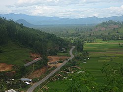
From above, left to rightː Ngalau Indah, Tuo Koto Nan Ampek Mosque, Payakumbuh City Council Office, Monument on Jalan Soekarno-Hatta which is now Adipura monument, Mount Sago, Adipura monument Road Junction, and rice fields.
Lokasi Sumatra Barat Kota Payakumbuh.svg
Location within West Sumatra
Indonesia Sumatra location map.svg
Red pog.svg
Payakumbuh
Location in West Sumatra and Indonesia
Indonesia location map.svg
Red pog.svg
Payakumbuh
Payakumbuh (Indonesia)
Coordinates: 0°14′S100°38′E / 0.233°S 100.633°E / -0.233; 100.633
Country Flag of Indonesia.svg  Indonesia
Region Sumatra
Province Flag of West Sumatra.svg  West Sumatra
Government
  MayorZulmaeta
  Vice MayorElzadaswarman
Area
  Total
80.42 km2 (31.05 sq mi)
Population
 (mid 2023 estimate)
  Total
144,830
  Density1,800/km2 (4,700/sq mi)
  [1]
Time zone UTC+7 (Indonesia Western Time)
Area code (+62) 752
Climate Af
Website payakumbuhkota.go.id
Pajakoemboeh scene with water wheel, children swimming, a mosque and a Minangkabau town hall in the background COLLECTIE TROPENMUSEUM Een waterrad in een rivier met zwemmende kinderen voor een moskee te Pajakoemboeh met een Minangkabau raadhuis op de achtergrond TMnr 60043177.jpg
Pajakoemboeh scene with water wheel, children swimming, a mosque and a Minangkabau town hall in the background

Payakumbuh (Minangkabau : Payokumbuah, Jawi: ڤايوكومبواه) is the second largest city in West Sumatra province, Indonesia, with a population of 116,825 at the 2010 Census [2] and 139,576 at the 2020 Census; [3] the official estimate as at mid 2023 was 144,830 - comprising 72,840 males and 71,990 females. [1] It covers an area of 80.42 km² and is in the Minangkabau Highlands, 120 km by road from the West Sumatran capital city of Padang and 180 km from the Riau capital city of Pekanbaru.

Contents

The whole area is surrounded on all sides by (but administratively independent from) the Lima Puluh Kota Regency, making it an enclave. It is located near the volcanoes of Mount Merapi, Mount Sago, and Bukit Barisan. Payakumbuh means "grassy swamp" in the Minangkabau language., suggesting that the area was originally swampy.

In 2011, Payakumbuh had the highest economic growth of any city in West Sumatra. Innovations in sanitation, waste management, healthy traditional markets, street vendors coaching, and urban drainage resulted in this city being awarded the "Urban Innovation Management" in 2012. In 2013, Payakumbuh received the "Adipura" ('cleanest city') award in the category of small city for the seventh time.

Payakumbuh is known for flying duck races, foods like batiah (small sweet rice cookies), gelamai (a sweet coconut palm sugared snack) and rendang . Payakumbuh produces a wide range of agriculture products including rice, milk, cattle and palm sugar.

Payakumbuh and its surrounding villages, namely Mungka, Simalanggang and Batuhampar are the origin of the Negeri Sembilan people of Malaysia. [4]

Transportation

Main street of Payakumbuh. Payakumbuh.JPG
Main street of Payakumbuh.

Payakumbuh is connected to Padang and Pekanbaru by road; a dysfunctional railway line also exists. For inner-city transport, Payakumbuh employs a public transportation system known as "Sago", taken from name of a nearby volcano (Mount Sago) in Payakumbuh. In addition, transport within the city occurs in the form of horse-drawn carts known as bendi.

Administrative districts

The city is administratively divided into five administrative districts (kecamatan), 8 kanagarian, and 47 villages (kelurahan). A mayor (walikota) leads the city administration. The districts are listed below with their areas and their populations at the 2010 Census [2] and 2020 Census, [3] together with the official estimates as at mid 2023. [1] The table also includes the locations of the administrative centres and the number of urban villages (kelurahan) in each district.

Name of
District
(kecamatan)
Area
in
km2
Pop'n
2010
Census
Pop'n
2020
Census
Pop'n
end 2023
Estimate
Admin
centre
No.
of
villages
Payakumbuh Barat
(West Payakumbuh)
19.0645,84854,53456,490Tanjuang Pauah17
Payakumbah Selatan
(South Payakumbuh)
14.689,38811,99012,680Sawah Padang
Aua Kuniang
6
Payakumbuh Timur
(East Payakumbuh)
22.7324,46629,32530,450Tiakar9
Payakumbuh Utara
(North Payakumbuh)
14.5328,46132,24232,930Tigo Koto Diate9
Lamposi Tigo Nagori9.438,66211,48512,280Sungai Durian6
Totals80.42116,825139,576144,830Kapalo Koto Dibalal47

Tourism

Payakumbuh is considered as one of the most popular cities in West Sumatra for domestic and foreign tourists. The varieties of food, the Muslim clothes stores, and natural scenery are some of the attractions of the city. Attractions within and surrounding the city include:[ citation needed ]

Payakumbuh market c. 1900. Payakumbuh market 1900.jpg
Payakumbuh market c.1900.

References

  1. 1 2 3 Badan Pusat Statistik, Jakarta, 28 February 2023, Kota Payakumbuh Dalam Angka 2024 (Katalog-BPS 1102001.1376)
  2. 1 2 Biro Pusat Statistik, Jakarta, 2011.
  3. 1 2 Badan Pusat Statistik, Jakarta, 2021.
  4. Abdullah Siddik, Pengantar Undang-undang Adat di Malaysia, 1975
  5. Stephen Backshall, The Rough Guide to Indonesia, 2003
  6. Abdul Baqir Zein, Masjid-masjid Bersejarah di Indonesia, 1999

0°14′S100°38′E / 0.233°S 100.633°E / -0.233; 100.633