893 Dvin earthquake

Last updated

893 Dvin earthquake
Relief Map of Armenia.png
Bullseye1.png
Local date28 December 893 (0893-12-28)
Local timeMidnight
Magnitude5.3–6.0 or ≥7.0
Epicenter Dvin
40°00′N44°36′E / 40.0°N 44.6°E / 40.0; 44.6
Areas affected Armenia
Max. intensity MMI IX (Violent) MMI X (Extreme)
Casualties30,000 [1]

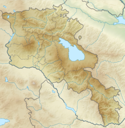
The 893 Dvin earthquake occurred on 28 December at around midnight. It had a magnitude of approximately 6 and a maximum intensity of approximately IX (Violent) on the Mercalli intensity scale. It destroyed the city of Dvin in Armenia, causing approximately 30,000 casualties. The similarity of the Arabic name for Dvin, 'Dabil' to Ardabil in northwestern Iran, has caused confusion in written records, such that the 893 Ardabil earthquake appears in several catalogues, although it is generally regarded as a false event. It was also recorded as an event during the classical period of India in several early catalogues at an unspecified capital.

Contents

Tectonic setting

Southern Armenia lies within the complex zone of continental collision between the Arabian plate and the Eurasian plate, which extends from the Bitlis-Zagros belt in the south to the Greater Caucasus Mountains, the Apsheron-Balkan Sill and the Kopet Dag mountains in the north. [2] In Armenia the collision is strongly oblique with a large dextral (right lateral) strike-slip component. The Sardarapat-Nakhicheven fault system is formed of four left-stepping fault segments, the Kagyzman, Sardarapat, Parackar-Dvin and Nakhichevan faults. Movement on the Parackar-Dvin segment of this fault system has been associated with a series of large earthquakes in the second half of the 9th century. [3] [4]

Earthquake characteristics

The magnitude of this earthquake has been given as 5.3 and 6, although a value of 7 or greater has been suggested. [4] The main shock was followed by five days of damaging aftershocks. [1] The intensity is estimated to be at least IX on the Mercalli intensity scale, with some seismologists suggesting that X would be a more appropriate value. [4]

Damage

The city was devastated with most of its buildings destroyed, including its defensive walls, the palace of the catholicos and all the other monumental buildings; just 100 houses were left standing. [5] The area damaged included the Artashat Plateau, where landslides were triggered. The Bishop of R'shtunik, Grigor, who was at a mountain retreat was killed with several of his followers. [1] The death toll is variously reported as 20,000, 30,000, 70,000, 82,000, 150,000 and 180,000 in historical sources. [1] [6]

Aftermath

The earthquake had ruined the city's defenses and Dvin was taken by Muhammad ibn Abi'l-Saj, the Sajid emir of Adharbayjan, who turned it into a military base. Although the capital of Armenia was moved to Ani in 961, Dvin became prosperous once more in the 10th century following its reconstruction. [7]

Confusion over the location and date

There has been much confusion over the location and date of this earthquake. Several Armenian sources place it clearly at Dvin in Armenia, the night after an eclipse of the moon that occurred on 27 December 893. However, the location has been given as Ardabil in several sources, presumed to be a misreading of the Arabic name for Dvin, 'Dabil'. Almost all of the Dvin earthquake's details are repeated in these reports, although in most cases the observed lunar eclipse has become solar. One source refers to this earthquake as taking place in 'Outer India' at an unnamed capital. This report has been repeated in several other sources, with the location given as 'Daibul', near modern Karachi. It is now considered that no such earthquake occurred in India/Pakistan [8] and that the 'well known' alleged 893 Ardabil earthquake is a phantom, despite it appearing in many modern catalogues and reference books. [9] [10]

In the National Geophysical Data Center earthquake database entry for this event, the date of the earthquake is variously given as 23 March 27 March, 14 December 24 December, with the year as 893, 894 or 895 in the quoted sources. [6]

See also

Related Research Articles

<span class="mw-page-title-main">2002 Hindu Kush earthquakes</span> Earthquakes in northern Afghanistan

The 2002 Hindu Kush earthquakes struck in northern Afghanistan during the month of March. At least 166 people were killed with a very large and intermediate-depth mainshock on March 3. Three weeks later, at least 1,200 were killed during a moderate but shallow event that had a maximum Mercalli intensity of VII. The M7.4 and M6.1 reverse events were focused in the Hindu Kush mountain range area.

The Dasht-e Bayaz and Ferdows earthquakes occurred in Dashte Bayaz, Kakhk and Ferdows, Iran in late August and early September 1968. The mainshock measured 7.1 on the moment magnitude scale and had a maximum perceived intensity of X (Extreme) on the Mercalli intensity scale. Damage was heavy in the affected areas with thousands of lives lost in the first event and many hundreds more in the second strong event.

The 1909 Borujerd earthquake also known as Silakhor earthquake occurred in Silakhor plain, Persia on January 23. Around 8,000 fatalities were caused directly from the magnitude 7.3 earthquake. An indefinite number of aftershocks continued for six months after the main shock. The section on this fault ruptured was the same as the main rupture zone of the 2006 Borujerd earthquake.

The 1202 Syria earthquake struck at about dawn on 20 May 1202 with an epicenter in southwestern Syria. The earthquake is estimated to have killed around 30,000 people. It was felt over an extensive area, from Sicily to Mesopotamia and Anatolia to upper Egypt, mostly affecting the Ayyubid Sultanate and the Kingdom of Jerusalem. The cities of Tyre, Acre and Nablus were heavily damaged. A magnitude of Ms 7.6 has been estimated with damage up to XI on the Mercalli intensity scale.

<span class="mw-page-title-main">856 Damghan earthquake</span> Earthquake in Iran

The 856 Damghan earthquake or the 856 Qumis earthquake occurred on 22 December 856. The earthquake had an estimated magnitude of 7.9, and a maximum intensity of X (Extreme) on the Mercalli intensity scale. The meizoseismal area extended for about 350 kilometres (220 mi) along the southern edge of the eastern Alborz mountains of present-day Iran including parts of Tabaristan and Gorgan. The earthquake's epicenter is estimated to be close to the city of Damghan, which was then the capital of the Persian province of Qumis. It caused approximately 200,000 deaths and is listed by the USGS as the sixth deadliest earthquake in recorded history. This death toll has been debated.

Several earthquake catalogues and historical sources describe the 893 Ardabil earthquake as a destructive earthquake that struck the city of Ardabil, Iran, on 23 March 893. The magnitude is unknown, but the death toll was reported to be very large. The USGS, in their "List of Earthquakes with 50,000 or More Deaths", give an estimate that 150,000 were killed, which would make it the ninth deadliest earthquake in history.

The 1972 Qir earthquake occurred at 05:36 local time on April 10, 1972. It had a magnitude of 6.7 on the moment magnitude scale and a maximum perceived intensity of IX (Violent) on the Mercalli intensity scale. The epicentre was in the province of Fars in southern Iran. The earthquake caused the destruction of Qir and serious damage to towns and villages in the surrounding area. The estimated number of deaths is 5,374, with a further 1,710 injured.

The 1895 Quchan earthquake occurred at about 11:30 local time on 17 January. It had an estimated magnitude of 6.8 on the surface-wave magnitude scale and a maximum perceived intensity of VIII (Severe) on the Mercalli intensity scale. It caused severe damage in Quchan County, particularly to the town of Quchan itself and there were an estimated 1,000–11,000 casualties. It was the last in a sequence of major damaging earthquakes that struck the area between 1851 and 1895.

The 2014 Murmuri earthquake occurred on August 18 in the Zagros Mountains of Iran with a moment magnitude of 6.2 and a maximum Mercalli intensity of VIII (Severe). The thrust earthquake injured 60–330 people and was followed by a number of high intensity aftershocks.

The 2010 Damghan earthquake occurred in northern Iran at 11:53:49 local time on August 27 with a moment magnitude of 5.8 and maximum Mercalli intensity of VII. This strike-slip event damaged and destroyed a number of small villages in a sparsely populated region near the Alborz mountain range. It left four people dead, 40 injured, and about 800 without homes. The deaths and injuries in this moderate event were attributed to the low-quality construction styles that are typical of the area. The Iranian Strong Motion Network provided data by which seismologists determined the type and extent of the slip as well as the peak ground acceleration. Other large and destructive earthquakes have affected Semnan Province, including several events in 856 AD and 1953.

The 1780 Tabriz earthquake occurred at 01:15 local time on 8 January. It had an estimated magnitude of 7.4 and a maximum felt intensity of IX on the Mercalli intensity scale. The city of Tabriz was almost completely destroyed. The number of reported casualties varies from 40,000 to as many as 200,000, with 50,000 being a more likely estimate.

<span class="mw-page-title-main">2021 Hormozgan earthquakes</span> Earthquakes in Iran

The 2021 Hormozgan earthquakes was a doublet earthquake event in Iran that occurred on November 14, 2021, with magnitudes of 6.0 and 6.4 on the moment magnitude scale. The two quakes occurred just a minute and a half apart, killing 2 people and injuring a further 100.

The 2019 East Azerbaijan earthquake occurred at 03:17 local-time on November 8, 2019. This earthquake had a moment magnitude of 5.9 and had a shallow depth of 20 km.

<span class="mw-page-title-main">1641 Tabriz earthquake</span> Earthquake centered in northwestern Iran

The 1641 Tabriz earthquake occurred on the night of February 5 in present-day East Azerbaijan province, Iran. The earthquake had an estimated surface-wave magnitude of 6.8 and an epicenter between Lake Urmia and the city of Tabriz. It was one of the most destructive earthquakes in the region, resulting in the loss of up to 30,000 lives.

The 1977 Bob–Tangol earthquake struck Kerman province of Iran on December 20, 1977, at 03:04 Iran Standard Time. The earthquake measured Mw 5.9 and struck at a depth of 22.7 km (14.1 mi). A maximum Modified Mercalli intensity of VII was evaluated based on damage. It had a strike-slip focal mechanism, which was unusual as the source structure was a thrust fault. It was part of a sequence of strong earthquakes along the 400 km (250 mi) Kuh Banan Fault. Between 584 and 665 people perished while a further 500–1,000 were injured; thousands were also made homeless. Casualties from the earthquake was considered moderate due to the sparsely populated area it affected. Preceded by foreshocks the month before, many residents became wary of a larger earthquake and took refuge outside their homes, contributing to the moderate death toll. However, there were none immediately before the mainshock so many were still in their homes when it struck. Aftershocks were felt for several months, some causing additional damage.

The 1977 Naghan earthquake struck Chaharmahal and Bakhtiari province in Iran on April 6 at 13:36 UTC. The earthquake measuring 6.0 Mw  occurred at a depth of 15 km (9.3 mi) and had a maximum Modified Mercalli intensity of VIII (Severe). More than 2,100 homes were destroyed and at least 348 people died.

The 1957 Alborz earthquake struck northern Iran's Mazandaran province at 04:12 local time on 2 July. It had a moment magnitude (Mw ) of 7.1 and occurred at a focal depth of 15 km (9.3 mi). The thrust-faulting shock was assigned a maximum Modified Mercalli intensity of IX (Violent). It devastated 120 villages in the Alborz Mountains and caused an estimated 1,500 fatalities. The earthquake also triggered landslides including one that dammed the Haraz River. Some damage was also reported in Tehran, Qaem Shahr and Sari. The total damage was estimated at US$25 million.

The 1957 Farsinaj earthquake struck Hamadan province, Iran on 13 December at 05:15 local time. The moment magnitude 6.5 earthquake struck at a depth of 15 km (9.3 mi). The epicenter of the earthquake was located in the seismically active Zagros Mountains. The mountain range was also the location for several historic earthquakes. The earthquake occurred near two segments of the active strike-slip Main Recent Fault. At least 1,130 people died, including over 700 in the village of Farsinaj. Additional deaths also occurred in Dehasiyab, Sarab, and other villages. The earthquake left an estimated 15,000 homeless; poor weather conditions including a winter storm on 21 December killed another 20 people. Several deadly and damaging aftershocks in that month killed a total of 38 people.

The 1947 Dustabad earthquake, also known as the Charmeh earthquake, occurred in South Khorasan Province of northeastern Iran on 23 September. The mainshock had a magnitude of Mw 6.9 and maximum Modified Mercalli intensity of VIII (Severe). It was accompanied by a Mw  6.1 aftershock on 26 September. These earthquakes killed an estimated 500 people.

The 1958 Firuzabad earthquake was the second destructive earthquake to strike Hamadan province, Iran, in nine months. The Mw 6.7 earthquake occurred at a depth of 15 km (9.3 mi) on 16 August at 22:43 local time. It caused severe damage to over 170 villages in the province. Due to several strong foreshocks, most of the population fled their homes and the death toll only stood at 132 and another 948 were injured. A destructive aftershock on 21 September killed another 16 people.

References

  1. 1 2 3 4 Ambraseys, N.N.; Melville, C.P. (2005). A History of Persian Earthquakes. Cambridge Earth Science Series. Cambridge University Press. p. 38. ISBN   978-0-521-02187-6.
  2. Talebian, M.; Jackson J. (2004). "A reappraisal of earthquake focal mechanisms and active shortening in the Zagros mountains of Iran". Geophysical Journal International. 156 (3): 506–526. Bibcode:2004GeoJI.156..506T. doi: 10.1111/j.1365-246X.2004.02092.x .
  3. Karakhanian, A.S.; Trifonov V.G.; Philip H.; Avagyan A.; Hessami K.; Jamali F.; Bayraktutan M.S.; Bagdassarian H.; Arakelian S.; Davtian V.; Adilkhanyan A. (2004). "Active faulting and natural hazards in Armenia, eastern Turkey and northwestern Iran". Tectonophysics. 380 (3–4): 206. Bibcode:2004Tectp.380..189K. doi:10.1016/j.tecto.2003.09.020.
  4. 1 2 3 Mkrtchian, H.K. (2000). "A major neotectonic structure within the Arabia-Eurasia collisional orogen: the Ararat-Araks conjugate fault system and its possible impact on the safety of the Metsamor nuclear power plant". In Balassanian S., Cisternas A. & Melkumyan M. (ed.). Earthquake hazard and seismic risk reduction. Advances in natural and technological hazards research. Vol. 12. Springer. pp. 156–157. ISBN   978-0-7923-6390-3.
  5. Hasrat'yan, M. (1995). "The medieval earthquakes of the Armenian Plateau and the historic towns of Ayrarat and Shirak (Dvin, Ani, Erevan)" (PDF). Annali di Geofisica. 38 (5–6): 719–722. Retrieved 4 October 2011.
  6. 1 2 National Geophysical Data Center. "Comments for the Significant Earthquake" . Retrieved 1 October 2011.
  7. Adalian, R.P. (2010). Historical Dictionary of Armenia. Historical dictionaries of Europe G – Reference, Information and Interdisciplinary Subjects. Vol. 77 (2 ed.). Scarecrow Press. pp. 287–288. ISBN   978-0-8108-6096-4.
  8. Ambraseys, N.N. (2004). "Three little known early earthquakes in India". Current Science. 86 (4): 506–508. JSTOR   24107899.
  9. Musson, R. (7 March 2001). "The ten deadliest ever earthquakes". British Geological Survey . Retrieved 1 October 2011.
  10. Gupta, H. (2011). Encyclopedia of Solid Earth Geophysics. Encyclopedia of Earth Sciences (2 ed.). Springer. p. 566. ISBN   978-90-481-8701-0.