115 Antioch earthquake

Last updated
115 Antioch earthquake
Syria physical location map.svg
Bullseye1.png
Local date13 December 115 (0115-12-13)
Local timeAt night
Magnitude7.5 Ms [1]
Epicentre 36°06′N36°06′E / 36.1°N 36.1°E / 36.1; 36.1 [1]
Areas affected Anatolia, Syria in the Roman Empire
Max. intensity XI (Extreme)
TsunamiYes
Casualties~260,000

An earthquake occurred in Antioch on 13 December 115 AD. It had an estimated magnitude of 7.5 on the surface wave magnitude scale and an estimated maximum intensity of XI (Extreme) on the Mercalli intensity scale. Antioch and surrounding areas were devastated with a great loss of life and property. It triggered a local tsunami that badly damaged the harbour at Caesarea Maritima. The Roman Emperor Trajan was caught in the earthquake, as was his successor Hadrian. Although the consul Marcus Pedo Vergilianus was killed, they escaped with only slight injuries and later began a program to rebuild the city. [2] [3]

Contents

Tectonic setting

The site of Antioch lies close to the complex triple junction between the northern end of the Dead Sea Transform, the mainly transform boundary between the African Plate and the Arabian Plate, the southwestern end of the East Anatolian Fault, the mainly transform boundary between the Anatolian Plate and the Arabian Plate, and the northeastern end of the Cyprus Arc, the boundary between the Anatolian and African Plates. The city lies on the Antakya Basin, part of the Amik Basin, filled by Pliocene-to-recent alluvial sediments. The area has been affected by many large earthquakes during the last 2,000 years. [4]

The results of trenching over the northern part of the Dead Sea Transform indicate that three major earthquakes have occurred along the Missyaf segment of the fault since about 100 AD, the earliest of which may correlate with the 115 earthquake. [5]

Damage

The earthquake killed an estimated 260,000 people. The cities of Antioch, Daphne and Apamea were almost completely destroyed. Trees were uprooted and felled; people were thrown down to the ground. The Roman emperor Trajan was trapped under the rubble of his home but escaped with minor injuries. [6]

An account of the earthquake was included by the writer Cassius Dio in his Roman History. [7] He describes Antioch at that time as crowded with soldiers and many civilians that had travelled from all parts of the empire, because Trajan was wintering there. The earthquake began with a loud roaring sound, followed by intense shaking of the ground. Whole trees were thrown into the air, as were many of the inhabitants, causing great injury. Large numbers of people were killed by falling debris, while many others were trapped. The aftershocks that followed the earthquake for several days killed some of the survivors, while others that were trapped died of hunger. Trajan managed to get clear of the house he was staying in by leaving through a window and only suffered minor injuries. Because of the danger from aftershocks, he moved with his retinue to the open hippodrome. [7]

The city of Apamea was also destroyed by the earthquake and Beirut suffered significant damage. [5] The tsunami triggered by the earthquake affected the Lebanese coast, particularly at Caesarea and Yavneh. [8] The harbour at Caesarea Maritima was probably destroyed by the tsunami, an interpretation based on the dating of a half metre thick tsunami deposit found outside the harbour. [9]

Aftermath

The restoration of Antioch was started by Trajan but seems to have been completed by Hadrian. [10] Trajan had a copy of the statue of Tyche by Eutychides erected at the new theatre, to commemorate the rebuilding of the city. [11] Almost all of the mosaics that have been found in Antioch date from after the earthquake. [12]

See also

Related Research Articles

An earthquake struck Turkey's eastern Erzincan Province at 1:57:23 a.m. on 27 December 1939 local time with a moment magnitude of 7.8Mw and a maximum Mercalli intensity of XII (Extreme). It is the joint second most-powerful earthquake recorded in Turkey, tied with the 2023 Turkey–Syria earthquake. Only the 1668 North Anatolia earthquake was more powerful. This was one of the largest in a sequence of violent shocks to affect Turkey along the North Anatolian Fault between 1939 and 1999. Surface rupturing, with a horizontal displacement of up to 3.7 meters, occurred in a 360 km long segment of the North Anatolian Fault Zone. The earthquake was the most severe natural loss of life in Turkey in the 20th century, with 32,968 dead, and some 100,000 injured.

The 1202 Syria earthquake struck at about dawn on 20 May 1202 with an epicenter in southwestern Syria. The earthquake is estimated to have killed around 30,000 people. It was felt over an extensive area, from Sicily to Mesopotamia and Anatolia to upper Egypt, mostly affecting the Ayyubid Sultanate and the Kingdom of Jerusalem. The cities of Tyre, Acre and Nablus were heavily damaged. A magnitude of Ms 7.6 has been estimated with damage up to XI on the Mercalli intensity scale.

The 526 Antioch earthquake struck Syria and, in particular, the city of Antioch in the Byzantine Empire. It occurred some time in late May 526, probably between 20 and 29 May, during mid-morning, killing approximately 250,000 people. This was in the seventh year of the reign of the Byzantine emperor Justin I and occurred under the consulship of Olybrius. In Antioch the earthquake was followed by a fire that destroyed most of the buildings left standing after the earthquake. The maximum intensity in Antioch is estimated to have been between VIII (Severe) and IX (Violent) on the Mercalli intensity scale.

The 1730 Valparaíso earthquake occurred at 04:45 local time on July 8. It had an estimated magnitude of 9.1–9.3 and triggered a major tsunami with an estimated magnitude of Mt  8.75, that inundated the lower parts of Valparaíso. The earthquake caused severe damage from La Serena to Chillan, while the tsunami affected more than 1,000 km (620 mi) of Chile's coastline.

The 1293 Kamakura earthquake in Japan occurred at about 06:00 local time on 27 May 1293. It had an estimated magnitude of 7.1–7.5 and triggered a tsunami. The estimated death toll was 23,024. It occurred during the Kamakura period, and the city of Kamakura was seriously damaged.

<span class="mw-page-title-main">551 Beirut earthquake</span> Earthquake off the Lebanese coast

The 551 Beirut earthquake occurred on 9 July with an estimated magnitude of about 7.5 on the moment magnitude scale and a maximum felt intensity of X (Extreme) on the Mercalli intensity scale. It triggered a devastating tsunami which affected the coastal towns of Byzantine Phoenicia, causing great destruction and sinking many ships. Overall large numbers of people were reported killed, with one estimate of 30,000 by the anonymous pilgrim of Piacenza for Beirut alone.

The 1931 Southwest Sumatra earthquake occurred on 25 September at 05:59 UTC. It was located between the Enggano Island and Sumatra, Indonesia, then under the rule of Dutch East Indies. It had a magnitude of Mw 7.3, or Ms 7.5.

After a year of foreshocks, an earthquake occurred on 12 August 1157 near the city of Hama, in west-central Syria, where the most casualties were sustained. In eastern Syria, near the Euphrates, the quake destroyed the predecessor of the citadel al-Rahba, subsequently rebuilt on the same strategic site. The earthquake also affected Christian monasteries and churches in the vicinity of Jerusalem.

The 1615 Arica earthquake was a major earthquake centered near Arica in the Spanish colonial Viceroyalty of Peru, within the present day Arica y Parinacota Region of northwestern Chile.

<span class="mw-page-title-main">1170 Syria earthquake</span> 29 June, 1170, earthquake in Syria

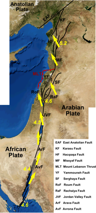
The 1170 Syria earthquake was one of the largest earthquakes to hit Syria. It occurred early in the morning of 29 June 1170. It formed part of a sequence of large earthquakes that propagated southwards along the Dead Sea Transform, starting with the 1138 Aleppo earthquake, continuing with the 1157 Hama, 1170 and 1202 Syria events. The estimated magnitude is 7.7 on the moment magnitude scale, with the maximum intensity of X (Extreme) on the Mercalli intensity scale.

The Valparaíso Region of central Chile was struck by an earthquake of magnitude 7.8 Mw at 22:03 8 July 1971 local time. It had a maximum felt intensity of IX (violent) on the Modified Mercalli intensity scale and caused the deaths of 83 people and injured a further 447.

During April 1819, the area around Copiapó in northern Chile was struck by a sequence of earthquakes over a period of several days. The largest of these earthquakes occurred on 11 April at about 15:00 local time, with an estimated magnitude of Mw 8.5. The other two events, on 3 April between 08:00 and 09:00 local time and on 4 April at 16:00 local time, are interpreted as foreshocks to the mainshock on 11 April. The mainshock triggered a tsunami that affected 800 km of coastline and was also recorded at Hawaii. The city of Copiapó was devastated.

The northern part of the Ottoman Empire was struck by a major earthquake on 13 August 1822. It had an estimated magnitude of 7.0 Ms and a maximum felt intensity of IX (Destructive) on the European macroseismic scale (EMS). It may have triggered a tsunami, affecting nearby coasts. Damaging aftershocks continued for more than two years, with the most destructive being on 5 September 1822. The earthquake was felt over a large area including Rhodes, Cyprus and Gaza. The total death toll reported for this whole earthquake sequence ranges between 30,000 and 60,000, although 20,000 is regarded as a more likely number.

<span class="mw-page-title-main">2021 Hormozgan earthquakes</span> Earthquakes in Iran

The 2021 Hormozgan earthquakes was a doublet earthquake event in Iran that occurred on November 14, 2021 with magnitudes of 6.0 and 6.4 on the moment magnitude scale. The two quakes occurred just a minute and a half apart, killing 2 people and injuring a further 100.

The 1872 Amik (Antakya) earthquake occurred on April 3 with an epicenter within the Amik Valley in the Ottoman Empire. Earthquake had an estimated magnitude of Mw  7.0–7.2 or Ms  7.2 and maximum MSK 64 rating of XI (Catastrophic). Turkey and Syria were devastated by this earthquake, and the region lost at least 1,800 residents.

<span class="mw-page-title-main">1867 Keelung earthquake</span> Earthquake and tsunami affecting the northern coast of Taiwan

The 1867 Keelung earthquake occurred off the northern coast of Taiwan on the morning of December 18 with a magnitude of 7.0. It produced strong shaking that seriously damaged the cities of Keelung and Taipei. A tsunami, thought to be the only confirmed destructive of its kind in Taiwan, drowned hundreds and had a run-up exceeding 15 m (49 ft). The total death toll was estimated to be 580 while more than 100 were injured. It was followed by aftershocks that were felt on average ten times a day.

The 1941 Hyūga-nada earthquake occurred off the coast of Kyushu, Japan at 19:02 local time on November 19. The earthquake measured 8.0 Mw  and had a depth of 35 km (22 mi). A JMA seismic intensity of 5 was observed in Miyazaki City and Nobeoka City in Miyazaki Prefecture, and Hitoyoshi City in Kumamoto Prefecture. Due to the earthquake, a tsunami with a maximum wave height of 1.2 m was observed in Kyushu and Shikoku. The tsunami washed away many ships. Twenty-seven homes were destroyed and two people were killed. In Miyazaki, Ōita and Kagoshima prefectures, telephone services were disrupted. Subsidence by 8 cm (3.1 in) was recorded at Hyūga, Miyazaki. At Nobeoka, stone walls and embankments were damaged while roads cracked. It was felt as far as central Honshu.

<span class="mw-page-title-main">Eastern margin of the Sea of Japan</span> Plate boundary between the Amurian and Okhotsk plates in East Asia

The eastern margin of the Sea of Japan is a zone of concentrated geological strain which extends several hundred kilometers and north–south along the eastern margin of the Sea of Japan. The margin has undergone convergence tectonics since the end of the Pliocene. It is believed to be an incipient subduction zone which defines the tectonic boundary between the Amurian and Okhotsk plates. This geological zone is seismically active and has been the source of destructive tsunamis. The feature runs off the west coast of Honshu, passes west of the Shakotan Peninsula on Hokkaido and through the Strait of Tartary, between Sakhalin and mainland Russia.

A destructive earthquake affected present-day northwestern Syria and south-central Turkey in January 1344. Estimates of the seismic magnitude (Mw ) range between 6.8 and 7.6. The MSK 64 intensity was VII–VIII at Manbij; VI–VII at Aleppo and IV at Damascus. Thousands died in Syria and many structures were destroyed.

References

  1. 1 2 National Geophysical Data Center / World Data Service (NGDC/WDS): NCEI/WDS Global Significant Earthquake Database. NOAA National Centers for Environmental Information (1972). "Comments for the Significant Earthquake". NOAA National Centers for Environmental Information. doi:10.7289/V5TD9V7K . Retrieved 19 October 2011.
  2. Fant, C.E.; Reddish, M.G. (2003). "Antioch on the Orontes". A guide to biblical sites in Greece and Turkey. Oxford University Press. p. 303. ISBN   978-0-19-513917-4.
  3. Cassius Dio, Roman History 68,24–25
  4. Çaktı, E.; Bikçe M.; Özel O.; Geneş C.; Kaçın S. & Kaya Y. (2011). "Antakya Basin Strong Ground Motion Network" (PDF). Retrieved 22 September 2011.
  5. 1 2 Meghraoui, M.; Gomez F.; Sbeinati R.; van der Woerd J.; Mouty M.; Darkal A.N.; Radwan Y.; Layyous I.; Al Najjar H.; Darawcheh R.; Hijazi F.; Al-Ghazzi R & Barazangi M. (2003). "Evidence for 830 years of seismic quiescence from palaeoseismology, archaeoseismology and historical seismicity along the Dead Sea fault in Syria" (PDF). Earth and Planetary Science Letters. Elsevier. 210 (1–2): 35–52. Bibcode:2003E&PSL.210...35M. doi:10.1016/S0012-821X(03)00144-4. hdl: 1813/5320 .
  6. National Geophysical Data Center (1972). "National Geophysical Data Center / World Data Service (NGDC/WDS)". Global Significant Earthquake Database. NOAA National Centers for Environmental Information. doi:10.7289/V5TD9V7K . Retrieved 21 February 2023.
  7. 1 2 Bennett, J. (1997). Trajan: Optimus Princeps : a Life and Times. Roman imperial biographies Batsford Series (2nd ed.). pp. 199–201. ISBN   978-0-415-16524-2 . Retrieved 20 October 2011.
  8. Sbeinati, M.R.; Darawcheh, R. & Mouty, M. (2005). "The historical earthquakes of Syria: an analysis of large and moderate earthquakes from 1365 B.C. to 1900 A.D." (PDF). Annals of Geophysics. 48 (3): 347–435. Retrieved 22 October 2011.
  9. Reinhardt, E.G.; Goodman B.N.; Boyce J.I.; Lopez G.; van Hengstum P.; Rinnk W.J.; Mart Y. & Raban A. (2006). "The tsunami of 13 December A.D. 115 and the destruction of Herod the Great's harbor at Caesarea Maritima, Israel". Geology . Geological Society of America. 34 (12): 1061–1064. Bibcode:2006Geo....34.1061R. doi:10.1130/G22780A.1 . Retrieved 20 October 2011.
  10. Boatwright, M.T. (2003). Hadrian and the Cities of the Roman Empire. Princeton University Press. p. 138. ISBN   978-0-691-09493-9.
  11. Dirven, L. (1999). The Palmyrenes of Dura-Europos: A Study of Religious Interaction in Roman Syria. Religions in the Graeco-Roman world. Vol. 138. BRILL. p. 112. ISBN   978-90-04-11589-7 . Retrieved 20 October 2011.
  12. Hengel, M.; Schwemer, A.M. (1997). Paul Between Damascus and Antioch: The Unknown Years. Westminster John Knox Press. p. 478. ISBN   978-0-664-25736-1 . Retrieved 20 October 2011.