Related Research Articles

Year 743 (DCCXLIII) was a common year starting on Tuesday of the Julian calendar. The denomination 743 for this year has been used since the early medieval period, when the Anno Domini calendar era became the prevalent method in Europe for naming years.

Year 363 (CCCLXIII) was a common year starting on Wednesday of the Julian calendar. At the time, it was known as the Year of the Consulship of Iulianus and Sallustius. The denomination 363 for this year has been used since the early medieval period, when the Anno Domini calendar era became the prevalent method in Europe for naming years.

The Darial Gorge is a river gorge on the border between Russia and Georgia. It is at the east base of Mount Kazbek, south of present-day Vladikavkaz. The gorge was carved by the river Terek, and is approximately 13 kilometres (8.1 mi) long. The steep granite walls of the gorge can be as much as 1,800 metres (5,900 ft) tall in some places.

Derbent, formerly romanized as Derbend, is a city in Dagestan, Russia, located on the Caspian Sea. It is the southernmost city in Russia, and it is the second-most important city of Dagestan. Derbent occupies the narrow gateway between the Caspian Sea and the Caucasus Mountains connecting the Eurasian Steppe to the north and the Iranian Plateau to the south; covering an area of 69.63 square kilometres (26.88 sq mi), with a population of roughly 120,000 residents.
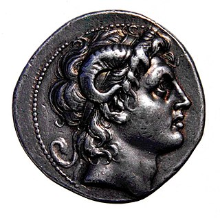
The story of Dhul-Qarnayn, is mentioned in the Quran.

Shamakhi is the capital of the Shamakhi District of Azerbaijan. The city's estimated population as of 2010 was 31,704. It is famous for its traditional dancers, the Shamakhi Dancers, and also for perhaps giving its name to the Soumak rugs.

The Gates of Alexander was a legendary barrier supposedly built by Alexander the Great in the Caucasus to keep the uncivilized barbarians of the north from invading the land to the south. The gates were a popular subject in medieval travel literature, starting with the Alexander Romance in a version from perhaps the 7th century.
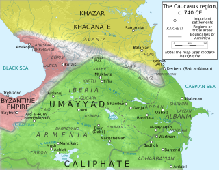
The Arab–Khazar wars were a series of conflicts fought between the armies of the Khazar Khaganate and the Rashidun, Umayyad, and Abbasid caliphates and their respective vassals. Historians usually distinguish two major periods of conflict, the First Arab–Khazar War and Second Arab–Khazar War, but the Arab–Khazar military confrontation also involved sporadic raids and isolated clashes from the middle of the 7th century to the end of the 8th century.

A devastating earthquake known in scientific literature as the Earthquake of 749 struck on January 18, 749, in areas of the Umayyad Caliphate, with the epicenter in Galilee. The most severely affected areas were parts of Palestine and western Transjordan. The cities of Tiberias, Beit She'an, Pella, Gadara, and Hippos were largely destroyed while many other cities across the Levant were heavily damaged. The casualties numbered in the tens of thousands.

The defense lines of the Sasanians were part of their military strategy and tactics. They were networks of fortifications, walls, and/or ditches built opposite the territory of the enemies. These defense lines are known from tradition and archaeological evidence.
The 499 Nicopolis earthquake took place in September 499. It affected the cities of Nicopolis, Neocaesarea, Arsamosata, and Abarne.
The 461 Apahunik' earthquake affected the province of Apahunik', located to the north of Lake Van, in Anatolia.
The 363 Arsakawan earthquake took place c. 363. It affected the cities of Arsakawan and Salat.
The 139 Mcurn earthquake is listed in bibliographical records of seismology as having affected the city of Mcurn.
The 602 Surb Karapet Monastery earthquake took place in 602 and affected the Surb Karapet Monastery, located in the district of Taron.

The 632 Armenia earthquake reportedly affected the region of Armenia. The primary source for this earthquake is the chronicle of Michael the Syrian, which only offers a brief narrative on the subject. According to it, a "tremor" (earthquake) destroyed many places in Armenia. It does not specifically name these places. Michael the Syrian dates this earthquake to 632, but the exact date is unknown. The chronology of Michael's narrative is considered unreliable, and it is possible that he misdated this earthquake.
The 735 Vayots Dzor Province earthquake affected the Vayots Dzor Province.
The 840 Erzurum earthquake reportedly took place in the city of Qaliqala.
The 863 Dvin earthquake reportedly took place in the city of Dvin on 13 February, 863.
The 995 Balu earthquake took place in 995 or 996. It reportedly affected the Armenian areas of Balu, Cop'k, Palnatun, and the districts of Hasteank and Xorjean.