 | |
| UTC time | 1983-07-05 12:01:30 |
|---|---|
| ISC event | 571502 |
| USGS-ANSS | ComCat |
| Local date | 5 July 1983 |
| Local time | 15:01:30 EEST |
| Magnitude | 6.1 Ms |
| Depth | 10 km |
| Epicenter | 40°19′26″N27°13′19″E / 40.324°N 27.222°E [1] |
| Type | Strike-slip [2] |
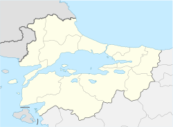
| Areas affected | Turkey Biga |
| Max. intensity | MMI IX (Violent) |
| Landslides | Yes |
| Casualties | 5 dead, 30 injured |
The 1983 Biga earthquake hit northwestern Turkey on 5 July 1983. It measured 6.1 on the surface-wave magnitude scale and was felt as far away as eastern Greece. The United States Geological Survey listed the earthquake among the "Significant Earthquakes of the World" for 1983. [3]