UTC time | 2019-05-26 07:41:14 |
---|---|
ISC event | 615748456 |
USGS-ANSS | ComCat |
Local date | 2019-05-26 |
Local time | 02:41:12 |
Duration | 60 seconds [1] |
Magnitude | 8.0 Mww |
Depth | 122.8 km (76.3 mi) |
Epicenter | 5°47′46″S75°17′53″W / 5.796°S 75.298°W |
Type | Dip-slip (normal) |
Areas affected | Peru Ecuador |
Max. intensity | MMI VII (Very strong) [2] |
Casualties | 2 dead, 30 injured |
An earthquake measuring Mw 8.0 struck Peru and the surrounding areas on 26 May 2019 at 02:41 local time. It had a maximum perceived intensity of VII (Very strong) on the Modified Mercalli intensity scale in the towns of Yurimaguas and Lagunas. [2] Two people died and a further 30 were injured. It was the strongest earthquake in 2019 by magnitude. [3]
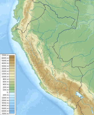
Peru lies above the destructive plate boundary where the Nazca plate subducts beneath the South American plate. The plates converge at a rate of 70 mm per year. The country has been affected by many large megathrust earthquakes caused by slip along the plate interface, such as the 1868 Arica earthquake. There are also large earthquakes of intermediate depth caused by faulting within the downgoing Nazca plate. [4]
The earthquake lasted for about 60 seconds, with most of the energy being released within a period of about 40–60 seconds. [1] The earthquake's epicenter was in the northern region of Peru, near Ecuador. This intermediate depth event (122.8 km) was caused by normal faulting within the Nazca plate. Out of the two possible solutions of the moment tensor, analysis of seismic waveforms suggests that the causative fault dips towards the east. [1]
The earthquake occurred in a region of the Nazca plate where it transits from flat slab subduction to steep subduction. At this location, the plate bends to a steeper angle. An analysis of the event indicate rupture along a fault that measured 205 km by 105 km with an average rupture propagation velocity of 2.5 km/s. The rupture generated a maximum slip of 6.7 meters at the northern part of the rupture area. Two episodes of seismic energy release occurred within a span of 115 seconds. InSAR data showed that the quake produced 47 cm of subsidence at the surface of the earth, north of the epicenter. [2]
Exactly three years after the earthquake occurred, a magnitude 7.2 earthquake struck the Department of Puno. The earthquake was felt in Peru, Chile, Brazil and Bolivia. [5]
Two people were killed and 15 others were injured in Peru, while a further 15 people were injured in Ecuador. [6] [7]
The President of Peru, Martín Vizcarra, called for calm and said that he, along with his transportation minister, would evaluate the damage to roadways. Vizcarra also stated that other officials would evaluate damage to structures and any effects on a nearby reservoir. [8] Many people evacuated homes and stores when the earthquake struck late at night. Some buildings, streets, and bridges suffered damage from the earthquake. [9]
The earthquake damaged 833 homes and left 404 of them uninhabitable. 38 health facilities were damaged, with 4 of them being rendered unusable. 111 schools were affected with 7 being put out of action. [10]
Some damage was reported from the parts of Ecuador closest to the epicenter. [9]
The 2007 Tocopilla earthquake occurred on November 14 at 12:40:50 local time. Its epicenter was located between Quillagua and Tocopilla, affecting the Tarapacá and the Antofagasta regions in northern Chile. The earthquake had a moment magnitude of 7.7 and lasted about 3 minutes and 35 seconds. Seventeen aftershocks of magnitude greater than 5.3, including one of magnitude 7.1 and two others of magnitude 6.3 or higher, were recorded. The Pacific Tsunami Warning Center issued a tsunami warning, stating a tsunami had been generated; after one hour, this warning was cancelled. The earthquake was felt from Santiago, 1,245 km south from the epicenter, to La Paz, about 700 km north-northeast.
The 1906 Ecuador–Colombia earthquake occurred at 10:36:10 (UTC+5) on Wednesday January 31, 1906 off the coast of Ecuador, near Esmeraldas. The earthquake had a moment magnitude of 8.8 and triggered a destructive tsunami that caused at least 500 casualties on the coast of Colombia.
The 1979 Tumaco earthquake occurred at 02:59 local time on 12 December with a moment magnitude of 8.2 and a maximum Mercalli intensity of IX (Violent). The epicenter was just offshore from the border between Ecuador and Colombia, near the port city of Tumaco. It triggered a major tsunami, which was responsible for most of the estimated 300–600 deaths. The hardest hit area was Colombia's Nariño Department.
The 1942 Peru earthquake occurred on August 24 at 17:50 local time and was located near the border of the departments of Ica and Arequipa, Peru. It had a magnitude of Mw 8.2 or Ms 8.4.
The 1992 Murindó earthquake occurred on October 18 at 15:11 UTC with an epicenter in the Department of Chocó, northern Colombia. The shallow magnitude 7.2 earthquake struck northwest of the town of Murindó, killing ten and injured more than a hundred. Thirty-three municipalities were severely damaged.
The 1957 Guerrero earthquake occurred on 28 July at 08:40 UTC. It had a magnitude of 7.6 Mw and a maximum perceived intensity of VII on the Modified Mercalli intensity scale. Mexico City and Chilpancingo were particularly badly affected. It caused the deaths of between 54 and 160 people. A small tsunami was triggered but caused little damage.
At 14:11 PST on December 15, 2019, the province of Davao del Sur on the island of Mindanao in the Philippines was struck by an earthquake measuring 6.8 Mww. It had a maximum perceived intensity of VII on the Modified Mercalli Intensity Scale. At least 13 people were killed and another 210 injured.
On January 1, 1996, at 4:05 p.m. Central Indonesia Time, an earthquake with an epicenter in the Makassar Strait struck north of Minahasa on the island of Sulawesi, Indonesia. The earthquake measured 7.9 on the moment magnitude scale and was centered off Tolitoli Regency in Central Sulawesi, or 25 km from the Tonggolobibi village. A tsunami of 2–4 m (6.6–13.1 ft) was triggered by this earthquake as a result. At least 350 buildings were badly damaged, nine people died and 63 people were injured.
The 2013 Craig, Alaska earthquake struck on January 5, at 12:58 am (UTC–7) near the city of Craig and Hydaburg, on Prince of Wales Island. The Mw 7.5 earthquake came nearly three months after an Mw 7.8 quake struck Haida Gwaii on October 28, in 2012. The quake prompted a regional tsunami warning to British Columbia and Alaska, but it was later cancelled. Due to the remote location of the quake, there were no reports of casualties or damage.
The 1940 Lima earthquake occurred on May 24 at 11:35 a.m. PST with a magnitude of Mw 8.2 on the moment magnitude scale. Shaking from this powerful earthquake was felt throughout the country, and in Ecuador and Chile. An estimated 179 to 300 people died while 3,500 left injured by the earthquake. The earthquake was centered near the coastal cities of Huacho and Huaura, about 150 km (93 mi) north of the Peruvian capital, Lima. There was a tsunami of up to 2 m that did not cause damage.
The 1942 Ecuador earthquake or the Guayaquil earthquake occurred on 13 May at 21:13 local time with a moment magnitude of Mw 7.9. The temblor struck the coastal (Esmeraldas) region of Manabí Province, Ecuador. It caused damage mainly to cities including Guayaquil, Portoviejo and Guaranda. More than 300 people were killed and the total cost of damage was about US$2.5 million. Ecuador's largest city Guayaquil was the most affected despite the significant distantce from the epicenter. Many reinforced concrete structures in a particular area in the city were completely destroyed, contributing to fatalities.
An earthquake occurred off the coast of the Alaska Peninsula on July 28, 2021, at 10:15 p.m. local time. The large megathrust earthquake had a moment magnitude of 8.2 according to the United States Geological Survey (USGS). A tsunami warning was issued by the National Oceanic and Atmospheric Administration (NOAA) but later cancelled. The mainshock was followed by a number of aftershocks, including three that were of magnitude 5.9, 6.1 and 6.9 respectively.
The 1947 Satipo earthquake was the largest earthquake in the sub-Andean region of Peru. It occurred on November 1 at 09:58:57 local time with an epicenter in the Department of Junín. The earthquake had an estimated moment magnitude (Mw ) of 7.7 and focal depth of 20 km (12 mi). Damage was severe in the towns of Satipo and La Merced, and at least 233 people died.
On 9 July 2019, at 8:36 PM (PST), an earthquake measuring Mw 5.6 jolted the province of North Cotabato, Davao del Sur, and other nearby provinces. The National Disaster Risk Reduction and Management Council reported one dead and three injured in Makilala after the earthquake, and a total of 164 families affected in Cotabato Province. Near the epicenter of the earthquake, the severity of strong ground motion was assigned VI (Strong) on the Modified Mercalli intensity scale. A total of 106 schools, 119 houses, and 14 other infrastructures were damaged by the earthquake.
The 1950 Calama earthquake occurred near the Argentina–Chile border with an epicenter near Calama, Chile in the Atacama Desert on December 9. The event had a hypocenter depth of 113.9 km, beneath the Caichinque volcanic complex. It measured magnitude Mw 8.2 on the moment magnitude scale, making it the largest intermediate depth earthquake ever recorded on Chilean soil. One person was killed and an unspecified number of people were injured in Calama.
A major earthquake struck northern Peru on November 28, 2021, 5:52 a.m. local time with a magnitude of 7.5 on the moment magnitude scale between the Amazonas and Loreto departments of Peru. A maximum Modified Mercalli intensity (MMI) of VII was reported in the town of Santa Maria de Nieva according to the Geological Institute of Peru.
Between May 1990 and April 1991, an earthquake sequence occurred in the Department of San Martín, northern Peru. Three large earthquakes of magnitudes (Mw ) 6.5–6.9 occurred in the same region across 11 months, causing extensive damage. At least 189 people were killed in these earthquakes.
The 1979 Saint Elias earthquake affected Alaska at 12:27 AKST on 28 February. The thrust-faulting Mw 7.5 earthquake had an epicenter in the Granite Mountains. Though the maximum recorded Modified Mercalli intensity was VII, damage was minimal and there were no casualties due to the remoteness of the faulting. Damage also extended across the border in parts of Yukon, Canada.
A strong earthquake struck southern Ecuador on 18 March 2023. It measured 6.8 on the moment magnitude scale, and struck with a hypocenter 68.0 km (42.3 mi) deep. The epicenter was located in the Gulf of Guayaquil, off the coast of Balao Canton and about 80 kilometres (50 mi) south of Guayaquil. There was major damage, 446 injuries and 18 fatalities in Ecuador's El Oro, Azuay and Guayas provinces. Two additional fatalities and dozens of injuries were reported in Peru.
{{cite web}}
: CS1 maint: numeric names: authors list (link)