2024 Kanlaon eruption | |
---|---|
Volcano | Kanlaon |
Date | June 3, 2024– December 9, 2024 (6 months and 6 days) |
Type | Explosive eruption |
Location | Negros Island Region, Philippines 10°24′40″N123°07′54″E / 10.4111°N 123.1318°E |
VEI |
|
Impact |
|
Kanlaon Volcano in Negros Island Region, Philippines began erupting on June 3, 2024, when an explosive eruption from its summit vent spewed ash over parts of Bago, La Carlota, La Castellana and Canlaon. As a result, evacuations were ordered for five barangays near the volcano. Volcanic activity continued on December 9, with explosive eruptions generating a shockwave, and a plume visible as far away as the islands of Panay, Guimaras and Cebu. The National Disaster Risk Reduction and Management Council (NDRRMC) reported that 57,563 people were affected by the June eruption, with 3,905 displaced from their homes. Additionally, 2,680 houses were damaged. The estimated damage to the agricultural sector was US$3.07 million. Following the December eruption, the NDRRMC estimated that around 40,489 people in the Visayas were affected.
On March 11, 2020, PHIVOLCS raised the volcano's alert level from 0 to 1 due to its abnormal activities since March 9. 80 volcanic earthquakes were plotted since then. [3] On June 21, the volcano showed some signs of increased unrest. By June 22, the volcano's activity continued, with a series of tectonic earthquakes ranging from Mw 3.2 to Mw 4.7. A total of 278 earthquakes was observed for a 72-hour period (from June 21, 8AM – June 24, 8AM), possibly related to the magmatic activity underneath the volcano. Earthquakes continued, with steam and fumarolic activity rising 200–300 meters above. PHIVOLCS reminded the public to stay away to the 4-km PDZ (Permanent Danger Zone) around the volcano, as abnormal conditions and sudden phreatic explosions might occur. [4] [5] [6]
On June 3, 2024, PHIVOLCS raised the alert level of Kanlaon from alert level 1 to alert level 2, indicating increasing unrest after an explosive eruption occurred on its summit vent at 6:51 p.m. PST. The eruption produced a voluminous and incandescent plume that rose 5,000 m (16,000 ft) above the vent and a probable short pyroclastic flow of approximately 2-3 km down the south and southeastern slopes of the volcano. The eruption lasted for six minutes and was followed by a relatively strong volcanic earthquake. Sulfurous odors and ashfall were reported by communities on the western slope of the volcano, [7] particularly in Bago, La Carlota, La Castellana and Canlaon, [8] and as far as Bacolod, 85 km (53 mi) away. [9] Particles from the volcano were deposited in the form of haze as far as the Bicol Region. [10] On June 5, rains triggered lahar flows in La Castellana. [11]
On July 15, 2024, PHIVOLCS issued a notice regarding the increasing swelling of Kanlaon's edifice, which has been persisting since mid-June. [12] PHIVOLCS noted that this ongoing ground deformation could indicate magmatic intrusion, potentially increasing the likelihood of eruptive activity. [13] Increased activity was recorded by PHIVOLCS in September, starting with a series of volcano-tectonic earthquakes on September 9. [14] On September 10, Kanlaon produced its highest volume of sulfur dioxide emissions since 2009, at 9,985 tonnes, prompting PHIVOLCS to raise concern over its possible first magmatic eruption since 1902. [15] The record was surpassed the next day, when 11,556 tons of sulfur dioxide was emitted. [16] On October 19, 2024, the summit crater of the volcano exhibited continuous degassing, along with occasional weak ash emissions. PHIVOLCS recorded twenty-eight instances of ash emissions, ranging from four minutes to one hour and eighteen minutes in duration, producing grayish plumes that rose 300–800 m (980–2,620 ft) above the summit and drifted to the west. [17] On October 28, PHIVOLCS reported that sulfur dioxide gas emissions from the summit crater of Kanlaon totaled 10,074 tonnes, making it the fifth highest emission recorded from the volcano since instrumental gas monitoring began. [18] Late on October 31, sixty-four volcano-tectonic earthquakes were recorded, with magnitudes ranging from Mw 0.9 to Mw 2.9, occurring at depths of 2–8 km (1–5 mi). [19]
Before the December eruption, PHIVOCS noted a significant decrease in summit emissions, with the average sulfur dioxide level dropping to 1,669, and only six minor volcano-tectonic earthquakes were detected, with no significant seismic activity observed leading up to the eruption. [20] On December 9, PHIVOLCS raised the alert level of Kanlaon from level 2 to level 3 after an explosive eruption occurred at the summit vent at 3:03 p.m. The eruption produced a large plume that rose 4,000 m (13,000 ft) above the vent and drifted west-southwest, with pyroclastic flow moving down the south-southeastern side of the volcano. [20] [2] A resident volcanologist from PHIVOLCS stated that a shockwave was also heard. [21] Ashfall was recorded in Canlaon as well as in ten municipalities and cities of Negros Occidental, [22] and affected other islands such as Guimaras and Panay, particularly in southern Iloilo and Antique. The volcanic plume was visible as far as Iloilo City [23] and Toledo, Cebu. [24]
Evacuations were ordered in Canlaon for five barangays near the volcano [8] and communities located along rivers flowing from the volcano, [25] [26] as well as in La Carlota and La Castellana. A mask mandate was also imposed in San Carlos. [27] At least 4,752 people were displaced, [28] while offices in Canlaon were ordered closed on June 4. [29] Authorities in Negros Occidental were also placed on heightened alert, with ashfall warnings declared in Canlaon, La Carlota and La Castellana. [30] At least 29 flights at Ninoy Aquino International Airport as well as in Iloilo, Cebu, Kalibo, Bacolod, Davao, Cagayan de Oro, General Santos and San Jose Airports were cancelled due to the eruption. [31] [32] At least 248 people were evacuated in Canlaon. [33] On June 4, several flights were cancelled and a mandatory emergency evacuation within a 3-kilometer radius was ordered. [34] Canlaon Mayor Jose Chubasco Cardenas said that 23,622 residents of five barangays were affected. [35] President Bongbong Marcos assured that the government is prepared to offer support to those impacted by the eruption of Kanlaon Volcano. [36]
PHIVOLCS instructed local government units to evacuate residents within a 6-kilometer radius of the volcano's summit and to prepare for possible additional evacuations if the volcanic activity increased. Canlaon Mayor Jose Chubasco Cardenas advised residents in affected areas to prepare for mandatory evacuations. As a precaution, classes and work in local government offices were suspended, and a curfew was imposed, with all establishments required to close from 10 p.m. to 5 a.m. Additionally, a liquor ban was enforced. [2] Several flights were cancelled at Iloilo International Airport. [37] A health advisory was issued in Toledo, Cebu due to air pollution risks caused by the eruption. [38] The Office of Civil Defense said that around 87,000 people had to be evacuated, with 46,900 of them living in La Castellana. [39] A price freeze was imposed in Negros Occidental to curb "predatory pricing" by businesses and prevent the hoarding of goods. [40]
The town of La Castellana lost ₱11.33 million ( US$ 230,075.26), during the eruption, and the city of Canlaon lost ₱93.49 million ( US$ 1.9 million). [41] The eruption impacted the inflation rate from 4.1 percent to 4.3 percent after the eruption. [42] 29 flights were cancelled during the eruption. [31] A state of calamity was declared in Canlaon and La Castellana. [43] Around 23,000 hectares of sugarcane fields in Negros Island were affected by the eruption, while a curfew and water rationing was imposed in La Carlota and La Castellana due to sulfur contamination in regular sources. [9] [44] On June 18, 2024, La Castellana was given permission for more than 400 evacuees to return to their homes. Affected families were given food, hygiene kits, sleeping kits, kitchen kits, which was worth ₱26 million ( US$ 527,918.78) by the Department of Social Welfare and Development. Canlaon was given ₱2 million ( US$ 40,609.14) in financial aid, and La Castellana was given ₱1 million ( US$ 20,304.57). [41]
As of September 22,2024 [update] , the National Disaster Risk Reduction and Management Council (NDDRRMC) reported that the June volcanic eruption affected 57,563 people, displacing 3,905 individuals and damaging 2,680 homes. The agricultural sector suffered an estimated loss of ₱150.96 million ( US$ 3.07 million), with 1,595.81 ha (3,943.3 acres) of land impacted. [45] Following the December eruption, the NDRRMC estimated that around 40,489 people in the Visayas were affected and reported that assistance and relief goods worth ₱7.32 million ( US$ 148,580.8) have been distributed to the affected families. [46] A state of calamity was declared in Negros Occidental. [47]
The Ring of Fire is a tectonic belt of volcanoes and earthquakes.
Mayon, also known as Mount Mayon and Mayon Volcano, is an active stratovolcano in the province of Albay in Bicol, Philippines. A popular tourist spot, it is renowned for its "perfect cone" because of its symmetric conical shape, and is regarded as sacred in Philippine mythology.
Nevado del Ruiz, also known as La Mesa de Herveo is a volcano on the border of the departments of Caldas and Tolima in Colombia, being the highest point of both. It is located about 130 km (81 mi) west of the capital city Bogotá. It is a stratovolcano composed of many layers of lava alternating with hardened volcanic ash and other pyroclastic rocks. Volcanic activity at Nevado del Ruiz began about two million years ago, during the Early Pleistocene or Late Pliocene, with three major eruptive periods. The current volcanic cone formed during the present eruptive period, which began 150,000 years ago.
Mount Pinatubo is an active stratovolcano in the Zambales Mountains in Luzon in the Philippines. Located on the tripoint of Zambales, Tarlac and Pampanga provinces, most people were unaware of its eruptive history before the pre-eruption volcanic activity in early 1991. Dense forests, which supported a population of several thousand indigenous Aetas, heavily eroded and obscured Pinatubo.
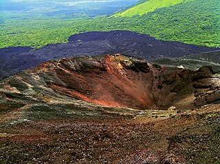
Cerro Negro is an active volcano in the Cordillera de los Maribios mountain range in Nicaragua, about 10 km (6.2 mi) from the village of Malpaisillo. It is a very new volcano, the youngest in Central America, having first appeared in April 1850. It consists of a gravelly basaltic cinder cone, which contrasts greatly with the surrounding verdant hillsides, and gives rise to its name, which means Black Hill. Cerro Negro has erupted frequently since its first eruption. One unusual aspect of several eruptions has been the emission of ash from the top of the cone, while lava erupts from fractures at the base.
La Soufrière or Soufrière Saint Vincent is an active volcano on the Caribbean island of Saint Vincent in Saint Vincent and the Grenadines. It is the highest peak on Saint Vincent, and has had eight recorded eruptions since 1718. The latest eruptive activity began on 27 December 2020 with the slow extrusion of a dome of lava, and culminated in a series of explosive events between 9 and 22 April 2021.
Taal Volcano is a large caldera filled by Taal Lake in the Philippines. Located in the province of Batangas about 50 kilometers (31 mi) south of Manila, the volcano is the second most active volcano in the country with 38 recorded historical eruptions, all of which were concentrated on Volcano Island, near the middle of Taal Lake. The caldera was formed by prehistoric eruptions between 140,000 and 5,380 BP.
Mount Bulusan, also known as Bulusan Volcano, is a stratovolcano on the island of Luzon in the Philippines. Located in the province of Sorsogon in the Bicol Region, it is 70 kilometres (43 mi) southeast of Mayon Volcano and approximately 390 kilometres (240 mi) southeast of Manila. Bulusan is one of the active volcanoes in the Philippines.
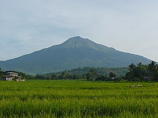
Kanlaon, also known as Mount Kanlaon and Kanlaon Volcano, is an active andesitic stratovolcano and the highest mountain on the island of Negros in the Philippines, as well as the highest peak in the Visayas, with an elevation of 2,465 m (8,087 ft) above sea level. Mount Kanlaon ranks as the 42nd-highest peak of an island in the world.
The Philippine Institute of Volcanology and Seismology is a Philippine national institution dedicated to provide information on the activities of volcanoes, earthquakes, and tsunamis, as well as other specialized information and services primarily for the protection of life and property and in support of economic, productivity, and sustainable development. It is one of the service agencies of the Department of Science and Technology.
The National Disaster Risk Reduction and Management Council (NDRRMC), formerly known as the National Disaster Coordinating Council (NDCC) until August 2011, is a working group of various government, non-government, civil sector and private sector organizations of the Government of the Republic of the Philippines established on June 11, 1978 by Presidential Decree 1566. It is administered by the Office of Civil Defense (OCD) under the Department of National Defense (DND). The council is responsible for ensuring the protection and welfare of the people during disasters or emergencies. The NDRRMC plans and leads the guiding activities in the field of communication, warning signals, emergency, transportation, evacuation, rescue, engineering, health and rehabilitation, public education and auxiliary services such as fire fighting and the police in the country. The Council utilizes the UN Cluster Approach in disaster management. It is the country's focal for the ASEAN Agreement on Disaster Management and Emergency Response (AADMER) and many other related international commitments.
The 1991 eruption of Mount Pinatubo in the Philippines' Luzon Volcanic Arc was the second-largest volcanic eruption of the 20th century, behind only the 1912 eruption of Novarupta in Alaska. Eruptive activity began on April 2 as a series of phreatic explosions from a fissure that opened on the north side of Mount Pinatubo. Seismographs were set up and began monitoring the volcano for earthquakes. In late May, the number of seismic events under the volcano fluctuated from day-to-day. Beginning June 6, a swarm of progressively shallower earthquakes accompanied by inflationary tilt on the upper east flank of the mountain, culminated in the extrusion of a small lava dome.
The 2011–2012 Puyehue-Cordón Caulle eruption was a volcanic eruption that began in the Puyehue-Cordón Caulle volcanic complex in Chile on 4 June 2011. The eruption, which occurred from the Cordón Caulle fissure after 51 years of the volcano being inactive, is one of the largest volcanic eruptions of the 21st century thus far. At least 3,500 people were evacuated from nearby areas, while the ash cloud was blown across cities all around the Southern hemisphere, including Bariloche, Buenos Aires, Montevideo, Stanley, Porto Alegre, Cape Town, Hobart, Perth, Adelaide, Sydney, Melbourne, Wellington, Auckland and Port Moresby, forcing airlines to cancel hundreds of international and domestic flights and causing travel chaos.
The 2012 Negros earthquake occurred on February 6 at 11:49 PST, with a body wave magnitude of 6.7 and a maximum intensity of VII (Destructive) off the coast of Negros Oriental, Philippines. The epicenter of the thrust fault earthquake was approximately 72 kilometres (45 mi) north of Negros Oriental's provincial capital, Dumaguete.
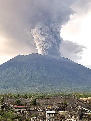
Mount Agung, a volcano on the island of Bali in Indonesia, erupted five times in late November 2017, causing thousands to evacuate, disrupting air travel and causing environmental damage. As of 27 November 2017, the alert level was at its highest and evacuation orders were in place.
Taal Volcano in Batangas, Philippines began to erupt on January 12, 2020, when a phreatomagmatic eruption from its main crater spewed ashes over Calabarzon, Metro Manila, and some parts of Central Luzon and Ilocos Region, resulting in the suspension of school classes, work schedules, and flights in the area, as well as temporarily drying up Taal Main Crater Lake and destroying Vulcan Point, an Island surrounded by the lake. The Philippine Institute of Volcanology and Seismology (PHIVOLCS) subsequently issued an Alert Level 4, indicating "that a hazardous explosive eruption is possible within hours to days." Volcanic activity continued into 2021, when smaller eruptions occurred in July 2021. On March 26, 2022, a short-lived phreatomagmatic eruption was recorded by PHIVOLCS raising the status from Alert level 2 to Alert level 3 as well as surrounding towns.
La Soufrière, a stratovolcano on the Caribbean island of Saint Vincent in Saint Vincent and the Grenadines, began an effusive eruption on 27 December 2020. On 9 April 2021 there was an explosive eruption, and the volcano "continued to erupt explosively" over the following days, with pyroclastic flows. The activity pattern of the eruption was comparable to that of the event that occurred in 1902, which had a Volcanic Explosivity Index (VEI) of 4. The volcano is known to have erupted 23 times in the last 4,000 years, and had been dormant since 1979.
An eruption at the Cumbre Vieja volcanic ridge, comprising the southern half of the Spanish island of La Palma in the Canary Islands, took place between 19 September and 13 December 2021. It was the first volcanic eruption on the island since the eruption of Teneguía in 1971. At 85 days, it is the longest known and the most damaging volcanic eruption on La Palma since records began. The total damage caused by the volcano amounts up to 843 million euros.