
Thiruvananthapuram, formerly known as Trivandrum, is the capital city of the Indian state of Kerala. It is the largest and most populous city in Kerala and it is also a major port city. Thiruvananthapuram is where Asia's first space university, the Indian Institute of Space Science and Technology is located, and India's first IT park, Technopark Thiruvananthapuram is in Thiruvananthapuram. The city also includes India’s first deep-water trans-shipment port, the Vizhinjam International Seaport Thiruvananthapuram, as well as the Sree Padmanabhaswamy Temple, known as the richest temple in the world. Thiruvananthapuram is where India's space program began, with the Vikram Sarabhai Space Centre and the headquarters of Liquid Propulsion Systems Centre located here. Thiruvananthapuram is also known for its cultural heritage, being associated with the musical contributions of Swathi Thirunal Rama varma and the artistic legacy of painter Raja Ravi Varma. Notable beaches in Thiruvananthapuram include Kovalam, Varkala, Shankumugham Beach and Poovar. The encompassing urban agglomeration population is around 1.68 million. Located on the west coast of India near the extreme south of the mainland, Thiruvananthapuram is a major information technology hub in Kerala and contributes 55% of the state's software exports as of 2016. Referred to by Mahatma Gandhi as the "Evergreen city of India", the city is characterised by its undulating terrain of low coastal hills.

Kovalam is a beach and seaside resort in the city of Thiruvananthapuram in Kerala, India. Kovalam is located 12.6 km (7.8 mi) southeast of the city center. The beaches around Kovalam are popular vacation destinations for both domestic and international travellers.

Kasaragod is a municipal town and administrative headquarters of Kasaragod district in the state of Kerala, India. Established in 1966, Kasaragod was the first municipal town in the district. It is the northernmost district of Kerala and is also known as Sapta Bhasha Sangama Bhumi.

Neyyattinkara, is a significant municipal town and a prominent center for both industry and commerce, positioned at the southernmost tip of the Thiruvananthapuram metropolitan area in Thiruvananthapuram, the capital city of Kerala State. It also serves as the administrative headquarters of Neyyattinkara Taluk.Nestled along the banks of the Neyyar River, one of the district's principal rivers, the town derives its name from its location, with 'Neyyatinkara' in Malayalam translating to 'the shore of the river Neyyar.' Neyyattinkara ranks as the second most densely populated municipality in the district, following Varkala. Notably, the Vizhinjam International Seaport Thiruvananthapuram is situated within Neyyattinkara Taluk."In the Vizhinjam International Seaport Thiruvananthapuram, the port international code IN NYY 1, the "NYY" represents Neyyattinkara

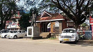
Nedumangad is a municipal town in the Thiruvananthapuram district in the Indian state of Kerala. It is the headquarters of Nedumangad Tehsil and Nedumangad Revenue Division. It is a suburb of the extended metropolitan region of Thiruvananthapuram. It is located around 16 km (9.9 mi) to the north-east of Thiruvananthapuram on the State Highway 2. It is an important commercial center in the district. It is a growing commercial and educational hub and all important government institutions are situated in the town. The Nedumangadu market has significance in southern Kerala.

Thiruvananthapuram District is the southernmost district in the Indian state of Kerala. The district was created in 1949, with its headquarters in the city of Thiruvananthapuram, which is also Kerala's administrative centre. The present district was created in 1956 by separating the four southernmost Taluks of the erstwhile district to form Kanyakumari district. The city of Thiruvananthapuram is also known as the Information technology capital of the State, since it is home to the first and largest IT park in India, Technopark, established in 1990. The district is home to more than 9% of total population of the state.

Kanyakumari district, officially Kanniyakumari district, is one of the 38 districts of Tamil Nadu state and the southernmost district in mainland India. It stands second in terms of population density among the districts of Tamil Nadu. It is also the richest district in Tamil Nadu in terms of per capita income, and also tops the state in Human Development Index (HDI), literacy, and education. The district's headquarters is Nagercoil.
Adoor is a municipality in the Pathanamthitta district of Kerala, India. It is the headquarters of the Adoor Taluk and Adoor Revenue Division. Adoor is located 18 km (11.2 mi) southwest of the district headquarters Pathanamthitta and 85 km (52.8 mi) north of the state capital Thiruvananthapuram.

Alappuzha, formerly known as Alleppey, is a city and municipality in the Alappuzha district of Kerala, India. It is the district headquarters of the district, and is located about 130 km (80.8 mi) north of the state capital Thiruvananthapuram. As per the 2011 Indian census, Alappuzha has a population of 240,991 people, and a population density of 3,675/km2 (9,520/sq mi).

Chengannur is a municipality in the Alappuzha district of Kerala, India. It is located 43 km (26.7 mi) south east of the district headquarters in Alappuzha and about 98 km (60.9 mi) north of the state capital Thiruvananthapuram. As per the 2011 Indian census, Chengannur has a population of 23,466 people, and a population density of 1,607/km2 (4,160/sq mi).
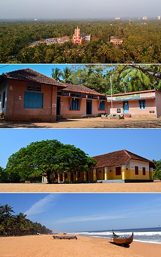
Puthenthope is a coastal village in Thiruvananthapuram (Trivandrum) district in Kerala, India, and situated 19 km (12 mi) northwest of city centre, 16 km from Trivandrum International Airport. The village is mostly covered with coconut palms and cashew trees. Its western side edges the Arabian Sea, while the east is separated by Parvathi Puthanar, a manmade canal completed during the time of Regent Sethu Lakshmi Bhai of Travancore Kingdom. Access to National Highway and a railway station is as short as 2 km (1.2 mi) and the VSSC of the Indian Space Research Organisation is close by. There are two man made hills — one on the south (Thekkekkunnu)and the other on the north (Vadakkekkunnu), which are believed to have been made during the time of Portuguese.India's first DNA-Barcoding Centre, set up at bio-informatic centre for Tropical Garden and Research institute at Puthenthope. Famous Malayalam Cine Artist Alencier Ley Lopez hails from Puthenthope.
Colachel is a coastal town in the far south of India, located in the Kanyakumari district of Tamil Nadu. It is a natural harbor on the Malabar coast, located 20 km north-west of Kanyakumari, the southernmost tip of India. As of 2011 the municipality had a population of 23,227 and a metropolitan population of 47,007.

Kuttikkanam is a hill station in Idukki district, Kerala state, India. It is 3,500 feet (1,100 m) above sea level and surrounded by lush green tea plantations. It is within the territory of Peermade. Kanjirappally and Mundakayam are the nearest towns.

Edava is a panchayat in Varkala Taluk, which is the northernmost tip of Thiruvananthapuram district in the state of Kerala, India. Edava is located 5km north of Varkala, 21km south of port city Kollam and 44km north of capital city Thiruvananthapuram. Kappil beach is a famous surf location.

Palode is a town in Thiruvananthapuram district in the Indian state of Kerala. Palode town is 35 km (22 mi) from Thiruvananthapuram city and 17 km (11 mi) from Nedumangad municipality.There is a Helipad in palode. Palode is surrounded by Western Ghats. Jawaharlal Nehru Tropical Botanic Garden and Research Institute is situated near Palode. Mankayam Ecotourism near Brimore is 11 km (6.8 mi) away. Brimore has tea estate and plantations make Palode a gateway for tourism destination.Thenmala is 38 km (24 mi) from Palode and Ponmudi hills is 35 km. Palode is a town in Thiruvananthapuram-Thenmala -Shenkottai State Highway 2 (Kerala). Tenkasi is 75 km (47 mi) from Palode. Palode is a town located in Nedumangad Taluk of Thiruvananthapuram district in Kerala.
Thoothoor - Chinnathurai is a small village in Kanyakumari district of Tamil Nadu, at the southern tip of peninsular India Under the Parent village of Thoothoor. The two major towns nearby are Thiruvananthapuram in Kerala state to the west and Nagercoil to the east. The town is located on the coast and is historically a fishing village, specializing in catching sharks and other large fishes.
Pozhiyoor is a village in the district of Thiruvananthapuram in the State of Kerala in India. It has gradually grown to a well known tourist destination in India. The major attractions of Poovar tourism area are in Pozhiyoor. Pozhikkara, estuary formed by river Neyyar before it falls into the mighty Arabian Sea is the centre of attraction of tourism circuit in Poovar. Golden Beach, Elephant Rock, Anantha Victoria Marthanda Varma Canal, Pieta are other major attractions in Pozhiyoor Beach area in Thiruvananthapuram. It is at the coastal border of the Indian states of Kerala and Tamil Nadu.

Anakkara is a geographic area of around 50 square kilometres that spans across Vandanmedu, Chakkupallam Panchayats in the Udumbanchola Taluk of Idukki District. Anakkara is the administrative capital of Chakkupallam Grama Panchayat and Anakkara Revenue Village. Situated at about 18 kilometers (11 mi) from Thekkady wildlife sanctuary on the Kumily-Munnar state highway, Anakkara is a fast-growing tourist destination for its unique spice gardens and many picnic spots in and around. It is one of the 36 distinct places identified by Government of India and United Nations Development Programme for exploring and promoting the unique tourism potential of these places.
Marthandanthurai is a coastal village on the shore of the Arabian Sea in Kanyakumari district, Tamil Nadu, India, near the border with Kerala and Tamil Nadu. The village is part of the Kollemcode panchayat. It belongs to the Roman Catholic Archdiocese of Trivandrum from 1967. Prior to joining with the Trivandrum Latin Archdiocese, this village was a part of the Roman Catholic Diocese of Cochin. The village is known for its beauty and versatility. It is a pilgrimage centre of Our Lady of Lourdu and is dedicated to the patronage of Our Lady of Dolours. The historical AVM Canal flows through this village. Its golden sand beach is the attraction of this tourist village. Being the part of Kollemcode Town Panchayat, this is the prime centre of trade and transportation for the neighboring villages. The 30% of people live in Marthandanthurai speak Malayalam as their major spoken language and the remainder speak a mixture of Tamil and Malayalam. In short, it can be said that people have their own colloquial way of talking and language. This language slang has big difference among neighbor regions and villages. Marthandanthurai the name sometimes referred as "Land of Marthanda Varma" because the king who did a lot of favors to this village. The villages of Vallavilai and Neerody are located near the village Marthandanthurai. This Village is located nearly 70 km from Kanyakumari and 30 km from Trivandrum.
Thengapattanam, named after dense coconut grooves, is a major trade and tourism centre in the painkulam panchayath along the coastal plains of Kanyakumari district. Thengapattanam, once part of Travancore and later Kerala, was added to Tamil Nadu on 1 November 1956 along with some parts of today's Kanniyakumari District.


